Fraud Blocker Skip to main content

Atlas Book Collection

Discover the world through the pages of the Atlas Book

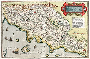
Background imageAtlas Book Collection: Map of Tuscany in Italy, 1570 (engraving)

Map of Tuscany in Italy, 1570 (engraving)
LRI4704766 Map of Tuscany in Italy, 1570 (engraving) by Ortelius, Abraham (1527-98); Museo Navale di Pegli, Genoa, Italy; (add.info.: Thusciae)

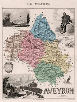
Background imageAtlas Book Collection: L Aveyron (12), Midi-Pyrenees (Midi Pyrenees) - France and its Colonies

L Aveyron (12), Midi-Pyrenees (Midi Pyrenees) - France and its Colonies. Atlas illustrates one hundred
XEE4144628 L Aveyron (12), Midi-Pyrenees (Midi Pyrenees) - France and its Colonies. Atlas illustrates one hundred and five maps from the maps of the depot of war

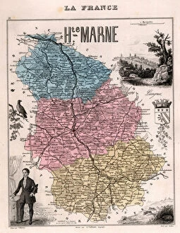
Background imageAtlas Book Collection: La Haute Marne (Haute-Marne, 52), Champagne-Ardennes (Champagne Ardennes) - France and its Colonies

La Haute Marne (Haute-Marne, 52), Champagne-Ardennes (Champagne Ardennes) - France and its Colonies
XEE4144506 La Haute Marne (Haute-Marne, 52), Champagne-Ardennes (Champagne Ardennes) - France and its Colonies. Atlas illustrates one hundred and five maps from the maps of the depot of war

Background imageAtlas Book Collection: Ile de La Reunion (Bourbon Island), DOM (overseas department or overseas department)

Ile de La Reunion (Bourbon Island), DOM (overseas department or overseas department) - France and its Colonies
XEE4144389 Ile de La Reunion (Bourbon Island), DOM (overseas department or overseas department) - France and its Colonies

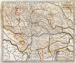
Background imageAtlas Book Collection: Map of the province of Mantova (Italy) (Engraving, 1717)

Map of the province of Mantova (Italy) (Engraving, 1717)
LRI4712986 Map of the province of Mantova (Italy) (Engraving, 1717) by Nolin, Jean-Baptiste (c.1657-1708); Private Collection; (add.info.: Map of the Duche of Mantua (Lombardy)

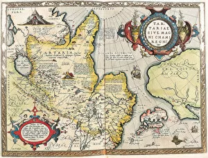
Background imageAtlas Book Collection: Map of the Tartar territory, 1570 (engraving)

Map of the Tartar territory, 1570 (engraving)
LRI4704938 Map of the Tartar territory, 1570 (engraving) by Ortelius, Abraham (1527-98); Museo Navale di Pegli, Genoa, Italy; (add.info)

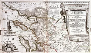
Background imageAtlas Book Collection: Map of Poitou Charentes (France) (Engraving, 1717)

Map of Poitou Charentes (France) (Engraving, 1717)
LRI4711769 Map of Poitou Charentes (France) (Engraving, 1717) by Nolin, Jean-Baptiste (c.1657-1708); Private Collection; (add.info.: Map of the generality of La Rochelle)

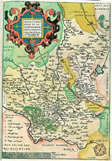
Background imageAtlas Book Collection: Map of Franconia in Germany, 1570 (engraving)

Map of Franconia in Germany, 1570 (engraving)
LRI4704575 Map of Franconia in Germany, 1570 (engraving) by Ortelius, Abraham (1527-98); Museo Navale di Pegli, Genoa, Italy; (add.info.: Franciae Orientalis)

Background imageAtlas Book Collection: Map of France at the end of the regne of King Louis XIV and after the treats of Utrecht

Map of France at the end of the regne of King Louis XIV and after the treats of Utrecht and Rastadt between 1643
ELD4930134 Map of France at the end of the regne of King Louis XIV and after the treats of Utrecht and Rastadt between 1643 and 1715

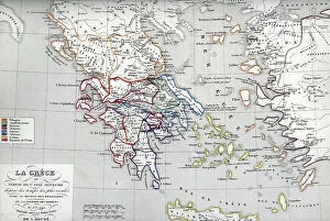
Background imageAtlas Book Collection: Map of Greece at the times of Heraclides (son of Heracles) Plate from ' Atlas Universel' by Houze

Map of Greece at the times of Heraclides (son of Heracles) Plate from " Atlas Universel" by Houze
ELD4924939 Map of Greece at the times of Heraclides (son of Heracles) Plate from " Atlas Universel" by Houze, 1851 Private collection; (add.info)

Background imageAtlas Book Collection: Manual of Atlas Geography (Atlas-Geography) of elementary courses in accordance with the official

Manual of Atlas Geography (Atlas-Geography) of elementary courses in accordance with the official curriculum
LET4395303 Manual of Atlas Geography (Atlas-Geography) of elementary courses in accordance with the official curriculum. Collection " L'Ecole libre", ninth edition

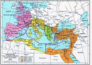
Background imageAtlas Book Collection: Plate extracted from a historical Atlas by Vidal Lablache, beg of 20th century (print)

Plate extracted from a historical Atlas by Vidal Lablache, beg of 20th century (print)
PCT4292088 Plate extracted from a historical Atlas by Vidal Lablache, beg of 20th century (print); (add.info.: Plate extracted from a historical Atlas by Vidal Lablache (Vidal-Lablache)

Background imageAtlas Book Collection: Barbarian invasions - Geographic map of Russia, Sweden, Norway and Denmark

Barbarian invasions - Geographic map of Russia, Sweden, Norway and Denmark, with indications of the barbarians (goths)
ELD4924560 Barbarian invasions - Geographic map of Russia, Sweden, Norway and Denmark, with indications of the barbarians (goths, ostrogoths, visigoths, alains)

Background imageAtlas Book Collection: Plate extracted from a historical Atlas by Vidal Lablache beg of 20th century (print)

Plate extracted from a historical Atlas by Vidal Lablache beg of 20th century (print)
PCT4284009 Plate extracted from a historical Atlas by Vidal Lablache beg of 20th century (print); (add.info.: Plate extracted from a historical Atlas by Vidal Lablache (Vidal-Lablache)

Background imageAtlas Book Collection: Map of France at the times of king Louis XI, 1851 Private collection

Map of France at the times of king Louis XI, 1851 Private collection
ELD4930236 Map of France at the times of king Louis XI, 1851 Private collection; Private Collection; (add.info.: Map of France at the times of king Louis XI)

Background imageAtlas Book Collection: Plate extracted from a historical Atlas by Vidal Lablache, beg of 20th century (print)

Plate extracted from a historical Atlas by Vidal Lablache, beg of 20th century (print)
PCT4284003 Plate extracted from a historical Atlas by Vidal Lablache, beg of 20th century (print); (add.info.: Plate extracted from a historical Atlas by Vidal Lablache (Vidal-Lablache)

Background imageAtlas Book Collection: Geography Atlas: frontispiece of 'The west indian atlas or general description of west indies' by

Geography Atlas: frontispiece of "The west indian atlas or general description of west indies" by Thomas
VEN5029591 Geography Atlas: frontispiece of "The west indian atlas or general description of west indies" by Thomas Jefferys, Prince of Wales geographer, 1794

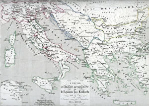
Background imageAtlas Book Collection: Map of the Eastern Roman Empire (Byzantine Empire) and the Kingdom of the Lombards

Map of the Eastern Roman Empire (Byzantine Empire) and the Kingdom of the Lombards
ELD4928045 Map of the Eastern Roman Empire (Byzantine Empire) and the Kingdom of the Lombards, 553-774 (Map of byzantine empire and Kingdom of the Lombards)

Background imageAtlas Book Collection: Jerusalem, leave B, Israel (engraving, 1572-1617)

Jerusalem, leave B, Israel (engraving, 1572-1617)
LRI4714746 Jerusalem, leave B, Israel (engraving, 1572-1617) by Braun, Georg (1541-1622) and Hogenberg, Franz (1535-90); Private Collection; (add.info.: Jerusalem, leave)

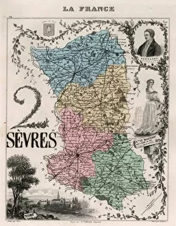
Background imageAtlas Book Collection: Les Deux Sevres (Deux-Sevres, 79), Poitou Charentes (Poitou-Charentes) - France and its Colonies

Les Deux Sevres (Deux-Sevres, 79), Poitou Charentes (Poitou-Charentes) - France and its Colonies
XEE4144439 Les Deux Sevres (Deux-Sevres, 79), Poitou Charentes (Poitou-Charentes) - France and its Colonies. Atlas illustrates one hundred and five maps from the maps of the depot of war

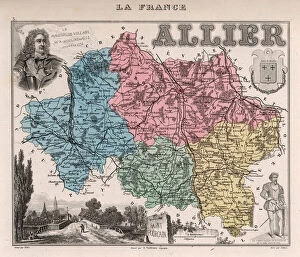
Background imageAtlas Book Collection: Department of Allier (03), Auvergne - France and its Colonies. Atlas illustrates one hundred

Department of Allier (03), Auvergne - France and its Colonies. Atlas illustrates one hundred
XEE4144657 Department of Allier (03), Auvergne - France and its Colonies. Atlas illustrates one hundred and five maps from the maps of the depot of war, bridges and footwear and the Navy by M

Background imageAtlas Book Collection: Le Cantal (15), Auvergne - France and its Colonies. Atlas illustrates one hundred

Le Cantal (15), Auvergne - France and its Colonies. Atlas illustrates one hundred
XEE4144621 Le Cantal (15), Auvergne - France and its Colonies. Atlas illustrates one hundred and five maps from the maps of the depot of war, bridges and footwear and the Navy by M. VUILLEMIN. 1876

Background imageAtlas Book Collection: Corsica including South Corsica (2A) and Haute Corsica (2B) - France and its Colonies

Corsica including South Corsica (2A) and Haute Corsica (2B) - France and its Colonies
XEE4144608 Corsica including South Corsica (2A) and Haute Corsica (2B) - France and its Colonies. Atlas illustrates one hundred and five maps drawn from the maps of the depot of war

Background imageAtlas Book Collection: Le Gers (32), Midi-Pyrenees (Midi Pyrenees) - France and its Colonies. Atlas illustrates one hundred

Le Gers (32), Midi-Pyrenees (Midi Pyrenees) - France and its Colonies. Atlas illustrates one hundred
XEE4144568 Le Gers (32), Midi-Pyrenees (Midi Pyrenees) - France and its Colonies. Atlas illustrates one hundred and five maps from the maps of the depot of war

Background imageAtlas Book Collection: Le Morbihan (56), Brittany - France and its Colonies. Atlas illustrates one hundred

Le Morbihan (56), Brittany - France and its Colonies. Atlas illustrates one hundred
XEE4144496 Le Morbihan (56), Brittany - France and its Colonies. Atlas illustrates one hundred and five maps from the maps of the depot of war, bridges and footwear and the Navy by M. VUILLEMIN

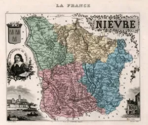
Background imageAtlas Book Collection: La Nievre (58), Burgundy - France and its Colonies. Atlas illustrates one hundred

La Nievre (58), Burgundy - France and its Colonies. Atlas illustrates one hundred
XEE4144487 La Nievre (58), Burgundy - France and its Colonies. Atlas illustrates one hundred and five maps from the maps of the depot of war, bridges and footwear and the Navy by M. VUILLEMIN. 1876

Background imageAtlas Book Collection: Le Nord (59), Nord Pas De Calais (Nord-Pas-de-Calais) - France and its Colonies

Le Nord (59), Nord Pas De Calais (Nord-Pas-de-Calais) - France and its Colonies
XEE4144486 Le Nord (59), Nord Pas De Calais (Nord-Pas-de-Calais) - France and its Colonies. Atlas illustrates one hundred and five maps from the maps of the depot of war

Background imageAtlas Book Collection: Tarn (Tarn, 81), Midi-Pyrenees (Midi Pyrenees) - France and its Colonies

Tarn (Tarn, 81), Midi-Pyrenees (Midi Pyrenees) - France and its Colonies. Atlas illustrates one hundred
XEE4144429 Tarn (Tarn, 81), Midi-Pyrenees (Midi Pyrenees) - France and its Colonies. Atlas illustrates one hundred and five maps from the maps of the depot of war

Background imageAtlas Book Collection: La Vendee (85), Pays de la Loire, - France and its Colonies. Atlas illustrates one hundred

La Vendee (85), Pays de la Loire, - France and its Colonies. Atlas illustrates one hundred
XEE4144421 La Vendee (85), Pays de la Loire, - France and its Colonies. Atlas illustrates one hundred and five maps from the maps of the depot of war, bridges and footwear and the Navy by M

Background imageAtlas Book Collection: Map of the city of Paris in 1876. - France and its Colonies. Atlas illustrates one hundred

Map of the city of Paris in 1876. - France and its Colonies. Atlas illustrates one hundred
XEE4144404 Map of the city of Paris in 1876. - France and its Colonies. Atlas illustrates one hundred and five maps drawn from the maps of the depot of war, bridges and footwear and the Navy by M

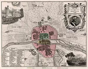
Background imageAtlas Book Collection: The city of Paris as it was in the future of Philippe Auguste in 1180. - France and its Colonies

The city of Paris as it was in the future of Philippe Auguste in 1180. - France and its Colonies
XEE4144408 The city of Paris as it was in the future of Philippe Auguste in 1180. - France and its Colonies. Atlas illustrates one hundred and five maps from the maps of the depot of war

Background imageAtlas Book Collection: Africa Francaise, Senegal - France and its Colonies. Atlas illustrates one hundred

Africa Francaise, Senegal - France and its Colonies. Atlas illustrates one hundred
XEE4144393 Africa Francaise, Senegal - France and its Colonies. Atlas illustrates one hundred and five maps from the maps of the depot of war, bridges and footwear and the Navy by M. VUILLEMIN. 1876

Background imageAtlas Book Collection: Department of Ariege (09), Midi-Pyrenees (Midi Pyrenees) - France and its Colonies

Department of Ariege (09), Midi-Pyrenees (Midi Pyrenees) - France and its Colonies
XEE4144639 Department of Ariege (09), Midi-Pyrenees (Midi Pyrenees) - France and its Colonies. Atlas illustrates one hundred and five maps from the maps of the depot of war

Background imageAtlas Book Collection: La Charente (16), Poitou-Charentes (Poitou Charentes) - France and its Colonies

La Charente (16), Poitou-Charentes (Poitou Charentes) - France and its Colonies
XEE4144617 La Charente (16), Poitou-Charentes (Poitou Charentes) - France and its Colonies. Atlas illustrates one hundred and five maps from the maps of the depot of war

Background imageAtlas Book Collection: Les Cotes du Nord (now Cotes d Armor or or Cotes d Armor, 22), Brittany - La France et ses Colonies

Les Cotes du Nord (now Cotes d Armor or or Cotes d Armor, 22), Brittany - La France et ses Colonies
XEE4144600 Les Cotes du Nord (now Cotes d Armor or or Cotes d Armor, 22), Brittany - La France et ses Colonies. Atlas illustrates one hundred and five maps from the maps of the depot of war

Background imageAtlas Book Collection: La Haute Garonne (Haute-Garonne, 31), Midi-Pyrenees (Midi Pyrenees) - France and its Colonies

La Haute Garonne (Haute-Garonne, 31), Midi-Pyrenees (Midi Pyrenees) - France and its Colonies
XEE4144571 La Haute Garonne (Haute-Garonne, 31), Midi-Pyrenees (Midi Pyrenees) - France and its Colonies. Atlas illustrates one hundred and five maps from the maps of the depot of war

Background imageAtlas Book Collection: Ille-et-Vilaine (Ille and Vilaine, 35), Brittany - La France et ses Colonies

Ille-et-Vilaine (Ille and Vilaine, 35), Brittany - La France et ses Colonies
XEE4144562 Ille-et-Vilaine (Ille and Vilaine, 35), Brittany - La France et ses Colonies. Atlas illustrates one hundred and five maps from the maps of the depot of war

Background imageAtlas Book Collection: L Isere (38), Rhone-Alpes (Rhone Alpes) - France and its Colonies. Atlas illustrates one hundred

L Isere (38), Rhone-Alpes (Rhone Alpes) - France and its Colonies. Atlas illustrates one hundred
XEE4144554 L Isere (38), Rhone-Alpes (Rhone Alpes) - France and its Colonies. Atlas illustrates one hundred and five maps from the maps of the depot of war, bridges and footwear and the Navy by M

Background imageAtlas Book Collection: Le Loir-et-Cher (Loir et Cher, 41), Centre - La France et ses Colonies

Le Loir-et-Cher (Loir et Cher, 41), Centre - La France et ses Colonies. Atlas illustrates one hundred
XEE4144546 Le Loir-et-Cher (Loir et Cher, 41), Centre - La France et ses Colonies. Atlas illustrates one hundred and five maps from the maps of the depot of war

Background imageAtlas Book Collection: La Loire Inferieure (Loire-Inferieure, now Loire Atlantique, 44)

La Loire Inferieure (Loire-Inferieure, now Loire Atlantique, 44), Pays de la Loire - France and its Colonies
XEE4144540 La Loire Inferieure (Loire-Inferieure, now Loire Atlantique, 44), Pays de la Loire - France and its Colonies. Atlas illustrates one hundred and five maps from the maps of the depot of war

Background imageAtlas Book Collection: La Moselle (57) - France and its Colonies. Atlas illustrates one hundred

La Moselle (57) - France and its Colonies. Atlas illustrates one hundred and five maps from the maps of the depot of
XEE4144492 La Moselle (57) - France and its Colonies. Atlas illustrates one hundred and five maps from the maps of the depot of war, bridges and footwear and the Navy by M. VUILLEMIN. 1876

Background imageAtlas Book Collection: Pas de Calais (62), Nord Pas de Calais (Nord-Pas-De-Calais) - France and its Colonies

Pas de Calais (62), Nord Pas de Calais (Nord-Pas-De-Calais) - France and its Colonies
XEE4144480 Pas de Calais (62), Nord Pas de Calais (Nord-Pas-De-Calais) - France and its Colonies. Atlas illustrates one hundred and five maps from the maps of the depot of war

Background imageAtlas Book Collection: Bases Pyrenees, now Pyrenees-Atlantiques (Pyrenees Atlantiques, 64)

Bases Pyrenees, now Pyrenees-Atlantiques (Pyrenees Atlantiques, 64), Aquitaine - La France et ses Colonies
XEE4144473 Bases Pyrenees, now Pyrenees-Atlantiques (Pyrenees Atlantiques, 64), Aquitaine - La France et ses Colonies. Atlas illustrates one hundred and five maps from the maps of the depot of war

Background imageAtlas Book Collection: Bas Rhin (Bas-Rhin, 67), Alsace - La France et ses Colonies. Atlas illustrates one hundred

Bas Rhin (Bas-Rhin, 67), Alsace - La France et ses Colonies. Atlas illustrates one hundred
XEE4144467 Bas Rhin (Bas-Rhin, 67), Alsace - La France et ses Colonies. Atlas illustrates one hundred and five maps from the maps of the depot of war, bridges and footwear and the Navy by M

Background imageAtlas Book Collection: La Somme (80), Picardie - France and its Colonies. Atlas illustrates one hundred

La Somme (80), Picardie - France and its Colonies. Atlas illustrates one hundred
XEE4144432 La Somme (80), Picardie - France and its Colonies. Atlas illustrates one hundred and five maps from the maps of the depot of war, bridges and footwear and the Navy by M. VUILLEMIN. 1876

Background imageAtlas Book Collection: Tarn et Garonne (Tarn-et-Garonne, 82), Midi-Pyrenees (Midi Pyrenees) - France and its Colonies

Tarn et Garonne (Tarn-et-Garonne, 82), Midi-Pyrenees (Midi Pyrenees) - France and its Colonies
XEE4144425 Tarn et Garonne (Tarn-et-Garonne, 82), Midi-Pyrenees (Midi Pyrenees) - France and its Colonies. Atlas illustrates one hundred and five maps from the maps of the depot of war

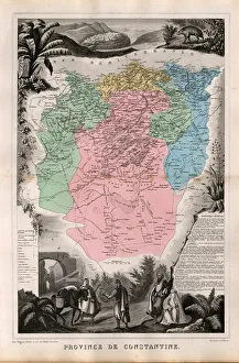
Background imageAtlas Book Collection: Department of Constantine, French Algeria. - France and its Colonies. Atlas illustrates one hundred

Department of Constantine, French Algeria. - France and its Colonies. Atlas illustrates one hundred
XEE4144396 Department of Constantine, French Algeria. - France and its Colonies. Atlas illustrates one hundred and five maps from the maps of the depot of war, bridges and footwear and the Navy by M

Background imageAtlas Book Collection: La Guadeloupe (overseas department or overseas department) - France and its Colonies

La Guadeloupe (overseas department or overseas department) - France and its Colonies
XEE4144387 La Guadeloupe (overseas department or overseas department) - France and its Colonies. Atlas illustrates one hundred and five maps from the maps of the depot of war


All Professionally Made to Order for Quick Shipping

Discover the world through the pages of the Atlas Book. This captivating collection takes you on a journey across time and space, showcasing intricate engravings of maps from various regions. Immerse yourself in history as you explore the Map of Tartar territory, dating back to 1570, or marvel at the detailed depiction of Tuscany in Italy from the same era. Travel further with a glimpse into Poitou Charentes in France during 1717 or delve into Franconia in Germany during 1570. But it doesn't stop there; this remarkable atlas also includes fascinating maps such as Jerusalem, offering a unique perspective on Israel between 1572 and 1617. Explore Les Deux Sevres and Department of Allier in France, both part of an extensive collection featuring one hundred and five meticulously crafted maps by M. VUILLEMIN from 1876. From Corsica's stunning landscapes to Le Gers' picturesque Midi-Pyrenees region, each map offers a window into different corners of France and its colonies. Lose yourself among these beautifully illustrated depictions that were once used by war depots, bridges departments, footwear manufacturers, and even naval forces. The Atlas Book is not just an ordinary compilation; it is a treasure trove for history enthusiasts and cartography aficionados alike. Embark on an extraordinary voyage through time with this exceptional volume that brings centuries-old maps to life before your eyes. Let your imagination soar as you flip through page after page filled with rich details waiting to be discovered within these ancient engravings. Uncover hidden gems like Le Cantal's enchanting landscapes or get lost amidst Brittany's charming beauty captured within La Nievre's borders. Each turn reveals new wonders awaiting exploration - all thanks to M. VUILLEMIN's masterful artistry showcased throughout this remarkable atlas. Whether you're seeking knowledge about historical territories or simply appreciate fine craftsmanship, the a must-have addition to any collection.