
Atlas Maior Collection
The "Atlas Maior" is a remarkable collection of maps and engravings that offers a glimpse into the world as it was in the 17th century


All Professionally Made to Order for Quick Shipping
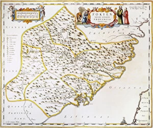
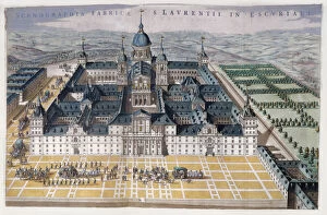
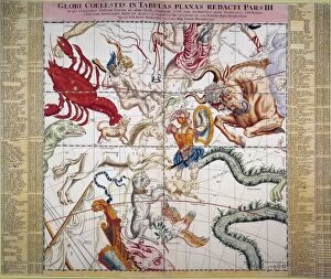
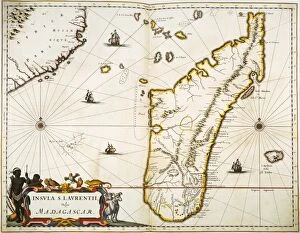
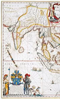
The "Atlas Maior" is a remarkable collection of maps and engravings that offers a glimpse into the world as it was in the 17th century. One of its notable pieces is the Fujian Map, engraved in 1662 by Jan Blaeu. This map showcases the province of Fujian in China, along with the Strait of Taiwan and part of Taiwan itself (then known as Formosa). It provides an intriguing snapshot of this region's geography during that time. Another captivating artwork within the the View of Madrid Escorial, created between 1662-5. This colorful engraving allows us to marvel at this architectural masterpiece located near Madrid, Spain. Its intricate details transport us back to a period when grandeur and opulence were highly valued. The it also presents several maps that provide insights into global perspectives from centuries ago. The Double Hemisphere Map of the World, crafted by Joan Blaeu in 1662, offers a comprehensive view of our planet during that era. Similarly, his Europe Map showcases political boundaries and geographical features specific to Europe. Moving beyond continents, we find fascinating regional maps like Livonia Map or Vulgo Lyefland which focuses on present-day Estonia and Latvia. These detailed depictions give us an idea about how these regions were perceived at that time. The Atlas Maior doesn't limit itself to Earthly realms; it delves into celestial wonders too. A Celestial Planisphere from 1729 displays constellations on a flat sheet - providing astronomers and enthusiasts alike with valuable information about heavenly bodies during this period. Exploring further eastwards brings us to East Africa through another map featured in this atlas. Printed in Amsterdam in 1665, it depicts Ethiopia (the kingdom associated with Prester John), Abyssinia, and Arabia – offering glimpses into trade routes and cultural connections prevalent then.