
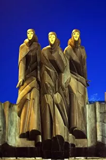
Baltic Sea Collection
The Baltic Sea, a picturesque body of water nestled between Scandinavia and Northern Europe, holds a rich tapestry of history and natural beauty


All Professionally Made to Order for Quick Shipping
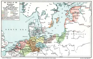
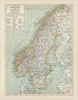
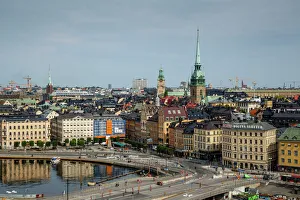
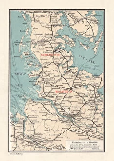
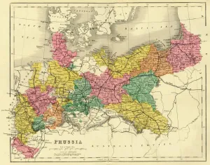
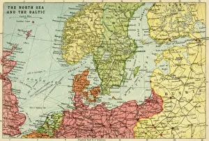
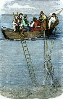
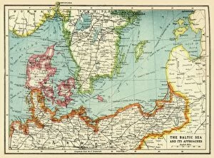
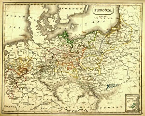
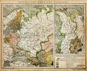
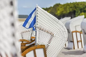
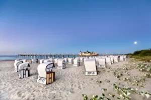
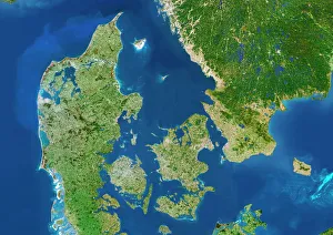
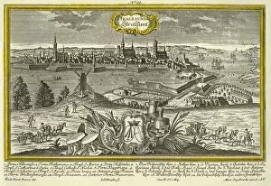
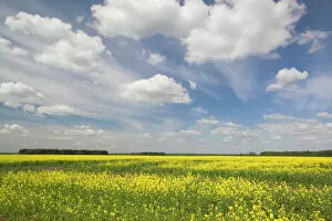
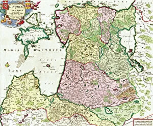
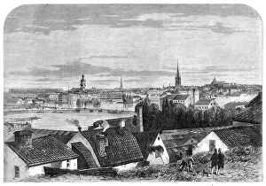
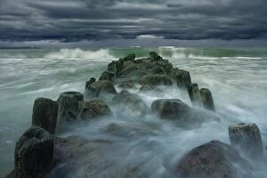
The Baltic Sea, a picturesque body of water nestled between Scandinavia and Northern Europe, holds a rich tapestry of history and natural beauty. Its significance is evident in the map showcasing the extent of the Hanseatic League during its prime in 1400. This league was an influential trading alliance that shaped commerce and culture across the region. Moving forward to 1887, we find ourselves exploring Kiel, the capital of Schleswig-Holstein in Germany. The lithograph captures this vibrant city's essence as it bustles with activity around its harbor. Nearby lies Flensburg, another charming German town situated on the Baltic coast. Venturing further northward, we encounter Sweden and Norway through a lithograph published in 1878. These Scandinavian nations boast stunning landscapes and cultural heritage that have captivated visitors for centuries. Stockholm's skyline stands tall as a testament to its historical significance within Europe. Maps serve as gateways to understanding regions better; one such map from 1887 showcases Schleswig-Holstein's position as Germany's northernmost state. It highlights both its geographical features and importance within Prussia during that era. As we delve deeper into maritime exploration, John Bartholomew & Son present us with their depiction of the North Sea and Baltic circa 1914-1920. This map illustrates how these interconnected bodies of water facilitated trade routes while shaping political boundaries throughout history. Now let us shift our focus towards serene coastal scenes along this enchanting sea: Zingst beach in Mecklenburg-Western Pomerania offers respite with its inviting beach chairs dotting sandy shores under clear blue skies. Meanwhile, Dueodde Beach on Denmark's Bornholm Island boasts majestic dunes that beckon adventurers seeking tranquility amidst nature's wonders. Finally, imagine gazing at Ahlbeck pier under a full moon illuminating beach baskets lining Usedom island’s shoreline—Mecklenburg-Western Pomerania's crown jewel.