
Bering Strait Collection
"Discovering the Mysteries of the Bering Strait: A Journey through Time and Nature" Step into the past with Cornelis de Jode's 1593 map


All Professionally Made to Order for Quick Shipping
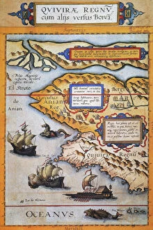
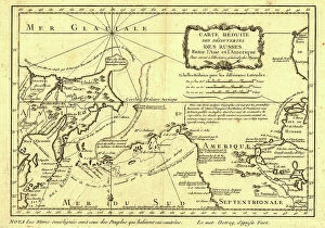
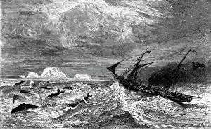
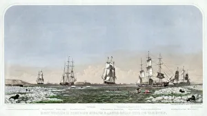
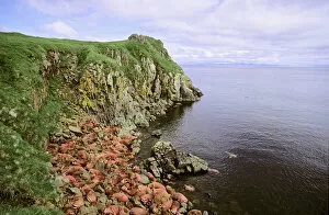
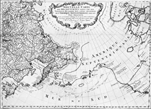
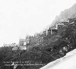
"Discovering the Mysteries of the Bering Strait: A Journey through Time and Nature" Step into the past with Cornelis de Jode's 1593 map, where Western North America unfolds before your eyes. Behold the fabled province of Quivira in California, alongside the legendary Bering Strait (El Streto de Anian). As if from a tale, two sea monsters lurk in these uncharted waters while European sailing ships and an Oriental presence hint at distant encounters. Fast forward to 1875, as we embark on a thrilling boat adventure in the Behrings Sea. The unknown awaits us as we navigate through icy currents and vast expanses. Who knows what wonders lie beyond? In this journey through time, witness right whaling in Behering Straits & Arctic Ocean with its varieties. Published in 1871, a color lithograph captures scenes of brave sailors pursuing their quarry amidst treacherous ice floes. Their courage is matched only by their determination to harvest nature's bounties. Travel back further still to Middleton Park, Oxfordshire in 1840. Enter the Chinese Room adorned with exquisite artifacts that speak of cultural exchange between East and West—a testament to humanity's ceaseless curiosity about distant lands. Nature takes center stage once more as Pacific Walruses grace our presence on Round Island, Alaska. These magnificent creatures (Odobenus rosmarus divergens) embody resilience against harsh Arctic conditions—symbols of adaptability and survival. Finally, let us not forget Alaska itself—a land teeming with opportunities for exploration and adventure since time immemorial. With a good-natured map from 1934 guiding our way, we can revel in all that this majestic state has to offer—from breathtaking landscapes to unparalleled services catering to every traveler's needs. Join us on this captivating journey across centuries—an odyssey filled with maps depicting uncharted territories, daring expeditions, cultural encounters, and the awe-inspiring beauty of nature.