Fraud Blocker Skip to main content

Bracken Close Collection

Discover the charm of Bracken Close, a hidden gem nestled in various locations across the UK

Background imageBracken Close Collection: Cannock Chase WS12 4 Map

Cannock Chase WS12 4 Map
Postcode Sector Map of Cannock Chase WS12 4

Background imageBracken Close Collection: North Yorkshire YO22 4 Map

North Yorkshire YO22 4 Map
Postcode Sector Map of North Yorkshire YO22 4

Background imageBracken Close Collection: York YO32 9 Map

York YO32 9 Map
Postcode Sector Map of York YO32 9

Background imageBracken Close Collection: Teignbridge TQ12 4 Map

Teignbridge TQ12 4 Map
Postcode Sector Map of Teignbridge TQ12 4

Background imageBracken Close Collection: Horsham RH20 3 Map

Horsham RH20 3 Map
Postcode Sector Map of Horsham RH20 3

Background imageBracken Close Collection: Bolsover NG20 0 Map

Bolsover NG20 0 Map
Postcode Sector Map of Bolsover NG20 0

Background imageBracken Close Collection: Tameside M43 7 Map

Tameside M43 7 Map
Postcode Sector Map of Tameside M43 7

Background imageBracken Close Collection: Leeds LS25 6 Map

Leeds LS25 6 Map
Postcode Sector Map of Leeds LS25 6

Background imageBracken Close Collection: Leicester LE5 4 Map

Leicester LE5 4 Map
Postcode Sector Map of Leicester LE5 4

Background imageBracken Close Collection: Mole Valley KT23 3 Map

Mole Valley KT23 3 Map
Postcode Sector Map of Mole Valley KT23 3

Background imageBracken Close Collection: Doncaster DN3 3 Map

Doncaster DN3 3 Map
Postcode Sector Map of Doncaster DN3 3

Background imageBracken Close Collection: Wolverhampton WV8 1 Map

Wolverhampton WV8 1 Map
Postcode Sector Map of Wolverhampton WV8 1

Background imageBracken Close Collection: Wigan WA3 7 Map

Wigan WA3 7 Map
Postcode Sector Map of Wigan WA3 7

Background imageBracken Close Collection: Hertsmere WD6 5 Map

Hertsmere WD6 5 Map
Postcode Sector Map of Hertsmere WD6 5

Background imageBracken Close Collection: Worcester WR2 6 Map

Worcester WR2 6 Map
Postcode Sector Map of Worcester WR2 6

Background imageBracken Close Collection: Wigan WN6 0 Map

Wigan WN6 0 Map
Postcode Sector Map of Wigan WN6 0

Background imageBracken Close Collection: Ashford TN24 9 Map

Ashford TN24 9 Map
Postcode Sector Map of Ashford TN24 9

Background imageBracken Close Collection: Spelthorne TW16 7 Map

Spelthorne TW16 7 Map
Postcode Sector Map of Spelthorne TW16 7

Background imageBracken Close Collection: Staffordshire ST16 1 Map

Staffordshire ST16 1 Map
Postcode Sector Map of Staffordshire ST16 1

Background imageBracken Close Collection: Staffordshire ST12 9 Map

Staffordshire ST12 9 Map
Postcode Sector Map of Staffordshire ST12 9

Background imageBracken Close Collection: Tameside SK14 8 Map

Tameside SK14 8 Map
Postcode Sector Map of Tameside SK14 8

Background imageBracken Close Collection: Cheshire East SK10 3 Map

Cheshire East SK10 3 Map
Postcode Sector Map of Cheshire East SK10 3

Background imageBracken Close Collection: South Buckinghamshire SL2 3 Map

South Buckinghamshire SL2 3 Map
Postcode Sector Map of South Buckinghamshire SL2 3

Background imageBracken Close Collection: Lichfield WS7 9 Map

Lichfield WS7 9 Map
Postcode Sector Map of Lichfield WS7 9

Background imageBracken Close Collection: Kirklees WF14 0 Map

Kirklees WF14 0 Map
Postcode Sector Map of Kirklees WF14 0

Background imageBracken Close Collection: Lichfield WS14 9 Map

Lichfield WS14 9 Map
Postcode Sector Map of Lichfield WS14 9

Background imageBracken Close Collection: Richmond upon Thames TW2 7 Map

Richmond upon Thames TW2 7 Map
Postcode Sector Map of Richmond upon Thames TW2 7

Background imageBracken Close Collection: Staffordshire ST7 3 Map

Staffordshire ST7 3 Map
Postcode Sector Map of Staffordshire ST7 3

Background imageBracken Close Collection: Wealden TN6 2 Map

Wealden TN6 2 Map
Postcode Sector Map of Wealden TN6 2

Background imageBracken Close Collection: Tunbridge Wells TN2 3 Map

Tunbridge Wells TN2 3 Map
Postcode Sector Map of Tunbridge Wells TN2 3

Background imageBracken Close Collection: Berkshire RG31 5 Map

Berkshire RG31 5 Map
Postcode Sector Map of Berkshire RG31 5

Background imageBracken Close Collection: Test Valley SO52 9 Map

Test Valley SO52 9 Map
Postcode Sector Map of Test Valley SO52 9

Background imageBracken Close Collection: Wiltshire SP5 3 Map

Wiltshire SP5 3 Map
Postcode Sector Map of Wiltshire SP5 3

Background imageBracken Close Collection: Staffordshire ST3 7 Map

Staffordshire ST3 7 Map
Postcode Sector Map of Staffordshire ST3 7

Background imageBracken Close Collection: Cornwall PL31 2 Map

Cornwall PL31 2 Map
Postcode Sector Map of Cornwall PL31 2

Background imageBracken Close Collection: Plymouth PL6 7 Map

Plymouth PL6 7 Map
Postcode Sector Map of Plymouth PL6 7

Background imageBracken Close Collection: Stockport SK6 5 Map

Stockport SK6 5 Map
Postcode Sector Map of Stockport SK6 5

Background imageBracken Close Collection: Kettering NN16 9 Map

Kettering NN16 9 Map
Postcode Sector Map of Kettering NN16 9

Background imageBracken Close Collection: West Oxfordshire OX18 1 Map

West Oxfordshire OX18 1 Map
Postcode Sector Map of West Oxfordshire OX18 1

Background imageBracken Close Collection: Oldham OL4 4 Map

Oldham OL4 4 Map
Postcode Sector Map of Oldham OL4 4

Background imageBracken Close Collection: Gedling NG4 4 Map

Gedling NG4 4 Map
Postcode Sector Map of Gedling NG4 4

Background imageBracken Close Collection: Chorley PR6 0 Map

Chorley PR6 0 Map
Postcode Sector Map of Chorley PR6 0

Background imageBracken Close Collection: Hampshire PO13 8 Map

Hampshire PO13 8 Map
Postcode Sector Map of Hampshire PO13 8

Background imageBracken Close Collection: Crawley RH10 8 Map

Crawley RH10 8 Map
Postcode Sector Map of Crawley RH10 8

Background imageBracken Close Collection: Crawley RH10 3 Map

Crawley RH10 3 Map
Postcode Sector Map of Crawley RH10 3

Background imageBracken Close Collection: Norfolk NR21 8 Map

Norfolk NR21 8 Map
Postcode Sector Map of Norfolk NR21 8

Background imageBracken Close Collection: Norfolk NR10 5 Map

Norfolk NR10 5 Map
Postcode Sector Map of Norfolk NR10 5

Background imageBracken Close Collection: Norfolk NR10 3 Map

Norfolk NR10 3 Map
Postcode Sector Map of Norfolk NR10 3


All Professionally Made to Order for Quick Shipping

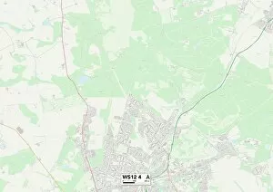
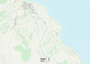
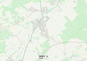
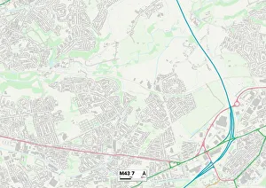
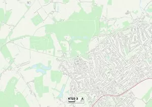
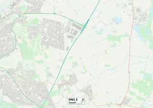
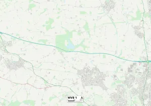
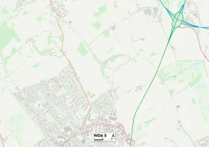
Discover the charm of Bracken Close, a hidden gem nestled in various locations across the UK. From Cannock Chase to North Yorkshire, Teignbridge to Horsham, and Bolsover to Tameside, this enchanting neighborhood can be found in diverse landscapes. Whether you're seeking tranquility amidst nature or vibrant city life, it offers something for everyone. Immerse yourself in the beauty of Cannock Chase's WS12 4 Map location, where lush greenery and scenic trails await your exploration. In North Yorkshire's YO22 4 Map area, picturesque countryside views will captivate your senses and provide a peaceful retreat from bustling city life. For those craving coastal adventures, head to Teignbridge's TQ12 4 Map spot and indulge in sandy beaches and breathtaking ocean vistas. Alternatively, escape to Horsham's RH20 3 Map region for idyllic countryside living with charming villages dotted throughout. Experience history come alive at Bolsover's NG20 0 Map location as you explore its rich heritage sites and architectural wonders. Meanwhile, Tameside's M43 7 Map area boasts a perfect blend of urban amenities and natural beauty that caters to all interests. Leicester's LE5 4 Map district invites you into its vibrant community filled with cultural diversity and an array of entertainment options. Mole Valley's KT23 3 Map locale beckons outdoor enthusiasts with its rolling hillsides perfect for hiking or cycling adventures. Doncaster's DN3 3 Map setting offers a mix of modern conveniences alongside historic landmarks that showcase the town’s fascinating past. Wolverhampton’s WV8 1 map position provides easy access to both rural charm and urban excitement within close proximity. Lastly but not leastly is Wigan’s WA3 7 map destination located within Hertsmere WD6-5 map territory which combines small-town charm with a bustling atmosphere, offering an array of shopping and dining experiences.