Fraud Blocker Skip to main content

Bridge Road Collection (page 2)

Discover the charm of Bridge Road as it winds through various picturesque locations across the UK

Background imageBridge Road Collection: St. Helens WA9 4 Map

St. Helens WA9 4 Map
Postcode Sector Map of St. Helens WA9 4

Background imageBridge Road Collection: Hampshire PO10 7 Map

Hampshire PO10 7 Map
Postcode Sector Map of Hampshire PO10 7

Background imageBridge Road Collection: Mid Sussex RH16 1 Map

Mid Sussex RH16 1 Map
Postcode Sector Map of Mid Sussex RH16 1

Background imageBridge Road Collection: Staffordshire ST4 6 Map

Staffordshire ST4 6 Map
Postcode Sector Map of Staffordshire ST4 6

Background imageBridge Road Collection: Shropshire TF9 3 Map

Shropshire TF9 3 Map
Postcode Sector Map of Shropshire TF9 3

Background imageBridge Road Collection: Telford and Wrekin TF8 7 Map

Telford and Wrekin TF8 7 Map
Postcode Sector Map of Telford and Wrekin TF8 7

Background imageBridge Road Collection: Shropshire TF13 6 Map

Shropshire TF13 6 Map
Postcode Sector Map of Shropshire TF13 6

Background imageBridge Road Collection: Shropshire TF12 5 Map

Shropshire TF12 5 Map
Postcode Sector Map of Shropshire TF12 5

Background imageBridge Road Collection: Telford and Wrekin TF1 1 Map

Telford and Wrekin TF1 1 Map
Postcode Sector Map of Telford and Wrekin TF1 1

Background imageBridge Road Collection: Teignbridge TQ14 0 Map

Teignbridge TQ14 0 Map
Postcode Sector Map of Teignbridge TQ14 0

Background imageBridge Road Collection: South Hams TQ9 5 Map

South Hams TQ9 5 Map
Postcode Sector Map of South Hams TQ9 5

Background imageBridge Road Collection: South Hams TQ6 0 Map

South Hams TQ6 0 Map
Postcode Sector Map of South Hams TQ6 0

Background imageBridge Road Collection: Torbay TQ5 0 Map

Torbay TQ5 0 Map
Postcode Sector Map of Torbay TQ5 0

Background imageBridge Road Collection: Havering RM13 9 Map

Havering RM13 9 Map
Postcode Sector Map of Havering RM13 9

Background imageBridge Road Collection: Sutton SM1 1 Map

Sutton SM1 1 Map
Postcode Sector Map of Sutton SM1 1

Background imageBridge Road Collection: South Buckinghamshire SL6 8 Map

South Buckinghamshire SL6 8 Map
Postcode Sector Map of South Buckinghamshire SL6 8

Background imageBridge Road Collection: Windsor and Maidenhead SL5 9 Map

Windsor and Maidenhead SL5 9 Map
Postcode Sector Map of Windsor and Maidenhead SL5 9

Background imageBridge Road Collection: Basildon SS11 8 Map

Basildon SS11 8 Map
Postcode Sector Map of Basildon SS11 8

Background imageBridge Road Collection: Rochford SS3 9 Map

Rochford SS3 9 Map
Postcode Sector Map of Rochford SS3 9

Background imageBridge Road Collection: Test Valley SO51 5 Map

Test Valley SO51 5 Map
Postcode Sector Map of Test Valley SO51 5

Background imageBridge Road Collection: Wiltshire SP5 4 Map

Wiltshire SP5 4 Map
Postcode Sector Map of Wiltshire SP5 4

Background imageBridge Road Collection: Cornwall PL12 5 Map

Cornwall PL12 5 Map
Postcode Sector Map of Cornwall PL12 5

Background imageBridge Road Collection: Cornwall PL11 3 Map

Cornwall PL11 3 Map
Postcode Sector Map of Cornwall PL11 3

Background imageBridge Road Collection: Perth and Kinross PH16 5 Map

Perth and Kinross PH16 5 Map
Postcode Sector Map of Perth and Kinross PH16 5

Background imageBridge Road Collection: Cornwall PL25 5 Map

Cornwall PL25 5 Map
Postcode Sector Map of Cornwall PL25 5

Background imageBridge Road Collection: Preston PR2 2 Map

Preston PR2 2 Map
Postcode Sector Map of Preston PR2 2

Background imageBridge Road Collection: Isle of Wight PO41 0 Map

Isle of Wight PO41 0 Map
Postcode Sector Map of Isle of Wight PO41 0

Background imageBridge Road Collection: East Lindsey PE23 4 Map

East Lindsey PE23 4 Map
Postcode Sector Map of East Lindsey PE23 4

Background imageBridge Road Collection: Renfrewshire PA14 5 Map

Renfrewshire PA14 5 Map
Postcode Sector Map of Renfrewshire PA14 5

Background imageBridge Road Collection: South Holland PE12 9 Map

South Holland PE12 9 Map
Postcode Sector Map of South Holland PE12 9

Background imageBridge Road Collection: East Northamptonshire NN14 2 Map

East Northamptonshire NN14 2 Map
Postcode Sector Map of East Northamptonshire NN14 2

Background imageBridge Road Collection: South Northamptonshire NN12 7 Map

South Northamptonshire NN12 7 Map
Postcode Sector Map of South Northamptonshire NN12 7

Background imageBridge Road Collection: Brent NW10 9 Map

Brent NW10 9 Map
Postcode Sector Map of Brent NW10 9

Background imageBridge Road Collection: West Norfolk PE38 0 Map

West Norfolk PE38 0 Map
Postcode Sector Map of West Norfolk PE38 0

Background imageBridge Road Collection: Norfolk NR31 6 Map

Norfolk NR31 6 Map
Postcode Sector Map of Norfolk NR31 6

Background imageBridge Road Collection: Norfolk NR21 0 Map

Norfolk NR21 0 Map
Postcode Sector Map of Norfolk NR21 0

Background imageBridge Road Collection: Perth and Kinross PH1 4 Map

Perth and Kinross PH1 4 Map
Postcode Sector Map of Perth and Kinross PH1 4

Background imageBridge Road Collection: South Ribble PR5 5 Map

South Ribble PR5 5 Map
Postcode Sector Map of South Ribble PR5 5

Background imageBridge Road Collection: Isle of Wight PO32 6 Map

Isle of Wight PO32 6 Map
Postcode Sector Map of Isle of Wight PO32 6

Background imageBridge Road Collection: Isle of Wight PO31 7 Map

Isle of Wight PO31 7 Map
Postcode Sector Map of Isle of Wight PO31 7

Background imageBridge Road Collection: Sussex PO19 6 Map

Sussex PO19 6 Map
Postcode Sector Map of Sussex PO19 6

Background imageBridge Road Collection: Horsham RH12 3 Map

Horsham RH12 3 Map
Postcode Sector Map of Horsham RH12 3

Background imageBridge Road Collection: Suffolk NR33 9 Map

Suffolk NR33 9 Map
Postcode Sector Map of Suffolk NR33 9

Background imageBridge Road Collection: Norfolk NR31 0 Map

Norfolk NR31 0 Map
Postcode Sector Map of Norfolk NR31 0

Background imageBridge Road Collection: Norfolk NR30 1 Map

Norfolk NR30 1 Map
Postcode Sector Map of Norfolk NR30 1

Background imageBridge Road Collection: Norfolk NR29 5 Map

Norfolk NR29 5 Map
Postcode Sector Map of Norfolk NR29 5

Background imageBridge Road Collection: Norfolk NR25 6 Map

Norfolk NR25 6 Map
Postcode Sector Map of Norfolk NR25 6

Background imageBridge Road Collection: Norfolk NR20 5 Map

Norfolk NR20 5 Map
Postcode Sector Map of Norfolk NR20 5


All Professionally Made to Order for Quick Shipping

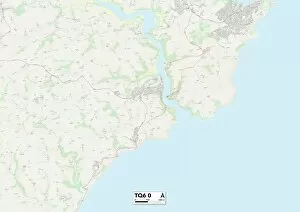
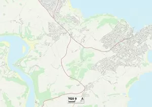
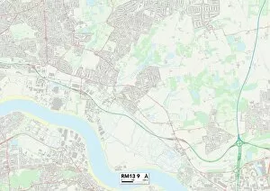
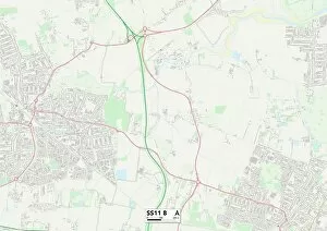
Discover the charm of Bridge Road as it winds through various picturesque locations across the UK. From Bexley DA7 to Ashford TN25, this road takes you on a journey through stunning landscapes and vibrant communities. Explore Telford and Wrekin TF4, where history meets modernity, or immerse yourself in the lively atmosphere of Thurrock RM17. West Norfolk PE33 offers a tranquil escape with its idyllic countryside views, while Huntingdonshire PE28 invites you to explore its rich heritage. Lancaster LA1 is known for its captivating architecture and cultural offerings, while Conwy LL30 boasts breathtaking coastal scenery. East Riding of Yorkshire HU15 takes you on an adventure through charming villages and rolling hillsides. Gloucester GL13 captivates with its historic landmarks and natural beauty. Waltham Forest E11 showcases a diverse mix of cultures along Bridge Road, offering unique experiences at every turn. Finally, Bexley DA8 welcomes visitors with open arms to experience its warm community spirit. So grab your map and embark on an unforgettable journey along Bridge Road – each destination holds something special waiting to be discovered.