
Carthography Collection
Carthography, the art and science of map-making, has played a crucial role in shaping our understanding of the world throughout history


All Professionally Made to Order for Quick Shipping
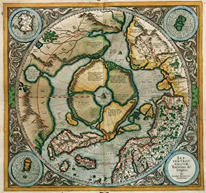
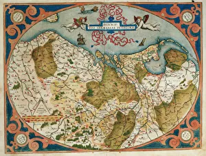
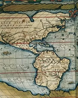
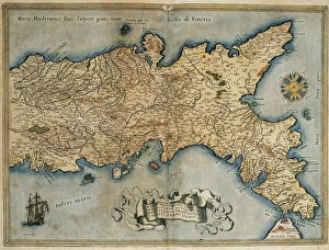
Carthography, the art and science of map-making, has played a crucial role in shaping our understanding of the world throughout history. From ancient times to the present day, maps have provided us with valuable insights into the geography, culture, and politics of different regions. One notable example is the "Septentrionalium Terrarum descriptio" by Gerardus Mercator in 1595. This map depicted Northern Europe and showcased Mercator's innovative projection technique that revolutionized navigation. Similarly, Abraham Ortelius' "Theatrum Orbis Terrarum" presented a comprehensive collection of maps including Germany and current Netherlands as well as Central and South America. In Spain during the 19th century, cartographers created detailed maps that captured various provinces such as Alicante, Castellon de la Plana, and Valencia. These maps not only served practical purposes but also reflected Spain's rich cultural heritage. Furthermore, cartography extended its reach beyond Europe. The Kingdom of Naples was meticulously mapped in "Theatrum Orbis Terrarum, " highlighting its strategic importance in Italy's history. Additionally, Palestine was intricately portrayed in a hand-colored engraving from "Theatrvm Orbis Terrarvm" by Abraham Ortelius in 1570. Throughout these historical periods, skilled cartographers like Gerardus Mercator left an indelible mark on their craft through engravings that showcased their expertise. Their contributions paved the way for advancements in mapping techniques that continue to shape modern cartography today. From Fecknam Manor in Worcester to distant lands across continents like Central America or Palestine - each map tells a unique story about our world's past. Carthography remains an invaluable tool for exploring new territories while preserving our collective knowledge for future generations to come.