Fraud Blocker Skip to main content

Cartography Collection

Cartography, the art of mapmaking, has a rich history that spans centuries and continents

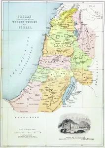
Background imageCartography Collection: Canaan as it was divided between the twelve tribes of Israel (colour litho)

Canaan as it was divided between the twelve tribes of Israel (colour litho)
KW360490 Canaan as it was divided between the twelve tribes of Israel (colour litho) by English School, (19th century); Private Collection; (add.info.: from The Holy Bible)

Background imageCartography Collection: Antique map of the Roman Empire

Antique map of the Roman Empire, with a detail on Rome

Background imageCartography Collection: EXPL2A-00352

EXPL2A-00352
The Hereford Mappa Mundi of 1280 - Jerusalem is at the center, Europe lower left, Africa lower right. Printed color halftone reproduction 19th century
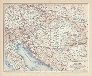
Background imageCartography Collection: Austro-Hungarian Empire, Habsburg Monarchy, lithograph, published in 1877

Austro-Hungarian Empire, Habsburg Monarchy, lithograph, published in 1877
Ancient map of Austro-Hungarian Empire. Habsburg Monarchy. Lithograph, published in 1877
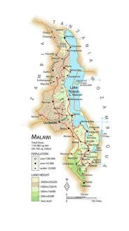
Background imageCartography Collection: Map of Malawi

Map of Malawi

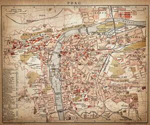
Background imageCartography Collection: Prague

Prague
Antique map of Prague from 1898

Background imageCartography Collection: Antique map of Britain under the Anglo Saxons

Antique map of Britain under the Anglo Saxons

Background imageCartography Collection: Al-Idrisis world map, 1154

Al-Idrisis world map, 1154
Al-Idrisis world map. This world map, known as the Tabula Rogeriana, dates from 1154, and is orientated with North at bottom

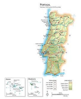
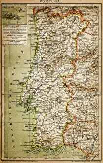
Background imageCartography Collection: Map of Portugal

Map of Portugal

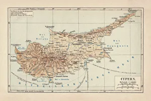
Background imageCartography Collection: Map of Cyprus, published in 1880

Map of Cyprus, published in 1880
Ancient map of Cyprus. Lithograph, published in 1880

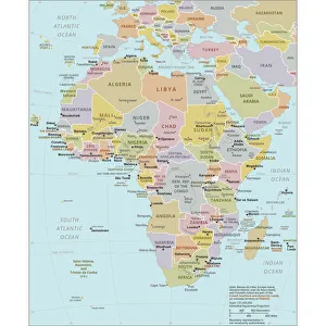
Background imageCartography Collection: Political Map of Africa

Political Map of Africa
Vector Illustration of the policital map of Africa Reference map as created by the US Central Intelligence Agency

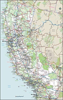
Background imageCartography Collection: California Highway Map

California Highway Map
Reference Maps, Top Sellers Art Prints, 103312667

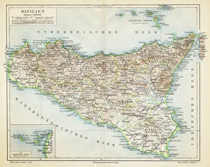
Background imageCartography Collection: Sicily map 1895

Sicily map 1895
Meyers Konversations-Lexikon. Ein Nachschlagewerk des allgemeinen Wissens, 5th edition 17 volumes Bibliographisches Institut - Leipzig 1895-1897

Background imageCartography Collection: Map of Ireland 1897

Map of Ireland 1897
Map of Ireland

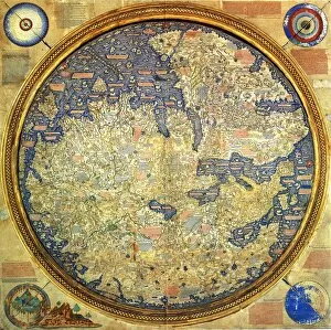
Background imageCartography Collection: Fra Mauro map (1460). The Fra Mauro Map orientation (South at the top). is considered

Fra Mauro map (1460). The Fra Mauro Map orientation (South at the top). is considered
Fra Mauro map (1460). The Fra Mauro Map orientation (South at the top).is considered the greatest memorial of medieval cartography. by the Venetian monk Fra Mauro

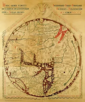
Background imageCartography Collection: Hereford mappa mundi (world map)

Hereford mappa mundi (world map)
3849688 Hereford mappa mundi (world map) by Richard of Haldingham (Richard de Bello) (fl.c.1260-1305); 158x133 cm; (add.info.: Hereford mappa mundi (world map)

Background imageCartography Collection: China map

China map
illustration of a South Eastern Asia map

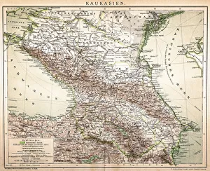
Background imageCartography Collection: Old Caucasus map

Old Caucasus map
Antique map of Caucasus

Background imageCartography Collection: Antique map of Ireland

Antique map of Ireland, 1864

Background imageCartography Collection: Old map of Australia 1899

Old map of Australia 1899
an old map of Australia 1899 - combined with several different textures and grunge papers

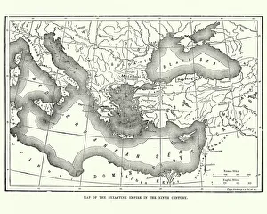
Background imageCartography Collection: Map of the Byzantine Empire in the 9th Century

Map of the Byzantine Empire in the 9th Century
Vintage engraving of a Map of the Byzantine Empire in the 9th Century

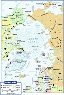
Background imageCartography Collection: arctic ocean, cartography, map, no people, north pole, polar equal area projection

arctic ocean, cartography, map, no people, north pole, polar equal area projection, political map, arctic, Reference Maps, 102270272

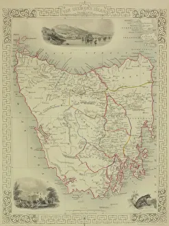
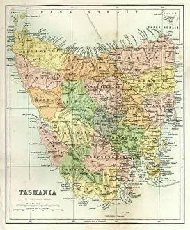
Background imageCartography Collection: Antique map of Tasmania

Antique map of Tasmania

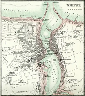
Background imageCartography Collection: Map of Whitby

Map of Whitby
Vintage map from 1880 of Whitby a town in North Yorkshire, England.++Inspector: Info about source material uploaded as property release++

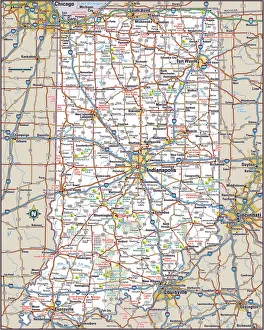
Background imageCartography Collection: Indiana Highway Map

Indiana Highway Map
Reference Maps, Top Sellers Art Prints, 103312674

Background imageCartography Collection: Antique Map of Tasmania

Antique Map of Tasmania
Antique map of Tasmania from 1867

Background imageCartography Collection: Orteliuss map of Ottoman Empire, 1570

Orteliuss map of Ottoman Empire, 1570
Orteliuss map of the Ottoman Empire. This map is from the 1570 first edition of Theatrum orbis terrarum ( Theatre of the World )

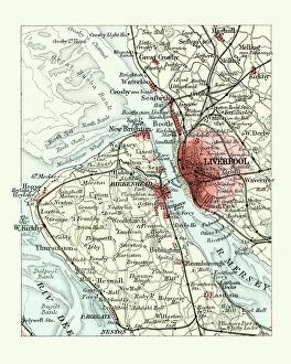
Background imageCartography Collection: Antique map, Liverpool and Birkenhead, England, 19th Century

Antique map, Liverpool and Birkenhead, England, 19th Century
Vintage engraving of a Antique map, Liverpool and Birkenhead, England, 19th Century

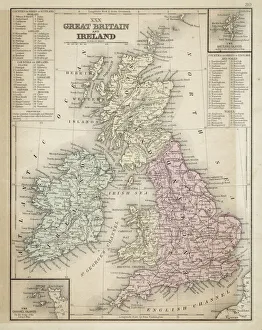
Background imageCartography Collection: Great Britain and Ireland map 1867

Great Britain and Ireland map 1867
Mitchell's Modern Atlas - Published by E.H. Butler and Co - Philadelphia 1867

Background imageCartography Collection: Map of Portugal

Map of Portugal
Antique illustration engraving map og Portugal

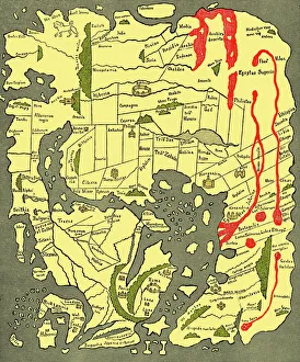
Background imageCartography Collection: Anglo-Saxon 10th century world map

Anglo-Saxon 10th century world map
Anglo-Saxon world map, dating from the 10th century. East is top. This map of the known world was probably produced by an Irish monk

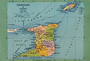
Background imageCartography Collection: Trinidad & Tobago Map, c1940s. Creator: Unknown

Trinidad & Tobago Map, c1940s. Creator: Unknown
Trinidad & Tobago Map, c1940s. From " Trinidad - British West Indies, Land of the Humming Bird". [Tichnor Quality Views, Boston]

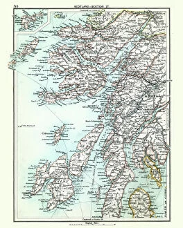
Background imageCartography Collection: Antique map, Scotland, Jura, Mull, Argyll, Islay 19th Century

Antique map, Scotland, Jura, Mull, Argyll, Islay 19th Century
Vintage engraving of a Antique map, Scotland, Jura, Mull, Argyll, Islay 19th Century

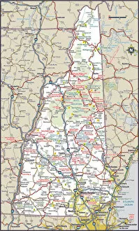
Background imageCartography Collection: New Hampshire Highway Map

New Hampshire Highway Map
Reference Maps, Top Sellers Art Prints, 103312572

Background imageCartography Collection: The Tabula Rogeriana, drawn by al-Idrisi for Roger II of Sicily in 1154, an important

The Tabula Rogeriana, drawn by al-Idrisi for Roger II of Sicily in 1154, an important ancient world map

Background imageCartography Collection: The Mappa Mundi of Fra Mauro, a Camaldolese monk from the monastery of San Michele in Murano, 1459

The Mappa Mundi of Fra Mauro, a Camaldolese monk from the monastery of San Michele in Murano, 1459
ALI75764 The Mappa Mundi of Fra Mauro, a Camaldolese monk from the monastery of San Michele in Murano, 1459 by Italian School, (15th century); Palazzo Ducale, Venice, Italy; Alinari

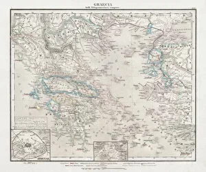
Background imageCartography Collection: Greece at the beginning of the Peloponnesian War (431-404 BC)

Greece at the beginning of the Peloponnesian War (431-404 BC)
Antique Map of Greece at the beginning of the Peloponnesian War (431 - 404 BC) with the different tribal groups. Steel engraving with hand colored borderlines, published in 1861

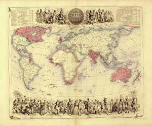
Background imageCartography Collection: British Empire world map, 19th century

British Empire world map, 19th century
British Empire world map. This world map shows the 19th-century British Empire (pink) and its indigenous peoples. Five illustrations (clockwise from upper left) show the people of Australia

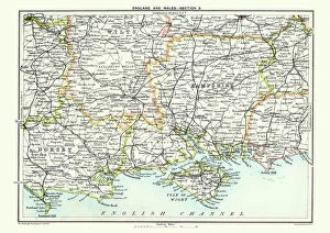
Background imageCartography Collection: Map of South East England, Hampshire, Dorset, Wiltshire 1891

Map of South East England, Hampshire, Dorset, Wiltshire 1891
Antique Map of Map of South East England, showing Hampshire, Dorset, Wiltshire, and the Isle of Wight 1891

Background imageCartography Collection: 1768, James Craig Map of New Town, Edinburgh, Scotland, First Plan of New Town, topography

1768, James Craig Map of New Town, Edinburgh, Scotland, First Plan of New Town, topography
1768, James Craig Map of New Town, Edinburgh, Scotland, First Plan of New Town

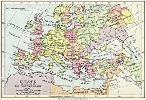
Background imageCartography Collection: Map of Europe at the time of the Third Crusade, 1190, from Historical Atlas

Map of Europe at the time of the Third Crusade, 1190, from Historical Atlas
KW342818 Map of Europe at the time of the Third Crusade, 1190, from Historical Atlas, published by W. & A.K. Johnston Limited, 1911 (colour litho) by English School

Background imageCartography Collection: 17th century world map

17th century world map
World map, published around 1664 in Amsterdam, the Netherlands, by Dutch mapmaker Joan Blaeu (c.1599- 1673). The Latin title is Nova et Accuratissima Totius Terrarum Orbis Tabula

Background imageCartography Collection: Catalan Atlas, 14th century

Catalan Atlas, 14th century. The 6-page Catalan Atlas (1375) was produced on vellum by the Jewish cartographer Abraham Cresques

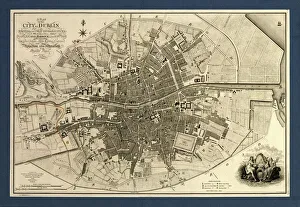
Background imageCartography Collection: Map of the City of Dublin, 1797

Map of the City of Dublin, 1797
Map of the City of Dublin, Ireland. Published in 1797, this map includes details of the canals being built at the time. Canal Harbour (lower right)

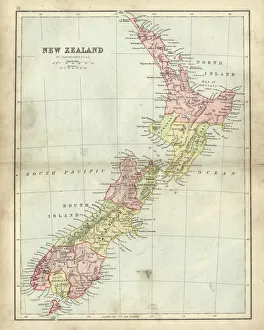
Background imageCartography Collection: Antique map of New Zealand in the 19th Century, 1873

Antique map of New Zealand in the 19th Century, 1873
Vintage engraving of a Antique map of New Zealand in the 19th Century, 1873

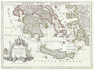
Background imageCartography Collection: 1794, Delisle Map of Southern Ancient Greece, Greeks Isles, and Crete, topography

1794, Delisle Map of Southern Ancient Greece, Greeks Isles, and Crete, topography
1794, Delisle Map of Southern Ancient Greece, Greeks Isles, and Crete

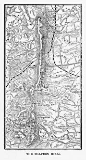
Background imageCartography Collection: Map of Malvern Hills in Worcestershire, England Victorian Engraving, 1840

Map of Malvern Hills in Worcestershire, England Victorian Engraving, 1840
Very Rare, Beautifully Illustrated Antique Engraving of Map of Malvern Hills in Worcestershire, England Victorian Engraving, 1840. Source: Original edition from my own archives

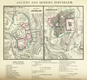
Background imageCartography Collection: Ancient and Modern Jerusalem Map Engraving

Ancient and Modern Jerusalem Map Engraving
Engraved illustration of Ancient and Modern Jerusalem Map Engraving from The Popular Pictorial Bible, Containing the Old and New Testaments, Published in 1862. Copyright has expired on this artwork


All Professionally Made to Order for Quick Shipping

Cartography, the art of mapmaking, has a rich history that spans centuries and continents. From ancient civilizations to modern times, maps have been used as powerful tools for navigation, exploration, and understanding the world around us. One notable example of early the Hereford Mappa Mundi, created in 1285 by Richard de Bello. This intricate map depicts a combination of geographical features and religious symbolism, offering a unique perspective on medieval Europe. Another remarkable piece is Al-Idrisi's world map from 1154. Crafted during the Islamic Golden Age, this map showcases an impressive level of detail and accuracy for its time. It highlights trade routes and important cities across Africa, Asia, and Europe. For those interested in British history, antique maps provide fascinating insights into different eras. An antique map depicting Britain under the Anglo Saxons offers a glimpse into the island's past before Norman conquests reshaped its landscape. Similarly captivating is an antique map showcasing the vast Roman Empire at its height. This visual representation allows us to trace their expansive territories across Europe, North Africa, and parts of Asia. Moving forward in time brings us to more recent cartographic works like the Map of Cyprus published in 1880. This detailed depiction captures not only geographical features but also cultural landmarks that define this Mediterranean island nation. Maps are not limited to landmasses alone; they can also illustrate political boundaries on larger scales. A Political Map of Africa provides valuable information about countries' borders and capital cities within this diverse continent. On a smaller scale but equally significant is California Highway Map—a practical tool for travelers navigating through one of America's most populous states with ease. Exploring historical empires leads us to delve into Byzantine history with a Map of the Byzantine Empire from the 9th century—showcasing Constantinople as its vibrant heart while encompassing regions stretching from Greece to Egypt.