
Compass Collection
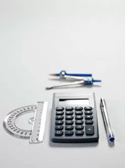
The compass, a versatile tool used in carpentry and joinery, has a rich history that spans across various fields and cultures


All Professionally Made to Order for Quick Shipping
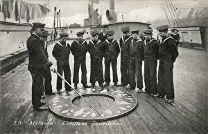
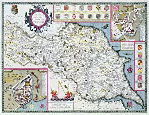
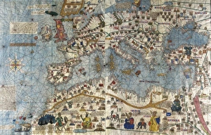
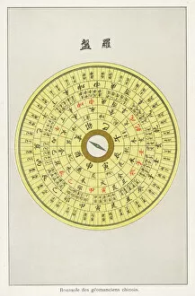
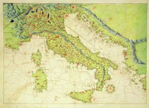
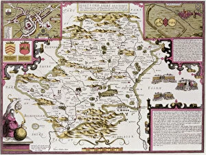
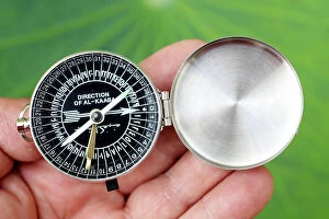
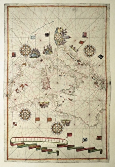
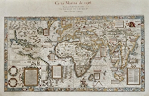
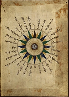
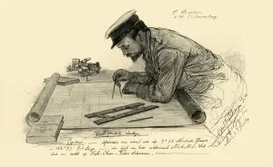
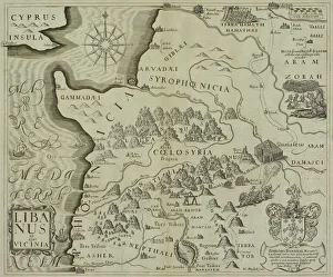
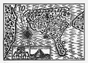
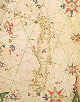
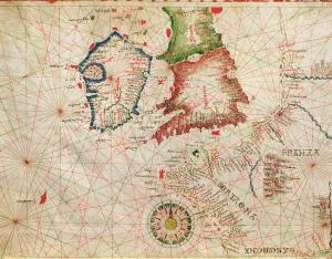
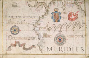
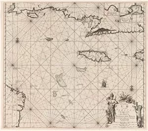
The compass, a versatile tool used in carpentry and joinery, has a rich history that spans across various fields and cultures. From the Compass Drill on the Training Ship Arethusa in Greenhithe, Kent to Captain John Smith's intricate map of Virginia in 1612, this instrument has played a crucial role in shaping our understanding of the world. Intriguingly, even ancient manuscripts have depicted the compass as an emblem of divine creation. Manuscript illuminations from the 13th century French Bible showcase God as the great Architect of the Universe, holding a compass to symbolize his meticulous design. Moving forward through time, we find ourselves at Newmarket Race Course in 1940 where precision is key for determining accurate distances. The compass aids not only navigators but also cartographers like those who created maps such as "Map of Cyprus - The Island of Venus" or "The North and East Ridings of Yorkshire" engraved by Jodocus Hondius (1563-1612). These maps provide invaluable insights into geographical features and historical contexts. Beyond geography lies Feng-Shui; an ancient Chinese practice that utilizes a specialized compass to harmonize energies within spaces. This Feng-Shui Compass guides practitioners towards optimal arrangements for balance and prosperity. Even artistic endeavors have been influenced by this remarkable tool. An Atlas of the World from Venice in 1553 showcases Italy with intricate details meticulously drawn using ink on vellum – all made possible with precise measurements provided by none other than the trusty compass. Whether it be aiding sailors at sea or guiding architects' hands, whether it be unlocking hidden energies or creating stunning works of art – throughout history and across continents –the humble yet powerful compass continues to play an indispensable role in shaping our world both physically and metaphorically.