
Cornwall Close Collection
Welcome to Cornwall Close, a charming residential neighborhood located in various parts of the United Kingdom


All Professionally Made to Order for Quick Shipping
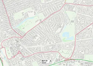
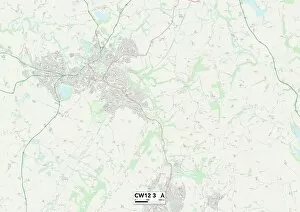
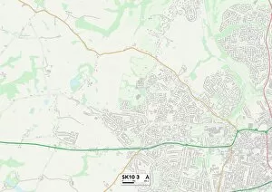
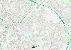
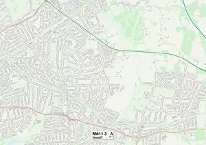
Welcome to Cornwall Close, a charming residential neighborhood located in various parts of the United Kingdom. From Barking and Dagenham to Cheshire East, Middlesbrough to Southampton, this community stretches far and wide, offering a diverse range of homes and lifestyles. In Barking and Dagenham (IG11 9), you'll find a vibrant atmosphere with bustling streets filled with local shops and amenities. The Cheshire East area (CW12 3) offers picturesque countryside views along with easy access to nearby towns for shopping and entertainment. For those seeking tranquility amidst nature's beauty, Middlesbrough (TS7 0) is surrounded by lush greenery and stunning landscapes that are perfect for outdoor enthusiasts. Meanwhile, Southampton (SO18 2) boasts a thriving waterfront scene where residents can enjoy scenic walks along the marina or indulge in delicious seafood at waterfront restaurants. Cheshire East's SK10 3 postcode provides an idyllic setting for families looking for peaceful suburban living while still being within reach of major cities. Walsall (WS9 8), Sandwell (WS10 0), Barnsley (S71 2), Halton (WA7 2), Havering (RM11 3), Bracknell Forest (RG42 3), and Wokingham (RG41 3) all offer their own unique charm and character that make them desirable places to call home. Whether you're searching for a close-knit community or convenient city living, it has something to suit every lifestyle. So come explore this wonderful collection of neighborhoods scattered across the UK map – your dream home may be just around the corner.