
Frans Hogenberg Collection
Frans Hogenberg was a renowned artist and cartographer of the sixteenth century


All Professionally Made to Order for Quick Shipping
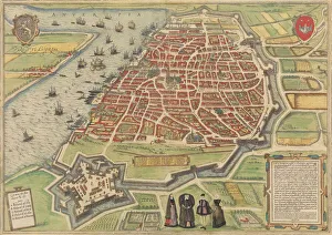
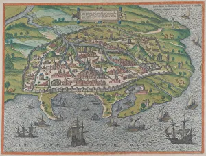
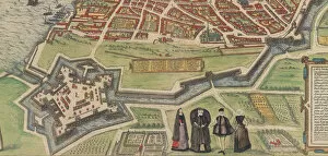
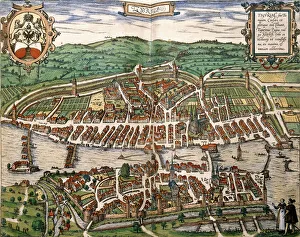
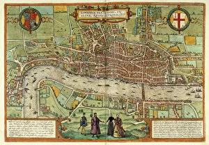
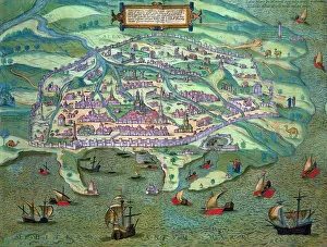
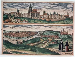
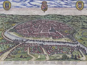
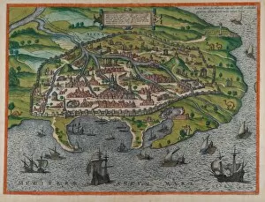
Frans Hogenberg was a renowned artist and cartographer of the sixteenth century. His works encompassed various cities and landscapes, providing valuable insights into the historical and architectural aspects of different regions. One notable creation by Hogenberg is the "Plan of Canterbury in the Sixteenth Century" (1943). This detailed map offers a glimpse into the city's layout during that era, showcasing its streets, buildings, and landmarks. Another remarkable piece is the "View of Antwerp" (1572-94), which Hogenberg co-created with Simon Novellanus. This panoramic view captures Antwerp's bustling atmosphere, depicting its vibrant streets filled with people going about their daily lives. Hogenberg also collaborated with Georg Braun to produce the "Map of Alexandria" (1575). This intricately designed map showcases Alexandria's geographical features while highlighting important landmarks within the city. In addition to his maps, Hogenberg contributed to Braun's Civitates Orbis Terrarum project. One example is his depiction of Palazzo Farnese at Caprarola, which showcases this magnificent Renaissance palace in all its grandeur. Hogenberg's talent extended beyond mapping as he created stunning engravings like "A View of London" (1613) and "View of Calcutta. " These artworks provide unique perspectives on these cities' architecture and urban landscapes during specific periods in history. Furthermore, Hogenberg captured scenes from everyday life such as "The Kermis at Hoboken" (ca. 1559), where he portrays locals enjoying festivities in traditional attire. These lively depictions offer glimpses into cultural practices prevalent during that time. Notably, Joris Hoefnagel created an exquisite map titled "Map of Alexandria, " but it bears mentioning here due to its relevance to Frans Hogenberg's body of work. The collaboration between these two artists resulted in an accurate representation of Alexandria's topography and landmarks.