Fraud Blocker Skip to main content

Geographical Map Collection

"Journey through Time: Exploring the Intricate World of Geographical Maps" Step into a world where maps were not just tools, but works of art

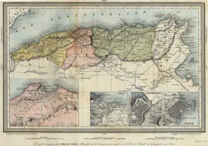
Background imageGeographical Map Collection: Geographic map of Algeria and details of the provinces of Algiers, Oran and Constantine

Geographic map of Algeria and details of the provinces of Algiers, Oran and Constantine
XEE4405752 Geographic map of Algeria and details of the provinces of Algiers, Oran and Constantine, realized by Amboise Tardieu, 19th century

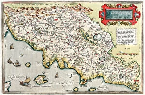
Background imageGeographical Map Collection: Map of Tuscany in Italy, 1570 (engraving)

Map of Tuscany in Italy, 1570 (engraving)
LRI4704766 Map of Tuscany in Italy, 1570 (engraving) by Ortelius, Abraham (1527-98); Museo Navale di Pegli, Genoa, Italy; (add.info.: Thusciae)

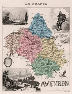
Background imageGeographical Map Collection: L Aveyron (12), Midi-Pyrenees (Midi Pyrenees) - France and its Colonies

L Aveyron (12), Midi-Pyrenees (Midi Pyrenees) - France and its Colonies. Atlas illustrates one hundred
XEE4144628 L Aveyron (12), Midi-Pyrenees (Midi Pyrenees) - France and its Colonies. Atlas illustrates one hundred and five maps from the maps of the depot of war

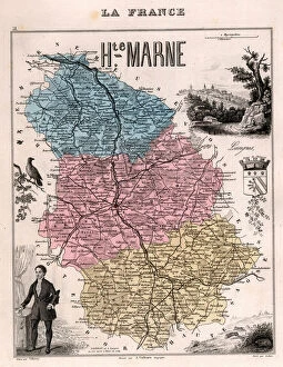
Background imageGeographical Map Collection: La Haute Marne (Haute-Marne, 52), Champagne-Ardennes (Champagne Ardennes) - France and its Colonies

La Haute Marne (Haute-Marne, 52), Champagne-Ardennes (Champagne Ardennes) - France and its Colonies
XEE4144506 La Haute Marne (Haute-Marne, 52), Champagne-Ardennes (Champagne Ardennes) - France and its Colonies. Atlas illustrates one hundred and five maps from the maps of the depot of war

Background imageGeographical Map Collection: Ile de La Reunion (Bourbon Island), DOM (overseas department or overseas department)

Ile de La Reunion (Bourbon Island), DOM (overseas department or overseas department) - France and its Colonies
XEE4144389 Ile de La Reunion (Bourbon Island), DOM (overseas department or overseas department) - France and its Colonies

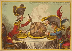
Background imageGeographical Map Collection: The Plum Pudding in Danger or State Epicures taking un Petit Souper, 1805 (engraving)

The Plum Pudding in Danger or State Epicures taking un Petit Souper, 1805 (engraving)
7088732 The Plum Pudding in Danger or State Epicures taking un Petit Souper, 1805 (engraving) by Gillray, James (1757-1815); Private Collection; (add.info)

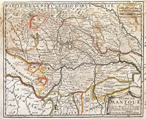
Background imageGeographical Map Collection: Map of the province of Mantova (Italy) (Engraving, 1717)

Map of the province of Mantova (Italy) (Engraving, 1717)
LRI4712986 Map of the province of Mantova (Italy) (Engraving, 1717) by Nolin, Jean-Baptiste (c.1657-1708); Private Collection; (add.info.: Map of the Duche of Mantua (Lombardy)

Background imageGeographical Map Collection: Atlas 1587: Orbis Terrae Compendiosa Descriptio de Rumold Mercator (1546 / 48-1599)

Atlas 1587: Orbis Terrae Compendiosa Descriptio de Rumold Mercator (1546 / 48-1599), third son of Gerhard Kremer
GIA4699208 Atlas 1587: Orbis Terrae Compendiosa Descriptio de Rumold Mercator (1546/48-1599), third son of Gerhard Kremer, known as Gerardus Mercator

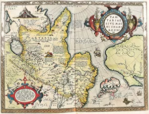
Background imageGeographical Map Collection: Map of the Tartar territory, 1570 (engraving)

Map of the Tartar territory, 1570 (engraving)
LRI4704938 Map of the Tartar territory, 1570 (engraving) by Ortelius, Abraham (1527-98); Museo Navale di Pegli, Genoa, Italy; (add.info)

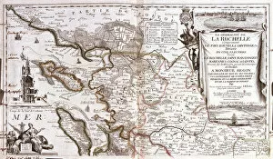
Background imageGeographical Map Collection: Map of Poitou Charentes (France) (Engraving, 1717)

Map of Poitou Charentes (France) (Engraving, 1717)
LRI4711769 Map of Poitou Charentes (France) (Engraving, 1717) by Nolin, Jean-Baptiste (c.1657-1708); Private Collection; (add.info.: Map of the generality of La Rochelle)

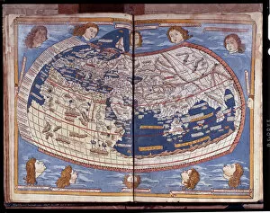
Background imageGeographical Map Collection: Map of Ptolemy published in 1482

Map of Ptolemy published in 1482
GIA4812936 Map of Ptolemy published in 1482. by Unknown Artist, (15th century); Pinacoteca di Brera, Milan, Italy; (add.info.: Map of Ptolemy published in 1482.); eGiancarlo Costa; out of copyright

Background imageGeographical Map Collection: Map of Franconia in Germany, 1570 (engraving)

Map of Franconia in Germany, 1570 (engraving)
LRI4704575 Map of Franconia in Germany, 1570 (engraving) by Ortelius, Abraham (1527-98); Museo Navale di Pegli, Genoa, Italy; (add.info.: Franciae Orientalis)

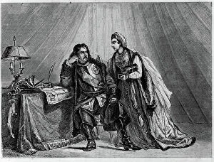
Background imageGeographical Map Collection: Peace of the Pruth (1711): Catherine Iere of Russia advises her wife Peter I the Great

Peace of the Pruth (1711): Catherine Iere of Russia advises her wife Peter I the Great, Emperor of Russia
XEE5032155 Peace of the Pruth (1711): Catherine Iere of Russia advises her wife Peter I the Great, Emperor of Russia, to sign the peace of Pruth in 1711 with the empire of Turkey; (add.info)

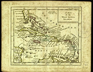
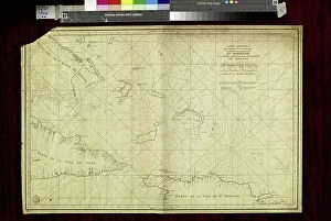
Background imageGeographical Map Collection: Geography: map showing the Gulf of Mexico, the Caribbean Islands, Central America (Honduras)

Geography: map showing the Gulf of Mexico, the Caribbean Islands, Central America (Honduras, Costarica)
VEN5031255 Geography: map showing the Gulf of Mexico, the Caribbean Islands, Central America (Honduras, Costarica), northern South America (Venezuela) and southern United States

Background imageGeographical Map Collection: Geography: representation of the Gulf of Mexico with the coasts of Mexico, Yucatan

Geography: representation of the Gulf of Mexico with the coasts of Mexico, Yucatan, Florida and Cuba (Antilles)
VEN5031179 Geography: representation of the Gulf of Mexico with the coasts of Mexico, Yucatan, Florida and Cuba (Antilles)

Background imageGeographical Map Collection: Geography map: representation of the island of Hispaniola (Santo Domingo and Haiti)

Geography map: representation of the island of Hispaniola (Santo Domingo and Haiti) (Greater Antilles)
VEN5030472 Geography map: representation of the island of Hispaniola (Santo Domingo and Haiti) (Greater Antilles), of the Virgin Islands (Lesser Antilles)

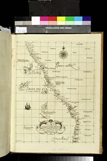
Background imageGeographical Map Collection: Geography map: representation of Peru's South American coast from an Atlas made by Italian

Geography map: representation of Peru's South American coast from an Atlas made by Italian cartographer Antonio
VEN5030459 Geography map: representation of Peru's South American coast from an Atlas made by Italian cartographer Antonio Francesco Lucini (born 1605), 1661 approximately Biblioteca Angelica

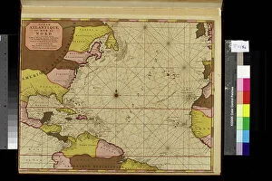
Background imageGeographical Map Collection: Geography map: representation of the Atlantic Ocean (or North Sea) with the coasts of the Americas

Geography map: representation of the Atlantic Ocean (or North Sea) with the coasts of the Americas
VEN5030386 Geography map: representation of the Atlantic Ocean (or North Sea) with the coasts of the Americas (South and United States), the Caribbean Sea and the Caribbean

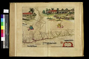
Background imageGeographical Map Collection: Geography map: representation of the Paraiba region in northern Brazil where the Rio Grande river

Geography map: representation of the Paraiba region in northern Brazil where the Rio Grande river of the North in South
VEN5030364 Geography map: representation of the Paraiba region in northern Brazil where the Rio Grande river of the North in South America is located from an Atlas made by the cartographer Willem

Background imageGeographical Map Collection: Geography map: representation of Chile from an Atlas by Willem Janszoon Blaeu (1571-1638)

Geography map: representation of Chile from an Atlas by Willem Janszoon Blaeu (1571-1638), approximately 1630
VEN5030319 Geography map: representation of Chile from an Atlas by Willem Janszoon Blaeu (1571-1638), approximately 1630. Biblioteca Angelica

Background imageGeographical Map Collection: Geography map: representation of Magellan Detroit and Tierra del Fuego in the extreme south of

Geography map: representation of Magellan Detroit and Tierra del Fuego in the extreme south of South America from an
VEN5030314 Geography map: representation of Magellan Detroit and Tierra del Fuego in the extreme south of South America from an Atlas by Willem Janszoon Blaeu (1571-1638), approximately 1630

Background imageGeographical Map Collection: Geography map: representation of Barbados Island (Barbados) from an Atlas by Charles Price

Geography map: representation of Barbados Island (Barbados) from an Atlas by Charles Price
VEN5030270 Geography map: representation of Barbados Island (Barbados) from an Atlas by Charles Price, beginning of the 18th century

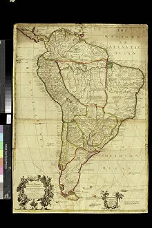
Background imageGeographical Map Collection: Geography map: representation of South America from an Atlas by Charles Price

Geography map: representation of South America from an Atlas by Charles Price, beginning of the 18th century
VEN5030268 Geography map: representation of South America from an Atlas by Charles Price, beginning of the 18th century. Biblioteca Angelica

Background imageGeographical Map Collection: Geography map: representation of South America from an Atlas of Guillaume de l'Isle (1675-1726)

Geography map: representation of South America from an Atlas of Guillaume de l'Isle (1675-1726), 1700
VEN5030263 Geography map: representation of South America from an Atlas of Guillaume de l'Isle (1675-1726), 1700. Biblioteca Angelica

Background imageGeographical Map Collection: Geography map: representation of the meridional part of South America (Argentina, Chile)

Geography map: representation of the meridional part of South America (Argentina, Chile)
VEN5030237 Geography map: representation of the meridional part of South America (Argentina, Chile, Falkland Islands) from the Atlas " Amerique meridionale" by French cartographer

Background imageGeographical Map Collection: Geography map: representation of the coasts of Colombia, made by Dutch cartographer Gerard van

Geography map: representation of the coasts of Colombia, made by Dutch cartographer Gerard van Keulen (1678-1726)
VEN5030222 Geography map: representation of the coasts of Colombia, made by Dutch cartographer Gerard van Keulen (1678-1726) 1709-1713

Background imageGeographical Map Collection: Geography map: representation of the coasts of Cuba and Havana Bay in the West Indies

Geography map: representation of the coasts of Cuba and Havana Bay in the West Indies
VEN5030185 Geography map: representation of the coasts of Cuba and Havana Bay in the West Indies, made by Dutch cartographer Gerard van Keulen (1678-1726) 1709-1713

Background imageGeographical Map Collection: Geography map: representation of Turtle Island off Hispaniola near the Passage of the Winds

Geography map: representation of Turtle Island off Hispaniola near the Passage of the Winds between Cuba
VEN5030175 Geography map: representation of Turtle Island off Hispaniola near the Passage of the Winds between Cuba and Hispaniola, made by Dutch cartographer Gerard van Keulen (1678-1726) 1709-1713

Background imageGeographical Map Collection: Geography map: representation of the coasts of New Spain (which included part of present-day Mexico)

Geography map: representation of the coasts of New Spain (which included part of present-day Mexico)
VEN5030163 Geography map: representation of the coasts of New Spain (which included part of present-day Mexico, California and some southern states of the United States)

Background imageGeographical Map Collection: Geography Atlas: representation of the Bahamas islands, northern Hispaniola (Santo Domingo)

Geography Atlas: representation of the Bahamas islands, northern Hispaniola (Santo Domingo)
VEN5031335 Geography Atlas: representation of the Bahamas islands, northern Hispaniola (Santo Domingo) and the Leewind Passage between Cuba and Hispaniola in the West Indies

Background imageGeographical Map Collection: Geography: Map of Puerto Rico Island, Beata Island, Hispaniola coasts in the West Indies

Geography: Map of Puerto Rico Island, Beata Island, Hispaniola coasts in the West Indies
VEN5031327 Geography: Map of Puerto Rico Island, Beata Island, Hispaniola coasts in the West Indies. Map from an Atlas of Maritime Geography of 1767

Background imageGeographical Map Collection: Plan of the Battle of Waterloo (Belgium), between Allied Armies and Napoleon I, June 18, 1815

Plan of the Battle of Waterloo (Belgium), between Allied Armies and Napoleon I, June 18, 1815
JAB5035993 Plan of the Battle of Waterloo (Belgium), between Allied Armies and Napoleon I, June 18, 1815.; (add.info.: Plan of the Battle of Waterloo (Belgium), between Allied Armies and Napoleon I

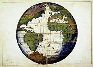
Background imageGeographical Map Collection: Planisphere - by G.B. Agnese, 15th century

Planisphere - by G.B. Agnese, 15th century
GIA5036361 Planisphere - by G.B. Agnese, 15th century.; (add.info.: Planisphere - by G.B. Agnese, 15th century.); © Giancarlo Costa.

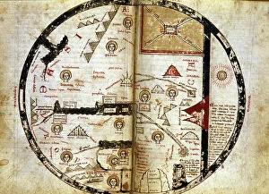
Background imageGeographical Map Collection: Handwritten map of the world as it was known in the 13th century

Handwritten map of the world as it was known in the 13th century. Mount Sinai is indicated at the top right and in red
GIA5034616 Handwritten map of the world as it was known in the 13th century. Mount Sinai is indicated at the top right and in red. Olympus down and left

Background imageGeographical Map Collection: Map of Fort Ticonderoga near Lake Champlain in 1759 at the time of the French War against

Map of Fort Ticonderoga near Lake Champlain in 1759 at the time of the French War against the Indians
NWI4836012 Map of Fort Ticonderoga near Lake Champlain in 1759 at the time of the French War against the Indians. Colourful engraving of the 19th century.; (add.info)

Background imageGeographical Map Collection: United States of America Independence War (1775-1783): Map of the Battle of Bunker Hill after an

United States of America Independence War (1775-1783): Map of the Battle of Bunker Hill after an English map
NWI4841874 United States of America Independence War (1775-1783): Map of the Battle of Bunker Hill after an English map. Reproduction.; (add.info)

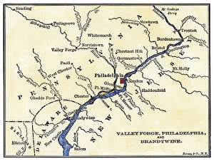
Background imageGeographical Map Collection: War of Independence or American Revolution (1775-1783): Map of the vicinity of Philadelphia

War of Independence or American Revolution (1775-1783): Map of the vicinity of Philadelphia (Pennsylvania)
NWI4841014 War of Independence or American Revolution (1775-1783): Map of the vicinity of Philadelphia (Pennsylvania), Valley Forge and Brandywine

Background imageGeographical Map Collection: Map of the inland territories of Maine, used by Benedict Arnold (1741-1801)

Map of the inland territories of Maine, used by Benedict Arnold (1741-1801), at the head of the continental army
NWI4840594 Map of the inland territories of Maine, used by Benedict Arnold (1741-1801), at the head of the continental army, for the invasion of Quebec (Canada), 1775

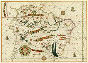
Background imageGeographical Map Collection: Map of South America from a Spanish atlas made in Messina in 1582 by Joan Martines

Map of South America from a Spanish atlas made in Messina in 1582 by Joan Martines. Lithograph of the 19th century
NWI4846181 Map of South America from a Spanish atlas made in Messina in 1582 by Joan Martines. Lithograph of the 19th century.; (add.info)

Background imageGeographical Map Collection: American map showing the secession of states by date during the Secession War between 1860 and 1861

American map showing the secession of states by date during the Secession War between 1860 and 1861
NWI4830538 American map showing the secession of states by date during the Secession War between 1860 and 1861. Colouring engraving of the 19th century.; (add.info)

Background imageGeographical Map Collection: United States, State of Virginia: Part of Maryland and Colonial Virginia in 1738

United States, State of Virginia: Part of Maryland and Colonial Virginia in 1738. Colour engraving of the 19th century
NWI4967573 United States, State of Virginia: Part of Maryland and Colonial Virginia in 1738. Colour engraving of the 19th century.; (add.info.: United States)

Background imageGeographical Map Collection: United States, Hawai Island: Map of Hawai Islands, years 1870. 19th century color engraving

United States, Hawai Island: Map of Hawai Islands, years 1870. 19th century color engraving
NWI4965205 United States, Hawai Island: Map of Hawai Islands, years 1870. 19th century color engraving.; (add.info.: United States, Hawai Island: Map of Hawai Islands, years 1870)

Background imageGeographical Map Collection: United States, New York: Map of Ratzer depicting Manhattan in New York, 1767

United States, New York: Map of Ratzer depicting Manhattan in New York, 1767. Colour engraving of the 19th century
NWI4966866 United States, New York: Map of Ratzer depicting Manhattan in New York, 1767. Colour engraving of the 19th century.; (add.info.: United States)

Background imageGeographical Map Collection: United States, New York: Map of Bellin of New York Bay in 1764

United States, New York: Map of Bellin of New York Bay in 1764
NWI4966860 United States, New York: Map of Bellin of New York Bay in 1764.; (add.info.: United States, New York: Map of Bellin of New York Bay in 1764.); Photo © North Wind Pictures.

Background imageGeographical Map Collection: United States, New York: Map of John Hill from Manhattan to New York designed in 1782 draws in 1785

United States, New York: Map of John Hill from Manhattan to New York designed in 1782 draws in 1785
NWI4966854 United States, New York: Map of John Hill from Manhattan to New York designed in 1782 draws in 1785. Colour engraving of the 19th century.; (add.info.: United States)

Background imageGeographical Map Collection: United States, South Carolina: Colonial Map of the Ashley and Cooper Rivers, Charleston Site

United States, South Carolina: Colonial Map of the Ashley and Cooper Rivers, Charleston Site, South Carolina
NWI4967326 United States, South Carolina: Colonial Map of the Ashley and Cooper Rivers, Charleston Site, South Carolina, 17th century

Background imageGeographical Map Collection: United States, South Carolina: Map of Carolina showing Charleston and Outer Banks

United States, South Carolina: Map of Carolina showing Charleston and Outer Banks, north to the right
NWI4967396 United States, South Carolina: Map of Carolina showing Charleston and Outer Banks, north to the right. Colour engraving after a 17th century map; (add.info.: United States)

Background imageGeographical Map Collection: United States, State of New Jersey: Map of East and West New Jersey Colonies, late 17th century

United States, State of New Jersey: Map of East and West New Jersey Colonies, late 17th century
NWI4966628 United States, State of New Jersey: Map of East and West New Jersey Colonies, late 17th century. Colour engraving of the 19th century.; (add.info.: United States)


All Professionally Made to Order for Quick Shipping

"Journey through Time: Exploring the Intricate World of Geographical Maps" Step into a world where maps were not just tools, but works of art. The Plum Pudding in Danger or State Epicures taking un Petit Souper, 1805 engraving captures the essence of an era when cartography was both informative and visually captivating. Travel back to 1570 with the Map of the Tartar territory engraving, revealing a glimpse into ancient lands and distant cultures. Meanwhile, the Map of Tuscany in Italy from the same year showcases intricate details that transport us to Renaissance Europe. Gerardus Mercator's Atlas 1587 takes us on a comprehensive journey across continents, as his Orbis Terrae Compendiosa Descriptio reveals his mastery in capturing our vast planet's beauty. Delve deeper into specific regions like Algeria with its Geographic map highlighting Algiers, Oran, and Constantine provinces. Witness history unfold as Emperor Albert I studies France's map during Pope Boniface VIII and King Philip IV's conflict – a testament to how geography played a pivotal role even in medieval times. Jean Guerard's Universal hydrographic map manuscript from 1734 offers insights into maritime exploration while showcasing French expertise in cartography. And let us not forget the Representation of a geographic map depicting diseases prevalent at the end of the 19th century – reminding us that maps can also shed light on societal challenges. Finally, immerse yourself in Europe's past with an enchanting Map from 1743; it unveils borders long gone but still etched within historical memory. These they are more than mere navigational aids; they are gateways to different eras and windows into diverse worlds. Join us on this extraordinary expedition through time as we unravel their secrets and marvel at their enduring allure.