Fraud Blocker Skip to main content

Geographical Collection (page 14)

"Journey through Time and Space: Exploring the Geographical Evolution" Al-Idrisi's World Map, 1154: Unveiling ancient cartographic wisdom

Background imageGeographical Collection: 1855 Perthes Map Of Africa Prior To The Arab Invasions Of The 7th Century

1855 Perthes Map Of Africa Prior To The Arab Invasions Of The 7th Century
1855, Perthes Map of Africa prior to the Arab Invasions of the 7th Century

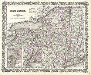
Background imageGeographical Collection: 1855 Colton Map Of New York Topography Cartography

1855 Colton Map Of New York Topography Cartography
1855, Colton Map of New York

Background imageGeographical Collection: 1855 Colton Map Of New Jersey Topography Cartography

1855 Colton Map Of New Jersey Topography Cartography
1855, Colton Map of New Jersey

Background imageGeographical Collection: 1855 Colton Map Of New Jersey Topography Cartography

1855 Colton Map Of New Jersey Topography Cartography
1855, Colton Map of New Jersey

Background imageGeographical Collection: 1855 Colton Map Of New Hampshire Topography Cartography

1855 Colton Map Of New Hampshire Topography Cartography
1855, Colton Map of New Hampshire

Background imageGeographical Collection: 1855 Colton Map Of Northeastern Africa Topography

1855 Colton Map Of Northeastern Africa Topography
1855, Colton Map of Northeastern Africa

Background imageGeographical Collection: 1855 Colton Map Of Mississippi Topography Cartography

1855 Colton Map Of Mississippi Topography Cartography
1855, Colton Map of Mississippi

Background imageGeographical Collection: 1855 Colton Map Of Missouri Topography Cartography

1855 Colton Map Of Missouri Topography Cartography
1855, Colton Map of Missouri

Background imageGeographical Collection: 1855 Colton Map Of Southern Africa Topography

1855 Colton Map Of Southern Africa Topography
1855, Colton Map of Southern Africa

Background imageGeographical Collection: 1855 Colton Map Of Michigan Topography Cartography

1855 Colton Map Of Michigan Topography Cartography
1855, Colton Map of Michigan

Background imageGeographical Collection: 1855 Colton Map Of South America Topography Cartography

1855 Colton Map Of South America Topography Cartography
1855, Colton Map of South America

Background imageGeographical Collection: 1855 Colton Map Of Scotland Topography Cartography

1855 Colton Map Of Scotland Topography Cartography
1855, Colton Map of Scotland

Background imageGeographical Collection: 1855 Colton Map Of Russia Topography Cartography

1855 Colton Map Of Russia Topography Cartography
1855, Colton Map of Russia

Background imageGeographical Collection: 1855 Colton Map Of Pennsylvania Topography Cartography

1855 Colton Map Of Pennsylvania Topography Cartography
1855, Colton Map of Pennsylvania

Background imageGeographical Collection: 1855 Colton Map Of Peru And Bolivia Topography

1855 Colton Map Of Peru And Bolivia Topography
1855, Colton Map of Peru and Bolivia

Background imageGeographical Collection: 1855 Colton Map Of Ohio Topography Cartography

1855 Colton Map Of Ohio Topography Cartography
1855, Colton Map of Ohio

Background imageGeographical Collection: 1855 Colton Map Of Patagonia And The Falkland Islands

1855 Colton Map Of Patagonia And The Falkland Islands
1855, Colton Map of Patagonia and the Falkland Islands

Background imageGeographical Collection: 1855 Colton Map Of North America Topography Cartography

1855 Colton Map Of North America Topography Cartography
1855, Colton Map of North America

Background imageGeographical Collection: 1855 Colton Map Of North Carolina Topography

1855 Colton Map Of North Carolina Topography
1855, Colton Map of North Carolina

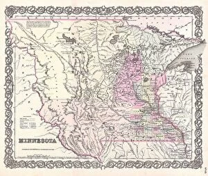
Background imageGeographical Collection: 1855 Colton Map Of Minnesota Topography Cartography

1855 Colton Map Of Minnesota Topography Cartography
1855, Colton Map of Minnesota

Background imageGeographical Collection: 1855 Colton Map Of South Carolina Topography

1855 Colton Map Of South Carolina Topography
1855, Colton Map of South Carolina

Background imageGeographical Collection: 1855 Colton Map Of Switzerland Topography Cartography

1855 Colton Map Of Switzerland Topography Cartography
1855, Colton Map of Switzerland

Background imageGeographical Collection: 1855 Colton Map Of Spain Topography Cartography

1855 Colton Map Of Spain Topography Cartography
1855, Colton Map of Spain

Background imageGeographical Collection: 1855 Colton Map Of Mexico Topography Cartography

1855 Colton Map Of Mexico Topography Cartography
1855, Colton Map of Mexico

Background imageGeographical Collection: 1855 Colton Map Of Massachusetts And Rhode Island

1855 Colton Map Of Massachusetts And Rhode Island
1855, Colton Map of Massachusetts and Rhode Island

Background imageGeographical Collection: 1855 Colton Map Of Massachusetts And Rhode Island

1855 Colton Map Of Massachusetts And Rhode Island
1855, Colton Map of Massachusetts and Rhode Island

Background imageGeographical Collection: 1855 Colton Map Of Kentucky And Tennessee Topography

1855 Colton Map Of Kentucky And Tennessee Topography
1855, Colton Map of Kentucky and Tennessee

Background imageGeographical Collection: 1855 Colton Map Of Japan Topography Cartography

1855 Colton Map Of Japan Topography Cartography
1855, Colton Map of Japan

Background imageGeographical Collection: 1855 Colton Map Of Iowa Topography Cartography

1855 Colton Map Of Iowa Topography Cartography
1855, Colton Map of Iowa

Background imageGeographical Collection: 1855 Colton Map Of India Topography Cartography

1855 Colton Map Of India Topography Cartography
1855, Colton Map of India

Background imageGeographical Collection: 1855 Colton Map Of Indiana Topography Cartography

1855 Colton Map Of Indiana Topography Cartography
1855, Colton Map of Indiana

Background imageGeographical Collection: 1855 Colton Map Of Maine Topography Cartography

1855 Colton Map Of Maine Topography Cartography
1855, Colton Map of Maine

Background imageGeographical Collection: 1855 Colton Map Of Illinois Topography Cartography

1855 Colton Map Of Illinois Topography Cartography
1855, Colton Map of Illinois

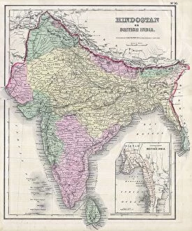
Background imageGeographical Collection: 1855 Colton Map Of India Or Hindostan Topography

1855 Colton Map Of India Or Hindostan Topography
1855, Colton Map of India or Hindostan

Background imageGeographical Collection: 1855 Colton Map Of Europe Topography Cartography

1855 Colton Map Of Europe Topography Cartography
1855, Colton Map of Europe

Background imageGeographical Collection: 1855 Colton Map Of Denmark Topography Cartography

1855 Colton Map Of Denmark Topography Cartography
1855, Colton Map of Denmark

Background imageGeographical Collection: 1855 Colton Map Of Central America And Jamaica

1855 Colton Map Of Central America And Jamaica
1855, Colton Map of Central America and Jamaica

Background imageGeographical Collection: 1855 Colton Map Of California And San Francisco

1855 Colton Map Of California And San Francisco
1855, Colton Map of California and San Francisco

Background imageGeographical Collection: 1855 Colton Map Of Canada East Or Quebec Topography

1855 Colton Map Of Canada East Or Quebec Topography
1855, Colton Map of Canada East or Quebec

Background imageGeographical Collection: 1855 Colton Map Of Hawaii And New Zealand Topography

1855 Colton Map Of Hawaii And New Zealand Topography
1855, Colton Map of Hawaii and New Zealand

Background imageGeographical Collection: 1855 Colton Map Of France Topography Cartography

1855 Colton Map Of France Topography Cartography
1855, Colton Map of France

Background imageGeographical Collection: 1855 Colton Map Of Holland And Belgium Topography

1855 Colton Map Of Holland And Belgium Topography
1855, Colton Map of Holland and Belgium

Background imageGeographical Collection: 1855 Colton Map Of Georgia Topography Cartography

1855 Colton Map Of Georgia Topography Cartography
1855, Colton Map of Georgia

Background imageGeographical Collection: 1855 Colton Map Of Florida Topography Cartography

1855 Colton Map Of Florida Topography Cartography
1855, Colton Map of Florida

Background imageGeographical Collection: 1855 Colton Map Of Greece Topography Cartography

1855 Colton Map Of Greece Topography Cartography
1855, Colton Map of Greece

Background imageGeographical Collection: 1855 Colton Map Of Connecticut And Long Island

1855 Colton Map Of Connecticut And Long Island
1855, Colton Map of Connecticut and Long Island

Background imageGeographical Collection: 1853 Mitchell Map Of Mississippi Topography Cartography

1853 Mitchell Map Of Mississippi Topography Cartography
1853, Mitchell Map of Mississippi

Background imageGeographical Collection: 1855 Colton Map Of British North America Or Canada

1855 Colton Map Of British North America Or Canada
1855, Colton Map of British North America or Canada


All Professionally Made to Order for Quick Shipping

"Journey through Time and Space: Exploring the Geographical Evolution" Al-Idrisi's World Map, 1154: Unveiling ancient cartographic wisdom, this map showcases the Islamic scholar's remarkable understanding of global geography. Continental Drift after 250 Million Years: Witnessing Earth's transformative power, this concept reveals how tectonic plates shaped our continents over millions of years. Malham Cove, Yorkshire Dales: A geological marvel standing tall in the picturesque Yorkshire Dales, showcasing nature's artistic prowess carved by ice and water. British Empire World Map, 19th Century: Tracing the vast expanse of an empire on which the sun never set; a testament to Britain's once-global dominance. James Craig Map of New Town, Edinburgh, Scotland (1768): The birth of urban planning captured in ink; explore Edinburgh’s meticulously designed New Town with its unique topography. Anglo-Saxon 10th Century World Map: Delving into medieval perceptions of our planet; discover how early societies envisioned their place within a world still shrouded in mystery. Catalan Atlas, 14th Century: Marvel at one of history’s most exquisite maps as it unveils Europe’s expanding knowledge during the Middle Ages – a true masterpiece. UK at Night from Space: Behold Britain illuminated like never before. This awe-inspiring view from space captures the vibrant tapestry that is modern-day United Kingdom after sundown. Orteliuss Map of Ottoman Empire (1570): Step back into time and witness one man’s meticulous depiction of an empire that spanned three continents - revealing cultural diversity and grandeur. Europe at Night - Satellite Image & Europe at Night - Illuminating Boundaries : Gaze upon two contrasting images capturing Europe under different lights – highlighting both unity and division across nations 17th Century World Map.