Fraud Blocker Skip to main content

Guidance Collection (page 6)

"Guidance: Illuminating Paths Across Time and Space" Step into the world of guidance, where ancient maps like the Mappa Mundi

Background imageGuidance Collection: Map of Vermont and New Hampshire, c.1900 (engraving)

Map of Vermont and New Hampshire, c.1900 (engraving)
533091 Map of Vermont and New Hampshire, c.1900 (engraving); (add.info.: Map showing the historical boundaries of Vermont and New Hampshire, United States, circa 1902)

Background imageGuidance Collection: Map of New York City, c.1900 (engraving)

Map of New York City, c.1900 (engraving)
532804 Map of New York City, c.1900 (engraving); (add.info.: Map of New York City, with an inset of the Hudson River from Yonkers to Kingston, circa 1900)

Background imageGuidance Collection: Map of Ontario, Canada, c.1900 (engraving)

Map of Ontario, Canada, c.1900 (engraving)
533076 Map of Ontario, Canada, c.1900 (engraving); (add.info.: Map of Ontario, Canada, with an inset of Toronto, circa 1902)

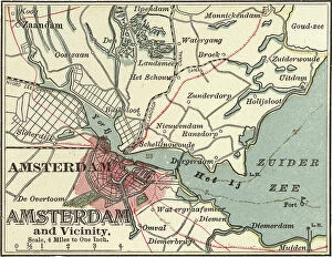
Background imageGuidance Collection: Map of Amsterdam, c.1900 (engraving)

Map of Amsterdam, c.1900 (engraving)
532699 Map of Amsterdam, c.1900 (engraving); (add.info.: Map of the city of Amsterdam, circa 1900, from the 10th edition of Encyclopaedia Britannica.); Encyclopaedia Britannica/UIG.

Background imageGuidance Collection: Map of Carson City with Virginia City and Reno, c.1900 (engraving)

Map of Carson City with Virginia City and Reno, c.1900 (engraving)
533459 Map of Carson City with Virginia City and Reno, c.1900 (engraving); (add.info.: Map of Reno, Carson City, and Virginia City, Nevada, circa 1902)

Background imageGuidance Collection: Map of St. Marys River and Sault Ste. Marie, MI, c.1900 (engraving)
Map of St. Marys River and Sault Ste. Marie, MI, c.1900 (engraving)
533450 Map of St. Marys River and Sault Ste. Marie, MI, c.1900 (engraving); (add.info.: Map of St. Marys River and Sault Ste)

Background imageGuidance Collection: Map of Jersey City, Paterson and Newark, c.1900 (engraving)

Map of Jersey City, Paterson and Newark, c.1900 (engraving)
533430 Map of Jersey City, Paterson and Newark, c.1900 (engraving); (add.info.: Map of Jersey City, Newark, and Paterson, New Jersey, circa 1902)

Background imageGuidance Collection: Map of Quebec, c.1900 (engraving)

Map of Quebec, c.1900 (engraving)
533412 Map of Quebec, c.1900 (engraving); (add.info.: Map of Quebec, Canada, circa 1902, from the 10th edition of Encyclopaedia Britannica.); Encyclopaedia Britannica/UIG.

Background imageGuidance Collection: Map of Cape Town, c.1900 (engraving)

Map of Cape Town, c.1900 (engraving)
533400 Map of Cape Town, c.1900 (engraving); (add.info.: Map of Cape Town, South Africa, circa 1902, from the 10th edition of Encyclopaedia Britannica.); Encyclopaedia Britannica/UIG.

Background imageGuidance Collection: Map of the Liu-Kiu Islands and Formosa, c.1900 (engraving)

Map of the Liu-Kiu Islands and Formosa, c.1900 (engraving)
533335 Map of the Liu-Kiu Islands and Formosa, c.1900 (engraving); (add.info.: Historical map of Southern part of Japan, Liu-Kiu Islands and Formosa with inset map of Bonin and Sulphur Islands)

Background imageGuidance Collection: Map of Naples, c.1900 (engraving)

Map of Naples, c.1900 (engraving)
533313 Map of Naples, c.1900 (engraving); (add.info.: Map of Naples, Italy, circa 1902, from the 10th edition of Encyclopaedia Britannica.); Encyclopaedia Britannica/UIG.

Background imageGuidance Collection: Map of Kristianiafjord, Kristiania, c.1900 (engraving)

Map of Kristianiafjord, Kristiania, c.1900 (engraving)
533309 Map of Kristianiafjord, Kristiania, c.1900 (engraving); (add.info.: Map of Kristiania (now Oslo), Norway, circa 1902

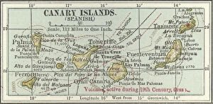
Background imageGuidance Collection: Map of the Canary Islands, c.1900 (engraving)

Map of the Canary Islands, c.1900 (engraving)
533299 Map of the Canary Islands, c.1900 (engraving); (add.info.: Map of Canary Islands (Spanish), circa 1902, from the 10th edition of Encyclopaedia Britannica.); Encyclopaedia Britannica/UIG.

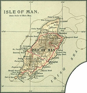
Background imageGuidance Collection: Map of the Isle of Man, c.1900 (engraving)

Map of the Isle of Man, c.1900 (engraving)
533276 Map of the Isle of Man, c.1900 (engraving); (add.info.: Map of Isle of Man, United Kingdom, circa 1902, from the 10th edition of Encyclopaedia Britannica.); Encyclopaedia Britannica/UIG.

Background imageGuidance Collection: Map of Russia showing historical boundaries of Russia in Europe with Poland and Finland, circa 1902

Map of Russia showing historical boundaries of Russia in Europe with Poland and Finland, circa 1902
532992 Map of Russia showing historical boundaries of Russia in Europe with Poland and Finland, circa 1902; (add.info.: Map showing historical boundaries of Russia in Europe with Poland and Finland)

Background imageGuidance Collection: Map of Italy with Sicily and Naples, c.1900 (engraving)

Map of Italy with Sicily and Naples, c.1900 (engraving)
532989 Map of Italy with Sicily and Naples, c.1900 (engraving); (add.info.: Map of central and southern Italy with insets map of Sicily and Naples, circa 1902)

Background imageGuidance Collection: Map of Denmark, c.1900 (engraving)

Map of Denmark, c.1900 (engraving)
532967 Map of Denmark, c.1900 (engraving); (add.info.: Map of Denmark, with insets of Iceland, Copenhagen, and the Faeroe Islands, circa 1902)

Background imageGuidance Collection: Map of Wisconsin, c.1900 (engraving)

Map of Wisconsin, c.1900 (engraving)
533185 Map of Wisconsin, c.1900 (engraving); (add.info.: Map of Wisconsin, United States, with an inset map of Milwaukee and the Waukesha Lake Region, circa 1902)

Background imageGuidance Collection: Map of the northern part of Michigan, c.1900 (engraving)

Map of the northern part of Michigan, c.1900 (engraving)
533181 Map of the northern part of Michigan, c.1900 (engraving); (add.info.: Map of the northern part of Michigan, United States, with inset maps of St)

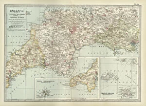
Background imageGuidance Collection: Map of England, c.1900 (engraving)

Map of England, c.1900 (engraving)
532930 Map of England, c.1900 (engraving); (add.info.: Map of England, with Cornwall, Devonshire, Dorset, and an inset of the Channel Islands, circa 1902)

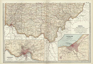
Background imageGuidance Collection: Map of southern Ohio, c.1900 (engraving)

Map of southern Ohio, c.1900 (engraving)
533168 Map of southern Ohio, c.1900 (engraving); (add.info.: Map of the southern part of Ohio, United States, with inset maps of Cincinnati and Cleveland, circa 1902)

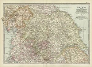
Background imageGuidance Collection: Map of England, c.1900 (engraving)

Map of England, c.1900 (engraving)
532911 Map of England, c.1900 (engraving); (add.info.: Map of England with Yorkshire, Lancashire, and Westmorland, circa 1902)

Background imageGuidance Collection: Map of Mississippi, c.1900 (engraving)

Map of Mississippi, c.1900 (engraving)
533154 Map of Mississippi, c.1900 (engraving); (add.info.: Map of Mississippi, United States, circa 1902, from the 10th edition of Encyclopaedia Britannica.); Encyclopaedia Britannica/UIG.

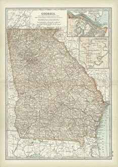
Background imageGuidance Collection: Map of Georgia, c.1900 (engraving)

Map of Georgia, c.1900 (engraving)
533139 Map of Georgia, c.1900 (engraving); (add.info.: Map of Georgia, United States, with inset maps of Savannah and Chickamauga National Park, circa 1902)

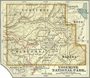
Background imageGuidance Collection: Map of Yosemite National Park, c.1900 (engraving)

Map of Yosemite National Park, c.1900 (engraving)
532890 Map of Yosemite National Park, c.1900 (engraving); (add.info.: Map of Yosemite National Park, highlighting major parks and other features, circa 1900)

Background imageGuidance Collection: Map of Maryland and Delaware, c.1900 (engraving)

Map of Maryland and Delaware, c.1900 (engraving)
533120 Map of Maryland and Delaware, c.1900 (engraving); (add.info.: Map of Maryland and Delaware, inset maps of District of Columbia and Baltimore, circa 1902)

Background imageGuidance Collection: Map of New York State, c.1900 (engraving)

Map of New York State, c.1900 (engraving)
533105 Map of New York State, c.1900 (engraving); (add.info.: Map of north and eastern New York State, United States, circa 1902)

Background imageGuidance Collection: Map of Connecticut and Rhode Island, c.1900 (engraving)

Map of Connecticut and Rhode Island, c.1900 (engraving)
533101 Map of Connecticut and Rhode Island, c.1900 (engraving); (add.info.: Map of Connecticut and Rhode Island, United States, with an inset of Newport, circa 1902)

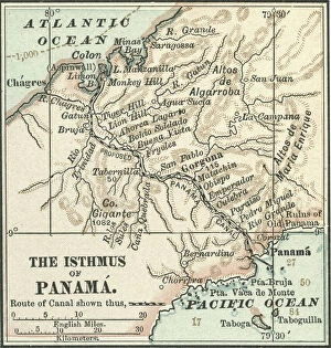
Background imageGuidance Collection: Map of Central Panama, c.1900 (engraving)

Map of Central Panama, c.1900 (engraving)
532816 Map of Central Panama, c.1900 (engraving); (add.info.: Map of central Panama, highlighting the proposed route of the Panama Canal through the isthmus, circa 1900)

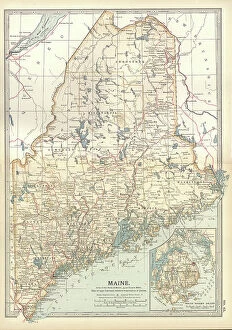
Background imageGuidance Collection: Map of Maine, c.1900 (engraving)

Map of Maine, c.1900 (engraving)
533088 Map of Maine, c.1900 (engraving); (add.info.: Map of Maine, United States, with inset map of Mount Desert Island, circa 1902)

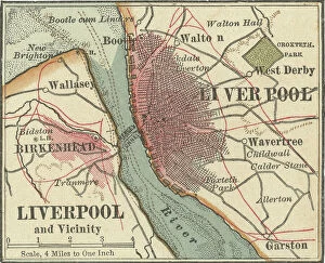
Background imageGuidance Collection: Map of Liverpool, c.1900 (engraving)

Map of Liverpool, c.1900 (engraving)
532785 Map of Liverpool, c.1900 (engraving); (add.info.: Map of Liverpool, circa 1900, from the 10th edition of Encyclopaedia Britannica.); Encyclopaedia Britannica/UIG.

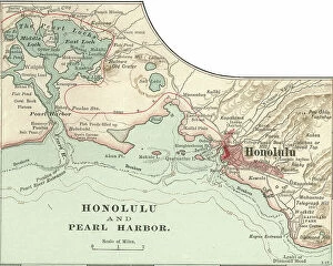
Background imageGuidance Collection: Map of Honolulu, c.1900 (engraving)

Map of Honolulu, c.1900 (engraving)
532773 Map of Honolulu, c.1900 (engraving); (add.info.: Map of Honolulu, Hawaii, circa 1900, from the 10th edition of Encyclopaedia Britannica.); Encyclopaedia Britannica/UIG.

Background imageGuidance Collection: Map of Hamburg, c.1900 (engraving)

Map of Hamburg, c.1900 (engraving)
532767 Map of Hamburg, c.1900 (engraving); (add.info.: Map of Hamburg, circa 1900, from the 10th edition of Encyclopaedia Britannica.); Encyclopaedia Britannica/UIG.

Background imageGuidance Collection: map of Detroit, c.1900 (engraving)

map of Detroit, c.1900 (engraving)
532755 map of Detroit, c.1900 (engraving); (add.info.: Map of Detroit, Michigan, and the Detroit River, circa 1900, from the 10th edition of Encyclopaedia Britannica.); Encyclopaedia Britannica/UIG.

Background imageGuidance Collection: Map of Dardanelles, c.1900 (engraving)

Map of Dardanelles, c.1900 (engraving)
532751 Map of Dardanelles, c.1900 (engraving); (add.info.: Map of Dardanelles, circa 1900, from the 10th edition of Encyclopaedia Britannica.); Encyclopaedia Britannica/UIG.

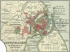
Background imageGuidance Collection: Map of Copenhagen, c.1900 (engraving)

Map of Copenhagen, c.1900 (engraving)
532749 Map of Copenhagen, c.1900 (engraving); (add.info.: Map of Copenhagen, Denmark, from the 10th edition of Encyclopaedia Britannica.); Encyclopaedia Britannica/UIG.

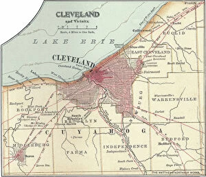
Background imageGuidance Collection: Map of Cleveland, c.1900 (engraving)

Map of Cleveland, c.1900 (engraving)
532746 Map of Cleveland, c.1900 (engraving); (add.info.: Map of Cleveland, Ohio, from the 10th edition of Encyclopaedia Britannica.); Encyclopaedia Britannica/UIG.

Background imageGuidance Collection: Map of Chicago, c.1900 (engraving)

Map of Chicago, c.1900 (engraving)
532740 Map of Chicago, c.1900 (engraving); (add.info.: Map of Chicago, Illinois, circa 1900, from the 10th edition of Encyclopaedia Britannica.); Encyclopaedia Britannica/UIG.

Background imageGuidance Collection: Map of Calcutta, c.1900 (engraving)

Map of Calcutta, c.1900 (engraving)
532731 Map of Calcutta, c.1900 (engraving); (add.info.: Map of Calcutta (now Kolkata), circa 1900, from the 10th edition of Encyclopaedia Britannica.); Encyclopaedia Britannica/UIG.

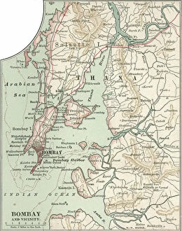
Background imageGuidance Collection: Map of Bombay (now Mumbai), c.1900 (engraving)

Map of Bombay (now Mumbai), c.1900 (engraving)
532711 Map of Bombay (now Mumbai), c.1900 (engraving); (add.info.: Map of the city of Bombay (now Mumbai) and vicinity, India, circa 1900

Background imageGuidance Collection: Map of Berlin, c.1900 (engraving)

Map of Berlin, c.1900 (engraving)
532708 Map of Berlin, c.1900 (engraving); (add.info.: Map of the city of Berlin and vicinity, Germany, circa 1900, from the 10th edition of Encyclopaedia Britannica.); Encyclopaedia Britannica/UIG.

Background imageGuidance Collection: Map of Baltimore, c.1900 (engraving)

Map of Baltimore, c.1900 (engraving)
532705 Map of Baltimore, c.1900 (engraving); (add.info.: Map of Baltimore, Maryland, circa 1900, from the 10th edition of Encyclopaedia Britannica.); Encyclopaedia Britannica/UIG.

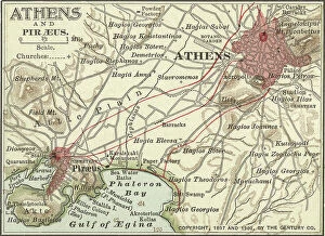
Background imageGuidance Collection: Map of Athens, c.1900 (engraving)

Map of Athens, c.1900 (engraving)
532702 Map of Athens, c.1900 (engraving); (add.info.: Map showing the historical churches of Athens and Piraeus, circa 1900)

Background imageGuidance Collection: Illustration showing a French coal miner with a safety lamp, 1900 (lithograph)

Illustration showing a French coal miner with a safety lamp, 1900 (lithograph)
3665925 Illustration showing a French coal miner with a safety lamp, 1900 (lithograph); Universal History Archive/UIG.

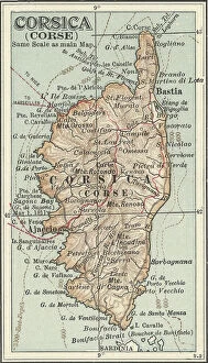
Background imageGuidance Collection: Map of Corsica, c.1900 (engraving)

Map of Corsica, c.1900 (engraving)
533290 Map of Corsica, c.1900 (engraving); (add.info.: Map of Corsica, France, circa 1902, from the 10th edition of Encyclopaedia Britannica.); Encyclopaedia Britannica/UIG.

Background imageGuidance Collection: Map of Persia with Afghanistan and Baluchistan, c.1900 (engraving)

Map of Persia with Afghanistan and Baluchistan, c.1900 (engraving)
533013 Map of Persia with Afghanistan and Baluchistan, c.1900 (engraving); (add.info.: Map showing the historical boundaries of Persia (now Iran), Afghanistan, and Baluchistan, circa 1902

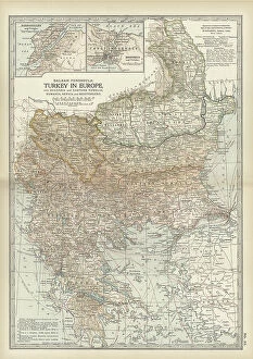
Background imageGuidance Collection: Map of Turkey, c.1900 (engraving)

Map of Turkey, c.1900 (engraving)
532998 Map of Turkey, c.1900 (engraving); (add.info.: Map showing historical boundaries of the European portion of Turkey, circa 1902)

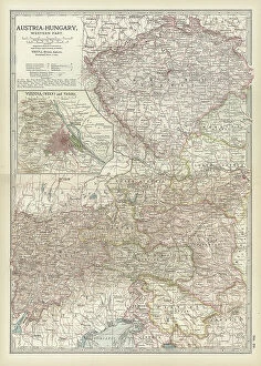
Background imageGuidance Collection: Map of Austria with Vienna, c.1900 (engraving)

Map of Austria with Vienna, c.1900 (engraving)
532980 Map of Austria with Vienna, c.1900 (engraving); (add.info.: Map showing Austria-Hungary, with an inset of Vienna, circa 1902)


All Professionally Made to Order for Quick Shipping

"Guidance: Illuminating Paths Across Time and Space" Step into the world of guidance, where ancient maps like the Mappa Mundi, inked with vibrant colors on delicate parchment, reveal the journeys of explorers in 1265 London. Feel the guiding light emanating from Sturgeon Bay Lighthouse in Door County, Wisconsin. Its beacon has guided countless sailors through treacherous waters to safety. In Pyongyang, Democratic People's Republic of Korea (DPRK), a painting depicting Great Leaders Kim Jong Il and Kim Il Sung stands as a symbol of unwavering guidance for their nation amidst turbulent times. At Fanad Head Lighthouse, witness how its steadfast presence guides ships along Ireland's rugged coastline, offering solace in stormy seas. Gaze upon Christ the Redeemer overlooking Rio de Janeiro from atop Sugar Loaf mountain. His outstretched arms serve as a constant reminder that they are be found even in towering heights. Discover unexpected guidance through "The Vegetabull" poster—a whimsical depiction reminding us to embrace nature's bounty and nourish our souls with its colorful offerings. As mid-summer sunrise bathes The Mull of Galloway Lighthouse in golden hues, let it remind you that each dawn brings new possibilities and fresh opportunities for personal growth. Travel across continents to Cape Neddick (The Nubble) Lighthouse in Maine. Witness how this stoic structure has provided unwavering guidance to mariners navigating New England's rocky shores since time immemorial. Enter "The New Jerusalem, " an enchanting vision crafted around 1900. This utopian cityscape serves as a testament to humanity's eternal quest for spiritual enlightenment and divine guidance. Underneath moonlit skies at Whitefish Point Lighthouse, allow yourself to be captivated by its ethereal glow. It stands as a guardian guiding lost souls home amidst Lake Superior’s vast expanse.