Fraud Blocker Skip to main content

Hall Lane Collection (page 4)

Hall Lane is a name that resonates with diverse locations across the United Kingdom

Background imageHall Lane Collection: Suffolk Coastal IP13 0 Map

Suffolk Coastal IP13 0 Map
Postcode Sector Map of Suffolk Coastal IP13 0

Background imageHall Lane Collection: Knowsley L32 1 Map

Knowsley L32 1 Map
Postcode Sector Map of Knowsley L32 1

Background imageHall Lane Collection: Sefton L31 4 Map

Sefton L31 4 Map
Postcode Sector Map of Sefton L31 4

Background imageHall Lane Collection: Sefton L31 3 Map

Sefton L31 3 Map
Postcode Sector Map of Sefton L31 3

Background imageHall Lane Collection: Calderdale HX6 4 Map

Calderdale HX6 4 Map
Postcode Sector Map of Calderdale HX6 4

Background imageHall Lane Collection: Calderdale HX3 7 Map

Calderdale HX3 7 Map
Postcode Sector Map of Calderdale HX3 7

Background imageHall Lane Collection: Mid Suffolk IP23 8 Map

Mid Suffolk IP23 8 Map
Postcode Sector Map of Mid Suffolk IP23 8

Background imageHall Lane Collection: Waveney IP19 0 Map

Waveney IP19 0 Map
Postcode Sector Map of Waveney IP19 0

Background imageHall Lane Collection: Mid Suffolk IP14 5 Map

Mid Suffolk IP14 5 Map
Postcode Sector Map of Mid Suffolk IP14 5

Background imageHall Lane Collection: St Edmundsbury IP30 9 Map

St Edmundsbury IP30 9 Map
Postcode Sector Map of St Edmundsbury IP30 9

Background imageHall Lane Collection: Forest Heath IP28 6 Map

Forest Heath IP28 6 Map
Postcode Sector Map of Forest Heath IP28 6

Background imageHall Lane Collection: Breckland IP26 5 Map

Breckland IP26 5 Map
Postcode Sector Map of Breckland IP26 5

Background imageHall Lane Collection: Breckland IP24 1 Map

Breckland IP24 1 Map
Postcode Sector Map of Breckland IP24 1

Background imageHall Lane Collection: South Norfolk IP22 5 Map

South Norfolk IP22 5 Map
Postcode Sector Map of South Norfolk IP22 5

Background imageHall Lane Collection: South Norfolk IP22 2 Map

South Norfolk IP22 2 Map
Postcode Sector Map of South Norfolk IP22 2

Background imageHall Lane Collection: South Norfolk IP22 1 Map

South Norfolk IP22 1 Map
Postcode Sector Map of South Norfolk IP22 1

Background imageHall Lane Collection: Mid Suffolk IP21 5 Map

Mid Suffolk IP21 5 Map
Postcode Sector Map of Mid Suffolk IP21 5

Background imageHall Lane Collection: Mid Suffolk IP21 4 Map

Mid Suffolk IP21 4 Map
Postcode Sector Map of Mid Suffolk IP21 4

Background imageHall Lane Collection: South Ayrshire KA10 7 Map

South Ayrshire KA10 7 Map
Postcode Sector Map of South Ayrshire KA10 7

Background imageHall Lane Collection: Kirklees HD3 3 Map

Kirklees HD3 3 Map
Postcode Sector Map of Kirklees HD3 3

Background imageHall Lane Collection: Hart GU46 6 Map

Hart GU46 6 Map
Postcode Sector Map of Hart GU46 6

Background imageHall Lane Collection: East Hampshire GU34 3 Map

East Hampshire GU34 3 Map
Postcode Sector Map of East Hampshire GU34 3

Background imageHall Lane Collection: Harrogate HG1 3 Map

Harrogate HG1 3 Map
Postcode Sector Map of Harrogate HG1 3

Background imageHall Lane Collection: Kirklees HD8 0 Map

Kirklees HD8 0 Map
Postcode Sector Map of Kirklees HD8 0

Background imageHall Lane Collection: Falkirk FK16 6 Map

Falkirk FK16 6 Map
Postcode Sector Map of Falkirk FK16 6

Background imageHall Lane Collection: Doncaster DN6 9 Map

Doncaster DN6 9 Map
Postcode Sector Map of Doncaster DN6 9

Background imageHall Lane Collection: Waltham Forest E4 8 Map

Waltham Forest E4 8 Map
Postcode Sector Map of Waltham Forest E4 8

Background imageHall Lane Collection: Mid Devon EX17 6 Map

Mid Devon EX17 6 Map
Postcode Sector Map of Mid Devon EX17 6

Background imageHall Lane Collection: South Derbyshire DE12 7 Map

South Derbyshire DE12 7 Map
Postcode Sector Map of South Derbyshire DE12 7

Background imageHall Lane Collection: Dudley DY4 0 Map

Dudley DY4 0 Map
Postcode Sector Map of Dudley DY4 0

Background imageHall Lane Collection: North Lincolnshire DN20 0 Map

North Lincolnshire DN20 0 Map
Postcode Sector Map of North Lincolnshire DN20 0

Background imageHall Lane Collection: Dudley DY9 9 Map

Dudley DY9 9 Map
Postcode Sector Map of Dudley DY9 9

Background imageHall Lane Collection: Amber Valley DE56 2 Map

Amber Valley DE56 2 Map
Postcode Sector Map of Amber Valley DE56 2

Background imageHall Lane Collection: North Yorkshire DL6 3 Map

North Yorkshire DL6 3 Map
Postcode Sector Map of North Yorkshire DL6 3

Background imageHall Lane Collection: Amber Valley DE55 5 Map

Amber Valley DE55 5 Map
Postcode Sector Map of Amber Valley DE55 5

Background imageHall Lane Collection: South Derbyshire DE65 6 Map

South Derbyshire DE65 6 Map
Postcode Sector Map of South Derbyshire DE65 6

Background imageHall Lane Collection: Cheshire East CW1 4 Map

Cheshire East CW1 4 Map
Postcode Sector Map of Cheshire East CW1 4

Background imageHall Lane Collection: Cheshire West and Chester CW6 9 Map

Cheshire West and Chester CW6 9 Map
Postcode Sector Map of Cheshire West and Chester CW6 9

Background imageHall Lane Collection: Cheshire West and Chester CW9 7 Map

Cheshire West and Chester CW9 7 Map
Postcode Sector Map of Cheshire West and Chester CW9 7

Background imageHall Lane Collection: Cheshire West and Chester CW9 6 Map

Cheshire West and Chester CW9 6 Map
Postcode Sector Map of Cheshire West and Chester CW9 6

Background imageHall Lane Collection: Cheshire West and Chester CW7 1 Map

Cheshire West and Chester CW7 1 Map
Postcode Sector Map of Cheshire West and Chester CW7 1

Background imageHall Lane Collection: Cheshire West and Chester CW6 0 Map

Cheshire West and Chester CW6 0 Map
Postcode Sector Map of Cheshire West and Chester CW6 0

Background imageHall Lane Collection: Cheshire East CW11 3 Map

Cheshire East CW11 3 Map
Postcode Sector Map of Cheshire East CW11 3

Background imageHall Lane Collection: Cheshire East CW3 0 Map

Cheshire East CW3 0 Map
Postcode Sector Map of Cheshire East CW3 0

Background imageHall Lane Collection: Cheshire West and Chester CW7 4 Map

Cheshire West and Chester CW7 4 Map
Postcode Sector Map of Cheshire West and Chester CW7 4

Background imageHall Lane Collection: Derbyshire Dales DE6 2 Map

Derbyshire Dales DE6 2 Map
Postcode Sector Map of Derbyshire Dales DE6 2

Background imageHall Lane Collection: Derbyshire Dales DE6 1 Map

Derbyshire Dales DE6 1 Map
Postcode Sector Map of Derbyshire Dales DE6 1

Background imageHall Lane Collection: Derbyshire Dales DE6 5 Map

Derbyshire Dales DE6 5 Map
Postcode Sector Map of Derbyshire Dales DE6 5


All Professionally Made to Order for Quick Shipping

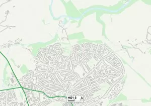
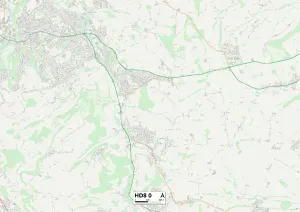
Hall Lane is a name that resonates with diverse locations across the United Kingdom. From Leeds LS7 3 to South Ribble PR25 3, this captivating lane stretches far and wide, connecting communities in BL Bolton, BL3 1 and Wigan WN3 It weaves its way through the heart of Wigan WN1 2 and Leeds LS12 2, leaving an indelible mark on these bustling cities. As you venture further along Hall Lane, you'll find yourself immersed in the charming neighborhoods of Leeds LS16 7 and Lincoln LN5 0. Each turn reveals a new story waiting to be discovered as you navigate through Leicester LE2 8 and South Lakeland LA10 The beauty lies not only in its geographical diversity but also in the sense of unity it brings. From Exeter EX7 0 to North Yorkshire DL11 7, people from all walks of life come together under the same sky. Whether it's a quiet stroll or an adventurous drive down Hall Lane, there's always something enchanting about exploring its hidden corners. So grab your map and embark on a journey filled with surprises as you traverse this remarkable road that connects countless lives across the UK.