Fraud Blocker Skip to main content

Hazel Close Collection (page 2)

Hazel Close is a charming residential street located in various parts of the UK

Background imageHazel Close Collection: South Northamptonshire NN13 6 Map

South Northamptonshire NN13 6 Map
Postcode Sector Map of South Northamptonshire NN13 6

Background imageHazel Close Collection: South Oxfordshire OX14 1 Map

South Oxfordshire OX14 1 Map
Postcode Sector Map of South Oxfordshire OX14 1

Background imageHazel Close Collection: Barnet NW9 5 Map

Barnet NW9 5 Map
Postcode Sector Map of Barnet NW9 5

Background imageHazel Close Collection: West Norfolk PE33 0 Map

West Norfolk PE33 0 Map
Postcode Sector Map of West Norfolk PE33 0

Background imageHazel Close Collection: West Norfolk PE32 1 Map

West Norfolk PE32 1 Map
Postcode Sector Map of West Norfolk PE32 1

Background imageHazel Close Collection: West Norfolk PE30 3 Map

West Norfolk PE30 3 Map
Postcode Sector Map of West Norfolk PE30 3

Background imageHazel Close Collection: South Ribble PR5 6 Map

South Ribble PR5 6 Map
Postcode Sector Map of South Ribble PR5 6

Background imageHazel Close Collection: Sussex PO20 8 Map

Sussex PO20 8 Map
Postcode Sector Map of Sussex PO20 8

Background imageHazel Close Collection: Isle of Wight PO38 1 Map

Isle of Wight PO38 1 Map
Postcode Sector Map of Isle of Wight PO38 1

Background imageHazel Close Collection: Chorley PR6 8 Map

Chorley PR6 8 Map
Postcode Sector Map of Chorley PR6 8

Background imageHazel Close Collection: Isle of Wight PO30 5 Map

Isle of Wight PO30 5 Map
Postcode Sector Map of Isle of Wight PO30 5

Background imageHazel Close Collection: Horsham RH13 9 Map

Horsham RH13 9 Map
Postcode Sector Map of Horsham RH13 9

Background imageHazel Close Collection: Crawley RH10 4 Map

Crawley RH10 4 Map
Postcode Sector Map of Crawley RH10 4

Background imageHazel Close Collection: Norfolk NR18 0 Map

Norfolk NR18 0 Map
Postcode Sector Map of Norfolk NR18 0

Background imageHazel Close Collection: Norfolk NR8 6 Map

Norfolk NR8 6 Map
Postcode Sector Map of Norfolk NR8 6

Background imageHazel Close Collection: Rushcliffe NG13 8 Map

Rushcliffe NG13 8 Map
Postcode Sector Map of Rushcliffe NG13 8

Background imageHazel Close Collection: Daventry NN7 3 Map

Daventry NN7 3 Map
Postcode Sector Map of Daventry NN7 3

Background imageHazel Close Collection: Daventry NN7 2 Map

Daventry NN7 2 Map
Postcode Sector Map of Daventry NN7 2

Background imageHazel Close Collection: Enfield N13 5 Map

Enfield N13 5 Map
Postcode Sector Map of Enfield N13 5

Background imageHazel Close Collection: Rutland LE15 9 Map

Rutland LE15 9 Map
Postcode Sector Map of Rutland LE15 9

Background imageHazel Close Collection: Gateshead NE42 5 Map

Gateshead NE42 5 Map
Postcode Sector Map of Gateshead NE42 5

Background imageHazel Close Collection: Leicester LE19 2 Map

Leicester LE19 2 Map
Postcode Sector Map of Leicester LE19 2

Background imageHazel Close Collection: Leicester LE4 4 Map

Leicester LE4 4 Map
Postcode Sector Map of Leicester LE4 4

Background imageHazel Close Collection: Leicester LE8 9 Map

Leicester LE8 9 Map
Postcode Sector Map of Leicester LE8 9

Background imageHazel Close Collection: Suffolk Coastal IP12 2 Map

Suffolk Coastal IP12 2 Map
Postcode Sector Map of Suffolk Coastal IP12 2

Background imageHazel Close Collection: Barrow-in-Furness LA14 4 Map

Barrow-in-Furness LA14 4 Map
Postcode Sector Map of Barrow-in-Furness LA14 4

Background imageHazel Close Collection: Forest Heath IP28 7 Map

Forest Heath IP28 7 Map
Postcode Sector Map of Forest Heath IP28 7

Background imageHazel Close Collection: Harrogate HG3 1 Map

Harrogate HG3 1 Map
Postcode Sector Map of Harrogate HG3 1

Background imageHazel Close Collection: Ripon HG4 3 Map

Ripon HG4 3 Map
Postcode Sector Map of Ripon HG4 3

Background imageHazel Close Collection: East Hampshire GU30 7 Map

East Hampshire GU30 7 Map
Postcode Sector Map of East Hampshire GU30 7

Background imageHazel Close Collection: Gloucester GL2 0 Map

Gloucester GL2 0 Map
Postcode Sector Map of Gloucester GL2 0

Background imageHazel Close Collection: Exeter EX10 0 Map

Exeter EX10 0 Map
Postcode Sector Map of Exeter EX10 0

Background imageHazel Close Collection: Exeter EX12 2 Map

Exeter EX12 2 Map
Postcode Sector Map of Exeter EX12 2

Background imageHazel Close Collection: Broxbourne EN7 6 Map

Broxbourne EN7 6 Map
Postcode Sector Map of Broxbourne EN7 6

Background imageHazel Close Collection: South Derbyshire DE11 0 Map

South Derbyshire DE11 0 Map
Postcode Sector Map of South Derbyshire DE11 0

Background imageHazel Close Collection: East Staffordshire DE13 0 Map

East Staffordshire DE13 0 Map
Postcode Sector Map of East Staffordshire DE13 0

Background imageHazel Close Collection: South Derbyshire DE12 7 Map

South Derbyshire DE12 7 Map
Postcode Sector Map of South Derbyshire DE12 7

Background imageHazel Close Collection: North Lincolnshire DN17 3 Map

North Lincolnshire DN17 3 Map
Postcode Sector Map of North Lincolnshire DN17 3

Background imageHazel Close Collection: Amber Valley DE75 7 Map

Amber Valley DE75 7 Map
Postcode Sector Map of Amber Valley DE75 7

Background imageHazel Close Collection: South Derbyshire DE65 6 Map

South Derbyshire DE65 6 Map
Postcode Sector Map of South Derbyshire DE65 6

Background imageHazel Close Collection: Stratford-on-Avon CV37 8 Map

Stratford-on-Avon CV37 8 Map
Postcode Sector Map of Stratford-on-Avon CV37 8

Background imageHazel Close Collection: Cheshire East CW4 8 Map

Cheshire East CW4 8 Map
Postcode Sector Map of Cheshire East CW4 8

Background imageHazel Close Collection: Derbyshire Dales DE6 1 Map

Derbyshire Dales DE6 1 Map
Postcode Sector Map of Derbyshire Dales DE6 1

Background imageHazel Close Collection: Nuneaton & Bedworth CV10 0 Map

Nuneaton & Bedworth CV10 0 Map
Postcode Sector Map of Nuneaton & Bedworth CV10 0

Background imageHazel Close Collection: Warwick CV32 5 Map

Warwick CV32 5 Map
Postcode Sector Map of Warwick CV32 5

Background imageHazel Close Collection: Rugby CV21 1 Map

Rugby CV21 1 Map
Postcode Sector Map of Rugby CV21 1

Background imageHazel Close Collection: Merton CR4 1 Map

Merton CR4 1 Map
Postcode Sector Map of Merton CR4 1

Background imageHazel Close Collection: Colchester CO7 8 Map

Colchester CO7 8 Map
Postcode Sector Map of Colchester CO7 8


All Professionally Made to Order for Quick Shipping

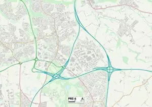
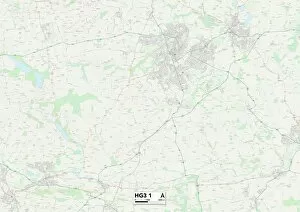
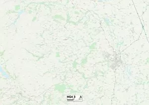
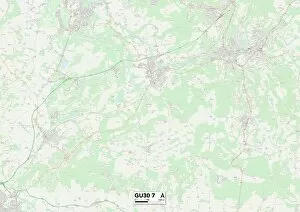
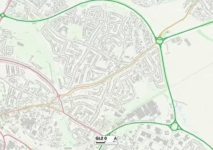
Hazel Close is a charming residential street located in various parts of the UK. From Worcester to Plymouth, Crawley to Wakefield, this name can be found on maps across the country. With its diverse locations like Wychavon and Teignbridge, it offers a variety of settings for residents to call home. In Worcester's WR4 9 Map, Hazel Close stands as a peaceful haven amidst bustling city life. Its proximity to amenities and transport links makes it an ideal choice for those seeking convenience without compromising tranquility. Moving southwards towards Wychavon's WR9 7 Map, Hazel Close reveals itself as a picturesque neighborhood with well-maintained houses and friendly neighbors. The surrounding green spaces provide ample opportunities for outdoor activities and family gatherings. Venturing further southwest into Teignbridge's TQ12 4 Map, Hazel Close showcases stunning views of rolling hills and lush landscapes. This idyllic setting creates a serene atmosphere that residents cherish every day. Heading westward towards Plymouth's PL6 6 Map, Hazel Close becomes part of a vibrant community filled with cultural attractions and coastal beauty. Living here means enjoying both urban excitement and seaside charm just moments away from your doorstep. Traveling northwards to Crawley's RH11 7 Map brings you another facet of Hazel Close—a thriving suburban area known for its excellent schools and close-knit community spirit. Families find solace in this welcoming environment where children can grow up surrounded by friends. Continuing our journey northeast towards Lincoln's LN6 9 Map takes us to yet another version of Hazel Close—this time nestled within historical surroundings steeped in heritage. Residents here enjoy exploring ancient landmarks while also benefiting from modern conveniences nearby. Making our way northwest into Tameside's M43 7 Map introduces us to another side of Hazel Close—an area known for its strong sense of community pride and local events that bring neighbors together year-round.