Fraud Blocker Skip to main content

Highfields Collection

Highfields is a diverse and vibrant community spread across various locations in the UK

Background imageHighfields Collection: The Governess

The Governess
Mel Brackstone

Background imageHighfields Collection: Wolverhampton WV14 0 Map

Wolverhampton WV14 0 Map
Postcode Sector Map of Wolverhampton WV14 0

Background imageHighfields Collection: Staffordshire ST17 9 Map

Staffordshire ST17 9 Map
Postcode Sector Map of Staffordshire ST17 9

Background imageHighfields Collection: East Riding of Yorkshire HU15 2 Map

East Riding of Yorkshire HU15 2 Map
Postcode Sector Map of East Riding of Yorkshire HU15 2

Background imageHighfields Collection: Wakefield WF4 2 Map

Wakefield WF4 2 Map
Postcode Sector Map of Wakefield WF4 2

Background imageHighfields Collection: Wakefield WF4 4 Map

Wakefield WF4 4 Map
Postcode Sector Map of Wakefield WF4 4

Background imageHighfields Collection: Hertsmere WD7 8 Map

Hertsmere WD7 8 Map
Postcode Sector Map of Hertsmere WD7 8

Background imageHighfields Collection: Shropshire SY13 3 Map

Shropshire SY13 3 Map
Postcode Sector Map of Shropshire SY13 3

Background imageHighfields Collection: Eastleigh SO31 6 Map

Eastleigh SO31 6 Map
Postcode Sector Map of Eastleigh SO31 6

Background imageHighfields Collection: Lichfield WS7 9 Map

Lichfield WS7 9 Map
Postcode Sector Map of Lichfield WS7 9

Background imageHighfields Collection: Lichfield WS7 3 Map

Lichfield WS7 3 Map
Postcode Sector Map of Lichfield WS7 3

Background imageHighfields Collection: Rother TN19 7 Map

Rother TN19 7 Map
Postcode Sector Map of Rother TN19 7

Background imageHighfields Collection: Hampshire RG25 3 Map

Hampshire RG25 3 Map
Postcode Sector Map of Hampshire RG25 3

Background imageHighfields Collection: Mid Sussex RH18 5 Map

Mid Sussex RH18 5 Map
Postcode Sector Map of Mid Sussex RH18 5

Background imageHighfields Collection: Chesterfield S43 4 Map

Chesterfield S43 4 Map
Postcode Sector Map of Chesterfield S43 4

Background imageHighfields Collection: Barnsley S36 7 Map

Barnsley S36 7 Map
Postcode Sector Map of Barnsley S36 7

Background imageHighfields Collection: Fenland PE14 8 Map

Fenland PE14 8 Map
Postcode Sector Map of Fenland PE14 8

Background imageHighfields Collection: East Northamptonshire PE8 5 Map

East Northamptonshire PE8 5 Map
Postcode Sector Map of East Northamptonshire PE8 5

Background imageHighfields Collection: South Northamptonshire NN12 6 Map

South Northamptonshire NN12 6 Map
Postcode Sector Map of South Northamptonshire NN12 6

Background imageHighfields Collection: Norfolk NR28 0 Map

Norfolk NR28 0 Map
Postcode Sector Map of Norfolk NR28 0

Background imageHighfields Collection: South Kesteven NG32 1 Map

South Kesteven NG32 1 Map
Postcode Sector Map of South Kesteven NG32 1

Background imageHighfields Collection: Norfolk NR5 0 Map

Norfolk NR5 0 Map
Postcode Sector Map of Norfolk NR5 0

Background imageHighfields Collection: Bedford MK45 5 Map

Bedford MK45 5 Map
Postcode Sector Map of Bedford MK45 5

Background imageHighfields Collection: Charnwood LE12 8 Map

Charnwood LE12 8 Map
Postcode Sector Map of Charnwood LE12 8

Background imageHighfields Collection: Knowsley L34 3 Map

Knowsley L34 3 Map
Postcode Sector Map of Knowsley L34 3

Background imageHighfields Collection: Leicester LE67 1 Map

Leicester LE67 1 Map
Postcode Sector Map of Leicester LE67 1

Background imageHighfields Collection: Leicester LE2 0 Map

Leicester LE2 0 Map
Postcode Sector Map of Leicester LE2 0

Background imageHighfields Collection: Babergh IP9 2 Map

Babergh IP9 2 Map
Postcode Sector Map of Babergh IP9 2

Background imageHighfields Collection: Mole Valley KT22 9 Map

Mole Valley KT22 9 Map
Postcode Sector Map of Mole Valley KT22 9

Background imageHighfields Collection: Mole Valley KT21 2 Map

Mole Valley KT21 2 Map
Postcode Sector Map of Mole Valley KT21 2

Background imageHighfields Collection: Forest Heath IP27 9 Map

Forest Heath IP27 9 Map
Postcode Sector Map of Forest Heath IP27 9

Background imageHighfields Collection: Guildford KT24 5 Map

Guildford KT24 5 Map
Postcode Sector Map of Guildford KT24 5

Background imageHighfields Collection: Kirklees HD1 5 Map

Kirklees HD1 5 Map
Postcode Sector Map of Kirklees HD1 5

Background imageHighfields Collection: Kirklees HD9 5 Map

Kirklees HD9 5 Map
Postcode Sector Map of Kirklees HD9 5

Background imageHighfields Collection: Tewkesbury GL20 6 Map

Tewkesbury GL20 6 Map
Postcode Sector Map of Tewkesbury GL20 6

Background imageHighfields Collection: Falkirk FK15 9 Map

Falkirk FK15 9 Map
Postcode Sector Map of Falkirk FK15 9

Background imageHighfields Collection: Stroud GL11 4 Map

Stroud GL11 4 Map
Postcode Sector Map of Stroud GL11 4

Background imageHighfields Collection: Gloucester GL9 1 Map

Gloucester GL9 1 Map
Postcode Sector Map of Gloucester GL9 1

Background imageHighfields Collection: Hertsmere EN6 4 Map

Hertsmere EN6 4 Map
Postcode Sector Map of Hertsmere EN6 4

Background imageHighfields Collection: North Lincolnshire DN19 7 Map

North Lincolnshire DN19 7 Map
Postcode Sector Map of North Lincolnshire DN19 7

Background imageHighfields Collection: North Lincolnshire DN17 4 Map

North Lincolnshire DN17 4 Map
Postcode Sector Map of North Lincolnshire DN17 4

Background imageHighfields Collection: North Dorset DT11 7 Map

North Dorset DT11 7 Map
Postcode Sector Map of North Dorset DT11 7

Background imageHighfields Collection: Amber Valley DE5 9 Map

Amber Valley DE5 9 Map
Postcode Sector Map of Amber Valley DE5 9

Background imageHighfields Collection: Braintree CO9 4 Map

Braintree CO9 4 Map
Postcode Sector Map of Braintree CO9 4

Background imageHighfields Collection: Braintree CO9 1 Map

Braintree CO9 1 Map
Postcode Sector Map of Braintree CO9 1

Background imageHighfields Collection: County Durham DL13 4 Map

County Durham DL13 4 Map
Postcode Sector Map of County Durham DL13 4

Background imageHighfields Collection: Doncaster DN6 7 Map

Doncaster DN6 7 Map
Postcode Sector Map of Doncaster DN6 7

Background imageHighfields Collection: Cardiff CF5 2 Map

Cardiff CF5 2 Map
Postcode Sector Map of Cardiff CF5 2


All Professionally Made to Order for Quick Shipping

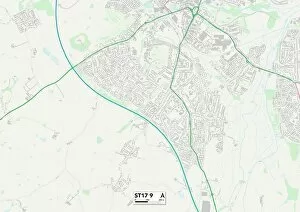
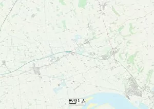
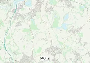
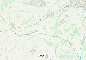
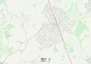
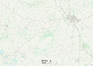
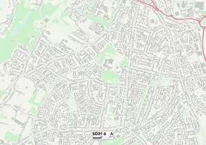
Highfields is a diverse and vibrant community spread across various locations in the UK. From Staffordshire to East Riding of Yorkshire, this captivating place offers something for everyone. With its rich history and stunning landscapes, Highfields is truly a hidden gem. In Staffordshire ST17 9 Map, you can explore the enchanting countryside and immerse yourself in nature's beauty. The rolling hills and picturesque views will leave you breathless. Head over to East Riding of Yorkshire HU15 2 Map, where you'll find The Governess - an iconic landmark that stands tall as a symbol of knowledge and education. Its grandeur architecture is sure to captivate your imagination. For those seeking adventure, Wakefield WF4 2 Map is the perfect destination. With its thrilling activities and adrenaline-pumping experiences, this place will satisfy even the most daring souls. If tranquility is what you seek, then make your way to Wakefield WF4 4 Map. Here, serenity awaits amidst peaceful surroundings that offer solace from the hustle and bustle of everyday life. Wolverhampton WV14 0 Map boasts a lively atmosphere with its bustling streets filled with shops, restaurants, and entertainment options galore. Get ready for an unforgettable shopping spree or indulge in delectable cuisine at one of its many eateries. Hertsmere WD7 8 Map welcomes visitors with open arms into its charming community. Immerse yourself in local culture by exploring quaint villages or enjoying leisurely walks through beautiful parks. Shropshire SY13 3 Map invites you on a journey back in time with its historic landmarks and fascinating museums. Uncover tales from centuries past as you wander through cobblestone streets lined with ancient buildings. Eastleigh SO31 6 Map offers an abundance of recreational opportunities for outdoor enthusiasts. Whether it's hiking along scenic trails or indulging in water sports on nearby lakeshores – adventure awaits at every turn.