Fraud Blocker Skip to main content

Planisphere Collection

A planisphere is a fascinating tool that has been used throughout history to map and navigate the world

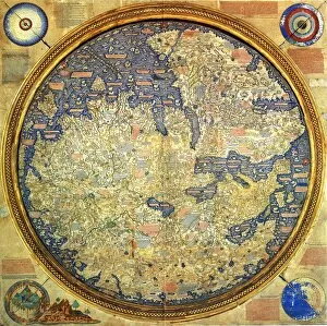
Background imagePlanisphere Collection: Fra Mauro map (1460). The Fra Mauro Map orientation (South at the top). is considered

Fra Mauro map (1460). The Fra Mauro Map orientation (South at the top). is considered
Fra Mauro map (1460). The Fra Mauro Map orientation (South at the top).is considered the greatest memorial of medieval cartography. by the Venetian monk Fra Mauro

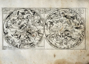
Background imagePlanisphere Collection: Constellation map. On the left side, the northern

Constellation map. On the left side, the northern
" Constellation map. On the left side, the northern constellations and on the right side, the southern constellations

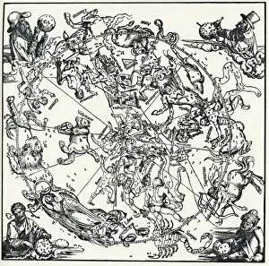
Background imagePlanisphere Collection: Durers Celestial Globe, 1515

Durers Celestial Globe, 1515. This shows the northern hemisphere, and was prepared in conjunction with the astronomer Stabius

Background imagePlanisphere Collection: Atlas 1587: Orbis Terrae Compendiosa Descriptio de Rumold Mercator (1546 / 48-1599)

Atlas 1587: Orbis Terrae Compendiosa Descriptio de Rumold Mercator (1546 / 48-1599), third son of Gerhard Kremer
GIA4699208 Atlas 1587: Orbis Terrae Compendiosa Descriptio de Rumold Mercator (1546/48-1599), third son of Gerhard Kremer, known as Gerardus Mercator

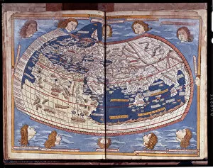
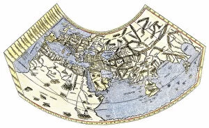
Background imagePlanisphere Collection: Map of Ptolemy published in 1482

Map of Ptolemy published in 1482
GIA4812936 Map of Ptolemy published in 1482. by Unknown Artist, (15th century); Pinacoteca di Brera, Milan, Italy; (add.info.: Map of Ptolemy published in 1482.); eGiancarlo Costa; out of copyright

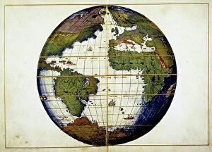
Background imagePlanisphere Collection: Planisphere - by G.B. Agnese, 15th century

Planisphere - by G.B. Agnese, 15th century
GIA5036361 Planisphere - by G.B. Agnese, 15th century.; (add.info.: Planisphere - by G.B. Agnese, 15th century.); © Giancarlo Costa.

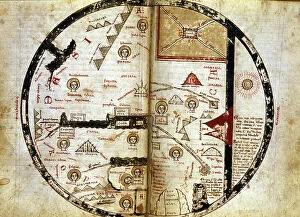
Background imagePlanisphere Collection: Handwritten map of the world as it was known in the 13th century

Handwritten map of the world as it was known in the 13th century. Mount Sinai is indicated at the top right and in red
GIA5034616 Handwritten map of the world as it was known in the 13th century. Mount Sinai is indicated at the top right and in red. Olympus down and left

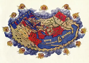
Background imagePlanisphere Collection: World map of Claudius Ptolemaeus (Claude Ptolemee, 90-168 ap JC)

World map of Claudius Ptolemaeus (Claude Ptolemee, 90-168 ap JC), Greek astronomer and astrologer (in red)
NWI4852574 World map of Claudius Ptolemaeus (Claude Ptolemee, 90-168 ap JC), Greek astronomer and astrologer (in red), contrasted with the real positions of cities and countries (in black)

Background imagePlanisphere Collection: Diagram of the globe of 1492 by Martin Behaim (1459-1506), just before the discovery of America

Diagram of the globe of 1492 by Martin Behaim (1459-1506), just before the discovery of America
NWI4851739 Diagram of the globe of 1492 by Martin Behaim (1459-1506), just before the discovery of America, which therefore does not appear on the reve

Background imagePlanisphere Collection: COSA, Juan de la (1460-1510). Cartographer. Chart by Juan de la Cosa (1500). SPAIN

COSA, Juan de la (1460-1510). Cartographer. Chart by Juan de la Cosa (1500). SPAIN. MADRID (AUTONOMOUS COMMUNITY)
CUL4877189 COSA, Juan de la (1460-1510). Cartographer. Chart by Juan de la Cosa (1500). SPAIN. MADRID (AUTONOMOUS COMMUNITY). Madrid. Navy Museum; (add.info.: COSA, Juan de la (1460-1510)

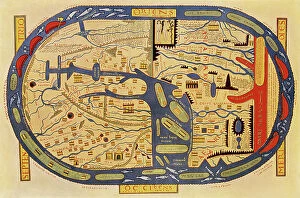
Background imagePlanisphere Collection: World map of a flat earth, printed by Beatus Rhenanus (Bild aus Rheinau), early 1500 s

World map of a flat earth, printed by Beatus Rhenanus (Bild aus Rheinau), early 1500 s
NWI4901273 World map of a flat earth, printed by Beatus Rhenanus (Bild aus Rheinau), early 1500 s.; (add.info.: World map of a flat earth, printed by Beatus Rhenanus (Bild aus Rheinau)

Background imagePlanisphere Collection: Meteorology, World Isothermal Lines. In 'Dictionnaire universel d'Histoire naturelle' by Mr

Meteorology, World Isothermal Lines. In "Dictionnaire universel d'Histoire naturelle" by Mr
JAB5036768 Meteorology, World Isothermal Lines. In "Dictionnaire universel d'Histoire naturelle" by Mr. Charles D'Orbigny, 1841-1849.; (add.info.: Meteorology)

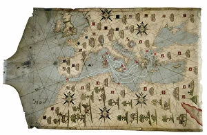
Background imagePlanisphere Collection: Portulan of the Mediterranean Sea and its coasts (Africa, Barbary, Europe, Middle East)

Portulan of the Mediterranean Sea and its coasts (Africa, Barbary, Europe, Middle East)
JEB4874759 Portulan of the Mediterranean Sea and its coasts (Africa, Barbary, Europe, Middle East). Nautical chart by Joan Oliva on parchment, 1593 preserved at the Municipal Library of Marseille

Background imagePlanisphere Collection: Theory of Round Earth: Map of the world drawn up from the discoveries of Christopher Columbus

Theory of Round Earth: Map of the world drawn up from the discoveries of Christopher Columbus (1451-1506)
NWI4848339 Theory of Round Earth: Map of the world drawn up from the discoveries of Christopher Columbus (1451-1506) and Vasco Nunez de Balboa

Background imagePlanisphere Collection: Atmosphere and Seas circulation. In 'Dictionnaire universel d'Histoire naturelle' by Mr

Atmosphere and Seas circulation. In "Dictionnaire universel d'Histoire naturelle" by Mr
JAB5036770 Atmosphere and Seas circulation. In "Dictionnaire universel d'Histoire naturelle" by Mr. Charles D'Orbigny, 1841-1849.; (add.info.: Atmosphere and Seas circulation)

Background imagePlanisphere Collection: Earth as we imagined it in Antiquity. North and Europe are on the left

Earth as we imagined it in Antiquity. North and Europe are on the left. The East is represented at the top
GIA5036364 Earth as we imagined it in Antiquity. North and Europe are on the left. The East is represented at the top, that is Asia and at the bottom right is Africa

Background imagePlanisphere Collection: Map of Fra Mauro, 1457 - 1459. From the book Life of Christopher Columbus by Clements R

Map of Fra Mauro, 1457 - 1459. From the book Life of Christopher Columbus by Clements R. Markham published 1892
2915315 Map of Fra Mauro, 1457 - 1459. From the book Life of Christopher Columbus by Clements R. Markham published 1892.; Photo © Hilary Morgan.

Background imagePlanisphere Collection: Celestial planisphere: northern hemisphere, c1880 (print)

Celestial planisphere: northern hemisphere, c1880 (print)
2526580 Celestial planisphere: northern hemisphere, c1880 (print) by Cellarius, Andreas (c.1596-1665) (after); (add.info.: Science. Astronomy. Celestial planisphere: northern hemisphere)

Background imagePlanisphere Collection: Geography map: world map representing the southern hemisphere and the boreal hemisphere

Geography map: world map representing the southern hemisphere and the boreal hemisphere. 17th or 18th century
VEN5030300 Geography map: world map representing the southern hemisphere and the boreal hemisphere. 17th or 18th century. Biblioteca Angelica

Background imagePlanisphere Collection: Geographic map of the new world made by a geographer in 1540

Geographic map of the new world made by a geographer in 1540. Colouring engraving of the 19th century
NWI4848357 Geographic map of the new world made by a geographer in 1540. Colouring engraving of the 19th century.; (add.info.: Geographic map of the new world made by a geographer in 1540)

Background imagePlanisphere Collection: World map depicting the flat earth by Greek historian Herodote (484 or 482-425 BC)

World map depicting the flat earth by Greek historian Herodote (484 or 482-425 BC)
NWI4848152 World map depicting the flat earth by Greek historian Herodote (484 or 482-425 BC). Colourful engraving of the 19th century.; (add.info)

Background imagePlanisphere Collection: World map of Claude Ptolemee (Claudius Ptolemaeus, 90-168) illustrating the flat earth

World map of Claude Ptolemee (Claudius Ptolemaeus, 90-168) illustrating the flat earth
NWI4846095 World map of Claude Ptolemee (Claudius Ptolemaeus, 90-168) illustrating the flat earth. Colourful engraving of the 19th century.; (add.info)

Background imagePlanisphere Collection: Map by Claude Ptolemee (Claudius Ptolemaeus, 90-168) showing the flat land without the American

Map by Claude Ptolemee (Claudius Ptolemaeus, 90-168) showing the flat land without the American continent
NWI4846822 Map by Claude Ptolemee (Claudius Ptolemaeus, 90-168) showing the flat land without the American continent, north and south poles, around 150

Background imagePlanisphere Collection: Map of the Atlantic with the coasts of the New World made by the navigator of the expedition of

Map of the Atlantic with the coasts of the New World made by the navigator of the expedition of Christopher Columbus
NWI4846249 Map of the Atlantic with the coasts of the New World made by the navigator of the expedition of Christopher Columbus, Juan de la Cosa (1460-1510), in 1500

Background imagePlanisphere Collection: Ptolemaeus Map A.D. 150. From the book Life of Christopher Columbus by Clements R

Ptolemaeus Map A.D. 150. From the book Life of Christopher Columbus by Clements R. Markham published 1892
2915322 Ptolemaeus Map A.D. 150. From the book Life of Christopher Columbus by Clements R. Markham published 1892.; Photo © Hilary Morgan.

Background imagePlanisphere Collection: Carte du monde (mappemonde) de 1763, reproduction supposee de la carte de l'eunuque chinois et

Carte du monde (mappemonde) de 1763, reproduction supposee de la carte de l'eunuque chinois et explorateur maritime
UIG5426399 Carte du monde (mappemonde) de 1763, reproduction supposee de la carte de l'eunuque chinois et explorateur maritime Zheng He (Zheng-He ou Cheng Ho) (1371-1433)

Background imagePlanisphere Collection: Planesphaeri Coelestis Hemisphaerium Meridionale, 1700 (coloured print)

Planesphaeri Coelestis Hemisphaerium Meridionale, 1700 (coloured print)
7340115 Planesphaeri Coelestis Hemisphaerium Meridionale, 1700 (coloured print) by Allard, Carel (c.1648-1709); 63x55 cm; National Maritime Museum, London

Background imagePlanisphere Collection: 'Planesphaerii Coelestis Hemisphaerium Septentrionale', 1700 (coloured print)

'Planesphaerii Coelestis Hemisphaerium Septentrionale', 1700 (coloured print)
7340113 'Planesphaerii Coelestis Hemisphaerium Septentrionale', 1700 (coloured print) by Allard, Carel (c.1648-1709); 63x55 cm; National Maritime Museum, London

Background imagePlanisphere Collection: A planisphere printed in white on a dark blue background, c.1900 (cardboard, gilt)

A planisphere printed in white on a dark blue background, c.1900 (cardboard, gilt)
7339847 A planisphere printed in white on a dark blue background, c.1900 (cardboard, gilt) by Jaubert, Leon (19th century); 73x69x3.5 cm; National Maritime Museum, London

Background imagePlanisphere Collection: Earth globe represented in a 15th century atlas

Earth globe represented in a 15th century atlas
GIA5033431 Earth globe represented in a 15th century atlas.; (add.info.: Earth globe represented in a 15th century atlas.); © Giancarlo Costa.

Background imagePlanisphere Collection: Representation du monde selon Claude Ptoleme (Claudius Ptolemaeus (vers 100-170)

Representation du monde selon Claude Ptoleme (Claudius Ptolemaeus (vers 100-170)
AIS5331520 Representation du monde selon Claude Ptoleme (Claudius Ptolemaeus (vers 100-170). Gravure extraite de "Atlas Coelestis seu Harmonia Macrocosmica" (1661)

Background imagePlanisphere Collection: World map based on the vision of the Greek geographer Eratosthene (276-194 BC)

World map based on the vision of the Greek geographer Eratosthene (276-194 BC). Colouring engraving of the 19th century
NWI4851714 World map based on the vision of the Greek geographer Eratosthene (276-194 BC). Colouring engraving of the 19th century.; (add.info)

Background imagePlanisphere Collection: Portulan showing the journey of Magellan's voyage. 16th century

Portulan showing the journey of Magellan's voyage. 16th century
GIA5033448 Portulan showing the journey of Magellan's voyage. 16th century.; © Giancarlo Costa.

Background imagePlanisphere Collection: The diagram of the globe of 1492 by Martin Behaim (1459-1507, German cartographer and navigator)

The diagram of the globe of 1492 by Martin Behaim (1459-1507, German cartographer and navigator)
NWI4846980 The diagram of the globe of 1492 by Martin Behaim (1459-1507, German cartographer and navigator), describing the totality of the world, without the New World (American continent)

Background imagePlanisphere Collection: Planisphere by Diego Ribero o Diogo Ribeiro, a Portuguese cartographer, in 1529

Planisphere by Diego Ribero o Diogo Ribeiro, a Portuguese cartographer, in 1529
3600112 Planisphere by Diego Ribero o Diogo Ribeiro, a Portuguese cartographer, in 1529; Biblioteca Apostolica Vaticana, Vatican City; (add.info.: Planisphere by Diego Ribero o Diogo Ribeiro)

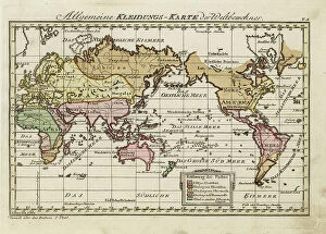
Background imagePlanisphere Collection: Map of the clothing of the world's inhabitants. Completely naked (red), wearing animal skins (brown)

Map of the clothing of the world's inhabitants. Completely naked (red), wearing animal skins (brown)
FLO4703343 Map of the clothing of the world's inhabitants. Completely naked (red), wearing animal skins (brown), clothed in wool (gold)

Background imagePlanisphere Collection: Reproduction of the T-map of Hereford, Late 13th Century World Map

Reproduction of the T-map of Hereford, Late 13th Century World Map (Hereford Mappa Mundi facsimile, 1285 ca)
ELD4918735 Reproduction of the T-map of Hereford, Late 13th Century World Map (Hereford Mappa Mundi facsimile, 1285 ca). 19th century (engraving); Private Collection; Photo © The Holbarn Archive.

Background imagePlanisphere Collection: Astronomic observatory in Germany 18th century, c1880 (engraving)

Astronomic observatory in Germany 18th century, c1880 (engraving)
2526589 Astronomic observatory in Germany 18th century, c1880 (engraving); (add.info.: Science. Astronomy. Astronomic observatory in Germany, XVIIIth cent)

Background imagePlanisphere Collection: Solar system according to Claudius Ptolemy, 1660 (engraving)

Solar system according to Claudius Ptolemy, 1660 (engraving)
2526586 Solar system according to Claudius Ptolemy, 1660 (engraving) by Cellarius, Andreas (c.1596-1665); (add.info.: Science. Astronomy. Solar system according to Claudius Ptolemy)

Background imagePlanisphere Collection: Martin Behaim´s Globe, 1492. From the book Life of Christopher Columbus by Clements R

Martin Behaim´s Globe, 1492. From the book Life of Christopher Columbus by Clements R. Markham published 1892
2915312 Martin Behaim´s Globe, 1492. From the book Life of Christopher Columbus by Clements R. Markham published 1892.; Photo © Hilary Morgan.

Background imagePlanisphere Collection: COSA, Juan de la (1460-1510). Cartographer. Chart by Juan de la Cosa (1500). SPAIN

COSA, Juan de la (1460-1510). Cartographer. Chart by Juan de la Cosa (1500). SPAIN. MADRID (AUTONOMOUS COMMUNITY)
CUL4869240 COSA, Juan de la (1460-1510). Cartographer. Chart by Juan de la Cosa (1500). SPAIN. MADRID (AUTONOMOUS COMMUNITY). Madrid. Navy Museum; (add.info.: COSA, Juan de la (1460-1510)

Background imagePlanisphere Collection: The Dauphin Map of the World, (1546), 1912. Artist: Pierre Desceliers

The Dauphin Map of the World, (1546), 1912. Artist: Pierre Desceliers
The Dauphin Map of the World, 1546. After Pierre Desceliers, (c1500-1558) Planisphere which is sometimes refered to as the Dauphin Map. The map was created for King Henri II of France (1519-1559)

Background imagePlanisphere Collection: Universal hydrographic map. Manuscript by Jean Guerard, French geographer. 1734. paris, B. N

Universal hydrographic map. Manuscript by Jean Guerard, French geographer. 1734. paris, B. N
JLJ4592059 Universal hydrographic map. Manuscript by Jean Guerard, French geographer. 1734. paris, B.N. by Guerard, Jean (active 1612-1634); Bibliotheque Nationale, Paris

Background imagePlanisphere Collection: Representation of the Universe as the model of Copernicus, 1661 (engraving)

Representation of the Universe as the model of Copernicus, 1661 (engraving)
CUL4930365 Representation of the Universe as the model of Copernicus, 1661 (engraving) by Cellarius, Andreas (c.1596-1665); Biblioteca Nacional, Madrid

Background imagePlanisphere Collection: The World, 1482 (engraving)

The World, 1482 (engraving)
3787416 The World, 1482 (engraving); (add.info.: The World - map engraved by Johannes Schnitzer de Armssheim, cartographer of Ptolemys Geography, 1482)

Background imagePlanisphere Collection: World Map Hall, Farnese Palace, 1515-34 (photo)

World Map Hall, Farnese Palace, 1515-34 (photo)
BEN5467088 World Map Hall, Farnese Palace, 1515-34 (photo) by Varese, Antonio Giovanni de (16th century); Photo © Raffaello Bencini

Background imagePlanisphere Collection: The land of Cocagne, ideal and imaginary country, 19th century (epinal print)

The land of Cocagne, ideal and imaginary country, 19th century (epinal print)
ELD4836011 The land of Cocagne, ideal and imaginary country, 19th century (epinal print) by French School, (19th century); Private Collection; (add.info.: The land of Cocagne)


All Professionally Made to Order for Quick Shipping

A planisphere is a fascinating tool that has been used throughout history to map and navigate the world. One notable example is the Fra Mauro map, created in 1460 by Italian cartographer Fra Mauro. What makes this map unique is its orientation, with South at the top instead of North. Another captivating depiction of celestial bodies can be found on Durer's Celestial Globe from 1515. This intricate globe showcases various constellations and their positions in the night sky. On the left side, we have a constellation map highlighting the northern hemisphere. Moving forward in time, we encounter Gerardus Mercator's Atlas from 1587. This comprehensive description of Earth provides valuable insights into geographical knowledge during that era. It was created by Rumold Mercator, Gerardus' son. Ptolemy's Map published in 1482 also deserves mention as it laid down significant foundations for cartography and geography. Its accuracy and attention to detail were highly regarded during Ptolemy's time. Jean Guerard, a French geographer, contributed to our understanding of hydrography with his Universal Hydrographic Map manuscript from 1734. This detailed work showcased water bodies around the world and played an essential role in maritime navigation. The Dauphin Map of the World from 1546 by Pierre Desceliers stands out due to its artistic beauty and precision. Created almost four centuries before modern technology allowed for accurate mapping techniques, this masterpiece demonstrates remarkable skill and craftsmanship. In contrast to these historical representations, Copernicus' model of the universe depicted in a 1661 engraving offers insight into how scientific advancements influenced our perception of space over time. Lastly, let us not forget about Farnese Palace's World Map Hall dating back to 1515-34; it serves as a testament to humanity's continuous quest for knowledge about our planet through cartography.