
Population Density Collection
"Unveiling the Tapestry of Population Density: A Global Perspective" The North Sea at night reveals a mesmerizing tapestry of twinkling lights


All Professionally Made to Order for Quick Shipping
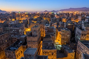
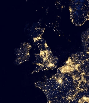
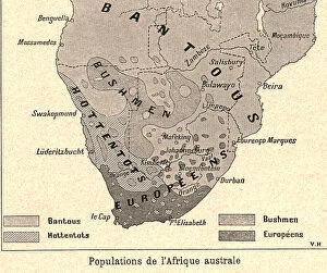
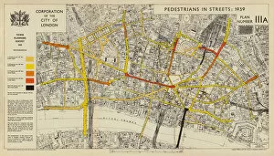
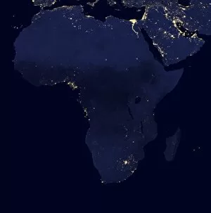
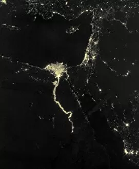
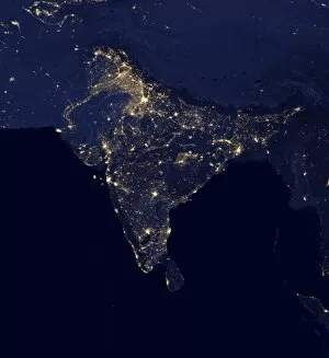
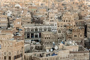
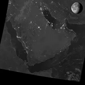
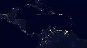
"Unveiling the Tapestry of Population Density: A Global Perspective" The North Sea at night reveals a mesmerizing tapestry of twinkling lights, showcasing the population density along its coastal regions. From high above, an aerial view captures the enchanting cityscape of Sanaa at twilight, offering a glimpse into Yemen's unique population density patterns. Behold the illuminated expanse of North America at night, as satellite images unveil the diverse and concentrated pockets of human habitation across this vast continent. Korea shines brightly under the cover of darkness in a captivating satellite image that showcases its remarkable population density dynamics. Mumbai's Chhatrapati Shivaji Maharaj Terminus railway station buzzes with life amidst India's bustling metropolis, exemplifying how urban centers contribute to high population densities. Transport yourself back to 1939 when pedestrian traffic filled the streets of London's City district, providing a vivid snapshot into historical population density trends. Delve into history with John Bartholomew's intricate map from 1891 depicting London and southeast England, offering insights into past population distribution patterns. Explore Germany's population landscape through an intriguing lithograph published in 1897 that highlights regional variations in density during that era. Australia sparkles like a constellation on satellite imagery captured at nightfall, revealing how sparse populations are scattered across this vast continent down under. Africa comes alive after sunset as satellite images showcase pockets of vibrant light illuminating various regions and unveiling distinct patterns of human settlement and concentration. Asia emerges as a glowing mosaic on nighttime satellite imagery—a testament to its immense diversity and staggering levels throughout its vast lands. The Nile River takes center stage on nocturnal satellite images; it serves not only as Egypt’s lifeline but also unveils clusters where civilization has thrived for millennia—showcasing the unique population density along its banks.