Fraud Blocker Skip to main content

Satellite Collection (page 6)

"Exploring the World from Above: Captivating Satellite Images Unveil Earth's Wonders" Discovering the British Isles

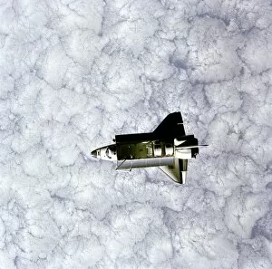
Background imageSatellite Collection: Challenger as seen from SPAS

Challenger as seen from SPAS
Full view of Space Shuttle Orbiter Challenger in space, taken by the Space Pallet Satellite (SPAS). A heavily cloud-covered portion of the earth forms the backdrop for this scene of Challenger

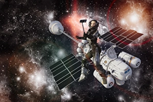
Background imageSatellite Collection: astronaut, cell phone, color image, computer graphic, concept, deep space, digital camera

astronaut, cell phone, color image, computer graphic, concept, deep space, digital camera
Woman astronaut posing for cell phone selfie during space walk

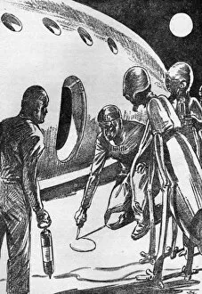
Background imageSatellite Collection: Contact with Ganymede

Contact with Ganymede
Space travellers from Earth try to explain where they come from to an inhabitant of Ganymede, a satellite of Jupiter Date: 1937

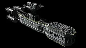
Background imageSatellite Collection: American orbital weapons platform

American orbital weapons platform featured in 2001: A Space Odyssey

Background imageSatellite Collection: Voyager 1 leaving the solar system

Voyager 1 leaving the solar system

Background imageSatellite Collection: Intelligence: Inspirational Quote and Motivational Poster

Intelligence: Inspirational Quote and Motivational Poster
Intelligence - Inspirational Quote and Motivational Poster. It reads: If you do not know others and do now know yourself, you will be in danger in every single battle. ~ Sun Tzu

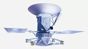
Background imageSatellite Collection: Illustration of Magellan spacecraft

Illustration of Magellan spacecraft

Background imageSatellite Collection: Astronautics-Launch-Satellite

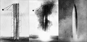
Astronautics-Launch-Satellite
File picture dated 1957, showing the launch of a Soviet satellite. / AFP PHOTO / DSK

Background imageSatellite Collection: Satellite-Spoutnik-236747

Satellite-Spoutnik-236747
Photo datant de 1957 du satellite sovietique Spoutnik II. Picture taken in 1957 of Soviet satellite Sputnik II. / AFP PHOTO / INTERCONTINENTALE

Background imageSatellite Collection: Space-Satellite-Rocket

Space-Satellite-Rocket
A Delta-2 rocket carrying a German communication satellite blasts off 12 October 1992. The satellite is named " Kopernikus" after the 16th century German-polish astronomer

Background imageSatellite Collection: Sputnik 3 in orbit, 1958 C016 / 6375

Sputnik 3 in orbit, 1958 C016 / 6375
Sputnik 3 in orbit, artwork. This small unmanned conical spacecraft carried scientific instruments to study the upper atmosphere, cosmic rays, and the Earths magnetic field

Background imageSatellite Collection: Sputnik 3 C016 / 6373

Sputnik 3 C016 / 6373
Sputnik 3. This small unmanned conical spacecraft carried scientific instruments to study the upper atmosphere, cosmic rays, and the Earths magnetic field

Background imageSatellite Collection: India at night, satellite image

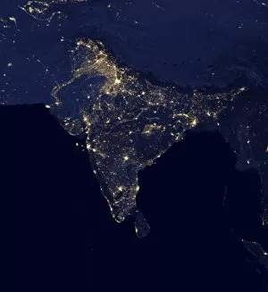
India at night, satellite image
India at night. Black marble satellite image of India at night. More densely populated areas are brighter. The nocturnal glow produced by the Earths atmosphere is shown as well as man-made light

Background imageSatellite Collection: DR Congo, satellite image

DR Congo, satellite image
DR Congo. North is at top. Satellite image of the Democratic Republic of the Congo (DRC) in Central Africa, with the surrounding countries shaded out

Background imageSatellite Collection: Explorer-1, Americas first satellite

Explorer-1, Americas first satellite, at Jet Propulsion Laboratory

Background imageSatellite Collection: Asia, 3D artwork C015 / 6575

Asia, 3D artwork C015 / 6575
Asia. 3D computer graphic map of Asia and the surrounding sea floor in the Pacific and Indian oceans. Image based on cloud-free satellite imagery, digital terrain and bathymetry data

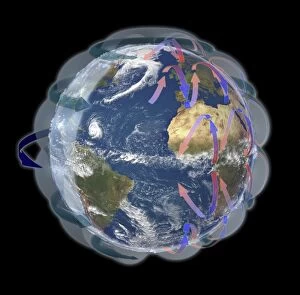
Background imageSatellite Collection: Global winds, satellite-based diagram C016 / 3731

Global winds, satellite-based diagram C016 / 3731
Global winds, satellite-based diagram. The rotation of this Earth globe (dark blue arrow) and the Coriolis effect causes the wind patterns shown

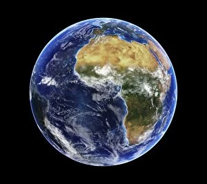
Background imageSatellite Collection: Africa and Atlantic Ocean, with clouds C016 / 3727

Africa and Atlantic Ocean, with clouds C016 / 3727
Africa and Atlantic Ocean, with clouds. Computer graphic of an Earth globe centred on West Africa, generated using satellite and mapping data

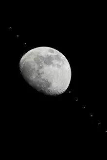
Background imageSatellite Collection: ISS crossing the Moon C013 / 5150

ISS crossing the Moon C013 / 5150
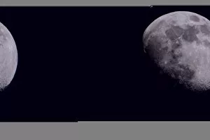
ISS crossing the Moon, time-lapse image. The International Space Station (ISS; upper left, lower right, and crossing the Moon) is orbiting the Earth here at an altitude of around 390 kilometres

Background imageSatellite Collection: ISS and the Moon C013 / 5149

ISS and the Moon C013 / 5149
ISS and the Moon. The International Space Station (ISS, upper left) is orbiting the Earth here at an altitude of around 390 kilometres

Background imageSatellite Collection: GALILEO GALILEI (1564-1642). Galileo demonstrating his telescopic discovery of the satellites of

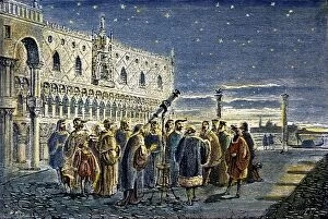
GALILEO GALILEI (1564-1642). Galileo demonstrating his telescopic discovery of the satellites of Jupiter to the Doge and councillors of Venice on 25 August 1609. Colored French engraving, 19th century

Background imageSatellite Collection: Typhoon Tokage

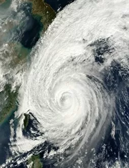
Typhoon Tokage. Satellite image of Typhoon Tokage (centre) hitting the western coast of Japan (upper left) on 19 October 2004 at 0215 GMT. The typhoon produced winds of 225 kilometres per hour

Background imageSatellite Collection: High-altitude clouds, satellite image

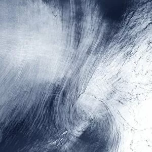
High-altitude clouds, satellite image. These swirling clouds are being shaped by high-altitude winds. They are over the Mediterranean Sea, just north of the coast of Morocco

Background imageSatellite Collection: Chilean fjords

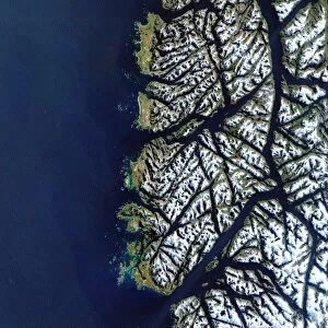
Chilean fjords, satellite image. During the last ice age, glaciers on the southern tip of Chile gouged out deep valleys. When the ice age ended the glaciers melted and the sea level rose

Background imageSatellite Collection: Asia

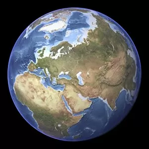
Asia. Satellite image centred on Asia. The North Pole is at upper right. Water is blue, vegetation is green, arid areas are brown, and snow and ice are white

Background imageSatellite Collection: Blue Marble image of Earth (2005)

Blue Marble image of Earth (2005)
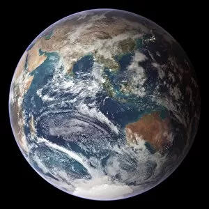
Blue Marble image of Earth. Composite satellite image of Earths eastern hemisphere, centred on the Indian Ocean. North is at top

Background imageSatellite Collection: Model of Sputnik 1, first satellite

Model of Sputnik 1, first satellite
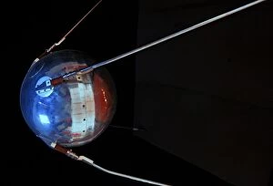
Sputnik 1. Model of Sputnik-1, the first artificial satellite. Sputnik 1 was launched on October 4th, 1957 by the former Soviet Union. The name Sputnik is Russian for travel companion or satellite

Background imageSatellite Collection: Central Europe at night, satellite image

Central Europe at night, satellite image
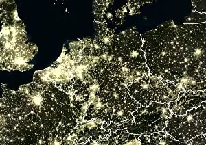
Central Europe at night. Satellite image showing Central Europe and parts of Western Europe at night. City lights (yellow) show areas of dense population. International borders are shown in white

Background imageSatellite Collection: Honeycomb core

Honeycomb core
A honeycomb core made from reinforced plastic, used as the filling in a honeycomb sandwich between two sheets of either aluminium or a manmade material such as carbon fibre reinforced plastic (CFRP)

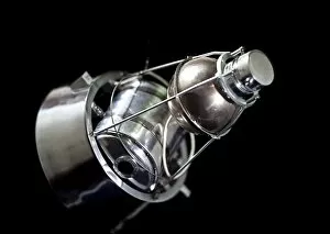
Background imageSatellite Collection: Sputnik 2, Soviet spacecraft

Sputnik 2, Soviet spacecraft. This was the second spacecraft to orbit the Earth, doing so on 3 November 1957. This cone-shaped spacecraft was 4 metres high and 2 metres across at the base

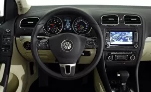
Background imageSatellite Collection: 2009 VW Golf Mk6 interior dashboard

2009 VW Golf Mk6 interior dashboard

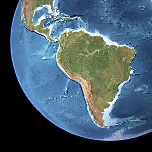
Background imageSatellite Collection: South America, topographic map

South America, topographic map. Highlands and lowlands of the continents are also shown, as ridges and flat areas. North America and the Caribbean (top left) and Antarctica (bottom right)

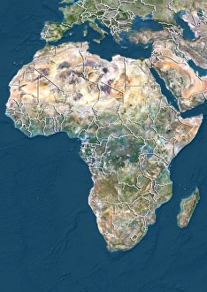
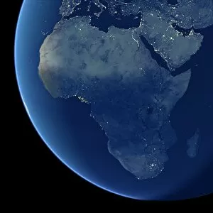
Background imageSatellite Collection: Africa at night, satellite image

Africa at night, satellite image. City lights (yellow) show areas of dense population, particularly in Europe and the Middle East (top)

Background imageSatellite Collection: Eurasia, topographic map

Eurasia, topographic map. This map is centred on Russia, with Europe at centre left and East Asia at right. The North Pole (upper left), with Greenland shown in white

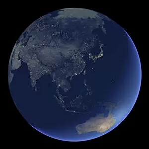
Background imageSatellite Collection: East Asia at night, satellite image

East Asia at night, satellite image
East Asia at night. Satellite image of the Earth at night, centred over China. City lights (yellow) show areas of dense population

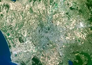
Background imageSatellite Collection: Rome, satellite image

Rome, satellite image. North is at top. Vegetationis green, bare ground is brown, urban areas aregrey and water is blue. Rome is the capital cityof Italy

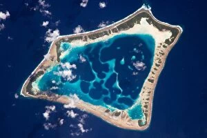
Background imageSatellite Collection: Atafu Atoll, Tokelau, Southern Pacific Ocean At roughly eight kilometres wide, Atafu

Atafu Atoll, Tokelau, Southern Pacific Ocean At roughly eight kilometres wide, Atafu Atoll is the smallest of three atolls and one island

Background imageSatellite Collection: Yucatan peninsula, south-eastern Mexico, separating the Gulf of Mexico from the Caribbean

Yucatan peninsula, south-eastern Mexico, separating the Gulf of Mexico from the Caribbean Sea photographed by Satellite. Credit NASA. Science Earth Geology Oceanography

Background imageSatellite Collection: Launch Preparation

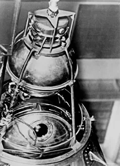
Launch Preparation
Inside the nose cone of this Delta rocket is Goddards geophysics research satellite, a 906-lb. (411-kg) satellite that looked more like a dimpled cosmic golf ball

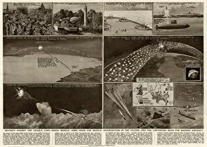
Background imageSatellite Collection: Defence against the deadly long-range missiles 1958

Defence against the deadly long-range missiles 1958
Illustration by George Horace Davis, showing some ideas for missile interception, based on radar, computers, satellite and missile rockets in the future, and the continuing need for manned aircraft

Background imageSatellite Collection: Satellite at Goonhilly Earth Station, Cornwall

Satellite at Goonhilly Earth Station, Cornwall
The worlds first parabolic satellite communications antenna, nicknamed Arthur, at Goonhilly Satellite Earth Station, Goonhilly Downs, near Helston, Cornwall. Date: circa 1980s

Background imageSatellite Collection: Cow and stonewall with communications tower in the background, Jodhpur, Rajasthan, India

Cow and stonewall with communications tower in the background, Jodhpur, Rajasthan, India

Background imageSatellite Collection: TrironTravel Poster

TrironTravel Poster
Triton is the largest moon of the gas giant Neptune. It is famous for its odd terrain (e.g. the Cantaloupe terrain) and its cryonic geysers

Background imageSatellite Collection: MirandaTravel Poster

MirandaTravel Poster
Miranda is the smallest of the five principal moons of Uranus. It is famous for its cliff, Verona Rupes, thought to be the tallest cliff in the known Solar System

Background imageSatellite Collection: Art Deco Poster Advertising Amalthea

Art Deco Poster Advertising Amalthea
Amalthea is a moon of Jupiter, the third closest to the planet at 181365 km away (about 2.6 Jupiter radii from the centre of the planet)

Background imageSatellite Collection: Engraving vintage Planetarium

Engraving vintage Planetarium

Background imageSatellite Collection: Lunar Map

Lunar Map
Antique illustration of a Lunar Map


All Professionally Made to Order for Quick Shipping

"Exploring the World from Above: Captivating Satellite Images Unveil Earth's Wonders" Discovering the British Isles: A mesmerizing satellite image showcases the stunning landscapes of the United Kingdom and Ireland, offering a bird's-eye view of their diverse beauty. Illuminating Europe at Night: Behold an enchanting satellite image capturing Europe in all its nocturnal glory, as cities sparkle like constellations against the darkened continent. Embracing Darkness: Witness Europe draped in darkness with another breathtaking satellite image, revealing a different perspective on our bustling continent during nighttime hours. The Whole Earth Shines Brightly: Prepare to be awestruck by an awe-inspiring satellite image showcasing our planet illuminated entirely at night, reminding us of humanity's collective presence across continents. Tenerife's Extraterrestrial Charm: Journey to Spain's Tenerife through a captivating satellite image that unveils this volcanic island's unique allure from space, where land and sea merge harmoniously. Earth Revealed from Space: Gaze upon an extraordinary satellite image that captures our magnificent blue planet suspended amidst endless cosmic wonders – a humbling reminder of our place in the universe. Scotland Unveiled from Above: Delight in a striking satellite image showcasing Scotland’s rugged terrain and picturesque lochs, inviting exploration into its untamed beauty from high above. Pioneering Space Exploration - Sputnik II & Laika: Commemorating history-making moments with a glimpse into space exploration’s early days – witness Sputnik II carrying Laika, paving the way for human endeavors beyond Earth’s atmosphere. Moonlit Phases Dance Across Skies: Marvel at nature’s celestial ballet as we present captivating images depicting various phases of the moon – each phase unveiling its own mystical charm against starry backdrops. Winter Wonderland Over United Kingdom 2010.