Fraud Blocker Skip to main content

Sea Lane Collection

"Exploring the Historic Sea Lanes

Background imageSea Lane Collection: The Battle of the Zuider Zee, 1573, 1663. Creator: Jan Theunisz. Blanckerhoff

The Battle of the Zuider Zee, 1573, 1663. Creator: Jan Theunisz. Blanckerhoff
The Battle of the Zuider Zee, 1573, 1663

Background imageSea Lane Collection: View of the Dardanelles Strait, 1742-1801. Creator: Anon

View of the Dardanelles Strait, 1742-1801. Creator: Anon
View of the Dardanelles Strait, 1742-1801. On the left the European side with the castle Kilitbahir. On the right the Asian side with the Cimenlik castle

Background imageSea Lane Collection: Clash of the Dutch and British Fleets during the Passage of the Dutch Flotilla to Boulogne (1804)

Clash of the Dutch and British Fleets during the Passage of the Dutch Flotilla to Boulogne (1804), 1806

Background imageSea Lane Collection: Dutch, English, French and American Squadrons in Japanese Waters during the Expedition led by

Dutch, English, French and American Squadrons in Japanese Waters during the Expedition led by the Fr Creator
Dutch, English, French and American Squadrons in Japanese Waters during the Expedition led by the French Commander Constant Jaures, September 1864, 1864

Background imageSea Lane Collection: The Battle of Cadiz, 1608. Creator: Aert Anthonisz

The Battle of Cadiz, 1608. Creator: Aert Anthonisz
The Battle of Cadiz, 1608. Other Title(s): The Battle of CadizIncident from the Battle of the Spanish Armada

Background imageSea Lane Collection: The Roads of Enkhuizen, 1654-1708. Creator: Abraham Storck

The Roads of Enkhuizen, 1654-1708. Creator: Abraham Storck
The Roads of Enkhuizen, 1654-1708

Background imageSea Lane Collection: Battle of the Combined Venetian and Dutch Fleets against the Turks in the Bay of Foya, 1649, 1656

Battle of the Combined Venetian and Dutch Fleets against the Turks in the Bay of Foya, 1649, 1656

Background imageSea Lane Collection: Portrait of Hendrik Brouwer, Governor-General of the Dutch East Indies, 1750-1800. Creator: Unknown

Portrait of Hendrik Brouwer, Governor-General of the Dutch East Indies, 1750-1800. Creator: Unknown
Portrait of Hendrik Brouwer, Governor-General of the Dutch East Indies, 1750-1800

Background imageSea Lane Collection: Pedro Miguel Locks, birdseye view, Panama Canal, between 1913 and 1920. Creator: Unknown

Pedro Miguel Locks, birdseye view, Panama Canal, between 1913 and 1920. Creator: Unknown
Pedro Miguel Locks, birdseye view, Panama Canal, between 1913 and 1920

Background imageSea Lane Collection: 'Les routes l'Atlantique; L'Ouest Africain, 1914. Creator: Unknown

'Les routes l'Atlantique; L'Ouest Africain, 1914. Creator: Unknown
'Les routes l'Atlantique; L'Ouest Africain, 1914. From "Grande Geographie Bong Illustree", 1914

Background imageSea Lane Collection: 'The Barrage of the Nile', 1854. Creator: Unknown. 'The Barrage of the Nile', 1854

"The Barrage of the Nile", 1854. Creator: Unknown. "The Barrage of the Nile", 1854
"The Barrage of the Nile", 1854. Dam across the River Nile in Egypt. A large passage is kept close to the Eastern shore, for the steamers

Background imageSea Lane Collection: Sea Lane Off Kazusa Province (Kazusa no kairo), from the series 'Thirty-six Views of... c. 1830/33

Sea Lane Off Kazusa Province (Kazusa no kairo), from the series "Thirty-six Views of... c. 1830/33
Sea Lane Off Kazusa Province (Kazusa no kairo), from the series "Thirty-six Views of Mount Fuji (Fugaku sanjurokkei)", Japan, c. 1830/33

Background imageSea Lane Collection: Millroy's map of Alaska and the Klondyke gold fields, 1897. Creator: J. J. Millroy

Millroy's map of Alaska and the Klondyke gold fields, 1897. Creator: J. J. Millroy
Millroy's map of Alaska and the Klondyke gold fields, 1897. The Klondike Gold Rush of 1898 began in earnest within 18 months of a major gold strike on Bonanza Creek

Background imageSea Lane Collection: Abosko-B'erneborg Province, 1856. Creator: Unknown

Abosko-B'erneborg Province, 1856. Creator: Unknown
Abosko-B'erneborg Province, 1856. This card is one of a souvenir set of 82 illustrated cards-one for each province of the Russian Empire as it existed in 1856

Background imageSea Lane Collection: The Alaska Line, 1934. Creator: Alaska Steamship Co

The Alaska Line, 1934. Creator: Alaska Steamship Co
The Alaska Line, 1934. This map, published in 1934 for the tourist market with colorful images and motifs, shows various shipping routes of the Alaska Line

Background imageSea Lane Collection: Wrought-iron lighthouse on the Daedalus Reef, in the Red Sea, 1862. Creator: Unknown

Wrought-iron lighthouse on the Daedalus Reef, in the Red Sea, 1862. Creator: Unknown
Wrought-iron lighthouse on the Daedalus Reef, in the Red Sea, 1862. The great intercourse which is carried on...by what is called the overland route, has made the Red Sea almost an English highway

Background imageSea Lane Collection: Wrought-iron lighthouse on the Ushruffee Reef, in the Strait of Jubal, in the Red Sea, 1862

Wrought-iron lighthouse on the Ushruffee Reef, in the Strait of Jubal, in the Red Sea, 1862. Creator: Unknown
Wrought-iron lighthouse on the Ushruffee Reef, in the Strait of Jubal, in the Red Sea, 1862. The great intercourse which is carried on...by what is called the overland route

Background imageSea Lane Collection: Lake Baikal, 1904-1917. Creator: Unknown

Lake Baikal, 1904-1917. Creator: Unknown
Lake Baikal, 1904-1917. National Library of Russia

Background imageSea Lane Collection: View of the Port of Calcutta, c1891. Creator: James Grant

View of the Port of Calcutta, c1891. Creator: James Grant
View of the Port of Calcutta, c1891. From " Cassells Illustrated History of India Vol. II.", by James Grant. [Cassell Petter & Galpin, London, Paris and New York]

Background imageSea Lane Collection: The Graphic, Front Cover Saturday July 14th. 1888, 1888. Creator: Unknown

The Graphic, Front Cover Saturday July 14th. 1888, 1888. Creator: Unknown
The Graphic, Front Cover Saturday July 14th. 1888, 1888. From, The Graphic. An Illustrated Weekly Newspaper Volume38. July to December, 1888

Background imageSea Lane Collection: The Graphic, Front Cover Saturday August 25th. 1888, 1888. Creator: Unknown

The Graphic, Front Cover Saturday August 25th. 1888, 1888. Creator: Unknown
The Graphic, Front Cover Saturday August 25th. 1888, 1888. From, The Graphic. An Illustrated Weekly Newspaper Volume 38. July to December, 1888

Background imageSea Lane Collection: Cornwall TR27 4 Map

Cornwall TR27 4 Map
Postcode Sector Map of Cornwall TR27 4

Background imageSea Lane Collection: Somerset TA23 0 Map

Somerset TA23 0 Map
Postcode Sector Map of Somerset TA23 0

Background imageSea Lane Collection: Sunderland SR6 9 Map

Sunderland SR6 9 Map
Postcode Sector Map of Sunderland SR6 9

Background imageSea Lane Collection: Sunderland SR6 7 Map

Sunderland SR6 7 Map
Postcode Sector Map of Sunderland SR6 7

Background imageSea Lane Collection: Halton WA7 5 Map

Halton WA7 5 Map
Postcode Sector Map of Halton WA7 5

Background imageSea Lane Collection: Somerset TA5 1 Map

Somerset TA5 1 Map
Postcode Sector Map of Somerset TA5 1

Background imageSea Lane Collection: East Lindsey PE25 1 Map

East Lindsey PE25 1 Map
Postcode Sector Map of East Lindsey PE25 1

Background imageSea Lane Collection: East Lindsey PE24 5 Map

East Lindsey PE24 5 Map
Postcode Sector Map of East Lindsey PE24 5

Background imageSea Lane Collection: Boston PE22 8 Map

Boston PE22 8 Map
Postcode Sector Map of Boston PE22 8

Background imageSea Lane Collection: Boston PE22 9 Map

Boston PE22 9 Map
Postcode Sector Map of Boston PE22 9

Background imageSea Lane Collection: Boston PE22 0 Map

Boston PE22 0 Map
Postcode Sector Map of Boston PE22 0

Background imageSea Lane Collection: East Lindsey PE24 4 Map

East Lindsey PE24 4 Map
Postcode Sector Map of East Lindsey PE24 4

Background imageSea Lane Collection: West Norfolk PE36 6 Map

West Norfolk PE36 6 Map
Postcode Sector Map of West Norfolk PE36 6

Background imageSea Lane Collection: Sussex PO21 4 Map

Sussex PO21 4 Map
Postcode Sector Map of Sussex PO21 4

Background imageSea Lane Collection: Sussex PO22 7 Map

Sussex PO22 7 Map
Postcode Sector Map of Sussex PO22 7

Background imageSea Lane Collection: Hampshire PO14 2 Map

Hampshire PO14 2 Map
Postcode Sector Map of Hampshire PO14 2

Background imageSea Lane Collection: East Lindsey LN12 2 Map

East Lindsey LN12 2 Map
Postcode Sector Map of East Lindsey LN12 2

Background imageSea Lane Collection: Lincoln LN13 9 Map

Lincoln LN13 9 Map
Postcode Sector Map of Lincoln LN13 9

Background imageSea Lane Collection: East Lindsey LN12 1 Map

East Lindsey LN12 1 Map
Postcode Sector Map of East Lindsey LN12 1

Background imageSea Lane Collection: Lincoln LN11 7 Map

Lincoln LN11 7 Map
Postcode Sector Map of Lincoln LN11 7

Background imageSea Lane Collection: Northumberland NE66 3 Map

Northumberland NE66 3 Map
Postcode Sector Map of Northumberland NE66 3

Background imageSea Lane Collection: North East Lincolnshire DN36 5 Map

North East Lincolnshire DN36 5 Map
Postcode Sector Map of North East Lincolnshire DN36 5

Background imageSea Lane Collection: Copeland CA22 2 Map

Copeland CA22 2 Map
Postcode Sector Map of Copeland CA22 2

Background imageSea Lane Collection: Arun BN16 2 Map

Arun BN16 2 Map
Postcode Sector Map of Arun BN16 2

Background imageSea Lane Collection: Arun BN16 1 Map

Arun BN16 1 Map
Postcode Sector Map of Arun BN16 1

Background imageSea Lane Collection: Worthing BN12 5 Map

Worthing BN12 5 Map
Postcode Sector Map of Worthing BN12 5


All Professionally Made to Order for Quick Shipping

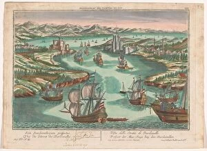
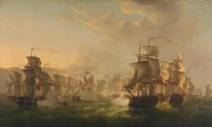
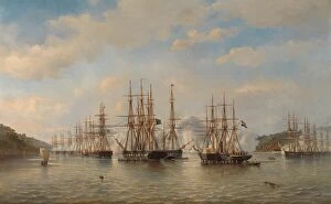
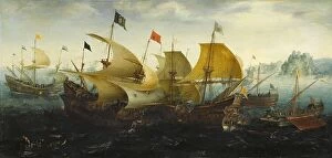
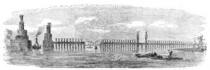
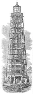
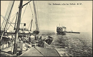
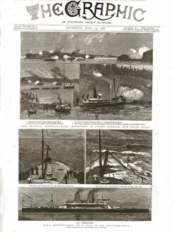
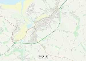
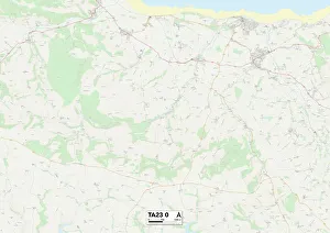
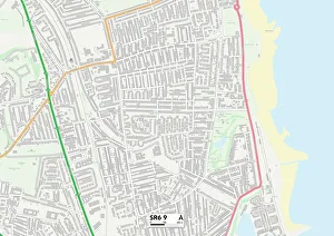
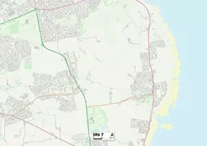
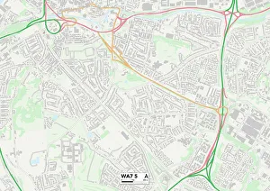
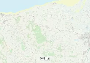
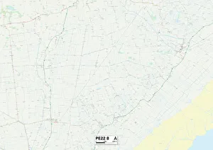
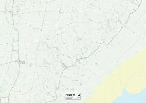
"Exploring the Historic Sea Lanes: A Glimpse into Maritime Trade and Navigation" Immerse yourself in the captivating world of sea lanes as we journey back in time to witness the bustling Port of Calcutta, circa 1891. This enchanting view captured by James Grant offers a glimpse into an era when ships sailed these waters, carrying goods from distant lands. Delving deeper into history, let us turn our attention to The Graphic's front covers from July 14th and August 25th, 1888. These intriguing creations by unknown artists transport us to an era filled with maritime adventures and tales yet untold. As we embark on our voyage through time, let us not forget the significance of geographical locations that played pivotal roles in shaping sea lanes. From Cornwall TR27 4 to Somerset TA23 0, Sunderland SR6 9 to Halton WA7 5 - each map represents a gateway connecting different regions through maritime trade. The maps further guide us towards East Lindsey PE25 1 and PE24 5, where sea lanes intertwined with coastal communities, and is here that generations have relied on these routes for their livelihoods – fishing fleets setting sail at dawn while merchants eagerly awaited exotic treasures brought ashore. Venturing inland brings us to Boston PE22 8; its strategic location along riverbanks made it a vital hub for both domestic and international trade. Ships laden with goods would navigate these waterways before dispersing their cargo across the land. In this exploration of sea lanes' historical significance, one cannot overlook their economic impact. They facilitated global commerce by connecting nations far apart - fostering cultural exchange while fueling economic growth throughout centuries past. So join us as we uncover stories hidden within these ancient pathways - tales of brave sailors battling treacherous storms or traders negotiating deals amidst turbulent seas. Let your imagination set sail upon these historic sea lanes as they weave together the tapestry of our maritime heritage.