Fraud Blocker Skip to main content

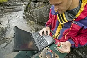
Sediment Collection (page 7)

"Sediment: Nature's Time Capsule Unveiled" Exploring the depths of Bombetoka Bay

Background imageSediment Collection: Cells from a urine infection, SEM

Cells from a urine infection, SEM
Cells from a urine infection. Coloured scanning electron micrograph (SEM) of crenated red blood cells, white blood cells and epithelial cells present in a urine sample taken from someone with a

Background imageSediment Collection: Mountain lake

Mountain lake formed from glacial run-off, water originating in mountain glaciers. Mount Mercator with a glacier can be seen In the background

Background imageSediment Collection: Shanghai and the Yangtze

Shanghai and the Yangtze river estuary, satellite image. North is at top. Shanghai, visible as a purple-grey conurbation towards bottom left, is one of the largest cities in the world

Background imageSediment Collection: Mary Lake

Mary Lake. Aerial view of Mary Lake, a glacial lake fed by meltwater from mountain glaciers. As a result the lake is full of silt and minerals, giving it an almost opaque blue colour

Background imageSediment Collection: Dried mud slopes

Dried mud slopes in a desert. The uneven surface of the slopes is caused by run-off during rain showers. Photographed in Arizona, USA

Background imageSediment Collection: Deforestation in the Amazon

Deforestation in the Amazon. Satellite image of the region around the mouth of the Amazon River (upper left) in northern Brazil. North is at top

Background imageSediment Collection: Iceland, satellite image

Iceland, satellite image. North is at top. Green areas are vegetated. White areas are ice. Iceland is an island nation situated just south of the Arctic Circle in the Northern Atlantic Ocean

Background imageSediment Collection: Aral Sea, satellite image, 1973

Aral Sea, satellite image, 1973
Aral Sea, satellite image. Image 1 of 3. North is at top. This inland lake is found between Uzbekistan (west) and Kazakhstan (east) and used to be the fourth largest lake in the world

Background imageSediment Collection: Aral Sea, satellite image, 2000

Aral Sea, satellite image, 2000
Aral Sea, satellite image. Image 3 of 3. North is at top. This inland lake is found between Uzbekistan (west) and Kazakhstan (east) and used to be the fourth largest lake in the world

Background imageSediment Collection: Bijagos archipelago, West Africa

Bijagos archipelago, West Africa
Bijagos archipelago off the Guinea-Bissau coast, West Africa, satellite image. North is at top. These islands are inhabited by a primitive people who still practise animism religions

Background imageSediment Collection: Ancient sea bed in a cliff

Ancient sea bed in a cliff. Cross section of a cliff face, revealing an ancient sea bed. Photographed in Cornwall England

Background imageSediment Collection: Porlock Ridge, Exmoor, UK

Porlock Ridge, Exmoor, UK
Porlock Ridge, Exmoor, Somerset, UK. This ridge, at Porlock Bay, started forming in the mid Holocene (around 5000 years ago) when sea levels were higher and coastal erosion greater

Background imageSediment Collection: Mississippi Delta, satellite image

Mississippi Delta, satellite image
Mississippi Delta. True colour Landsat satellite image of the Mississippi River Delta, Louisiana, USA. North is at top. The Mississippi River is seen running from top left into the Gulf of Mexico at

Background imageSediment Collection: Subduction zone processes

Subduction zone processes. Cutaway artwork showing the geological processes that occur at a subduction zone between two tectonic plates

Background imageSediment Collection: Rock formation and erosion cycle

Rock formation and erosion cycle. Cutaway artwork showing the cycle by which rocks are formed and eroded. At top, volcanic activity forms new rock on the Earths surface as molten rock (lava)

Background imageSediment Collection: Petrified Tree trunk, Libya

Petrified Tree trunk, Libya
Petrified wood (from Greek root petro meaning " rock" or " stone" ; literally " wood turned into stone" ) in the Libyan desert

Background imageSediment Collection: Meltwater emerging from Crusoe Glacier

Meltwater emerging from Crusoe Glacier
Sediment rich meltwater emerging from the Thompson Glacier on Axel Heiberg Island, Canadian Arctic

Background imageSediment Collection: Stones and fine sediment in a creek

Stones and fine sediment in a creek, Axel Heiberg Island, Canadian Arctic

Background imageSediment Collection: Mud volcano formation, artwork

Mud volcano formation, artwork
Mud volcano formation. Artwork showing the stages in the formation of a mud volcano. At left, sediment on the ocean floor is drawn into a subduction zone where two continental plates are colliding

Background imageSediment Collection: Coloured coastal rock

Coloured coastal rock. These colourful streaks result from the deposition and compression of coloured sediment during the rock formation. Photographed in Polzeath, Cornwall, UK

Background imageSediment Collection: Salt encrustations by the Dead Sea

Salt encrustations by the Dead Sea, Israel. The Dead Sea is the lowest elevation on the Earths surface on dry land and one of the worlds saltiest bodies of water, with 33.7 per cent salinity

Background imageSediment Collection: Layered Martian terrain, satellite image

Layered Martian terrain, satellite image
Layered Martian terrain. Coloured satellite image of layered rocks in Arabia Terra, northern Mars. The rocks have layers of roughly uniform depth

Background imageSediment Collection: Martian crater rim, satellite image

Martian crater rim, satellite image
Martian crater rim. Coloured satellite image of a fractured crater rim in Arabia Terra, northern Mars. It is thought the crater once held a large lake, which deposited sediments

Background imageSediment Collection: Barnacles on rocks

Barnacles on rocks
Barnacles on the rocks exposed at low tide. The rocks are a sedimentary shale and the barnacles have found some shelter in the joints between the layers on the exposed rock

Background imageSediment Collection: Norfolk Bay, Forestier Peninsula, Tasmania, Australia, Pacific

Norfolk Bay, Forestier Peninsula, Tasmania, Australia, Pacific

Background imageSediment Collection: Murky river water mixing with clear sea water at ilfracombe on the North devon Coast, UK

Murky river water mixing with clear sea water at ilfracombe on the North devon Coast, UK
Ashley Cooper / SpecialistStock

Background imageSediment Collection: Seaweed washing around in the surf on coastal rocks in ilfracome, Devon, UK

Seaweed washing around in the surf on coastal rocks in ilfracome, Devon, UK
Ashley Cooper / SpecialistStock

Background imageSediment Collection: The A591 blocked by flood debris at Thirlmere in the Lake District UK

The A591 blocked by flood debris at Thirlmere in the Lake District UK
Ashley Cooper / SpecialistStock

Background imageSediment Collection: a scientist studying sediment load in a strwam at Moorhouse in the north Pennines UK

a scientist studying sediment load in a strwam at Moorhouse in the north Pennines UK
Ashley Cooper / SpecialistStock

Background imageSediment Collection: Meltwater from the Russell Galcier that drains the Greenland Ice Sheet 26 km inland

Meltwater from the Russell Galcier that drains the Greenland Ice Sheet 26 km inland from Kangerlussuaq
Ashley Cooper / SpecialistStock

Background imageSediment Collection: River Nile Delta and Suez Canal

River Nile Delta and Suez Canal, Egypt, satellite image. North is at top. Water is black, vegetation is green and arid land is brown. The image data has been decorrelated to enhance the colours

Background imageSediment Collection: Alaska USA - showing river joining sea Hallo Bay, Katmai, Alaska

Alaska USA - showing river joining sea Hallo Bay, Katmai, Alaska
WAT-1574 Alaska USA - showing river joining sea Hallo Bay, Katmai, Alaska. M. Watson Please note that prints are for personal display purposes only and may not be reproduced in any way


All Professionally Made to Order for Quick Shipping

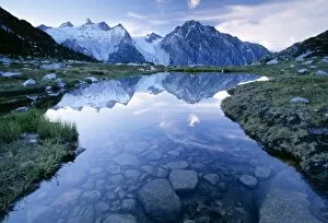
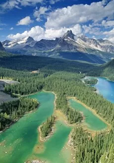
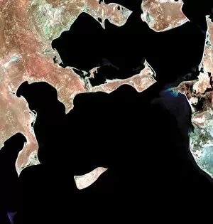
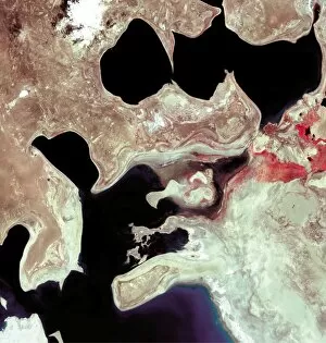
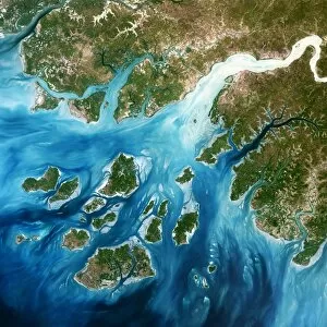
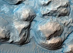
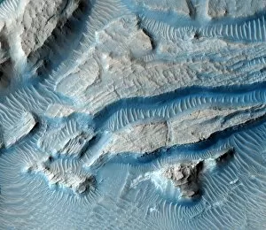
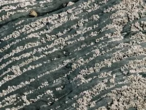
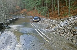
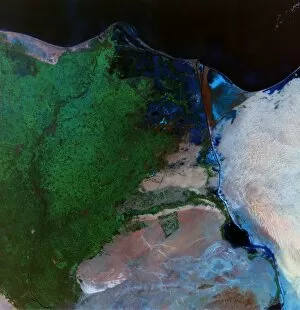
"Sediment: Nature's Time Capsule Unveiled" Exploring the depths of Bombetoka Bay, Madagascar reveals a hidden world where sediment tells tales of ancient marine life and geological wonders. A mesmerizing sight unfolds as gold with black sands dances in a gold pan, showcasing the captivating power of sedimentary deposits. The evening mood at Salar de Uyuni, Salt Lake in Bolivia sets the stage for an ethereal display layers that hold secrets from time immemorial. First light on Bonneville Salt Flats near the Utah-Nevada border illuminates delicate salt crystal patterns formed by centuries accumulation, painting nature's canvas with subtle hues. Amidst the serene beauty of Sandfly emerges a story etched in every grain of sand, as ancient sediments whisper tales from distant lands and forgotten eras. The allure of gold lies not only in its preciousness but also in its origin within earth's embrace – sedimentary layers that guard this coveted metal throughout history. Mountains and clouds bask in the enchanting evening light at Salar de Surire, revealing how sediment has shaped landscapes into breathtaking works of art over millennia. San Lorenzo Canyon stands tall as testament to the transformative power of flowing water and wind-carried sediments, sculpting magnificent slickensides along its rugged walls. Dalyan enchants visitors with its picturesque blend of turquoise waters and sandy shores; evidence that even coastal paradises owe their existence to eons-old deposits left by rivers and tides alike. Through lenses capturing DDE-90036665 & DDE-90036666, we witness how photographs freeze moments when time meets sediment – forever preserving memories etched upon Earth's surface. Intriguingly diverse yet interconnected across continents and ages, these glimpses into our planet's rich sedimentary tapestry remind us of the profound stories hidden within its layers.