Fraud Blocker Skip to main content

Topography Collection (page 3)

"Exploring the World's Varied Topography

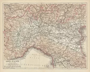
Background imageTopography Collection: Ancient map of Northern Italy, lithograph, published in 1876

Ancient map of Northern Italy, lithograph, published in 1876
Ancient map of Northern Italy. Lithograph, published in 1876

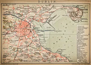
Background imageTopography Collection: Dublin

Dublin
Antique map of Dublin

Background imageTopography Collection: Satellite view of New Zealand

Satellite view of New Zealand
October 23, 2002 - This stunning true-color image provides a rare, cloud-free look at the island nation of New Zealand, including most of its North and South Islands

Background imageTopography Collection: Martian valley on planet Mars

Martian valley on planet Mars

Background imageTopography Collection: Sunset at St Leonards, Hastings, Sussex, throws the pier into relief. St Leonard s
Sunset at St Leonards, Hastings, Sussex, throws the pier into relief. St Leonard s
Sunset at St Leonard s, Hastings, Sussex, throws the pier into relief. St Leonards pier has suffered during the war years from gales, fire and cutting into for defence purposes. 31 March 1946

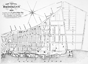
Background imageTopography Collection: Map of the village of Brooklyn, New York, in 1816

Map of the village of Brooklyn, New York, in 1816
BROOKLYN MAP, 1816. Map of the village of Brooklyn, New York, in 1816

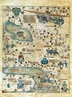
Background imageTopography Collection: Map of Cathay, China, from Catalan Atlas created for Charles V, King of France

Map of Cathay, China, from Catalan Atlas created for Charles V, King of France
Cartography, 14th century. Map of Cathay (China). From Catalan Atlas created for Charles V, King of France, attributed to Abraham and Jafuda Cresques Maiorca (circa 1375)

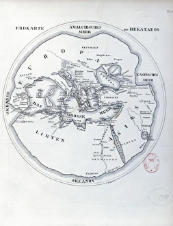
Background imageTopography Collection: Circular world map by Hecataeus of Miletus

Circular world map by Hecataeus of Miletus
Cartography, 6th-5th century b.C. Circular world map by Hecataeus of Miletus

Background imageTopography Collection: Rambling Sketches, Kemsing, Kent (engraving)

Rambling Sketches, Kemsing, Kent (engraving)
1614304 Rambling Sketches, Kemsing, Kent (engraving) by English School, (19th century); Private Collection; (add.info.: Rambling Sketches, Kemsing, Kent)

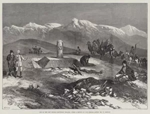
Background imageTopography Collection: One of the New Afghan Boundary Pillars (engraving)

One of the New Afghan Boundary Pillars (engraving)
1591343 One of the New Afghan Boundary Pillars (engraving) by Simpson, William Crimea (1823-99) (after); Private Collection; (add.info.: One of the New Afghan Boundary Pillars)

Background imageTopography Collection: Views of Launceston, Cornwall (engraving)

Views of Launceston, Cornwall (engraving)
1590593 Views of Launceston, Cornwall (engraving) by Smith, James Burrell (1822-97); Private Collection; (add.info.: Views of Launceston, Cornwall)

Background imageTopography Collection: Filey, Yorkshire (engraving)

Filey, Yorkshire (engraving)
1619177 Filey, Yorkshire (engraving) by English School, (19th century); Private Collection; (add.info.: Filey, Yorkshire. Illustration for The Illustrated London News, 17 July 1858)

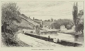
Background imageTopography Collection: Chapelizod, near Phoenix Park, Dublin (engraving)

Chapelizod, near Phoenix Park, Dublin (engraving)
1624014 Chapelizod, near Phoenix Park, Dublin (engraving) by English School, (19th century); Private Collection; (add.info.: Chapelizod, near Phoenix Park, Dublin)

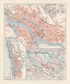
Background imageTopography Collection: City map of Bremen, Germany, lithograph, published 1897

City map of Bremen, Germany, lithograph, published 1897
City map of Bremen, Germany. Lithograph, published in 1897

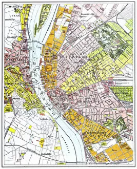
Background imageTopography Collection: Budapest city map

Budapest city map
Illustration of a Budapest city map

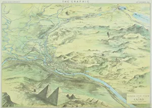
Background imageTopography Collection: Antique engraving depicting birds eye view of Cairo

Antique engraving depicting birds eye view of Cairo

Background imageTopography Collection: Antique map of Nile River

Antique map of Nile River

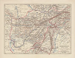
Background imageTopography Collection: Afghanistan, lithograph, published in 1881

Afghanistan, lithograph, published in 1881
Ancient map of Afghanistan. Lithograph, published in 1881

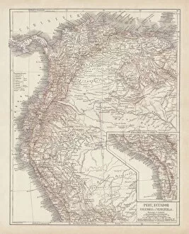
Background imageTopography Collection: Peru, Ecuador, Colombia, Venezuela, lithograph, published in 1877

Peru, Ecuador, Colombia, Venezuela, lithograph, published in 1877
Ancient map of Peru, Ecuador, Colombia, and Venezuela. Lithograph, published in 1877

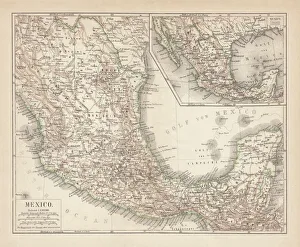
Background imageTopography Collection: Mexico, ancient map, lithograph, published in 1877

Mexico, ancient map, lithograph, published in 1877
Ancient map of Mexico. Lithograph, published in 1877

Background imageTopography Collection: Map of British Isles, lithograph, lithograph, published in 1876

Map of British Isles, lithograph, lithograph, published in 1876
Map of British Isles. Lithograph, published in 1876

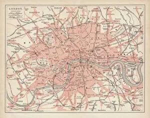
Background imageTopography Collection: City map of London, lithograph, lithograph, published in 1877

City map of London, lithograph, lithograph, published in 1877
City map of London, United Kingdom. Lithograph, published in 1877

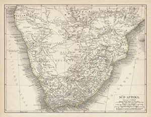
Background imageTopography Collection: Ancient map of South Africa, lithograph, published in 1876

Ancient map of South Africa, lithograph, published in 1876
Ancient map of South Africa. Lithograph, published in 1876

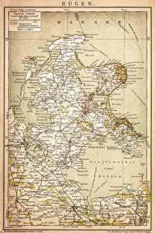
Background imageTopography Collection: RAOEgen

RAOEgen
Antique map of RAOEgen

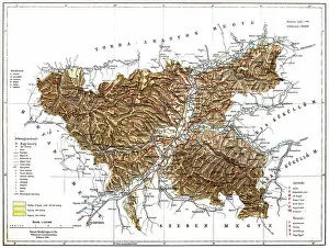
Background imageTopography Collection: Romania

Romania
Antique map of Romania

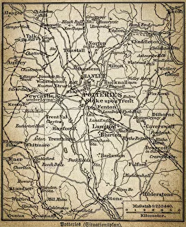
Background imageTopography Collection: Potteries map

Potteries map
Antique illustration of a Potteries map

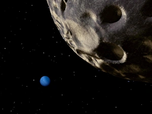
Background imageTopography Collection: Neptune seen from its tiny, distant moon, Nereid

Neptune seen from its tiny, distant moon, Nereid

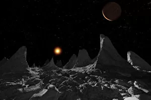
Background imageTopography Collection: Ice spires on Jupiters large moon, Callisto

Ice spires on Jupiters large moon, Callisto
The ice spires of Jupiters moon Callisto were created when softer ice evaporated, leaving behind the harder cores

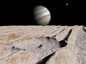
Background imageTopography Collection: Artists concept of an impact crater on Jupiters moon Ganymede, with Jupiter

Artists concept of an impact crater on Jupiters moon Ganymede, with Jupiter
Artists concept of an impact crater on Ganymede, about 10 miles in diameter, dominates a scene otherwise defined by a dozen long ridges

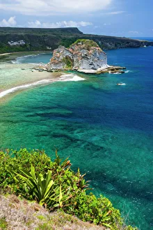
Background imageTopography Collection: Bird island outlook, Saipan, Northern Marianas, Central Pacific

Bird island outlook, Saipan, Northern Marianas, Central Pacific

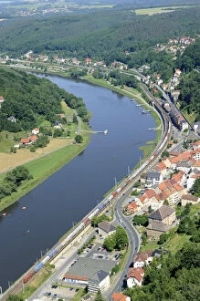
Background imageTopography Collection: Festung Koenigstein fortress on the river Elbe, overlooking the town of Koenigstein

Festung Koenigstein fortress on the river Elbe, overlooking the town of Koenigstein, Elbsandsteingebirge Elbe Sandstone Mountains, Nationalpark Saechsische Schweiz national park, Saxon Switzerland

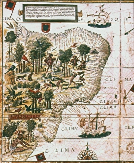
Background imageTopography Collection: PORTUGUESE MAP OF BRAZIL. Between the Amazon River and the Rio de la Plata, 1519

PORTUGUESE MAP OF BRAZIL. Between the Amazon River and the Rio de la Plata, 1519

Background imageTopography Collection: USA - Arizona - Grand Canyon - ?TopFoto / CW

USA - Arizona - Grand Canyon - ?TopFoto / CW
USA - Arizona - Grand Canyon - ?TopFoto/CW

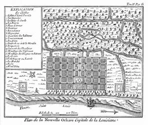
Background imageTopography Collection: Plan of New Orleans, Louisiana, 1718-1720: engraving, French, 1753

Plan of New Orleans, Louisiana, 1718-1720: engraving, French, 1753
NEW ORLEANS, 1718-1720. Plan of New Orleans, Louisiana, 1718-1720: engraving, French, 1753

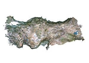
Background imageTopography Collection: Turkey, Satellite Image

Turkey, Satellite Image
Satellite view of Turkey. This image was compiled from data acquired by LANDSAT satellite

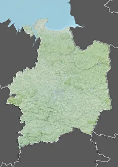
Background imageTopography Collection: Departement of Ille-et-Vilaine, France, Relief Map

Departement of Ille-et-Vilaine, France, Relief Map
Relief map of the departement of Ille-et-Vilaine, France. It is bordered by the English Channel to the north. This image was compiled from data acquired by LANDSAT 5 & 7 satellites combined with

Background imageTopography Collection: France, Brittany, Aerial view of Saint Malo

France, Brittany, Aerial view of Saint Malo
Aerial view of Saint Malo - Brittany, France

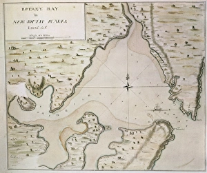
Background imageTopography Collection: Map of Botany Bay, New South Wales, Australia

Map of Botany Bay, New South Wales, Australia
Cartography, 18th century. Map of Botany Bay, New South Wales, Australia

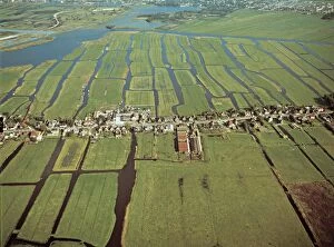
Background imageTopography Collection: Netherlands, Holland, Aerial view of the Polders near Amsterdam

Netherlands, Holland, Aerial view of the Polders near Amsterdam
Aerial view of the Polders near Amsterdam - Holland, Netherlands

Background imageTopography Collection: Middle East, satellite image

Middle East, satellite image
Middle East. North is at top. Satellite image of the Middle East, showing the borders (white lines) of the countries. The Middle East is a Eurocentric term used to describe a region that roughly

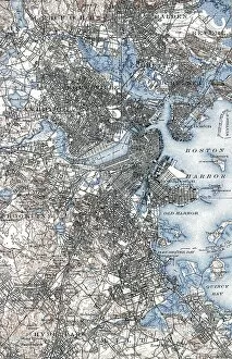
Background imageTopography Collection: BOSTON MAP, 1903. A map of Boston, Massachusetts. Engraving, 1903

BOSTON MAP, 1903. A map of Boston, Massachusetts. Engraving, 1903

Background imageTopography Collection: Europe, satellite image

Europe, satellite image
Europe. Satellite image centred on Europe. North converges towards top. Water is blue, vegetation is green, arid areas are brown, and snow and ice are white

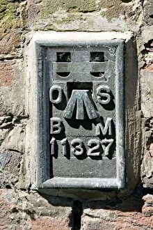
Background imageTopography Collection: Ordnance Survey benchmark, UK

Ordnance Survey benchmark, UK
Ordnance Survey (OS) benchmark. OS benchmarks were installed by the Ordnance Survey department throughout the UK to record the height above mean sea level as determined by the Ordnance Datum Newlyn

Background imageTopography Collection: Old Mill at Norwich, Norfolk

Old Mill at Norwich, Norfolk
Artist: Colkett, Samuel David - Title: Old Mill at Norwich, Norfolk - Date: N/A - Original Medium and Size: Oil on Wood 49.5 x 39.5

Background imageTopography Collection: Port Lyttelton, New Zealand with the Entrance to the New Graving Dock (engraving)

Port Lyttelton, New Zealand with the Entrance to the New Graving Dock (engraving)
1624349 Port Lyttelton, New Zealand with the Entrance to the New Graving Dock (engraving) by English School, (19th century); Private Collection; (add.info.: Port Lyttelton)

Background imageTopography Collection: The Rescue of a Castaway, Crew from Heard Island, near Kerguelen (engraving)

The Rescue of a Castaway, Crew from Heard Island, near Kerguelen (engraving)
1044014 The Rescue of a Castaway, Crew from Heard Island, near Kerguelen (engraving) by English School, (19th century); Private Collection; (add.info.: The Rescue of a Castaway)

Background imageTopography Collection: 1940s East Africa - train Limuru escarpment, Kenya

1940s East Africa - train Limuru escarpment, Kenya
1940s East Africa - train descending the Limuru escarpment, Kenya Photograph by a British army recruitment officer stationed in East Africa and the Middle East during World War II

Background imageTopography Collection: India - the Amir of Kabul Afghanistan 1860s

India - the Amir of Kabul Afghanistan 1860s
19th century vintage photograph India - the Amir of Kabul Afghanistan Shepherd and Robertson, 1860s


All Professionally Made to Order for Quick Shipping

"Exploring the World's Varied Topography: From Ancient Greece to Antarctica" Embark on a captivating journey through time and space as we delve into the fascinating realm of topography. This 150 caption takes you across continents, from Cyprus to Africa, Portugal to Wales, and beyond. Let's begin our expedition with a glimpse into history - an intriguing Map of Cyprus published in 1880. Its intricate details transport us back in time, unraveling the island's rich geographical tapestry. Next, we navigate towards Africa where a Political Map unveils the diverse nations that shape this vast continent. The contours and boundaries guide us through its majestic landscapes and vibrant cultures. Venturing westward, we encounter a Map of Portugal which showcases not only its cities but also reveals hidden gems nestled within its topographical wonders. It beckons explorers to uncover its secrets. As we traverse further northwards, three Welsh women dressed in traditional costumes capture our attention. Their attire reflects both their cultural heritage and the unique topography that surrounds them. Turning our gaze towards Scotland, James Craig's 1768 map presents Edinburgh's New Town for the first time. This pioneering plan intertwines urban development with meticulous attention to topographic features – shaping one of Europe's most enchanting cities. Across the Atlantic Ocean lies Plymouth, Massachusetts - Samuel de Champlain’s map from his 1605 expedition guides us through this historic settlement site. The rugged beauty of Plymouth is etched onto this map like a testament to human resilience against nature’s challenges. Our exploration now takes an icy turn as we discover Antarctica adorned with illustrations of sea gulls, penguins, elephant seals, and shrimp amidst towering ice formations. This juxtaposition between wildlife and man-made structures highlights how humanity has left imprints even on Earth’s harshest terrains. The turquoise waters surrounding Providenciales Island in Turks & Caicos come alive on a mural map depicting Grace Bay.