
Triangulation Collection
Triangulation, a timeless method of measurement and surveying, has played a crucial role in mapping the world we live in


All Professionally Made to Order for Quick Shipping
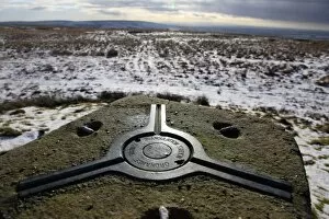
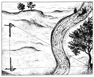
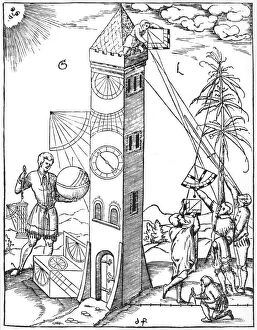
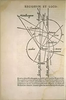
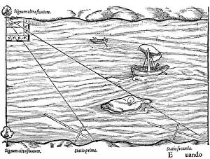
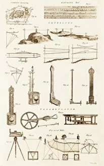
Triangulation, a timeless method of measurement and surveying, has played a crucial role in mapping the world we live in. From ancient times to modern technology, this technique has been employed by explorers and scientists alike. Looking west from an old Ordnance Survey triangulation point on The Chains above Blackmoor Gate in winter, Exmoor, Devon, England, United Kingdom; one can appreciate the breathtaking beauty that awaits those who venture into uncharted territories. These points served as reference markers for accurate measurements and allowed cartographers to create detailed maps. Hoisting the signals for triangulation was no easy task. Engravings depict dedicated individuals meticulously setting up these beacons atop mountains or tall structures. Their efforts ensured precise calculations and reliable data collection during extensive surveys. The Coming Transit of Venus brought about a significant event: the triangulation of the Island of Rodriguez. This engraving captures astronomers observing this celestial phenomenon while simultaneously mapping out new territories with their trusty instruments. In 1848, an impressive scaffolding and observatory were erected on St. Paul's Cathedral—a testament to mankind's pursuit of knowledge through triangulation techniques. Unknown creators immortalized this achievement through captivating photographs that still inspire awe today. Cross-staffs have long been used for surveying purposes since 1551 when they were first introduced. These versatile tools enabled early surveyors to measure distances accurately using triangulation methods—essential for creating comprehensive maps and charts. Measuring inaccessible objects became possible thanks to hinged staffs utilized in triangulation between 1617-1619. By employing mathematical principles combined with physical measurements taken from different angles, researchers could determine distances without physically reaching their targets—an invaluable breakthrough at the time. Surveying wouldn't be complete without considering timekeeping—a vital aspect highlighted since 1551 alongside traditional measuring techniques like cross-staffs and quadrants with plumb bobs used to calculate tower heights.