Fraud Blocker Skip to main content

Urbanization Collection (page 2)

From Sheffield to Vancouver, Europe to Hong Kong, urbanization paints a mesmerizing tapestry of human progress and development

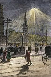
Background imageUrbanization Collection: Electric lights in New York City, 1880s

Electric lights in New York City, 1880s
Madison Square illuminated by electric light for the first time, New York City, 1880s. Hand-colored woodcut of a 19th-century illustration

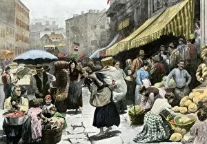
Background imageUrbanization Collection: Italian immigrants in New York City, 1890s

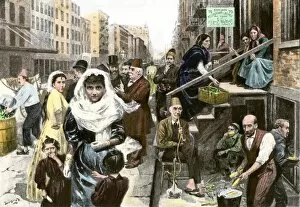
Italian immigrants in New York City, 1890s
Mulberry Street, center of the Italian immigrant neighborhood in New York City, 1890s. Hand-colored halftone reproduction of a 19th-century illustration

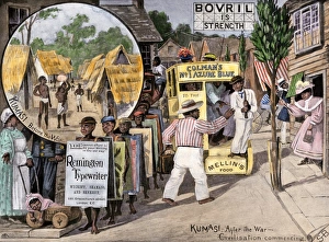
Background imageUrbanization Collection: Before and after views of Kumasi, Ghana, as a British protectorate, 1890s

Before and after views of Kumasi, Ghana, as a British protectorate, 1890s
British view of how the Ashanti will live after English occupation, 1890s. Hand-colored halftone reproduction of a 19th-century illustration

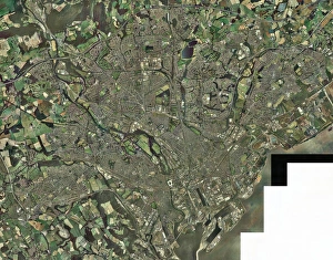
Background imageUrbanization Collection: Cardiff, aerial photograph

Cardiff, aerial photograph
Cardiff, Wales, UK, aerial photograph. Cardiff is the capital city of Wales. It is a port on the Bristol Channel (not imaged at lower right)

Background imageUrbanization Collection: Leeds, UK, aerial image

Leeds, UK, aerial image
Leeds, UK, aerial photograph. Leeds is a city of around half a million people in West Yorkshire. It is linked to London to the south by the M1 motorway (running from bottom centre to far right)

Background imageUrbanization Collection: Cleveland, Ohio, 1880s

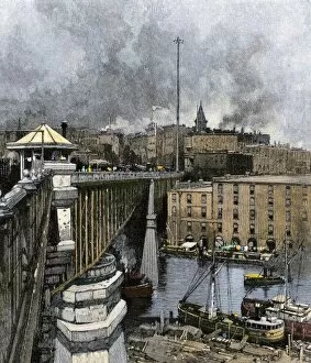
Cleveland, Ohio, 1880s
Cleveland, Ohio, from the viaduct over the Cuyahoga River, 1880s. Hand-colored woodcut of a 19th-century illustration

Background imageUrbanization Collection: Cincinnati, Ohio, 1850s

Cincinnati, Ohio, 1850s
Downtown Columbus, Ohio, in the mid-19th century. Hand-colored woodcut of a 19th-century illustration

Background imageUrbanization Collection: Cincinnati, viewed from the Kentucky side of the Ohio River, 1850s

Cincinnati, viewed from the Kentucky side of the Ohio River, 1850s
Cincinnati, Ohio, from Newport Barracks, Kentucky, on south bank of the Ohio River, 1850s. Hand-colored woodcut of a 19th-century illustration

Background imageUrbanization Collection: Syrian immigrants in New York City, 1890s

Syrian immigrants in New York City, 1890s
Syrian neighborhood on Washington Street, New York City, 1890s. Hand-colored halftone reproduction of a 19th-century illustration

Background imageUrbanization Collection: Wealthy New Yorkers out for an afternoon stroll, 1880s

Wealthy New Yorkers out for an afternoon stroll, 1880s
Saturday afternoon shoppers crossing Broadway at Madison Square, 1880s. Hand-colored woodcut of a 19th-century illustration

Background imageUrbanization Collection: New York City skyscrapers, circa 1900

New York City skyscrapers, circa 1900
View of Broadway from the top of the Singer Building, New York City, 1900. Hand-colored halftone reproduction of a photograph

Background imageUrbanization Collection: GGBR2A-00026

GGBR2A-00026
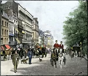
Horse-drawn carriage traffic outside the shops in Piccadilly, London, 1890s. Hand-colored woodcut

Background imageUrbanization Collection: GGBR2A-00007

GGBR2A-00007
London street scene at night with electric lighting, about 1890. Hand-colored woodcut of a 19th-century illustration

Background imageUrbanization Collection: Africa at night, satellite image

Africa at night, satellite image. City lights (yellow) show areas of dense population, particularly in Europe and the Middle East (top)

Background imageUrbanization Collection: East Asia at night, satellite image

East Asia at night, satellite image
East Asia at night. Satellite image of the Earth at night, centred over China. City lights (yellow) show areas of dense population

Background imageUrbanization Collection: Rome, satellite image

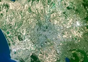
Rome, satellite image. North is at top. Vegetationis green, bare ground is brown, urban areas aregrey and water is blue. Rome is the capital cityof Italy

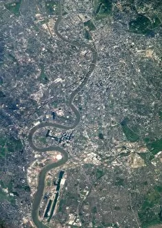
Background imageUrbanization Collection: London from the ISS

London from the ISS
London, UK, photographed from theInternational Space Station. North is at right.The River Thames flows eastwards down centre. Thebright white circle at lower left is theMillennium Dome

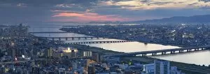
Background imageUrbanization Collection: View of Osaka at dusk, Kansai, Japan

View of Osaka at dusk, Kansai, Japan

Background imageUrbanization Collection: View of Yodo River and Osaka Bay at sunset, Osaka, Kansai, Japan

View of Yodo River and Osaka Bay at sunset, Osaka, Kansai, Japan

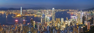
Background imageUrbanization Collection: View of Kowloon and Hong Kong Island from Victoria Peak at dusk, Hong Kong

View of Kowloon and Hong Kong Island from Victoria Peak at dusk, Hong Kong

Background imageUrbanization Collection: View of Kowloon and Hong Kong Island from Victoria Peak, Hong Kong

View of Kowloon and Hong Kong Island from Victoria Peak, Hong Kong

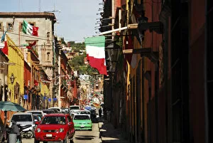
Background imageUrbanization Collection: Mexico, San Miguel de Allende, flag flattering on buildings, car moving on street

Mexico, San Miguel de Allende, flag flattering on buildings, car moving on street amid buildings

Background imageUrbanization Collection: Picture No. 11808829

Picture No. 11808829
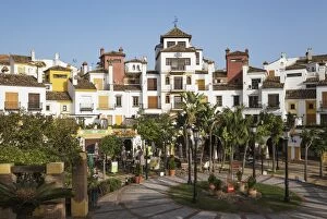
Andalusian architecture prevails in many contemporary urbanizations like La Alcaidesa at the Mediterranean Sea Cadiz province, Andalusia, Spain Date:

Background imageUrbanization Collection: Picture No. 11808828

Picture No. 11808828
Andalusian architecture prevails in many contemporary urbanizations like La Alcaidesa at the Mediterranean Sea Cadiz province, Andalusia, Spain Date:

Background imageUrbanization Collection: Cavour monument in Turin

Cavour monument in Turin
Antique illustration of a Cavour monument in Turin

Background imageUrbanization Collection: Planet Earth covered by huge skyscrapers and buildings

Planet Earth covered by huge skyscrapers and buildings

Background imageUrbanization Collection: False-color image of part of Dubai

False-color image of part of Dubai
February 8, 2010 - False-color image of part of Dubai, including the resort island of Palm Jumeirah. Bare ground appears brown, vegetation appears red, water appears dark blue

Background imageUrbanization Collection: Satellite view of Persepolis and the surrounding region

Satellite view of Persepolis and the surrounding region
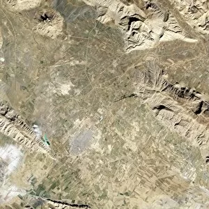
January 5, 2004 - Satellite view of Persepolis and the surrounding region. In southwestern Iran, roughly 400 miles south of the capital city of Tehran, and roughly 40 miles northeast of Shiraz

Background imageUrbanization Collection: Cityscape view of New York City, circa 1850

Cityscape view of New York City, circa 1850
Vintage American history print featuring a cityscape view of New York City, circa 1850

Background imageUrbanization Collection: Panoramic view of Milwaukee, Wisconsin, taken from City Hall Tower

Panoramic view of Milwaukee, Wisconsin, taken from City Hall Tower
Vintage American History print showing a panoramic view of Milwaukee, Wisconsin, taken from City Hall Tower

Background imageUrbanization Collection: Vintage print of Washington D. C

Vintage print of Washington D. C
Vintage birds-eye view print of Washington D.C. from the Potomac, looking North

Background imageUrbanization Collection: the town common in Grafton, Massachusetts

the town common in Grafton, Massachusetts

Background imageUrbanization Collection: Milton Keynes, aerial photograph C017 / 0653

Milton Keynes, aerial photograph C017 / 0653
Milton Keynes, aerial photograph. The main rectangular portion of the image shows the shopping district in central Milton Keynes. It is surrounded by residential housing

Background imageUrbanization Collection: Southampton, aerial photograph C017 / 0655

Southampton, aerial photograph C017 / 0655
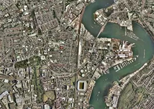
Southampton, aerial photograph. The sports stadium at bottom centre is St. Marys football stadium which lies next to the River Itchen

Background imageUrbanization Collection: Brighton, aerial photograph C016 / 9926

Brighton, aerial photograph C016 / 9926
Brighton, aerial photograph. Brighton Marine and Palace Pier is visible at centre, bottom along the beach front. To the far left are the remains of the West Pier which was closed in 1975

Background imageUrbanization Collection: Cardiff city centre, aerial photograph C016 / 9928

Cardiff city centre, aerial photograph C016 / 9928
Cardiff city centre, aerial photograph. The large sports ground at lower centre left is the Cardiff Millennium Stadium. To the north of the stadium is the circular structure of Cardiff Castle

Background imageUrbanization Collection: Gravelly Hill Interchange, aerial view C017 / 0657

Gravelly Hill Interchange, aerial view C017 / 0657
Gravelly Hill Interchange, UK, aerial photograph. This interchange lies off junction 6 on the M6 motorway where it meets the A38(M)

Background imageUrbanization Collection: Urban ecology, conceptual artwork F006 / 3897

Urban ecology, conceptual artwork F006 / 3897
Urban ecology, conceptual computer artwork

Background imageUrbanization Collection: Urban ecology, conceptual artwork F006 / 3862

Urban ecology, conceptual artwork F006 / 3862
Urban ecology, conceptual computer artwork

Background imageUrbanization Collection: Dartford, aerial photograph C016 / 9930

Dartford, aerial photograph C016 / 9930
Dartford, UK, aerial photograph. At lower left is Queen Elizabeth II bridge which spans the River Thames. Directly beneath the bridge is the Dartford Crossing and the Dartford tunnel

Background imageUrbanization Collection: Gatwick airport, aerial photograph C016 / 9932

Gatwick airport, aerial photograph C016 / 9932
Gatwick airport, aerial photograph. Photographed in 2012

Background imageUrbanization Collection: Urbanisation, conceptual artwork F006 / 8687

Urbanisation, conceptual artwork F006 / 8687
Urbanisation, conceptual computer artwork

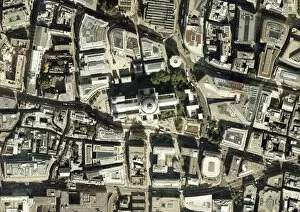
Background imageUrbanization Collection: St Pauls Cathedral, aerial photograph

St Pauls Cathedral, aerial photograph
St Pauls Cathedral, London, aerial photograph. Photographed in 2011

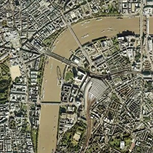
Background imageUrbanization Collection: Waterloo Station, London, aerial view C017 / 0661

Waterloo Station, London, aerial view C017 / 0661
Waterloo Station, London, aerial photograph. Waterloo Station terminal and lines can be seen centre middle towards bottom middle of the image

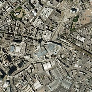
Background imageUrbanization Collection: Birmingham city centre, aerial photograph C016 / 9924

Birmingham city centre, aerial photograph C016 / 9924
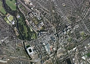
Birmingham city centre, aerial photograph. At centre, middle is the Bullring Shopping Centre. Photographed in 2004

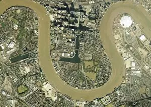
Background imageUrbanization Collection: Isle of Dogs, aerial photograph C016 / 9934

Isle of Dogs, aerial photograph C016 / 9934
Isle of Dogs, London, UK, aerial photograph. The Isle of Dogs in east London includes extensive office buildings around the Canary Wharf Tower (top)

Background imageUrbanization Collection: Plant growing through asphalt C015 / 5187

Plant growing through asphalt C015 / 5187
Plant growing through asphalt

Background imageUrbanization Collection: Urban landscaping C015 / 5184

Urban landscaping C015 / 5184
Urban landscaping. Trees growing on a skyscraper


All Professionally Made to Order for Quick Shipping

From Sheffield to Vancouver, Europe to Hong Kong, urbanization paints a mesmerizing tapestry of human progress and development. Aerial images capture the sprawling cityscape of Sheffield, UK, where towering buildings intertwine with green spaces. In Vancouver, Canada, a breathtaking view showcases the harmonious blend of modern architecture against nature's backdrop. The satellite image of Europe at night illuminates the continent like a constellation of bustling cities that never sleep. As dawn breaks over Hong Kong, its iconic skyline emerges from darkness in all its glory - a testament to rapid urban growth and economic prowess. Transporting us back in time, we witness the grandeur of Brooklyn Bridge when it first opened in 1883; an engineering marvel connecting New York City boroughs and symbolizing progress. Satellite images reveal India at night as millions of lights twinkle across vast landscapes - evidence of its thriving metropolises coexisting with ancient traditions. The old town of Modica Italy offers a glimpse into history through narrow streets and charming architecture that have stood the test of time. Returning to Brooklyn Bridge during its inaugural year brings alive the energy and excitement surrounding this vital link between Manhattan and Brooklyn. South America shines brightly under satellite observation as vibrant cities light up the night sky like constellations on another hemisphere. London's satellite image captures its majestic beauty; centuries-old landmarks blending seamlessly with contemporary skyscrapers embodying urban transformation. Reading and Southampton in the UK showcase aerial photographs revealing their unique charm amidst urban expansion. An ever-evolving phenomenon shaping our world – bridging cultures, transforming skylines, fostering innovation while preserving heritage. These glimpses into different corners around the globe remind us that despite our geographical distances or cultural diversity, we are united by our shared pursuit for progress.