mail_outline sales@mediastorehouse.com
Framed Print
Canvas Print
Metal Print
Photographic Print
Poster Print
Fine Art Print
Jigsaw Puzzle
Photo Mug
Greetings Card
Cushion
Mouse Mat
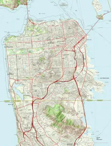
San Francisco City MapA street level map of central San Francisco based on USGS topo map data. Covers from Alcatraz Island in the north to Oyster Point in the south
Washington DC City MapA street level map of central Washington D.C. based on USGS topo map data. Covers from Manor Park in the north to Washington Highlands in the south
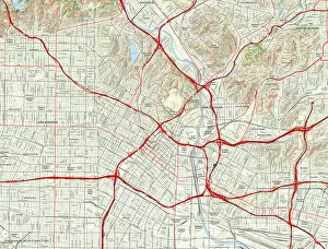
Los Angeles City MapA street level map of central Los Angeles based on USGS topo map data. Covers from Atwater in the north to Clement Junction in the south and from Eastmont in the east to Hancock Park in the west
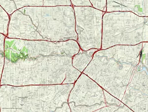
Houston City MapA street level map of central Houston based on USGS topo map data. Covers from the North Loop Freeway in the north to Riverside Terrace in the south
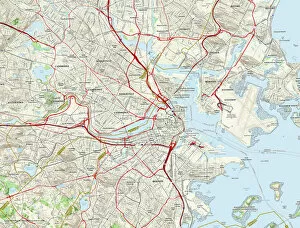
Boston City MapA street level map of central Boston based on USGS topo map data. Covers from Revere in the north to Jamacia Plain in the south and from Cottage Park in the east to Watertown in the west
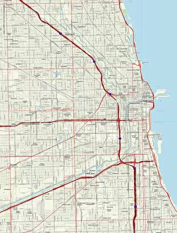
Chicago City MapA street level map of central Chicago based on USGS topo map data. Covers from North Center in the north to Back of the Yards in the south
Philadelphia City MapA street level map of central Philadelphia based on USGS topo map data. Covers from Feltonville in the north to the Navy Yard in the south and from Camden in the east to Wynnefield in the west