
William Perris Collection
William Perris was a renowned cartographer who meticulously documented the streets and neighborhoods of New York City in the mid-19th century


All Professionally Made to Order for Quick Shipping
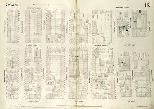
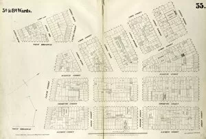
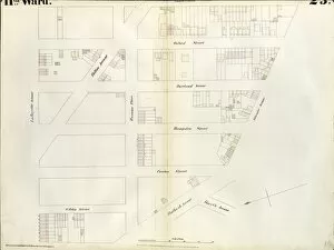
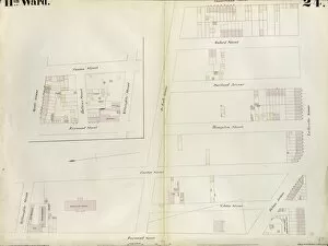
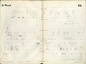
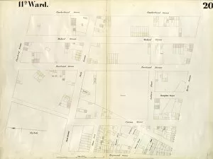
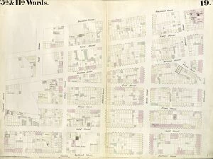
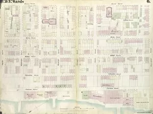
William Perris was a renowned cartographer who meticulously documented the streets and neighborhoods of New York City in the mid-19th century. His maps provide a fascinating glimpse into the city's history and development during that time. One of his notable works is Plate 33, which showcases an area bounded by Franklin Street, West Broadway, Reade Street, and West Street. This map allows us to visualize how this section of the city looked in the past and compare it to its present state. Plate 36 focuses on another neighborhood, bounded by Hamersley Street, Houston Street, Laurens Street, and Spring Street. Perris' attention to detail enables us to see how this part of town has evolved over time. In Plate 25, we explore an area bordered by Chambers Street, Center Street, White Street, and Orange Street. Perris' map captures not only street names but also various landmarks that existed at that time. Perris also delves into specific streets within larger areas. Plates 23 and 24 zoom in on Bowery with its intersections with Grand Street, Allen Street, Division Streets (1852). These detailed maps offer insights into the layout of these bustling streets during this period. Continuing his exploration of Lower Manhattan's streetscapes are Plates 22 through 20. These maps focus on Grand St. , Attorney St. , Division St. , Rivington St. , Columbia St. , providing a comprehensive view of these vibrant neighborhoods from different angles. Plates 15 through 18 showcase Division St. , Jefferson St. , South St. , Pike Slip; Jackson St. ; East Broadway; Chatham Square; Catherine st. ; Water st. ; Corlears st. Each plate offers a unique perspective on these bustling areas filled with shops, Through his meticulous mapping work captured in these plates along with many others throughout his career as a cartographer William Perris has left behind an invaluable record for historians today.