Fraud Blocker Skip to main content

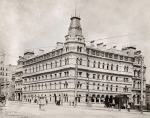
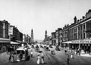
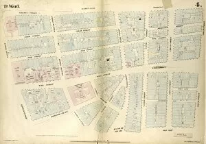
William Street Collection (page 6)

Discover the charm of William Street, a hidden gem nestled in various locations across Redcar & Cleveland, South Tyneside, Wigan, Sunderland, Rotherham, Somerset

Background imageWilliam Street Collection: AUSTRALIA: MELBOURNE, c1900. Menzies Hotel on the corner of Bourke Street South

AUSTRALIA: MELBOURNE, c1900. Menzies Hotel on the corner of Bourke Street South and William Street East in Melbourne, Australia. Photograph, c1900

Background imageWilliam Street Collection: Elias F. Noyes Building In New York Financial District

Elias F. Noyes Building In New York Financial District
View of the Elias F. Noyes Building at the corner of William Street and Beaver Street, New York, New York, 1910s. (Photo by Edwin Levick/Getty Images)

Background imageWilliam Street Collection: King William Street

King William Street
A view down King William Street, Adelaide, Australia, circa 1880. (Photo by Hulton Archive/Getty Images)

Background imageWilliam Street Collection: NYC: BANK OF NEW YORK. The Bank of New York Building at 48 Wall Street in New York City

NYC: BANK OF NEW YORK. The Bank of New York Building at 48 Wall Street in New York City. Photograph, c1922

Background imageWilliam Street Collection: Plate 1: Map bounded by Bowling Green Row, Marketfield Street, Beaver Street, William

Plate 1: Map bounded by Bowling Green Row, Marketfield Street, Beaver Street, William Street, Old Slip, South Street, Whitehall, State Street; Including Moore Street, Broad Street, Coenties Alley

Background imageWilliam Street Collection: 2nd Ward. Plate 1: Map bounded by Broadway, Parks Row, Beekman Street, William Street

2nd Ward. Plate 1: Map bounded by Broadway, Parks Row, Beekman Street, William Street, Liberty Street; Including Nassau Street, Theater Alley, Dutch Street, Maiden Lane, John Street, Fulton Street

Background imageWilliam Street Collection: 1st & 2nd Wards. Plate G: Map bounded by Platt Street, Burling Slip, South Street

1st & 2nd Wards. Plate G: Map bounded by Platt Street, Burling Slip, South Street, Wall Street, William Street; Including Maiden Lane, Fletcher Street, Liberty Street, Cedar Street, Depeyster Street

Background imageWilliam Street Collection: 2nd Ward. Plate: I Map bounded by William Street, Beekman Street, Gold Street, Ferry

2nd Ward. Plate: I Map bounded by William Street, Beekman Street, Gold Street, Ferry Street, Cliff Street, Pearl Street, Platt Street; Including Riders Alley, Cliff Street, John Street, Fulton Street

Background imageWilliam Street Collection: 1st Ward. Plate F: Map bounded by Liberty Street, William Street, Exchange Place

1st Ward. Plate F: Map bounded by Liberty Street, William Street, Exchange Place, Trinity Place; Including Cedar Street, Thames Street, Pine Street, Wall Street, Temple Street, Broadway

Background imageWilliam Street Collection: 1st Ward. Plate C: Map bounded by Exchange Place, William Street, Wall Street, Hanover

1st Ward. Plate C: Map bounded by Exchange Place, William Street, Wall Street, Hanover Street, Beaver Street, Stone Street, Whitehall, Broadway; Including New Street, Broad Street

Background imageWilliam Street Collection: Plate 8, Part of Section 1: Bounded by Franklin Street, Bayard Street, Bowery, Chatham

Plate 8, Part of Section 1: Bounded by Franklin Street, Bayard Street, Bowery, Chatham Square, New Bowery, Madison Street, New Chambers Street, William Street, Duane Street, Reade Street and Broadway

Background imageWilliam Street Collection: Plate 3, Part of Section 1: Bounded by Vesey Street, Ann Street, William Street

Plate 3, Part of Section 1: Bounded by Vesey Street, Ann Street, William Street, Pine Street, Broadway, Thames Street, Greenwich Street, Carlisle Street and Hudson River Piers West Street

Background imageWilliam Street Collection: Plate 2, Part of Section 1: Bounded by Carlisle Street, Greenwich Street, Thames Street

Plate 2, Part of Section 1: Bounded by Carlisle Street, Greenwich Street, Thames Street, Broadway, Pine Street, William Street, Exchange Place, Broad Street, Beaver Street, Bowling Green

Background imageWilliam Street Collection: Plate 10: Bounded by Intersection Street, Franklin Street, Stevens Avenue, Main Street

Plate 10: Bounded by Intersection Street, Franklin Street, Stevens Avenue, Main Street, Columbia Street, Stewart Avenue, Bennett Avenue, Fulton Street, William Street, Gerard Street

Background imageWilliam Street Collection: Plate 35: Map bounded by William Street, Richards Street, Elizabeth Street, Conover

Plate 35: Map bounded by William Street, Richards Street, Elizabeth Street, Conover Street. 1855, William Perris, Brooklyn, New York, N.Y. USA

Background imageWilliam Street Collection: Plate 34: Map bounded by Carroll Street, Columbia Street, Rapelye Street, Henry Street

Plate 34: Map bounded by Carroll Street, Columbia Street, Rapelye Street, Henry Street, Luquer Street, Commerce Street, Richards Street, William Street, Van Brunt Street

Background imageWilliam Street Collection: Plate 4: Map bounded by Liberty Street, Maiden Lane, South Street, Old Slip, William

Plate 4: Map bounded by Liberty Street, Maiden Lane, South Street, Old Slip, William Street, Exchange Place, Broad Street, Nassau Street. 1852, 1854, William Perris, New York, N.Y. USA

Background imageWilliam Street Collection: Plate 2: Map bounded by Rector Street, Broadway, Wall Street, Broad Street, Exchange

Plate 2: Map bounded by Rector Street, Broadway, Wall Street, Broad Street, Exchange Place, William Street, Beaver Street, Broad Street, Marketfield Place, Battery Place, West Street

Background imageWilliam Street Collection: Plate 4: Map bounded by Maiden Lane, South Street, Old Slip, William Street, Exchange

Plate 4: Map bounded by Maiden Lane, South Street, Old Slip, William Street, Exchange Place, Broad Street, Nassau Street. 1857, 1862, Perris and Browne, New York, USA


All Professionally Made to Order for Quick Shipping

Discover the charm of William Street, a hidden gem nestled in various locations across Redcar & Cleveland, South Tyneside, Wigan, Sunderland, Rotherham, Somerset, Thurrock, Rochdale, Manchester and Oldham. With its diverse range of maps showcasing different areas such as TS6 9 Map or NE33 1 Map to WN2 3 Map or SR1 1 Map and even S65 2 Map to TA2 6 Map – this street has something for everyone. Step into the vibrant atmosphere as you explore the bustling shops and local businesses that line its sidewalks. From quaint boutiques offering unique fashion finds to cozy cafes serving up delicious treats - there's no shortage of places to indulge your senses. As you wander through each map location like WN7 2 Map or WN3 4 Map, you'll be captivated by the rich history that seeps from every corner. Immerse yourself in the stories told by charming architecture and landmarks that stand tall amidst modern developments. Whether you're a resident or a visitor passing through M20 6 Map or OL16 2Map, it offers an escape from everyday life. Take a leisurely stroll along its well-paved paths and let your worries melt away with each step. The sense of community is palpable on William Street; friendly faces greet you at every turn. Engage in conversations with locals who are always eager to share their knowledge about the area's best-kept secrets – whether it's where to find the tastiest fish and chips or which park offers breathtaking views. No matter which part captures your heart – be it RM17 6Map or M35 9Map - one thing is certain: this street holds endless possibilities waiting to be explored. So come along on an adventure filled with surprises around every corner because on William Street, there's always something new just waiting to be discovered.