Fraud Blocker Skip to main content

World Wide Collection (page 4)

"Exploring the World: From Ancient Maps to Modern Discoveries" Step into a journey through time and space as we unravel the wonders of our world

Background imageWorld Wide Collection: Worldwide AIDS epidemic, artwork

Worldwide AIDS epidemic, artwork
Worldwide AIDS epidemic. Conceptual computer artwork of the Earth in the shape of the AIDS (acquired immune deficiency syndrome) virus

Background imageWorld Wide Collection: Buckminsterfullerene Earth, artwork

Buckminsterfullerene Earth, artwork
Buckminsterfullerene Earth. Conceptual computer artwork of the Earth surrounded by a molecular model of buckminsterfullerene (C60). This is a structural form (allotrope) of carbon

Background imageWorld Wide Collection: Global water supply, conceptual image

Global water supply, conceptual image
Global water supply. Conceptual artwork of the Earth inside a water droplet. This represents global water supplies and conservation of the Earths water resources

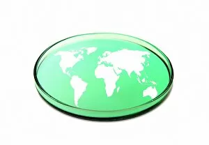
Background imageWorld Wide Collection: Global research, conceptual image

Global research, conceptual image
Global research. Conceptual image of a map of the world contained within a petri dish. This image represents worldwide biological, medical and epidemiological research

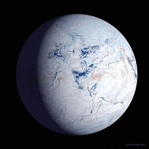
Background imageWorld Wide Collection: Snowball Earth

Snowball Earth. Computer artwork of the Earth frozen in snow and ice some 590 million years ago. The continents are in different positions due to tectonic plate movements

Background imageWorld Wide Collection: Internet security, conceptual artwork

Internet security, conceptual artwork
Internet security, conceptual computer artwork

Background imageWorld Wide Collection: Climate concerns, conceptual artwork

Climate concerns, conceptual artwork

Background imageWorld Wide Collection: Earth SOS, conceptual image

Earth SOS, conceptual image
Earth SOS. Conceptual image of the Earth forming the centre part of the SOS international Morse code distress signal. This image can represent a variety of dangers to the Earth

Background imageWorld Wide Collection: Russian heatwave, summer 2010

Russian heatwave, summer 2010
Russian heatwave, July 2010. This world satellite map shows global land surface temperature anomalies in the period from 28 July to 4 August 2010

Background imageWorld Wide Collection: Environmentally friendly planet, artwork

Environmentally friendly planet, artwork
Environmentally friendly planet, conceptual artwork

Background imageWorld Wide Collection: Global communications, artwork

Global communications, artwork
Global communications, computer artwork

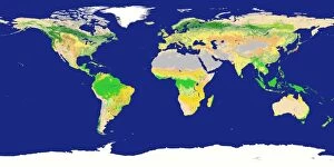
Background imageWorld Wide Collection: Earths land cover classification, 2003

Earths land cover classification, 2003. Produced using data obtained during 2003 from the MODIS instrument on NASAs Terra satellite

Background imageWorld Wide Collection: Lactose tolerance, Eurasia and Africa

Lactose tolerance, Eurasia and Africa
GERMAN LANGUAGE VERSION. Lactose tolerance. Map of Eurasia, African and Australia, showing the varying tolerance for lactose, the milk sugar found in dairy products from cows milk (lower centre)

Background imageWorld Wide Collection: Virus pandemic, conceptual image

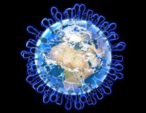
Virus pandemic, conceptual image. Computer artwork of virus particles superimposed on a map of the world, representing the worldwide spread of an infectious viral disease

Background imageWorld Wide Collection: Earth, topographic and bathymetric map

Earth, topographic and bathymetric map. Computer generated image showing the varying heights and depths of the Worlds landmasses, oceans and seas

Background imageWorld Wide Collection: Internet, conceptual image

Internet, conceptual image. The spiders web surrounding the Earth represents the global connectivity of the internet and other global systems such as the World Wide Web

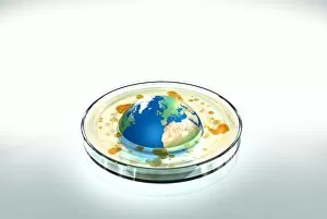
Background imageWorld Wide Collection: Global pandemic, conceptual image

Global pandemic, conceptual image
Global pandemic. Conceptual artwork of the Earth in a petri dish with microbial growths (orange). This could represent a bacterial or viral infection spreading to cause a global pandemic

Background imageWorld Wide Collection: H1N1 swine flu virus, SEM

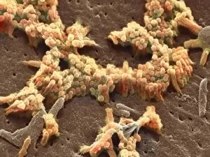
H1N1 swine flu virus, SEM
H1N1 swine flu virus. Coloured scanning electron micrograph (SEM) of swine influenza (flu) virus particles (virions, yellow)

Background imageWorld Wide Collection: Brown rat, artwork

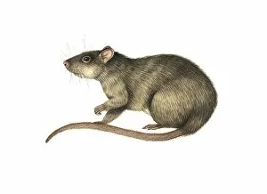
Brown rat, artwork
Brown rat (Rattus norvegicus), artwork. This small mammal is a rodent found worldwide, especially in Europe and North America

Background imageWorld Wide Collection: Global meat eating, conceptual artwork

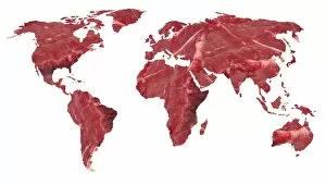
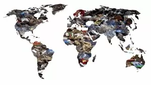
Global meat eating, conceptual artwork. This global map with the outline of the Earths countries filled in with a close-up of raw beef

Background imageWorld Wide Collection: House mouse, artwork

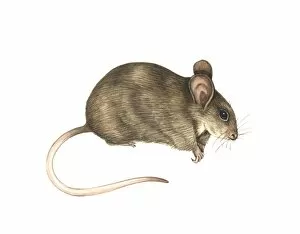
House mouse, artwork
House mouse (Mus musculus), artwork. This small mammal is a rodent found worldwide, associated with human populations. It reaches a body length of around 10 centimetres

Background imageWorld Wide Collection: European rabbit, artwork

European rabbit, artwork
European rabbit (Oryctolagus cuniculus), artwork. This is a herbivorous mammal. It is native to Europe but has been introduced to many regions worldwide, and has also been extensively domesticated

Background imageWorld Wide Collection: World map, artwork

World map, artwork
World map. Artwork of a map of the Earth and its rivers forming the backdrop for a television studio

Background imageWorld Wide Collection: Oil drilling, conceptual image

Oil drilling, conceptual image
Oil drilling. Conceptual artwork of a clamp being used to squeeze the Earth to extract oil. This image can represent oil drilling and other aspects of the oil industry

Background imageWorld Wide Collection: Cyber warfare, conceptual image

Cyber warfare, conceptual image
Cyber warfare. Conceptual artwork of arching coloured lines linking points on a world map. This image can be used to represent cyber warfare

Background imageWorld Wide Collection: Global temperature anomalies 2006-2010

Global temperature anomalies 2006-2010
Global temperature anomalies. Illustration showing five-year average global temperature anomalies from 2006 to 2010. The scale runs from dark red, indicating areas warmer than average, to dark blue

Background imageWorld Wide Collection: Gobal refuse, conceptual image

Gobal refuse, conceptual image
Global refuse, conceptual image

Background imageWorld Wide Collection: Single Earth, conceptual artwork

Single Earth, conceptual artwork
Single Earth. Conceptual artwork of the Earth among an array of steel spheres representing other planets. This image symbolises the uniqueness of life in the universe

Background imageWorld Wide Collection: Swine flu protection, conceptual image

Swine flu protection, conceptual image
Swine flu protection, conceptual computer artwork. Gas mask and pigs

Background imageWorld Wide Collection: Global flu pandemic, artwork

Global flu pandemic, artwork
Global flu pandemic. Computer artwork of a globe within an influenza (flu) A virus particle, representing a global flu pandemic

Background imageWorld Wide Collection: Swine flu pandemic, conceptual image

Swine flu pandemic, conceptual image
Swine flu pandemic, conceptual computer artwork. The Earth (green) is sandwiched between two H1N1 influenza (flu) A virus particles (virions, orange)

Background imageWorld Wide Collection: Swine flu, conceptual image

Swine flu, conceptual image
Swine flu, conceptual computer artwork. Pig and an H1N1 influenza (flu) A virus particle (virion)

Background imageWorld Wide Collection: H1N1 flu virus particles, artwork

H1N1 flu virus particles, artwork
H1N1 flu virus particles. Computer artwork of H1N1 influenza (flu) A virus particles (virions). In each particles lipid envelope are two types of protein spike, haemagglutinin (H)


All Professionally Made to Order for Quick Shipping

"Exploring the World: From Ancient Maps to Modern Discoveries" Step into a journey through time and space as we unravel the wonders of our world. Al-Idrisi's world map from 1154 takes us back to an era where cartography was in its infancy, showcasing the knowledge and curiosity of early explorers. Fast forward 250 million years, and witness continental drift shaping our planet's landscape, reminding us of Earth's ever-changing nature. As night falls, marvel at the breathtaking sight of our whole planet illuminated by city lights in a satellite image - a testament to human progress and interconnectedness. Oronce Fine's intricate world map from 1531 captures the spirit of Renaissance exploration, fueling dreams of distant lands waiting to be discovered. Dive beneath Earth's surface with topographic and bathymetric maps that reveal hidden depths and towering mountains alike. Explore the puzzle pieces that form our continents - tectonic plates shifting over millions of years have shaped Earth as we know it today. Transport yourself to Rue Du Bac with Vision - a glimpse into an artist's perspective on our global community. Witness humanity thriving amidst diversity, united under one sky. From high above, another satellite image showcases our entire planet in all its splendor; reminding us that borders are merely lines drawn by humans while nature knows no boundaries. Orteliuss' masterpiece from 1570 invites you to embark on an imaginary voyage across uncharted territories. Finally, behold the power unleashed by mankind with Dreadnought at Speed - a symbol of technological advancement propelling us further into unexplored realms. In this captivating collection spanning centuries, "World Wide" encapsulates not only geographical discoveries but also humanity's insatiable thirst for knowledge and connection across time and space.