Home > Europe > United Kingdom > England > Cornwall > Newlyn
Tidal Observatory, Newlyn Harbour, Cornwall DP221138
![]()

Wall Art and Photo Gifts from Historic England
Tidal Observatory, Newlyn Harbour, Cornwall DP221138
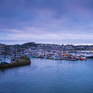
Tidal Observatory, Newlyn Harbour, Newlyn, Cornwall. General view of tidal observatory lighthouse, shot at dawn, view from north west. Photographed by James O. Davies for Listing Review 2019. The fishing industry in Newlyn on the south coast of Cornwall expanded in the 1880s, resulting in the construction of a new harbour and two piers. In the early 20th century, the south pier was extended to give better protection to the harbour and a tidal observatory was built at its north end. The observatory was one of three constructed at the request of Ordnance Survey to establish Mean Sea Level. With the observatory being completed in 1914, hourly measurements were taken of the height of the tide between 1915 and 1921, determining that Newlyn was the most stable and therefore the principal place to establish Mean Sea Level for the entire country. Over the next 100 years, the observatory contributed key tidal data to studies in oceanography, geology and climate change. Today, all heights on Ordnance Survey maps are referenced to a brass bolt within the observatory, 4.75m above Mean Sea Level - also known as Ordnance Datum Newlyn. The Ordnance Survey gave up responsibility for the tidal observatory in 1983, but it continues to be used for scientific tidal measurements, particularly for guiding climate change and coastal management studies
Historic England is the public body that champions and protects England's historic places
Media ID 18782253
© Historic England Archive
Blue Coast Dawn Harbour Light House
FEATURES IN THESE COLLECTIONS
> Europe
> United Kingdom
> England
> Cornwall
> Newlyn
> Europe
> United Kingdom
> England
> Maps
> Historic England
> Landscapes
> Coastal Landscapes
> Cornish Coast
> Historic England
> Landscapes
> Coastal Landscapes
> Historic England
> Transport
> Maritime
> Lighthouses
> Maps and Charts
> Early Maps
EDITORS COMMENTS
This photograph showcases the historic Tidal Observatory in Newlyn Harbour, Cornwall, captured at dawn by photographer James O. Davies for Historic England in 2019. The image is taken from the northwest, revealing the distinctive lighthouse-like structure of the observatory, which stands proudly at the north end of the harbour's north pier. Newlyn Harbour, situated on the south coast of Cornwall, underwent significant expansion in the late 1800s, leading to the construction of a new harbour and two piers. In the early 1900s, the south pier was extended to safeguard the harbour, and a tidal observatory was built at its northern end. This observatory was one of three constructed at the behest of Ordnance Survey to establish Mean Sea Level. Completed in 1914, hourly measurements of the tide's height were taken between 1915 and 1921, determining that Newlyn was the most stable and, consequently, the primary location to establish Mean Sea Level for the entire country. Over the subsequent 100 years, the observatory has provided essential tidal data for studies in oceanography, geology, and climate change. Today, all heights on Ordnance Survey maps are referenced to a brass bolt within the observatory, which is 4.75m above Mean Sea Level, also known as Ordnance Datum Newlyn. Although Ordnance Survey relinquished responsibility for the tidal observatory in 1983, it continues to be used for scientific tidal measurements, playing a crucial role in guiding climate change and coastal management studies.
MADE IN AUSTRALIA
Safe Shipping with 30 Day Money Back Guarantee
FREE PERSONALISATION*
We are proud to offer a range of customisation features including Personalised Captions, Color Filters and Picture Zoom Tools
SECURE PAYMENTS
We happily accept a wide range of payment options so you can pay for the things you need in the way that is most convenient for you
* Options may vary by product and licensing agreement. Zoomed Pictures can be adjusted in the Cart.


