Home > Europe > United Kingdom > England > Birmingham > Area > Billesley
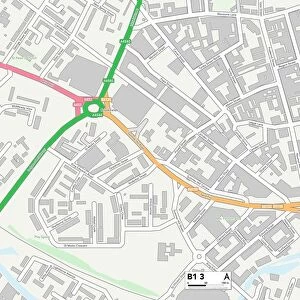
Birmingham B13 0 Map

![]()
Wall Art and Photo Gifts from Map Marketing
Birmingham B13 0 Map
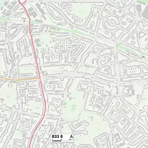
Postcode Sector Map of Birmingham B13 0
Media ID 19965834
Barn Lane Beauchamp Road Birmingham Bourne Close Brook Lane Brookside Avenue Chamberlain Road Church Grove Effingham Road Fir Grove Glen Rise Hollybank Road Millbrook Gardens Peacock Road Portman Road Ridge Close Taylor Road The Hurst Tudor Close Wheelers Lane Menin Road
FEATURES IN THESE COLLECTIONS
> Map Marketing
> Postcode Sector Maps
> B - Birmingham
> Europe
> United Kingdom
> England
> Birmingham
> Area
> Billesley
> Europe
> United Kingdom
> England
> Birmingham
> Area
> Yardley Wood
> Europe
> United Kingdom
> England
> Birmingham
> Area
> Yardley
> Maps and Charts
> Related Images
MADE IN AUSTRALIA
Safe Shipping with 30 Day Money Back Guarantee
FREE PERSONALISATION*
We are proud to offer a range of customisation features including Personalised Captions, Color Filters and Picture Zoom Tools
SECURE PAYMENTS
We happily accept a wide range of payment options so you can pay for the things you need in the way that is most convenient for you
* Options may vary by product and licensing agreement. Zoomed Pictures can be adjusted in the Cart.