Home > Europe > United Kingdom > Wales > Pembrokeshire > Pembroke
Wirral CH41 9 Map

![]()
Wall Art and Photo Gifts from Map Marketing
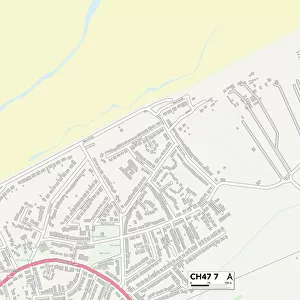
Wirral CH41 9 Map
Postcode Sector Map of Wirral CH41 9
Media ID 19967220
Beaconsfield Close Ch41 Chamberlain Street Convent Close Fairfax Road Green Lane Helena Street Hillside Close Hillside Road Holt Road Kelvin Road Leighton Road Orchard Court Pearson Road Queen Street Rectory Close Ripon Street Sidney Road Thompson Street Union Street Valiant Way West View Westbury Street Wirral Holborn Hill Olive Mount Tranmere
FEATURES IN THESE COLLECTIONS
> Map Marketing
> Postcode Sector Maps
> CH - Chester
> Arts
> Portraits
> Pop art gallery
> Street art portraits
> Europe
> United Kingdom
> Wales
> Pembrokeshire
> Pembroke
> Maps and Charts
> Related Images
MADE IN AUSTRALIA
Safe Shipping with 30 Day Money Back Guarantee
FREE PERSONALISATION*
We are proud to offer a range of customisation features including Personalised Captions, Color Filters and Picture Zoom Tools
SECURE PAYMENTS
We happily accept a wide range of payment options so you can pay for the things you need in the way that is most convenient for you
* Options may vary by product and licensing agreement. Zoomed Pictures can be adjusted in the Cart.