Fraud Blocker Skip to main content

Home > Europe > United Kingdom > England > London > Boroughs > Hackney
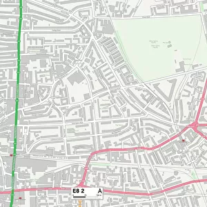
Hackney N1 1 Map

Hackney N1 1 Map


Photo Prints
Jigsaw Puzzles
Poster Prints
Canvas Prints
Fine Art Prints
Metal Prints
Cards
Home Decor
Background Images


We accept all major credit cards

Map Marketing

Wall Art and Photo Gifts from Map Marketing
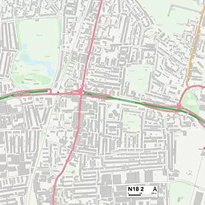
Hackney N1 1 Map

Postcode Sector Map of Hackney N1 1

Media ID 19975498

Albany Mews Albion Mews Beech Tree Close Caledonian Road Crescent Street Drummond Way Hackney Hampton Court Lambert Street Legion Close Liverpool Road Malvern Terrace The Courtyard Thornhill Road Upper Street Waterloo Terrace Barnsbury


FEATURES IN THESE COLLECTIONS

> Map Marketing > Postcode Sector Maps > N - London N

> Arts > Portraits > Pop art gallery > Street art portraits

> Europe > United Kingdom > England > London > Boroughs > Hackney

> Europe > United Kingdom > England > London > Boroughs > Islington

> Europe > United Kingdom > Scotland > Dumfries and Galloway > Thornhill

> Maps and Charts > Related Images

> Popular Themes > Waterloo Station


MADE IN AUSTRALIA
Safe Shipping with 30 Day Money Back Guarantee

FREE PERSONALISATION*
We are proud to offer a range of customisation features including Personalised Captions, Color Filters and Picture Zoom Tools

SECURE PAYMENTS
We happily accept a wide range of payment options so you can pay for the things you need in the way that is most convenient for you

* Options may vary by product and licensing agreement. Zoomed Pictures can be adjusted in the Cart.


redeem
Beautiful Photo Prints and Gifts
image
Professionally Printed
thumb_up
Professional quality finish
diamond
Made with high-grade materials
inventory_2
Carefully packed to aid safe arrival


Related Images


Welwyn Hatfield AL10 9 Map
Hackney E8 2 Map
Hackney E8 2 Map
Hackney E9 5 Map
Hackney E9 5 Map
Hackney N1 3 Map
Hackney N1 3 Map
Hackney N1 4 Map
Hackney N1 4 Map
Old Map of The Isle of Wight 1836 by Thomas Moule
Map of Islington, Clerkenwell, Holborn and Finsbury (engraving)
Descriptive map of London poverty, 1889 (engraving)
Cardinal de Tournon reading the Protestant Placard to Francis I

+

Shipping

+

Choices

+

Reviews

+

Guaranteed


Related Collections


Waterloo Station
Waterloo Station
Browse 469 Prints
Maps and Charts Related Images
Browse 44,395 Prints
Hackney
Hackney
Browse 1,213 Prints
Islington
Islington
Browse 1,858 Prints
N - London N
N - London N
Browse 87 Prints
Thornhill
Thornhill
Browse 428 Prints
Street art portraits
Browse 38,967 Prints