Home > Europe > United Kingdom > England > London > Sights > Richmond Park
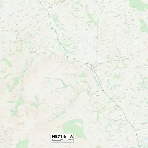
Sunderland NE38 7 Map

![]()
Wall Art and Photo Gifts from Map Marketing
Sunderland NE38 7 Map
Postcode Sector Map of Sunderland NE38 7
Media ID 19974610
Abbey Close Abbey Road Albert Place Ashley Close Autumn Close Barrington Drive Beaumont Drive Bell Street Boston Avenue Buckland Close Dene Court Fountains Close Gainsborough Avenue Glebe Crescent Henson Close Hill Rise Hugh Street Maltby Close Morland Avenue Morton Close Nelson Street Parkway Raeburn Avenue Reynolds Avenue Richmond Avenue Romney Avenue Sherwood Close Station Road Sunderland Talbot Close The Avenue The Poplars Titchfield Road Tweed Street Columbia Dryburgh Dundrennan Glastonbury Glebe Lanercost Lindisfarne Melrose Rievaulx Thetford Tintern Town Centre Valley Forge Village Lane Walsingham Waltham Wenlock Woburn Wroxton
FEATURES IN THESE COLLECTIONS
> Map Marketing
> Postcode Sector Maps
> NE - Newcastle upon Tyne
> Arts
> Artists
> R
> Cook Richmond
> Arts
> Portraits
> Pop art gallery
> Street art portraits
> Europe
> United Kingdom
> England
> London
> Sights
> Richmond Park
> Europe
> United Kingdom
> Heritage Sites
> Stonehenge, Avebury and Associated
> Europe
> United Kingdom
> Scotland
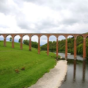
> Scottish Borders
> Melrose
> Maps and Charts
> Related Images
> North America
> United States of America
> Washington, District of Columbia
MADE IN AUSTRALIA
Safe Shipping with 30 Day Money Back Guarantee
FREE PERSONALISATION*
We are proud to offer a range of customisation features including Personalised Captions, Color Filters and Picture Zoom Tools
SECURE PAYMENTS
We happily accept a wide range of payment options so you can pay for the things you need in the way that is most convenient for you
* Options may vary by product and licensing agreement. Zoomed Pictures can be adjusted in the Cart.