Home > Europe > United Kingdom > Scotland > Strathclyde > Kilbarchan
Renfrewshire PA10 2 Map

![]()
Wall Art and Photo Gifts from Map Marketing
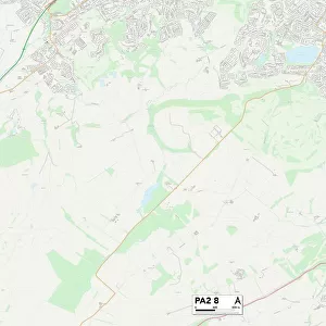
Renfrewshire PA10 2 Map
Postcode Sector Map of Renfrewshire PA10 2
Media ID 19977991
Burnside Gardens Cedar Court Church Street Churchill Place East Road Hunter Place Ladysmith Avenue Lewis Crescent Mackenzie Drive Montgomery Drive New Street Park Gardens Park View Renfrewshire Shuttle Street Station Road Taylor Avenue The Grove Waterside Lane Waterside Way Weavers Court Well Road West Road
FEATURES IN THESE COLLECTIONS
> Map Marketing
> Postcode Sector Maps
> PA - Paisley
> Arts
> Portraits
> Pop art gallery
> Street art portraits
> Europe
> United Kingdom
> Scotland
> Renfrewshire
> Europe
> United Kingdom
> Scotland
> Strathclyde
> Kilbarchan
> Europe
> United Kingdom
> Wales
> Powys
> Montgomery
> Maps and Charts
> Related Images
MADE IN AUSTRALIA
Safe Shipping with 30 Day Money Back Guarantee
FREE PERSONALISATION*
We are proud to offer a range of customisation features including Personalised Captions, Color Filters and Picture Zoom Tools
SECURE PAYMENTS
We happily accept a wide range of payment options so you can pay for the things you need in the way that is most convenient for you
* Options may vary by product and licensing agreement. Zoomed Pictures can be adjusted in the Cart.