Home > Europe > United Kingdom > Wales > Powys > Knighton
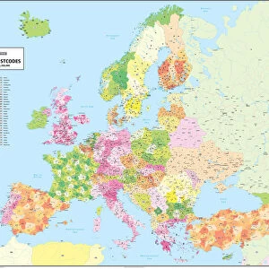
Bournemouth BH11 9 Map

![]()
Wall Art and Photo Gifts from Map Marketing
Bournemouth BH11 9 Map
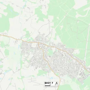
Postcode Sector Map of Bournemouth BH11 9
Media ID 19965488
Anchor Close Anchor Road Anstey Road April Close Baker Road Bournemouth Burgess Close Charter Road Coniston Avenue Cranwell Close Deacon Road Duck Lane Dukes Drive Elmhurst Road Fitzwilliam Close Fulwood Avenue Garsdale Close Greystoke Avenue Hull Road Knights Road Lake Road Lea Way Longfield Drive Magna Close Mayfair Gardens Meadow View Road Monks Way Oxford Lane Ringwood Road Ross Gardens Ryecroft Avenue School Lane Sunbury Close Teal Close The Orchard Townsend Close Viscount Close Wheelers Lane Wood Lane Woodfield Road Bearwood
FEATURES IN THESE COLLECTIONS
> Map Marketing
> Postcode Sector Maps
> BH - Bournemouth
> Map Marketing
> UK Maps
> Animals
> Birds
> Waterfowl
> Ducks
> Lake Duck
> Animals
> Birds
> Waterfowl
> Ducks
> Wood Duck
> Animals
> Mammals
> Muridae
> Heath Mouse
> Arts
> Artists
> B
> John Burgess
> Arts
> Artists
> W
> John Wood
> Arts
> Artists
> Y
> Art Young
> Arts
> Artists
> Y
> John Young
> Europe
> United Kingdom
> Wales
> Powys
> Knighton
> Maps and Charts
> Related Images
MADE IN AUSTRALIA
Safe Shipping with 30 Day Money Back Guarantee
FREE PERSONALISATION*
We are proud to offer a range of customisation features including Personalised Captions, Color Filters and Picture Zoom Tools
SECURE PAYMENTS
We happily accept a wide range of payment options so you can pay for the things you need in the way that is most convenient for you
* Options may vary by product and licensing agreement. Zoomed Pictures can be adjusted in the Cart.