Home > Europe > United Kingdom > England > London > Sights > Regents Park
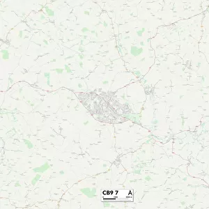
Newcastle NE3 5 Map

![]()
Wall Art and Photo Gifts from Map Marketing
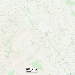
Newcastle NE3 5 Map
Postcode Sector Map of Newcastle NE3 5
Media ID 19974634
Beech Close Beechwood Avenue Beverley Close Briarwood Avenue Celandine Close Chapel Close Davenport Drive Dukes Drive Easby Close Fairway Close Ferndale Avenue Fernwood Avenue Glamis Avenue Granville Road Greenfield Road Grenville Drive Harewood Road Hartford Road Juniper Close Kingsley Avenue Knightsbridge Lincoln Green Melrose Close Newcastle Newlands Avenue Norwood Avenue Park Drive Princes Close Princes Road Queens Court Queensway Rosewood Avenue Rotary Way Salters Close Salters Lane Sandy Lane Sherwood Place South Ridge Strathmore Road Westwood Road Woodlea Gardens Brunton Park Linthorpe Road South Bend
FEATURES IN THESE COLLECTIONS
> Map Marketing
> Postcode Sector Maps
> NE - Newcastle upon Tyne
> Map Marketing
> UK Maps
> Europe
> United Kingdom
> England
> London
> Sights
> Regents Park
> Europe
> United Kingdom
> Northern Ireland
> County Down
> Newcastle
> Europe
> United Kingdom
> Scotland
> Dumfries and Galloway
> Langholm
> Europe
> United Kingdom
> Scotland
> Scottish Borders
> Melrose
> Maps and Charts
> Related Images
MADE IN AUSTRALIA
Safe Shipping with 30 Day Money Back Guarantee
FREE PERSONALISATION*
We are proud to offer a range of customisation features including Personalised Captions, Color Filters and Picture Zoom Tools
SECURE PAYMENTS
We happily accept a wide range of payment options so you can pay for the things you need in the way that is most convenient for you
* Options may vary by product and licensing agreement. Zoomed Pictures can be adjusted in the Cart.