Home > Arts > Artists > R > James Ross
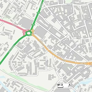
Sandwell B65 8 Map

![]()
Wall Art and Photo Gifts from Map Marketing
Sandwell B65 8 Map
Postcode Sector Map of Sandwell B65 8
Media ID 19965415
Admirals Way Blackberry Lane Britannia Gardens Carnegie Road Central Avenue Churchill Drive Conway Drive Cornfield Road Cromwell Close Dudley Close Dudley Road Duke Street Eagle Close Eden Gardens Farm Road Harvest Road Knowle Road Mayfield Crescent Moor Lane Orchard Close Robin Close Rockley Road Royal Oak Road Sandwell Sefton Drive Springfield Springfield Close Springfield Lane Springfield Terrace St Giles Avenue St James Avenue St Johns Avenue The Avenue The Crescent The Grove The Knowle The Mews Walton Close Warren Drive Wendover Road Yewtree Lane Ross
FEATURES IN THESE COLLECTIONS
> Map Marketing
> Postcode Sector Maps
> B - Birmingham
> Map Marketing
> UK Maps
> Arts
> Artists
> F
> John Field
> Arts
> Artists
> H
> John Hillers
> Arts
> Artists
> H
> John Hills
> Arts
> Artists
> R
> James Ross
> Arts
> Portraits
> Pop art gallery
> Street art portraits
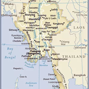
> Asia
> Myanmar
> Related Images
> Maps and Charts
> Related Images
MADE IN AUSTRALIA
Safe Shipping with 30 Day Money Back Guarantee
FREE PERSONALISATION*
We are proud to offer a range of customisation features including Personalised Captions, Color Filters and Picture Zoom Tools
SECURE PAYMENTS
We happily accept a wide range of payment options so you can pay for the things you need in the way that is most convenient for you
* Options may vary by product and licensing agreement. Zoomed Pictures can be adjusted in the Cart.