Fraud Blocker Skip to main content

Home > Maps and Charts > Africa

Africa Collection (#32)

Africa is the world's second-largest continent

1,673 Items

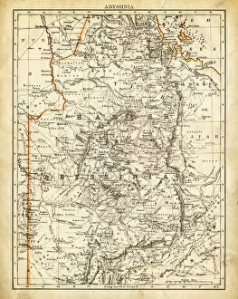
Background imageAfrica Collection: Map of Abyssinia 1897

Map of Abyssinia 1897

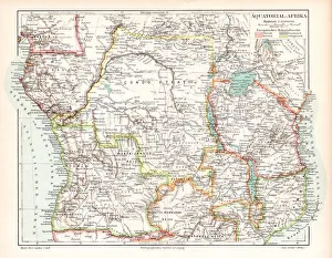
Background imageAfrica Collection: Equatorial Guinea map 1895

Equatorial Guinea map 1895
Meyers Konversations-Lexikon. Ein Nachschlagewerk des allgemeinen Wissens, 5th edition 17 volumes Bibliographisches Institut - Leipzig 1895-1897

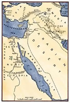
Background imageAfrica Collection: Antique map of Middle East with Arabia, Egypt, Nubia, and Abyssinia

Antique map of Middle East with Arabia, Egypt, Nubia, and Abyssinia

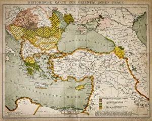
Background imageAfrica Collection: Historical map of the Oriental part of world

Historical map of the Oriental part of world
Antique illustration of a Historical map of the Oriental part of world

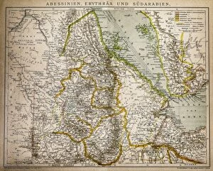
Background imageAfrica Collection: Abyssinia, Eritrea and South Arabia

Abyssinia, Eritrea and South Arabia
Antique illustration of a Abyssinia, Eritrea and South Arabia

Background imageAfrica Collection: Ethnic map of Africa

Ethnic map of Africa
Antique illustration of a ethnic map of Africa

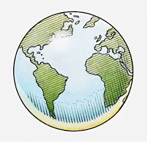
Background imageAfrica Collection: Illustration of globe showing North and South America, Africa, Europe and Atlantic Ocean

Illustration of globe showing North and South America, Africa, Europe and Atlantic Ocean

Background imageAfrica Collection: Illustrated map of Phoenician empire and trade routes

Illustrated map of Phoenician empire and trade routes

Background imageAfrica Collection: 3D rendering of planet Earth with clouds, centered on Asia

3D rendering of planet Earth with clouds, centered on Asia

Background imageAfrica Collection: Human hand holding Earth globe with a green landscape background

Human hand holding Earth globe with a green landscape background
Human hand holding Earth globe with a beautiful green landscape and river background

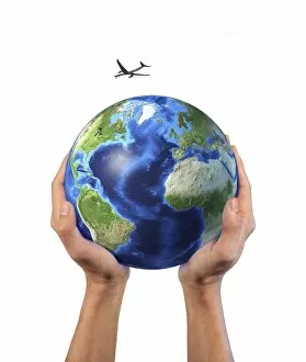
Background imageAfrica Collection: Mans hands holding the planet Earth, with a jet aircraft flying above

Mans hands holding the planet Earth, with a jet aircraft flying above

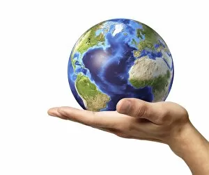
Background imageAfrica Collection: Male hand holding Earth globe

Male hand holding Earth globe, white background

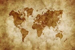
Background imageAfrica Collection: Aged world map on dirty paper

Aged world map on dirty paper

Background imageAfrica Collection: Enhanced Vegetation Index map showing the density of plant growth over the entire globe

Enhanced Vegetation Index map showing the density of plant growth over the entire globe
This MODIS Enhanced Vegetation Index (EVI) map shows the density of plant growth over the entire globe. Very low values of EVI (white and brown areas) correspond to barren areas of rock, sand

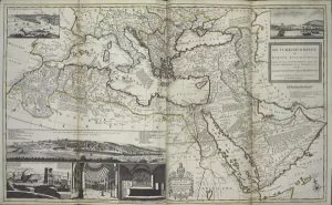
Background imageAfrica Collection: The Turkish Empire in Europe, Asia and Africa, 1736 (hand coloured print)

The Turkish Empire in Europe, Asia and Africa, 1736 (hand coloured print)
XOS1765727 The Turkish Empire in Europe, Asia and Africa, 1736 (hand coloured print) by Moll, Hermann (fl.1678-1732); 64x101 cm; New York Public Library

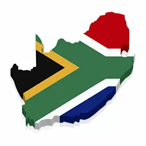
Background imageAfrica Collection: Outline and flag of South Africa, 3D

Outline and flag of South Africa, 3D

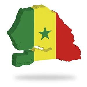
Background imageAfrica Collection: Shape and national flag of Senegal, levitating, 3D computer graphics

Shape and national flag of Senegal, levitating, 3D computer graphics

Background imageAfrica Collection: AFRICA: COLONIALISM, 1904. France & Britain agree not to let Africa divide them

AFRICA: COLONIALISM, 1904. France & Britain agree not to let Africa divide them by dividing Africa: French cartoon, 1904

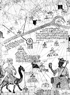
Background imageAfrica Collection: MANSA MUSA (1312-1337). King of Mali. Mansa Musa seated on his throne

MANSA MUSA (1312-1337). King of Mali. Mansa Musa seated on his throne. Facing him is a Tuareg on his camel. Detail from the Catalan Atlas of 1375

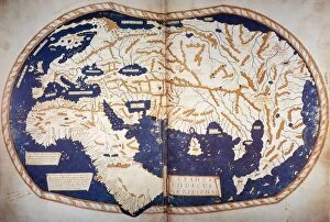
Background imageAfrica Collection: MARTELLUS: WORLD MAP, 1489. World map, c1489, of Henricus Martellus, copies of

MARTELLUS: WORLD MAP, 1489. World map, c1489, of Henricus Martellus, copies of which are believed to have reached Christopher Columbus in Spain and Martin Behaim in Nuremberg where, in 1492

Background imageAfrica Collection: WORLD MAP, 1490s. World map, c1488-1493, showing the continents of Asia, Africa

WORLD MAP, 1490s. World map, c1488-1493, showing the continents of Asia, Africa and Europe

Background imageAfrica Collection: Senegal-Africa-Map

Senegal-Africa-Map
A man reads his newspaper in front a map of Africa at the Place du Souvenir Africain, in Dakar, on January 27, 2016. / AFP PHOTO / SEYLLOU

Background imageAfrica Collection: Map of Northern Africa

Map of Northern Africa. Date: 1807

Background imageAfrica Collection: Human migration, artwork

Human migration, artwork
Human migration. Artwork showing the global history of human migration. Modern humans emerged 200, 000 years ago in Africa (centre left)

Background imageAfrica Collection: DR Congo, satellite image

DR Congo, satellite image
DR Congo. North is at top. Satellite image of the Democratic Republic of the Congo (DRC) in Central Africa, with the surrounding countries shaded out

Background imageAfrica Collection: Orteliuss map of Europe, 1603

Orteliuss map of Europe, 1603
Orteliuss map of Europe. This map of Europe is from the 1603 edition of Theatrum orbis terrarum (Theatre of the World). First published in 1570 by Flemish mapmaker Abraham Ortelius (1527-1598)

Background imageAfrica Collection: African Zenega and traders, 17th century

African Zenega and traders, 17th century
African Zenega and traders. 17th-century artwork of traders bartering brandy for water with Zenega (or Sanhaja) people of the African Kingdom of Cayor at Cap-Vert (in what is now Senegal)

Background imageAfrica Collection: African plants, 17th century C013 / 7756

African plants, 17th century C013 / 7756
African plants, 17th-century artwork. Three known plants are named (left to right): kassia (cassia or Chinese cinnamon), colekasia (Colocasia, the elephant-ear plant), and datura (thorn-apple)

Background imageAfrica Collection: African Zenega people, 17th century

African Zenega people, 17th century
African Zenega people. 17th-century artwork of clothing worn by Zenega (or Sanhaja) people in Africa. Of Berber origin, these people spread as far south as what is now Senegal

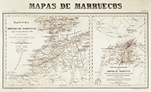
Background imageAfrica Collection: Spain. War of Africa (1859-1860). Maps of Morocco

Spain. War of Africa (1859-1860). Maps of Morocco

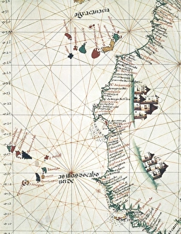
Background imageAfrica Collection: Map of the West of African coast with the Islands

Map of the West of African coast with the Islands of Macaronesia, the Canary Isles and Cape Verde. 1514. Miniature Painting. PORTUGAL. Lisbon. Maritime Museum

Background imageAfrica Collection: ATLAS: EAST AFRICA, 1665. Map of Ethiopia (kingdom of Prester John), Abyssinia, and Arabia

ATLAS: EAST AFRICA, 1665. Map of Ethiopia (kingdom of Prester John), Abyssinia, and Arabia, from Jan Blaeus Atlas Maior, printed in Amsterdam, 1665

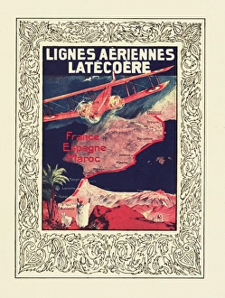
Background imageAfrica Collection: Cover design, Latecoere Airlines timetable

Cover design, Latecoere Airlines timetable, serving France, Spain and Morocco. The Latecoere company was founded in 1917, and is based in Toulouse. Showing a map with routes. circa 1922

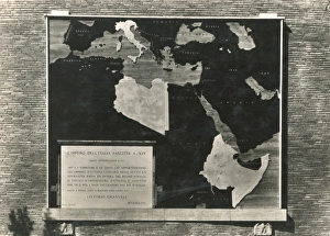
Background imageAfrica Collection: Map of the Italian Empire in 1939

Map of the Italian Empire in 1939, including the colonial African territories of Abyssinia (Ethiopia) and Libya. Date: 1939

Background imageAfrica Collection: MAP: PHOENICIAN EMPIRE. Map of the Phoenician colonies and routes of supposed voyages

MAP: PHOENICIAN EMPIRE. Map of the Phoenician colonies and routes of supposed voyages

Background imageAfrica Collection: PARTITIONED AFRICA, 1914. Map of Africa, English, 1934, with colors indicating European

PARTITIONED AFRICA, 1914. Map of Africa, English, 1934, with colors indicating European possessions in 1914

Background imageAfrica Collection: Hipparchus, Ancient Greek astronomer

Hipparchus, Ancient Greek astronomer
Hipparchus (c.190-c.120 BC), Ancient Greek astronomer, at the Alexandria Observatory, Egypt. At left is the armillary sphere he invented

Background imageAfrica Collection: Mammoth evolutionary migration, artwork

Mammoth evolutionary migration, artwork
Mammoth evolutionary migration. Artwork showing the evolution and migration of mammoth species over millions of years. Starting in Africa from 4.8 to 3 million years ago

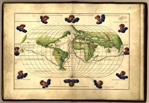
Background imageAfrica Collection: Magellans route, 16th century map

Magellans route, 16th century map
Magellans route around the world, in a 1544 copy of the Agnese Atlas. Magellans route is shown as a dark line. Ferdinand Magellan (c.1480-1521) set sail from Seville, Spain

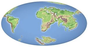
Background imageAfrica Collection: Continental drift after 100 million years

Continental drift after 100 million years. Map of the Earth showing the continents some 100 million years in the future, and 300 million years after the start of the break-up of the ancient

Background imageAfrica Collection: Continental drift, modern era

Continental drift, modern era. Map of the Earth showing the continents as they are today, 200 million years after the start of the break-up of the ancient supercontinent of Pangea

Background imageAfrica Collection: EXPL2A-00065

EXPL2A-00065
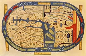
World map of the flat earth printed by Beatus Rhenanus Bildaus Rheinau early 1500s - North is left, Mediterranean Sea middle Printed color lithograph reproduction 19th century

Background imageAfrica Collection: EXPL2A-00353

EXPL2A-00353
Ptolemys map of the world shown in red, true locations in black. Printed color lithograph 19th century

Background imageAfrica Collection: EXPL2A-00024

EXPL2A-00024
Map of the Atlantic with the New World coast, drawn in 1500 by Juan de la Cosa, Columbus pilot. Hand colored 19th-century woodcut reproduction of the original chart

Background imageAfrica Collection: EXPL2A-00061

EXPL2A-00061
Ptolemys world map, circa 150 AD, from the edition of 1472. Color halftone reproduction of the first printed edition of 1472

Background imageAfrica Collection: Map of the Mideast in ancient times

Map of the Mideast in ancient times
Map of the ancient Near East, birthplace of civilization. Hand-colored woodcut of a 19th-century illustration

Background imageAfrica Collection: Cape of Good Hope mapped at its correct latitude, 1508

Cape of Good Hope mapped at its correct latitude, 1508
First map showing Africas southern point at the correct latitude, from Ruysch 1508. Hand-colored woodcut reproduction of a 16th-century illustration

Background imageAfrica Collection: Map of Europe, 1550

Map of Europe, 1550
Europe, as conceived in 1550


All Professionally Made to Order for Quick Shipping


-

Africa Collection

Africa is the world's second-largest continent, covering approximately 30 million square kilometers and has a population of over one billion people and is home to some of the most diverse cultures and languages on earth, and is known for its vast natural resources, including oil, gold, diamonds, and other minerals. However, despite its wealth in resources, many African countries struggle with poverty and political instability. Maps and charts can help us understand the geography as well as economic trends such as trade flows or GDP growth rates and can also highlight issues like climate change or disease outbreaks that affect different regions differently.
+

Our beautiful Wall Art and Photo Gifts include Framed Prints, Photo Prints, Poster Prints, Canvas Prints, Jigsaw Puzzles, Metal Prints and so much more

Media Storehouse offers a vast collection of Africa maps and charts that showcase the beauty and diversity of the continent. Our collection includes vintage maps, political maps, topographical maps, geological charts, and more. These prints are perfect for anyone who loves geography or wants to add an African touch to their home decor. The Africa Maps and Charts collection features high-quality prints that are available in various sizes and formats such as canvas prints, art prints, framed prints, or posters. Customers can choose from different styles ranging from colorful abstract designs to detailed black-and-white illustrations. These stunning pieces of wall art capture the essence of Africa's rich history and culture while providing educational value for those interested in learning about its geography. Whether you're looking to decorate your living room or office space with unique artwork or want to gift someone with a meaningful present related to their interests - our Africa Maps and Charts collection is definitely worth exploring.
+

What are Africa (Maps and Charts) art prints?

Africa art prints are a collection of high-quality, visually stunning artworks that showcase the diverse geography and topography of the African continent. These prints feature detailed maps and charts that highlight various regions, countries, cities, landmarks, and natural wonders across Africa. These art prints are perfect for anyone who has an interest in African history, culture or geography. They can be used to decorate homes or offices with a unique touch of elegance while also serving as educational resources for students studying African geography or history. The Africa art print collection is available in a variety of sizes to suit different needs. The prints are produced using state-of-the-art printing technology on premium quality paper to ensure they last for years without fading or losing their vibrancy. These art prints offer an excellent way to appreciate the beauty and diversity of Africa's landscapes while also learning more about its rich cultural heritage.
+

What Africa (Maps and Charts) art prints can I buy from Media Storehouse?

We offer a wide range of Africa maps and charts art prints that are perfect for anyone looking to add some African flair to their home or office decor. These prints feature detailed maps and charts of various regions in Africa, showcasing the diverse geography, topography, and cultural heritage of this vast continent. Some popular options include vintage-style maps that highlight colonial-era borders and territories, as well as more contemporary designs that showcase modern political boundaries and natural landmarks. You can also find charts depicting wildlife populations, climate patterns, and other fascinating data about different parts of Africa. Whether you're a history buff, nature lover, or simply appreciate beautiful artwork with an African theme, we have something for everyone. With high-quality printing techniques and a variety of sizes available to choose from, these art prints are sure to make a stunning addition to any space.
+

How do I buy Africa (Maps and Charts) art prints?

To buy Africa art prints from Media Storehouse, you can browse our extensive collection of high-quality prints online. Simply search for the specific artwork or artist that you are interested in, or explore their curated collections to discover new pieces. Once you have found a print that you would like to purchase, simply add it to your cart and proceed to checkout. You will be prompted to enter your shipping and payment information, after which your order will be processed. We offer a range of sizes and framing options for their prints, so be sure to choose the one that best suits your needs. Whether you are looking for a small print to display on your desk or a large statement piece for your living room wall, they have something for everyone. Buying Africa art prints from Media Storehouse is an easy and convenient way to bring beautiful artwork into your home or office.
+

How much do Africa (Maps and Charts) art prints cost?

We offer a wide range of Africa maps and charts art prints that are available at varying prices. Our collection features different styles and designs to suit your preferences. The cost of our Africa maps and charts art prints is dependent on several factors such as the size, quality, and type of print you choose. We provide affordable options for those looking for budget-friendly pieces while also offering high-end prints for those who want something more luxurious. Our pricing structure ensures that everyone can find an artwork that fits their budget without compromising on quality. Our Africa maps and charts art prints are perfect for adding a touch of culture to any space in your home or office. They make great gifts too. We take pride in providing our customers with exceptional products at reasonable prices so they can enjoy beautiful artwork without breaking the bank.
+

How will my Africa (Maps and Charts) art prints be delivered to me?

We take great care in ensuring that your Africa art prints are delivered to you in the best possible condition. We use high-quality packaging materials to protect your artwork during transit, including sturdy cardboard tubes for rolled prints and flat cardboard envelopes for smaller sizes. Once your order is processed, our team carefully packs your artwork and sends it out for delivery via a trusted courier service. You will receive a tracking number so that you can follow the progress of your package until it arrives at your doorstep. We understand how important it is to receive your artwork promptly and securely, which is why we work hard to ensure that all orders are dispatched as quickly as possible. Whether you're ordering from within the UK or overseas, we strive to provide a reliable and efficient delivery service every time.