Fraud Blocker Skip to main content

Home > Maps and Charts > Denmark

Denmark Collection (page 6)

Denmark is a Nordic country located in Northern Europe and has a population of approximately 5.8 million people and covers an area of 42,924 square kilometers

393 items

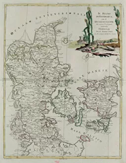
Background imageDenmark Collection: Kingdom of Denmark with the Duchy of Slesvik, engraving by G

Kingdom of Denmark with the Duchy of Slesvik, engraving by G. Zuliani taken from Tome III of the "Newest
3572576 Kingdom of Denmark with the Duchy of Slesvik, engraving by G. Zuliani taken from Tome III of the " Newest Atlas" published in Venice in 1781 by Antonio Zatta

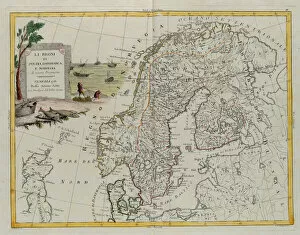
Background imageDenmark Collection: The Kingdoms of Sweden, Denmark and Norway, engraving by G. Zuliani taken from Tome III of

The Kingdoms of Sweden, Denmark and Norway, engraving by G. Zuliani taken from Tome III of the "Newest
3572574 The Kingdoms of Sweden, Denmark and Norway, engraving by G. Zuliani taken from Tome III of the " Newest Atlas" published in Venice in 1781 by Antonio Zatta

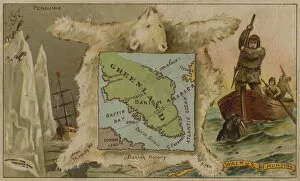
Background imageDenmark Collection: Greenland, penguins, polar bears and walrus hunting (chromolitho)

Greenland, penguins, polar bears and walrus hunting (chromolitho)
3105150 Greenland, penguins, polar bears and walrus hunting (chromolitho) by American School, (19th century); Private Collection; (add.info.: Greenland, penguins, polar bears and walrus hunting)

Background imageDenmark Collection: Map of the route taken by Vitus Bering (1681-1741) across Siberia to Kamchatka

Map of the route taken by Vitus Bering (1681-1741) across Siberia to Kamchatka
TRV227712 Map of the route taken by Vitus Bering (1681-1741) across Siberia to Kamchatka, from Navigantium atque Itinerantium Bibliotheca published 1744 (engraving) (b/w photo) by English School

Background imageDenmark Collection: Map of the Kingdom of Denmark (etching, 1730)

Map of the Kingdom of Denmark (etching, 1730)
LRI4706394 Map of the Kingdom of Denmark (etching, 1730) by Delisle, Guillaume (1675-1726); Private Collection; (add.info)

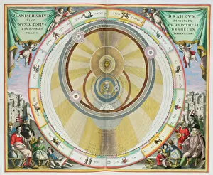
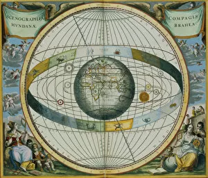
Background imageDenmark Collection: Map showing Tycho Brahes System of Planetary Orbits, from The Celestial Atlas

Map showing Tycho Brahes System of Planetary Orbits, from The Celestial Atlas
STC129824 Map showing Tycho Brahes System of Planetary Orbits, from The Celestial Atlas, or The Harmony of the Universe (Atlas coelestis seu harmonia macrocosmica) pub

Background imageDenmark Collection: Map of Northern Europe, from Civitates Orbis Terrarum

Map of Northern Europe, from Civitates Orbis Terrarum
STC138976 Map of Northern Europe, from Civitates Orbis Terrarum by Georg Braun (1541-1622) and Frans Hogenberg (1535-90) c.1572-1617 (coloured engraving) by Hoefnagel

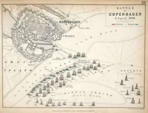
Background imageDenmark Collection: Map of the Battle of Copenhagen, published by William Blackwood and Sons

Map of the Battle of Copenhagen, published by William Blackwood and Sons
746916 Map of the Battle of Copenhagen, published by William Blackwood and Sons, Edinburgh & London, 1848 (hand-coloured engraving) by Johnston

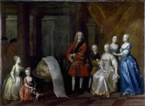
Background imageDenmark Collection: Group portrait of Frederick, Prince of Wales, with his brother the Duke of Cumberland

Group portrait of Frederick, Prince of Wales, with his brother the Duke of Cumberland
CTS336300 Group portrait of Frederick, Prince of Wales, with his brother the Duke of Cumberland and their five sisters, 1730 (oil on canvas) by Aikman

Background imageDenmark Collection: The Seat of War in Denmark (engraving)

The Seat of War in Denmark (engraving)
1103203 The Seat of War in Denmark (engraving) by English School, (19th century); Private Collection; (add.info.: The Seat of War in Denmark)

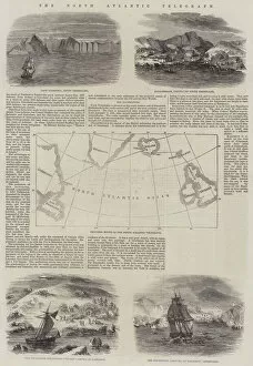
Background imageDenmark Collection: The North Atlantic Telegraph (engraving)

The North Atlantic Telegraph (engraving)
1612257 The North Atlantic Telegraph (engraving) by English School, (19th century); Private Collection; (add.info.: The North Atlantic Telegraph)

Background imageDenmark Collection: Schleswig-Holstein (engraving)

Schleswig-Holstein (engraving)
1096914 Schleswig-Holstein (engraving) by English School, (19th century); Private Collection; (add.info.: Schleswig-Holstein)

Background imageDenmark Collection: Geographic map of Denmark in 1861, with the Duches of Schleswig, Holstein and Lauenburg

Geographic map of Denmark in 1861, with the Duches of Schleswig, Holstein and Lauenburg
XEE4153844 Geographic map of Denmark in 1861, with the Duches of Schleswig, Holstein and Lauenburg. Engraving in " Le Monde Illustre" nA'200 of 9 February 1861

Background imageDenmark Collection: Map of the Nordic countries, kingdoms of Denmark, Sweden and Norway (etching, 1730)

Map of the Nordic countries, kingdoms of Denmark, Sweden and Norway (etching, 1730)
LRI4706363 Map of the Nordic countries, kingdoms of Denmark, Sweden and Norway (etching, 1730) by Delisle, Guillaume (1675-1726); Private Collection; (add.info.: Map of the Nordic countries)

Background imageDenmark Collection: Eutin, Germany and Tonder, Denmark (engraving, 1598)

Eutin, Germany and Tonder, Denmark (engraving, 1598)
LRI4715271 Eutin, Germany and Tonder, Denmark (engraving, 1598) by Hogenberg, Franz (1540-c.1590); Private Collection; (add.info.: Oitinense oppidulum et arx Episcopi Lubecensis sedes (Eutin)

Background imageDenmark Collection: Isle of Ven and Uranienborg, the palace and observatory of Tycho Brahe located on this

Isle of Ven and Uranienborg, the palace and observatory of Tycho Brahe located on this
LRI4714330 Isle of Ven and Uranienborg, the palace and observatory of Tycho Brahe located on this island, in the Sund (engraving, 1572-1617) by Hogenberg

Background imageDenmark Collection: Nova orbis terrarum, from Tabulae Rudolphinae by Johannes Kepler

Nova orbis terrarum, from Tabulae Rudolphinae by Johannes Kepler
3618828 Nova orbis terrarum, from Tabulae Rudolphinae by Johannes Kepler, 1627-30 (engraving) by German School, (17th century); 44x72 cm; (add.info)

Background imageDenmark Collection: The Danish Straits (chromolitho)

The Danish Straits (chromolitho)
735390 The Danish Straits (chromolitho) by European School, (19th century); Private Collection; (add.info.: The Danish Straits)

Background imageDenmark Collection: Map of Sixteenth Century Scandinavia, from the Sala delle Carte Geografiche

Map of Sixteenth Century Scandinavia, from the Sala delle Carte Geografiche
BEN90576 Map of Sixteenth Century Scandinavia, from the Sala delle Carte Geografiche (Hall of Geographical Maps) 1575 (oil on panel) by Bonsignori, Stefano and Danti

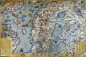
Background imageDenmark Collection: Scandinavia, detail from the Carta Marina da Olaus Magnus, 1572 (coloured engraving)

Scandinavia, detail from the Carta Marina da Olaus Magnus, 1572 (coloured engraving)
CHT214199 Scandinavia, detail from the Carta Marina da Olaus Magnus, 1572 (coloured engraving) by Lafreri, Antonio (1512-77); Institut Tessin, Hotel de Marle, Paris

Background imageDenmark Collection: Map Showing Tycho Brahes System of Planetary Orbits Around the Earth

Map Showing Tycho Brahes System of Planetary Orbits Around the Earth
STC129825 Map Showing Tycho Brahes System of Planetary Orbits Around the Earth, from The Celestial Atlas, or The Harmony of the Universe (Atlas coelestis seu harmonia macrocosmica) pub

Background imageDenmark Collection: Denmark (the Island Langeland with Odense) (engraving, 1596)

Denmark (the Island Langeland with Odense) (engraving, 1596)
LRI4716935 Denmark (the Island Langeland with Odense) (engraving, 1596) by Mercator, Gerardus (1512-94); Private Collection; (add.info.: Fionia)

Background imageDenmark Collection: Northern part of Jutland, Scandinavia (engraving, 1596)

Northern part of Jutland, Scandinavia (engraving, 1596)
LRI4716901 Northern part of Jutland, Scandinavia (engraving, 1596) by Mercator, Gerardus (1512-94); Private Collection; (add.info.: Iutia septentrionalis, 1631: Northern part of Jutland)

Background imageDenmark Collection: Map of Canada and Greenland (etching, 1730)

Map of Canada and Greenland (etching, 1730)
LRI4706965 Map of Canada and Greenland (etching, 1730) by Delisle, Guillaume (1675-1726); Private Collection; (add.info.: Map of Canada)

Background imageDenmark Collection: Map of the kingdoms of Norway, Sweden and Denmark (Engraving, 1717)

Map of the kingdoms of Norway, Sweden and Denmark (Engraving, 1717)
LRI4711470 Map of the kingdoms of Norway, Sweden and Denmark (Engraving, 1717) by Nolin, Jean-Baptiste (c.1657-1708); Private Collection; (add.info.: Map of the kingdoms of Norway)

Background imageDenmark Collection: Map of Scandinavia and Northern Europe, 1570 (engraving)

Map of Scandinavia and Northern Europe, 1570 (engraving)
LRI4704904 Map of Scandinavia and Northern Europe, 1570 (engraving) by Ortelius, Abraham (1527-98); Museo Navale di Pegli, Genoa, Italy; (add.info.: Septentrionalium Regionum Descrip)

Background imageDenmark Collection: Map of Denmark and southern Sweden, 1570 (engraving)

Map of Denmark and southern Sweden, 1570 (engraving)
LRI4704499 Map of Denmark and southern Sweden, 1570 (engraving) by Ortelius, Abraham (1527-98); Museo Navale di Pegli, Genoa

Background imageDenmark Collection: Antique Map of Denmark, 1890s, 19th Century

Antique Map of Denmark, 1890s, 19th Century

Background imageDenmark Collection: Antique Map of Copenhagen, Denmark, 19th Century

Antique Map of Copenhagen, Denmark, 19th Century

Background imageDenmark Collection: Fodina ferrea Danmorensis - A Danish Iron Mine (Aubry de La Mottrayes '

Fodina ferrea Danmorensis - A Danish Iron Mine (Aubry de La Mottrayes " Travels throughout Europe, Asia and into Part of Africa... " London, 1724, vol. II, pl. 35), 1723-24

Background imageDenmark Collection: Denmark 1851

Denmark 1851
A fine facimile artworked from an antique original map of Denmark, issued as part of the 1851 edition of John Tallis and Companys " The Illustrated Atlas and Modern History of the World"

Background imageDenmark Collection: Westminster WC2H 8 Map

Westminster WC2H 8 Map
Postcode Sector Map of Westminster WC2H 8

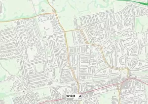
Background imageDenmark Collection: Ealing W13 8 Map

Ealing W13 8 Map
Postcode Sector Map of Ealing W13 8

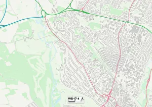
Background imageDenmark Collection: Watford WD17 4 Map

Watford WD17 4 Map
Postcode Sector Map of Watford WD17 4

Background imageDenmark Collection: Ashford TN23 7 Map

Ashford TN23 7 Map
Postcode Sector Map of Ashford TN23 7

Background imageDenmark Collection: Merton SW19 4 Map

Merton SW19 4 Map
Postcode Sector Map of Merton SW19 4

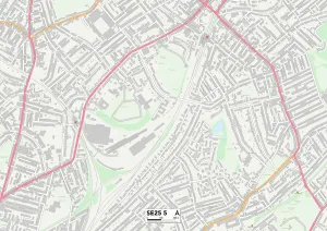
Background imageDenmark Collection: Croydon SE25 5 Map

Croydon SE25 5 Map
Postcode Sector Map of Croydon SE25 5

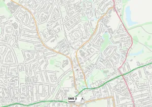
Background imageDenmark Collection: Sutton SM5 2 Map

Sutton SM5 2 Map
Postcode Sector Map of Sutton SM5 2

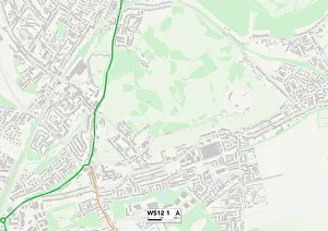
Background imageDenmark Collection: Cannock Chase WS12 1 Map

Cannock Chase WS12 1 Map
Postcode Sector Map of Cannock Chase WS12 1

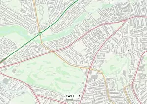
Background imageDenmark Collection: Richmond upon Thames TW2 5 Map

Richmond upon Thames TW2 5 Map
Postcode Sector Map of Richmond upon Thames TW2 5

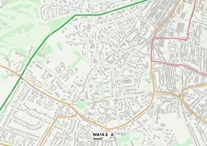
Background imageDenmark Collection: Trafford WA14 2 Map

Trafford WA14 2 Map
Postcode Sector Map of Trafford WA14 2

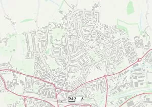
Background imageDenmark Collection: Somerset TA2 7 Map

Somerset TA2 7 Map
Postcode Sector Map of Somerset TA2 7

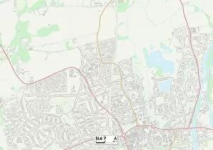
Background imageDenmark Collection: South Buckinghamshire SL6 7 Map

South Buckinghamshire SL6 7 Map
Postcode Sector Map of South Buckinghamshire SL6 7

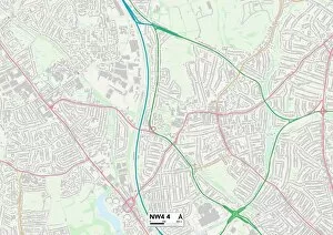
Background imageDenmark Collection: Barnet NW4 4 Map

Barnet NW4 4 Map
Postcode Sector Map of Barnet NW4 4

Background imageDenmark Collection: Brent NW6 5 Map

Brent NW6 5 Map
Postcode Sector Map of Brent NW6 5

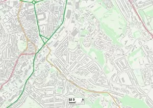
Background imageDenmark Collection: Sheffield S2 3 Map

Sheffield S2 3 Map
Postcode Sector Map of Sheffield S2 3

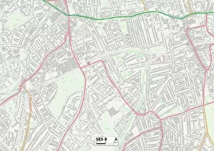
Background imageDenmark Collection: Lambeth SE5 8 Map

Lambeth SE5 8 Map
Postcode Sector Map of Lambeth SE5 8

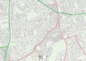
Background imageDenmark Collection: Lambeth SE5 9 Map

Lambeth SE5 9 Map
Postcode Sector Map of Lambeth SE5 9


All Professionally Made to Order for Quick Shipping


-

Denmark Collection

Denmark is a Nordic country located in Northern Europe and has a population of approximately 5.8 million people and covers an area of 42,924 square kilometers. The country is known for its high standard of living, social welfare system, and strong economy. Denmark's capital city is Copenhagen, which is also the largest city in the country with a population of over 600,000 people. A constitutional monarchy system with Queen Margrethe II as the current monarch. The official language spoken is Danish and the currency used is the Danish krone (DKK). A diverse landscape that includes beaches, forests, lakes, and islands scattered throughout the surrounding seas.
+

Our beautiful Wall Art and Photo Gifts include Framed Prints, Photo Prints, Poster Prints, Canvas Prints, Jigsaw Puzzles, Metal Prints and so much more

The Denmark collection from Media Storehouse offers a stunning selection of wall art and framed prints that showcase the beauty and history of Denmark. Our collection features a wide range of maps and charts that depict the country's geography, landmarks, cities, regions, and historical events. These high-quality prints are perfect for anyone who loves Danish culture or wants to add some unique décor to their home or office. From vintage maps dating back centuries to modern designs with vibrant colors, there is something for everyone in this collection. Each print is carefully crafted using premium materials such as archival paper and fade-resistant ink to ensure long-lasting quality. Whether you're looking for a striking centerpiece or an accent piece to complement your existing décor, these prints are sure to impress. The Denmark collection from Media Storehouse is an excellent choice for anyone who appreciates beautiful artwork that celebrates the rich history of this fascinating country.
+

What are Denmark (Maps and Charts) art prints?

Denmark art prints are a collection of high-quality, visually stunning prints that showcase the beauty and intricacies of Denmark's geography. These prints feature detailed maps and charts that highlight the country's topography, waterways, cities, towns, and landmarks. They are perfect for anyone who loves to travel or has an interest in geography. These art prints are created using state-of-the-art printing technology to ensure that they capture every detail of the original map or chart. The result is a beautiful piece of artwork that can be displayed in any home or office. Whether you're looking for a unique gift for someone special or want to add some visual interest to your own space, Denmark art prints are an excellent choice. With their intricate details and vibrant colors, these prints will transport you straight to Denmark without ever leaving your home.
+

What Denmark (Maps and Charts) art prints can I buy from Media Storehouse?

We offer a wide range of Denmark art prints, including maps and charts. These prints showcase the beauty and history of Denmark in stunning detail, making them perfect for anyone who loves this fascinating country. Whether you're looking for vintage maps or contemporary designs, we have something to suit every taste. Some of the most popular Denmark art prints available from Media Storehouse include detailed city maps that highlight all the major landmarks and attractions. You can also find beautiful coastal charts that show off the country's stunning coastline and islands. In addition to these traditional map-based designs, Media Storehouse also offers a range of artistic interpretations of Denmark. From abstract paintings to photographic collages, these unique prints capture the essence of this vibrant nation in a truly original way. So if you're looking for high-quality Denmark art prints that will add style and sophistication to your home or office, look no further than Media Storehouse.
+

How do I buy Denmark (Maps and Charts) art prints?

To purchase Denmark art prints from Media Storehouse, you can browse our extensive collection of high-quality images online. Once you have found the print that you would like to purchase, simply add it to your cart and proceed to checkout. You will be prompted to enter your shipping and payment information before completing your order. We offer a range of sizes for their art prints, so be sure to select the size that best fits your needs. We also offer framing options if you prefer a ready-to-hang piece. Their Denmark art prints are perfect for adding a touch of history or geography to any room in your home or office. Whether you are looking for a vintage map or a modern chart, we have something for everyone's taste. With our easy ordering process and fast shipping times, purchasing artwork has never been easier.
+

How much do Denmark (Maps and Charts) art prints cost?

We offer a wide range of Denmark maps and charts art prints. Our collection includes various styles and sizes to suit your preferences. The cost of our Denmark maps and charts art prints varies depending on the size, style, and material you choose. We have options ranging from small posters to large canvas prints that can fit any budget. Our Denmark maps and charts art prints are perfect for adding a touch of elegance to any room in your home or office. They make great gifts for anyone who loves history, geography or travel. You can browse our selection online at Media Storehouse without worrying about shipping costs or delivery times as we provide fast shipping services worldwide. Whether you're looking for a vintage map of Copenhagen or an antique chart of the North Sea, we've got you covered with high-quality Denmark maps and charts art prints that will last for years to come.
+

How will my Denmark (Maps and Charts) art prints be delivered to me?

Your Denmark art prints will be delivered to you in a safe and secure manner. We take great care in packaging your artwork so that it arrives at your doorstep undamaged. We use high-quality materials such as sturdy cardboard tubes or flat packaging to ensure that your prints are protected during transit. Once your order has been processed, our team will carefully package your artwork and dispatch it for delivery. Depending on the size of the print, we may use different courier services to deliver your order. However, rest assured that all our couriers are reliable and experienced in handling delicate items like art prints. When you receive your Denmark art prints, please inspect them carefully to ensure they have arrived in perfect condition. If there are any issues with the delivery or quality of the product, please do not hesitate to contact us so we can assist you further.