Fraud Blocker Skip to main content

Home > Maps and Charts > Germany

Germany Collection (#10)

Germany is a country located in central Europe with a population of over 83 million people and has a diverse landscape

6,586 Items

Background imageGermany Collection: Map of the Earl of Lancashire (England), circa 1870. 19th century lithography

Map of the Earl of Lancashire (England), circa 1870. 19th century lithography
NWI4875033 Map of the Earl of Lancashire (England), circa 1870. 19th century lithography.; (add.info.: Map of the Earl of Lancashire (England), circa 1870

Background imageGermany Collection: Map of the Earl of Hertford (England), circa 1870. 19th century lithography

Map of the Earl of Hertford (England), circa 1870. 19th century lithography
NWI4874966 Map of the Earl of Hertford (England), circa 1870. 19th century lithography.; (add.info.: Map of the Earl of Hertford (England), circa 1870

Background imageGermany Collection: German geographic map of Europe in 1810 during the Napoleonic Wars. Lithograph of the 19th century

German geographic map of Europe in 1810 during the Napoleonic Wars. Lithograph of the 19th century
NWI4871381 German geographic map of Europe in 1810 during the Napoleonic Wars. Lithograph of the 19th century; (add.info.: German geographic map of Europe in 1810 during the Napoleonic Wars)

Background imageGermany Collection: Map of the British Empire in the 10th and 11th centuries showing the counts

Map of the British Empire in the 10th and 11th centuries showing the counts and vassalite domain of the kingdom
NWI4874308 Map of the British Empire in the 10th and 11th centuries showing the counts and vassalite domain of the kingdom

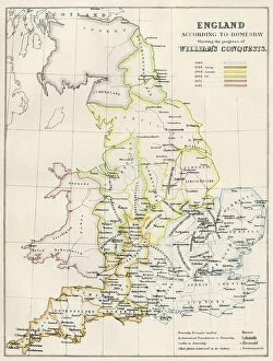
Background imageGermany Collection: Geographic map of England during the Norman Conquete (1066-1081)

Geographic map of England during the Norman Conquete (1066-1081). Norman invasion by William the Conquerant
NWI4873980 Geographic map of England during the Norman Conquete (1066-1081). Norman invasion by William the Conquerant. Colour engraving of the 19th century; (add.info)

Background imageGermany Collection: Geographic map of England and France when King Henry II came to power (1133-1189) in 1154

Geographic map of England and France when King Henry II came to power (1133-1189) in 1154
NWI4874482 Geographic map of England and France when King Henry II came to power (1133-1189) in 1154. Lithograph of the 19th century.; (add.info)

Background imageGermany Collection: Map of the Kingdom of Saxony (Germany) with Silesia, Boheme and Baviere, circa 1870

Map of the Kingdom of Saxony (Germany) with Silesia, Boheme and Baviere, circa 1870. 19th century lithography
NWI4871588 Map of the Kingdom of Saxony (Germany) with Silesia, Boheme and Baviere, circa 1870. 19th century lithography.; (add.info.: Map of the Kingdom of Saxony (Germany) with Silesia

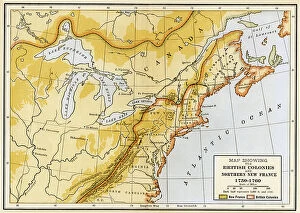
Background imageGermany Collection: Seven Years War (1756 to 1763): Map showing the English colonies

Seven Years War (1756 to 1763): Map showing the English colonies and northern New France during the war between
NWI4832711 Seven Years War (1756 to 1763): Map showing the English colonies and northern New France during the war between the French settlers and the Indians in the 1750s

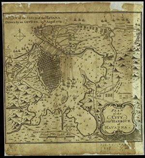
Background imageGermany Collection: Map of the city of Havana at the time of the siege of the British fleet in the port on 6/06/1762

Map of the city of Havana at the time of the siege of the British fleet in the port on 6/06/1762
VEN5031279 Map of the city of Havana at the time of the siege of the British fleet in the port on 6/06/1762. Card made on 15/08/1762

Background imageGermany Collection: Geologist William Smith

Geologist William Smith
NWI4947941 Geologist William Smith.; (add.info.: Geologist William Smith.); Photo © North Wind Pictures

Background imageGermany Collection: Dress during the Protectorate, 1653-1659. She wears five ribbons in her hair, a tall lace collar

Dress during the Protectorate, 1653-1659. She wears five ribbons in her hair, a tall lace collar
FLO4594692 Dress during the Protectorate, 1653-1659. She wears five ribbons in her hair, a tall lace collar, a black dress with green sleeves and scarlet shoulders over embroidered petticoats

Background imageGermany Collection: Map of an estate in East Sheen, Surrey, surveyed and delineated using a theodolite by James

Map of an estate in East Sheen, Surrey, surveyed and delineated using a theodolite by James Wadmore, 1811
FLO4593042 Map of an estate in East Sheen, Surrey, surveyed and delineated using a theodolite by James Wadmore, 1811. Copperplate engraving by W

Background imageGermany Collection: A European auroch has big horns attacked by wolves. Also called Ure (Bos primigenius)

A European auroch has big horns attacked by wolves. Also called Ure (Bos primigenius)
FLO4639223 A European auroch has big horns attacked by wolves. Also called Ure (Bos primigenius), the extinct ancestor of domestic cattle was a wild species, which lived in Europe

Background imageGermany Collection: Ichthyosaurus (fish lezard), is a genus of marine giant reptiles from the Jurassic period

Ichthyosaurus (fish lezard), is a genus of marine giant reptiles from the Jurassic period
FLO4639209 Ichthyosaurus (fish lezard), is a genus of marine giant reptiles from the Jurassic period. Colour illustration by Heinrich Harder (1858-1935)

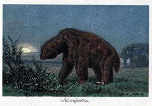
Background imageGermany Collection: Megatherium americanum or large American bete, a terrestrial mammal 6 meters long

Megatherium americanum or large American bete, a terrestrial mammal 6 meters long and weighing 3 tons
FLO4639207 Megatherium americanum or large American bete, a terrestrial mammal 6 meters long and weighing 3 tons, living in America in the Pleistocene era

Background imageGermany Collection: Plan of a large boat, with balancers and platform, built by the natives of the island Tinian

Plan of a large boat, with balancers and platform, built by the natives of the island Tinian (Mariana Islands, USA)
FLO4636310 Plan of a large boat, with balancers and platform, built by the natives of the island Tinian (Mariana Islands, USA)

Background imageGermany Collection: Ethnographische karte von Europa (ethnographic map of Europe) published in Germany

Ethnographische karte von Europa (ethnographic map of Europe) published in Germany
PCT4292188 Ethnographische karte von Europa (ethnographic map of Europe) published in Germany, late 19th century (around 1894)

Background imageGermany Collection: Plan of Aubusson Gardens (18th century)

Plan of Aubusson Gardens (18th century)
LSE4087254 Plan of Aubusson Gardens (18th century).; Private Collection; (add.info.: Plan of Aubusson Gardens (18th century).); Photo © Leonard de Selva

Background imageGermany Collection: First World War: France, Humorous map showing a French soldier in uniform laying down a German

First World War: France, Humorous map showing a French soldier in uniform laying down a German soldier with a comment
LUX4736264 First World War: France, Humorous map showing a French soldier in uniform laying down a German soldier with a comment: " the boche is dying in the Aisne"

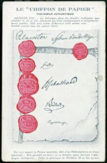
Background imageGermany Collection: First World War: France, Patriotic Map showing a facsimile of the paper cloth

First World War: France, Patriotic Map showing a facsimile of the paper cloth
LUX4739851 First World War: France, Patriotic Map showing a facsimile of the paper cloth (non-respect of the Germans for Belgian neutrality) with a patriotic commentary by Rene des Alyscanps

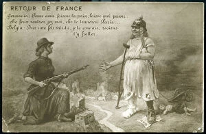
Background imageGermany Collection: First World War: France, Patriotic Map showing Germany asking Belgium to let her pass

First World War: France, Patriotic Map showing Germany asking Belgium to let her pass and return home, 1917
LUX4739448 First World War: France, Patriotic Map showing Germany asking Belgium to let her pass and return home, 1917, Return from France'; (add.info)

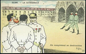
Background imageGermany Collection: First World War: France, Patriotic Map showing three German officers plotting the destruction of

First World War: France, Patriotic Map showing three German officers plotting the destruction of the cathedral of
LUX4739424 First World War: France, Patriotic Map showing three German officers plotting the destruction of the cathedral of Reims, 1914

Background imageGermany Collection: First World War: France, Patriotic Map showing a scarecrow disguise in William II unable to scare

First World War: France, Patriotic Map showing a scarecrow disguise in William II unable to scare birds
LUX4739397 First World War: France, Patriotic Map showing a scarecrow disguise in William II unable to scare birds, titled: The sparrows themselves are no longer afraid of it, 1915

Background imageGermany Collection: First World War: Patriotic Map showing a French soldier, an English soldier

First World War: Patriotic Map showing a French soldier, an English soldier
LUX4744803 First World War: Patriotic Map showing a French soldier, an English soldier and a Belgian soldier having fun reading the soldiers letters and entitled Dans les trchees

Background imageGermany Collection: Patriotic map showing in a dream trench a Belgian soldier plays an accordeon air in front of

Patriotic map showing in a dream trench a Belgian soldier plays an accordeon air in front of cheerful French
LUX4743619 Patriotic map showing in a dream trench a Belgian soldier plays an accordeon air in front of cheerful French and English soldiers

Background imageGermany Collection: First World War: Patriotic map showing a Belgian soldier and a French soldier repelling

First World War: Patriotic map showing a Belgian soldier and a French soldier repelling the Prussians in the Marne
LUX4743991 First World War: Patriotic map showing a Belgian soldier and a French soldier repelling the Prussians in the Marne and entitled Les Prussiens sont dans la Marne, 1914

Background imageGermany Collection: First World War: France, Propaganda map showing a British tank in action, 1918

First World War: France, Propaganda map showing a British tank in action, 1918
LUX4742268 First World War: France, Propaganda map showing a British tank in action, 1918; (add.info.: World War I - War 14-18 (1914-1918) - World War I (WWI or WW1): France

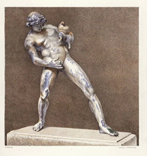
Background imageGermany Collection: Bronze statue of a drunken faun from the house of the Patrician, Regio IX, Insula VIII

Bronze statue of a drunken faun from the house of the Patrician, Regio IX, Insula VIII. Now in the Museum of Naples
FLO4687177 Bronze statue of a drunken faun from the house of the Patrician, Regio IX, Insula VIII. Now in the Museum of Naples. Chromolithograph by J.G

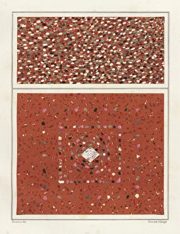
Background imageGermany Collection: Floors with colourful marble stones from the House of the Epigrams, Regio V, Insula 1, 18

Floors with colourful marble stones from the House of the Epigrams, Regio V, Insula 1, 18
FLO4687149 Floors with colourful marble stones from the House of the Epigrams, Regio V, Insula 1, 18. Chromolithograph by Victor Steeger after an illustration by Geremia Discanno from Emile Presuhn

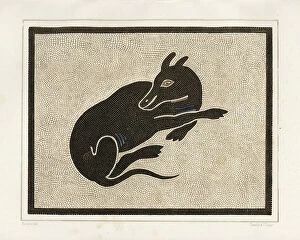
Background imageGermany Collection: Mosaic of a dog from the porter's threshold in the House of Vesonius Primus, a fuller

Mosaic of a dog from the porter's threshold in the House of Vesonius Primus, a fuller
FLO4687127 Mosaic of a dog from the porter's threshold in the House of Vesonius Primus, a fuller. Chromolithograph by Victor Steeger after an illustration by Geremia Discanno from Emile Presuhn

Background imageGermany Collection: Mosaic picture of a guard dog in the house of Lucius Caecilius Iucundus

Mosaic picture of a guard dog in the house of Lucius Caecilius Iucundus. Chromolithograph by Victor Steeger after an
FLO4687103 Mosaic picture of a guard dog in the house of Lucius Caecilius Iucundus. Chromolithograph by Victor Steeger after an illustration by Geremia Discanno from Emile Presuhn (1844-1878)

Background imageGermany Collection: Mural from unidentified building in Pompeii. Chromolithograph by Victor Steeger after an

Mural from unidentified building in Pompeii. Chromolithograph by Victor Steeger after an illustration by Geremia
FLO4686891 Mural from unidentified building in Pompeii. Chromolithograph by Victor Steeger after an illustration by Geremia Discanno from Emile Presuhn (1844-1878)

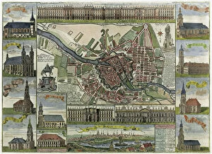
Background imageGermany Collection: Map of Berlin showing the fortress and numerous churches. Late 17th century (chromolithograph)

Map of Berlin showing the fortress and numerous churches. Late 17th century (chromolithograph)
529595 Map of Berlin showing the fortress and numerous churches. Late 17th century (chromolithograph); Universal History Archive/UIG

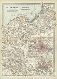
Background imageGermany Collection: Map of the German Empire with Berlin and Hamburg, c.1900 (engraving)

Map of the German Empire with Berlin and Hamburg, c.1900 (engraving)
532964 Map of the German Empire with Berlin and Hamburg, c.1900 (engraving); (add.info.: Map showing the eastern part of the German Empire, with inset maps of Berlin and Hamburg, circa 1902)

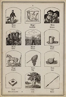
Background imageGermany Collection: Man, Map, Men, Mob, Mow, Mug, Nag, Net, Nut, Nut, Oak, Oar (engraving)

Man, Map, Men, Mob, Mow, Mug, Nag, Net, Nut, Nut, Oak, Oar (engraving)
8649982 Man, Map, Men, Mob, Mow, Mug, Nag, Net, Nut, Nut, Oak, Oar (engraving) by German School, (19th century) (after); Private Collection; (add.info.: Man, Map, Men, Mob, Mow, Mug, Nag, Net, Nut)

Background imageGermany Collection: Overview of the sewage system of Berlin (colour litho)

Overview of the sewage system of Berlin (colour litho)
8663951 Overview of the sewage system of Berlin (colour litho) by German School, (19th century) (after); Private Collection; (add.info.: Overview of the sewage system of Berlin)

Background imageGermany Collection: Battle of Salamis, 480 BC (engraving)

Battle of Salamis, 480 BC (engraving)
8663911 Battle of Salamis, 480 BC (engraving) by German School, (20th century); Private Collection; (add.info.: Map showing the Greek and Persian fleets at the Battle of Salamis, 480 BC)

Background imageGermany Collection: Map of Switzerland (litho)

Map of Switzerland (litho)
8661130 Map of Switzerland (litho) by English School, (20th century); Private Collection; (add.info.: Map of Switzerland. The Swiss nation offers an instance of a unique historical freak)

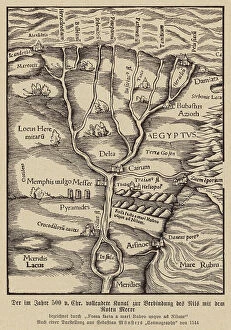
Background imageGermany Collection: Canal connecting the Nile and the Red Sea, 500 BC (engraving)

Canal connecting the Nile and the Red Sea, 500 BC (engraving)
8663872 Canal connecting the Nile and the Red Sea, 500 BC (engraving) by German School, (16th century) (after); Private Collection; (add.info.: Canal connecting the Nile and the Red Sea, Egypt)

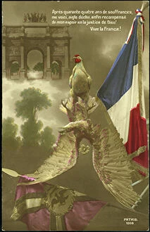
Background imageGermany Collection: First World War: Patriotic map showing a Gallic rooster terassing the German eagle and its flag

First World War: Patriotic map showing a Gallic rooster terassing the German eagle and its flag, 1917
LUX4745183 First World War: Patriotic map showing a Gallic rooster terassing the German eagle and its flag, 1917; (add.info.: World War I - War 14-18 (1914-1918) - World War I (WWI or WW1)

Background imageGermany Collection: First World War: France, Patriotic Map showing soldier in a trench with his studio machine gun

First World War: France, Patriotic Map showing soldier in a trench with his studio machine gun
LUX4743003 First World War: France, Patriotic Map showing soldier in a trench with his studio machine gun and a German helmet as decoration saying " we will hold said the machine gun pierking

Background imageGermany Collection: Duck-beaked dinosaur of the family Hardrosaurides, herbivores of the Upper Cretace

Duck-beaked dinosaur of the family Hardrosaurides, herbivores of the Upper Cretace
FLO4639177 Duck-beaked dinosaur of the family Hardrosaurides, herbivores of the Upper Cretace. Colour illustration by Heinrich Harder (1858-1935)

Background imageGermany Collection: Map of the Count of Devon (England), circa 1870. 19th century lithography

Map of the Count of Devon (England), circa 1870. 19th century lithography
NWI4874798 Map of the Count of Devon (England), circa 1870. 19th century lithography.; (add.info.: Map of the Count of Devon (England), circa 1870

Background imageGermany Collection: The diagram of the globe of 1492 by Martin Behaim (1459-1507, German cartographer and navigator)

The diagram of the globe of 1492 by Martin Behaim (1459-1507, German cartographer and navigator)
NWI4846980 The diagram of the globe of 1492 by Martin Behaim (1459-1507, German cartographer and navigator), describing the totality of the world, without the New World (American continent)

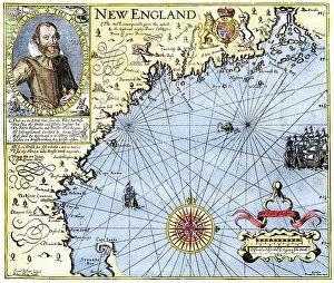
Background imageGermany Collection: Map of New England by John Smith of Jamestown (1580-1631) with his portrait, circa 1620

Map of New England by John Smith of Jamestown (1580-1631) with his portrait, circa 1620. Engraving of the 19th century
NWI4851262 Map of New England by John Smith of Jamestown (1580-1631) with his portrait, circa 1620. Engraving of the 19th century.; (add.info)

Background imageGermany Collection: World Map and Wind Map

World Map and Wind Map
2531457 World Map and Wind Map; (add.info.: Science. Geography. Mappemonde and wind map. Woodcut in: Geography, by Claudius Ptolemy, Basel (Switzerland), 1545

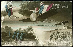
Background imageGermany Collection: First World War: France, Drawing map showing the bird of France: a plane Bleriot, 1915

First World War: France, Drawing map showing the bird of France: a plane Bleriot, 1915
LUX4735285 First World War: France, Drawing map showing the bird of France: a plane Bleriot, 1915; (add.info.: World War I - War 14-18 (1914-1918) - World War I (WWI or WW1): France

Background imageGermany Collection: First World War: France, Patriotic Map showing Joan of Arc in armor protecting France against her

First World War: France, Patriotic Map showing Joan of Arc in armor protecting France against her German barbarians
LUX4739154 First World War: France, Patriotic Map showing Joan of Arc in armor protecting France against her German barbarians with her sword, entitled Go T'en


All Professionally Made to Order for Quick Shipping


-

Germany Collection

Germany is a country located in central Europe with a population of over 83 million people and has a diverse landscape, ranging from the Alps in the south to the North Sea and Baltic Sea coasts in the north. The country is known for its strong economy, which is driven by industries such as automotive manufacturing, engineering, and pharmaceuticals. It also has a rich cultural history, with famous composers like Beethoven and Bach hailing from the country. Its capital city Berlin is renowned for its vibrant art scene and historical landmarks such as the Brandenburg Gate.
+

Our beautiful Wall Art and Photo Gifts include Framed Prints, Photo Prints, Poster Prints, Canvas Prints, Jigsaw Puzzles, Metal Prints and so much more

The Germany collection from Media Storehouse offers a wide selection of wall art and framed prints that showcase the beauty, history, and culture of Germany. Our collection features an array of maps and charts that depict the country's geography, landmarks, cities, regions, and historical events. From vintage maps to modern designs, our collection caters to different tastes and preferences. Some of the popular items in our collection include antique city plans of Berlin or Munich; topographic maps of Bavaria or Black Forest; political maps showing Germany's borders over time; charts illustrating Germanic tribes' migration patterns during ancient times. These artworks are available in various sizes and formats such as canvas prints or traditional frames. They make great decorations for homes, offices or public spaces like museums or libraries. The Germany collection is a must-see for anyone interested in exploring the rich heritage of this fascinating country through visual art.
+

What are Germany (Maps and Charts) art prints?

Germany art prints are high-quality reproductions of historical maps and charts depicting various regions, cities, and landmarks in Germany. These prints showcase the intricate details of the original maps and charts, including topography, street names, buildings, rivers, and other geographical features. These art prints are perfect for history enthusiasts who want to explore Germany's rich cultural heritage or for those who simply appreciate beautiful cartographic artwork. They can be used as decorative pieces in homes or offices or as educational tools in schools and libraries. We offer a wide range of Germany art prints that cater to different tastes and preferences. You can choose from vintage-style sepia-toned maps to colorful contemporary designs that highlight specific areas or themes such as wine regions or cycling routes. These art prints provide a unique way to experience Germany's geography and history while adding aesthetic value to any space.
+

What Germany (Maps and Charts) art prints can I buy from Media Storehouse?

We offer a wide range of Germany maps and charts art prints that you can purchase. These include vintage maps, city plans, topographical charts, and historical atlases. You can choose from different styles and sizes to suit your preferences. One popular option is the antique map of Germany created by cartographer Gerard Mercator in 1595. This beautifully detailed map shows the country's regions, cities, rivers, and mountains as they were known during the Renaissance period. Another interesting print is the Berlin Wall Map which depicts the infamous wall that divided East and West Berlin during the Cold War era. The map includes details on checkpoints, watchtowers, escape tunnels and other features related to this historic event. Whether you are looking for a decorative piece for your home or office or an educational resource for teaching purposes, we have a variety of Germany maps and charts art prints available to suit your needs.
+

How do I buy Germany (Maps and Charts) art prints?

To buy Germany art prints from Media Storehouse, you can browse our extensive collection of high-quality prints online. Simply search for the specific artwork or artist you are interested in, or filter by category to find maps and charts related to Germany. Once you have found a print that catches your eye, select the size and format that best suits your needs. We offer a range of options for printing on different materials such as canvas, photographic paper, and fine art paper. You can also choose to have your print framed or unframed depending on your preference. Once you have made your selection, simply add it to your cart and proceed to checkout. Payment is easy with various payment methods available including credit card payments. Buying Germany art prints from Media Storehouse is a straightforward process that allows you to easily access beautiful artworks at affordable prices.
+

How much do Germany (Maps and Charts) art prints cost?

We offer a wide range of Germany art prints at varying prices. Our collection includes vintage maps, historical charts, and modern interpretations of the country's geography. The cost of each print depends on several factors such as size, framing options, and printing material. We understand that every customer has unique preferences when it comes to purchasing art prints. That is why we have made sure to provide a diverse selection that caters to different tastes and budgets. Whether you are looking for an affordable poster or a high-quality canvas print, we have something for everyone. Our Germany art prints make great additions to any home or office space. They are not only aesthetically pleasing but also educational pieces that can spark interesting conversations about history and geography. So if you're interested in adding some German-inspired artwork to your collection, be sure to check out our selection today.
+

How will my Germany (Maps and Charts) art prints be delivered to me?

Your Germany art prints will be delivered to you in a safe and secure manner by our trusted delivery partners. We take great care to ensure that your artwork is packaged with the utmost care, so it arrives at your doorstep in pristine condition. Depending on the size of your order, we may use different shipping methods such as standard post or courier services. We understand how important it is for you to receive your artwork promptly, which is why we work hard to dispatch all orders as quickly as possible. Once dispatched, you will receive an email notification containing tracking information so that you can keep track of your package's progress. We are committed to providing our customers with high-quality products and exceptional service. If for any reason you are not completely satisfied with your purchase, please do not hesitate to contact us so that we can resolve any issues promptly.