Fraud Blocker Skip to main content

Mouse Mat > Maps and Charts > Ireland

Ireland Mouse Mat Collection (#31)

Brighten up your desk with our Ireland collection of mouse mats from Media Storehouse. These high-quality mouse mats feature intricately detailed maps and charts of Ireland, making them a perfect addition to any home or office. The non-slip rubber base ensures a stable surface for your mouse, while the smooth, microfiber surface provides a comfortable and efficient gliding surface. Each mouse mat is printed with vibrant colors and sharp lines, bringing the beauty of Ireland right to your fingertips. Order yours today and bring a touch of Irish charm to your workspace.
Ireland is an island nation located in the northwestern part of Europe

1,480 Mouse Mats

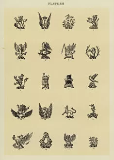
Background imageIreland Mouse Mat Collection: llustration for Fairbairns Book of Crests (engraving)

llustration for Fairbairns Book of Crests (engraving)
7178490 llustration for Fairbairns Book of Crests (engraving) by English School, (20th century); Private Collection; (add.info)

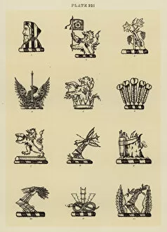
Background imageIreland Mouse Mat Collection: llustration for Fairbairns Book of Crests (engraving)

llustration for Fairbairns Book of Crests (engraving)
7178489 llustration for Fairbairns Book of Crests (engraving) by English School, (20th century); Private Collection; (add.info)

Background imageIreland Mouse Mat Collection: Covent Garden Market (engraving)

Covent Garden Market (engraving)
7165948 Covent Garden Market (engraving) by English School, (19th century); Private Collection; (add.info.: Covent Garden Market)

Background imageIreland Mouse Mat Collection: Western Europe At Night, Satellite Image. Lights of Western Europe at night from space. Coloured ima

Western Europe At Night, Satellite Image. Lights of Western Europe at night from space. Coloured image derived from satellite data showing Western Europe at night

Background imageIreland Mouse Mat Collection: London Architecture (engraving)

London Architecture (engraving)
587497 London Architecture (engraving) by English School, (19th century); Private Collection; (add.info.: Mark Elphick, wine and spirit merchant, 59 Newington Causeway, London)

Background imageIreland Mouse Mat Collection: London Architecture (engraving)

London Architecture (engraving)
587496 London Architecture (engraving) by English School, (19th century); Private Collection; (add.info.: Egyptian Hall and part of Piccadilly, London)

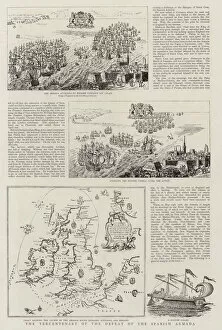
Background imageIreland Mouse Mat Collection: The Tercentenary of the Defeat of the Spanish Armada (engraving)

The Tercentenary of the Defeat of the Spanish Armada (engraving)
1041436 The Tercentenary of the Defeat of the Spanish Armada (engraving) by English School, (19th century); Private Collection; (add.info.: The Tercentenary of the Defeat of the Spanish Armada)

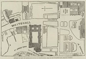
Background imageIreland Mouse Mat Collection: Attempt to blow up Government Offices at Westminster, Plan of the Buildings and Adjacent Streets

Attempt to blow up Government Offices at Westminster, Plan of the Buildings and Adjacent Streets (engraving)
1624288 Attempt to blow up Government Offices at Westminster, Plan of the Buildings and Adjacent Streets (engraving) by English School

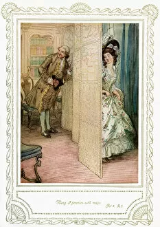
Background imageIreland Mouse Mat Collection: Richard Brinsley Sheridans play

Richard Brinsley Sheridans play
3777398 Richard Brinsley Sheridans play by Thomson, Hugh (1860-1920); (add.info.: Richard Brinsley Sheridans play- The School for Scandal. Act 4, Scene 1- Hung, I perceive with maps)

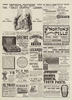
Background imageIreland Mouse Mat Collection: Page of Advertisements (engraving)

Page of Advertisements (engraving)
1056409 Page of Advertisements (engraving) by English School, (19th century); Private Collection; (add.info.: Page of Advertisements)

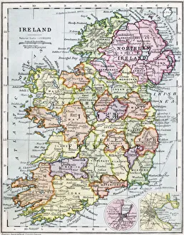
Background imageIreland Mouse Mat Collection: Antique Map of Ireland

Antique Map of Ireland 1898

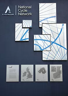
Background imageIreland Mouse Mat Collection: Ireland, North, Belfast

Ireland, North, Belfast, Sign mapping the Laganside National Cycle Network on Donegall Quay

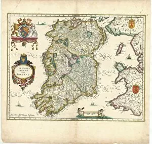
Background imageIreland Mouse Mat Collection: Map Hibernia Regnvm vulgo Ireland Copperplate print

Map Hibernia Regnvm vulgo Ireland Copperplate print
Map, Hibernia Regnvm vulgo Ireland, Copperplate print

Background imageIreland Mouse Mat Collection: Large map siege Namur first text sheet 1695 Plan de la Ville

Large map siege Namur first text sheet 1695 Plan de la Ville
Large map of the siege of Namur (first text sheet), 1695 Plan de la Ville and the Chateau de Namur, dance l etat qu etoit cette Place lors qu elle fut assee et reprise

Background imageIreland Mouse Mat Collection: Map Great Britain Chart shewing several Places

Map Great Britain Chart shewing several Places
Map of Great Britain A Chart shewing the several Places of Action between the English and Spanish Fleets, with the Places where serval of the Spanish Ships were destroyed in their return to Spain

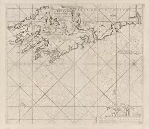
Background imageIreland Mouse Mat Collection: Map part south coast Ireland New Passage suyt syde

Map part south coast Ireland New Passage suyt syde
Map of a part of the south coast of Ireland New Passage of the suyt syde of Yrlandt (title on object), Map of a part of the south coast of Ireland with two compass roses, the North is above

Background imageIreland Mouse Mat Collection: Pass card part coast Ireland England France Spain Pass card

Pass card part coast Ireland England France Spain Pass card
Pass card of a part of the coast of Ireland, England, France and Spain Pass card of the Bight of Vrankryck Biscaien and Galissen the income of the Canaal as Meden t Channel of Bristol

Background imageIreland Mouse Mat Collection: Map Of Ireland From The History Of Ireland By Thomas Wright, Published In London Circa 1854

Map Of Ireland From The History Of Ireland By Thomas Wright, Published In London Circa 1854

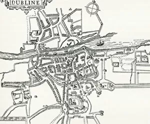
Background imageIreland Mouse Mat Collection: Map Of Dublin, Ireland In 1610. From Our Own Country Published 1898

Map Of Dublin, Ireland In 1610. From Our Own Country Published 1898

Background imageIreland Mouse Mat Collection: Chart Of The Spanish Armadas Course In 1588. From The Book Short History Of The English People By

Chart Of The Spanish Armadas Course In 1588. From The Book Short History Of The English People By J. R
Chart Of The Spanish Armadas Course In 1588. From The Book Short History Of The English People By J.R. Green Published London 1893

Background imageIreland Mouse Mat Collection: Irish Free State And Northern Ireland. From Bacons Excelsior Atlas Of The World

Irish Free State And Northern Ireland. From Bacons Excelsior Atlas Of The World, Published Circa 1930

Background imageIreland Mouse Mat Collection: Map Of Ireland In The Sixth Century From The Book The Church Of England A History For The People

Map Of Ireland In The Sixth Century From The Book The Church Of England A History For The People Published C. 1910
Map Of Ireland In The Sixth Century From The Book The Church Of England A History For The People Published C.1910

Background imageIreland Mouse Mat Collection: Map Of The British Isles, Circa. 1760. From 'Atlas De Toutes Les Parties Connues Du Globe

Map Of The British Isles, Circa. 1760. From "Atlas De Toutes Les Parties Connues Du Globe Terrestre "By
Map Of The British Isles, Circa.1760. From " Atlas De Toutes Les Parties Connues Du Globe Terrestre " By Cartographer Rigobert Bonne. Published Geneva Circa. 1760

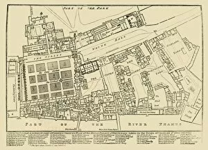
Background imageIreland Mouse Mat Collection: A reduced copy of Fishers Ground Plan of the Royal Palace of Whitehall, 1680, (1881)

A reduced copy of Fishers Ground Plan of the Royal Palace of Whitehall, 1680, (1881)
A reduced copy of Fishers Ground Plan of the Royal Palace of Whitehall, taken in the Reign of Charles 2d. 1680, (1881). John Fishers map of the Palace of Whitehall in the village of Westminster

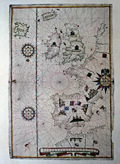
Background imageIreland Mouse Mat Collection: Atlas of Joan Martines, Messina, 1582. Portulan chart of Western Europe showing the

Atlas of Joan Martines, Messina, 1582. Portulan chart of Western Europe showing the Iberian peninsula, France, the Netherlands, Great Britain, Ireland and Iceland

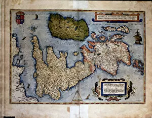
Background imageIreland Mouse Mat Collection: Theatrum Orbis Terrarum by Abraham Ortelius, Antwerp, 1574, map of United Kingdom and Ireland

Theatrum Orbis Terrarum by Abraham Ortelius, Antwerp, 1574, map of United Kingdom and Ireland

Background imageIreland Mouse Mat Collection: Trade card for William Allen, Map and Print Seller in Dublin, late

Trade card for William Allen, Map and Print Seller in Dublin, late... late 18th-early 19th century. Creator: Anon
Trade card for William Allen, Map and Print Seller in Dublin, late 18th-early 19th century

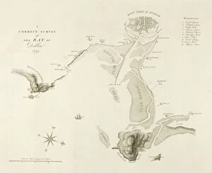
Background imageIreland Mouse Mat Collection: A Correct Survey of the Bay of Dublin, published December 1795. Creator: James Malton

A Correct Survey of the Bay of Dublin, published December 1795. Creator: James Malton
A Correct Survey of the Bay of Dublin, published December 1795

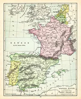
Background imageIreland Mouse Mat Collection: Map of Europe 1895

Map of Europe 1895
The Rand-McNally Grammar School Geography 1895 - Chicago & New York

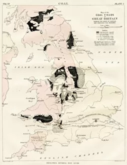
Background imageIreland Mouse Mat Collection: Coal fields of great britain map 1884

Coal fields of great britain map 1884
Encyclopedia Britannica 9th Edition New York Charles Scribners and Sons 1884 Vol VI

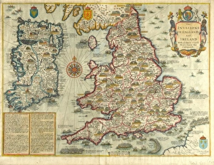
Background imageIreland Mouse Mat Collection: Map: The Invasions of England and Ireland - 1627

Map: The Invasions of England and Ireland - 1627
Map: The Invasions of England and Ireland With al [sic] their Civill [sic] Wars since the Conquest Corn Danckertsz sculpsit [London] George Humble, 1627 (c)

Background imageIreland Mouse Mat Collection: Victorian Map of Europe

Victorian Map of Europe
Engraved illustrations of Europe in the Time of Charlemagne from Iconographic Encyclopedia of Science, Literature and Art, Published in 1851. Copyright has expired on this artwork. Digitally restored

Background imageIreland Mouse Mat Collection: Map of British Isles 1897

Map of British Isles 1897
Map of British Isles

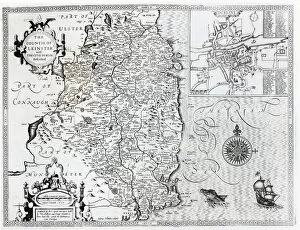
Background imageIreland Mouse Mat Collection: The County of Leinster with the City of Dublin Described, engraved by Jodocus Hondius (1563-1612)

The County of Leinster with the City of Dublin Described, engraved by Jodocus Hondius (1563-1612)
XJF105449 The County of Leinster with the City of Dublin Described, engraved by Jodocus Hondius (1563-1612), from Theatre of the Empire of Great Britain, pub

Background imageIreland Mouse Mat Collection: Orteliuss map of Europe, 1603

Orteliuss map of Europe, 1603
Orteliuss map of Europe. This map of Europe is from the 1603 edition of Theatrum orbis terrarum (Theatre of the World). First published in 1570 by Flemish mapmaker Abraham Ortelius (1527-1598)

Background imageIreland Mouse Mat Collection: Structural geological units of Britain and Ireland

Structural geological units of Britain and Ireland
Map shows the main structural units of Britain, Ireland and surrounding seas. Fig 10 from Britain Before Man (1978), a Geological Museum publication

Background imageIreland Mouse Mat Collection: Spanish Armadas route in 1588

Spanish Armadas route in 1588
Chart of the Spanish Armadas course, 1588. Hand-colored engraving

Background imageIreland Mouse Mat Collection: Fate Magazine cover, Bridey Murphy in Ireland

Fate Magazine cover, Bridey Murphy in Ireland
Cover of Fate Magazine, depicting Bridey Murphy (alias Ruth Simmons, alias Virginia Tighe) -- the subject of a reincarnation experience visiting Ireland, home of the supposed Bridey Murphy

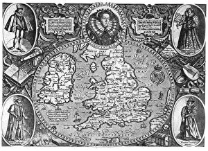
Background imageIreland Mouse Mat Collection: Map of England, 16th century, (1896)

Map of England, 16th century, (1896)
Map of Britain, 16th century, (1896). A map of England, Wales and Ireland featuring Queen Elizabeth I (1533-1603)

Background imageIreland Mouse Mat Collection: Postcard advertising golfing trips to Ireland, c1910

Postcard advertising golfing trips to Ireland, c1910. Travelling by the London and North Western Railway, operating between the ports of Liverpool, Heysham and Stranraer


All Professionally Made to Order for Quick Shipping


-

Ireland Mouse Mat Collection

Ireland is an island nation located in the northwestern part of Europe. It covers an area of 70,273 square kilometers and has a population of approximately 4.9 million people. The country is divided into four provinces: Leinster, Munster, Connacht, and Ulster. Ireland's capital city is Dublin which is also its largest city. The official languages are Irish and English with Catholicism being the predominant religion. Ireland's economy relies heavily on exports particularly in pharmaceuticals, software development, and financial services sectors. Its natural beauty attracts millions of tourists annually to explore its rugged coastline, rolling hillsides dotted with sheep farms as well as ancient castles and ruins dating back centuries ago.
+

Our beautiful Wall Art and Photo Gifts include Framed Prints, Photo Prints, Poster Prints, Canvas Prints, Jigsaw Puzzles, Metal Prints and so much more

The Ireland collection from Media Storehouse is a stunning compilation of vintage maps and charts that depict the beautiful landscapes, cities, towns, and coastlines of Ireland. Our collection features an extensive range of prints that showcase different regions in Ireland, including Dublin City Centre, Cork Harbour, Galway Bay, Connemara National Park, Ring of Kerry and many more. These maps are carefully curated to provide a unique perspective on the history and geography of Ireland. They offer a glimpse into the past with their intricate details such as old road networks or historical landmarks. Our collection includes both black-and-white and color prints which can be customized to suit any decor style. Whether you're looking for wall art for your home or office space or searching for unique gifts for loved ones who have an affinity towards Irish culture or heritage - our collection has something special to offer everyone. These high-quality framed prints make perfect additions to any room's decor while also being educational pieces that spark conversations about Irish history and geography.
+

What are Ireland (Maps and Charts) art prints?

Ireland art prints are high-quality reproductions of antique maps and charts depicting the geography, topography, and history of Ireland. These prints showcase the intricate details of Ireland's landscape, including its mountains, rivers, lakes, cities, towns, and historical landmarks. We offer a fascinating glimpse into Ireland's past as well as its present-day layout. These art prints are perfect for anyone with an interest in Irish history or geography. They make great gifts for those who have a connection to Ireland or simply appreciate beautiful artwork. The prints come in a variety of sizes to suit any space or decor style. We offer a wide selection of these stunning art prints that can be easily ordered online from their website. Each print is made using high-quality materials to ensure longevity and durability over time. Whether you're looking for something to hang on your wall at home or in your office space, these Ireland art prints will add character and charm to any room they're displayed in.
+

What Ireland (Maps and Charts) art prints can I buy from Media Storehouse?

We offer a wide range of Ireland art prints that are perfect for adding a touch of Irish charm to your home or office. These prints feature detailed maps and charts of various regions in Ireland, showcasing the country's rich history and culture. Some popular options include vintage maps of Dublin, Cork, Galway, and Belfast, as well as antique charts depicting the coastlines and waterways around Ireland. You can also find contemporary designs featuring colorful illustrations of iconic landmarks like the Cliffs of Moher or the Giant's Causeway. Whether you're looking for a unique gift for an Irish friend or simply want to decorate your own space with some beautiful artwork inspired by this stunning country, we have plenty of options to choose from. With high-quality printing on premium paper stock, these art prints are sure to impress anyone who sees them.
+

How do I buy Ireland (Maps and Charts) art prints?

To purchase Ireland art prints from Media Storehouse, you can browse our extensive collection of prints online. Simply search for the specific print you are interested in or browse through their categories to find a print that catches your eye. Once you have found the perfect print, select the size and format that suits your needs. We offer a range of formats including framed prints, canvas prints, and photographic prints. You can also choose to customize your order by selecting different framing options or adding a mount. Once you have made your selection, simply add it to your cart and proceed to checkout. At this point, you will be prompted to enter your shipping information and payment details. Buying Ireland art prints from Media Storehouse is an easy process that allows you to bring beautiful artwork into your home or office with just a few clicks of a button.
+

How much do Ireland (Maps and Charts) art prints cost?

We offer a wide range of Ireland art prints that are available at varying prices. Our collection includes high-quality prints featuring detailed maps and charts of different regions in Ireland, showcasing the country's rich history and culture. Our pricing is competitive and affordable, ensuring that everyone can find something they love within their budget. We have options for every taste and preference, from vintage-style prints to modern designs. Each print is produced using premium materials to ensure longevity and durability. They are printed on high-quality paper with vibrant colors that will not fade over time. Whether you're looking for a unique piece of art to decorate your home or office or searching for the perfect gift for an Irish enthusiast, our Ireland art prints are an excellent choice. With our extensive selection of designs at various price points, you're sure to find the perfect print to suit your needs.
+

How will my Ireland (Maps and Charts) art prints be delivered to me?

We take great care in delivering your Ireland art prints to you. We use high-quality packaging materials to ensure that your print arrives in perfect condition. Depending on the size of the print, it will either be delivered flat or rolled up in a sturdy tube. We work with trusted courier partners who provide reliable and secure delivery services. Once your order has been dispatched, you will receive an email notification with tracking information so that you can keep track of its progress. We understand how important it is for our customers to receive their orders promptly and safely. That's why we strive to deliver all orders as quickly as possible while ensuring they are well-protected during transit. Whether you're ordering for yourself or as a gift for someone else, rest assured that your Ireland art prints will be delivered to you with the utmost care and attention from Media Storehouse.