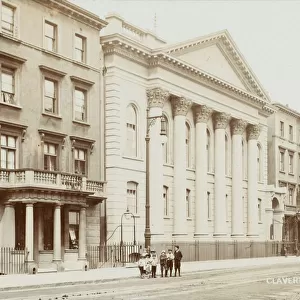
Home > Europe > United Kingdom > England > London > Towns > Richmond
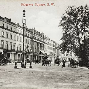
Birds-eye view of the Social London, 1914

![]()
Wall Art and Photo Gifts from Mary Evans Picture Library
Birds-eye view of the Social London, 1914
An aerial view of the two prestigious, social areas of London - Mayfair and Belgravia. In the foreground is Belgravia with its eastern frontier running down from Grosvenor Place and fronting the wall of the Buckingham Palace garden. Its western boundary is held to be Sloane Street. A number of the chief residences are shown including the homes of the Dukes of Richmond & Gordon, Bedford and the Earl of Albermarle in the Belgrave Square area. The frontiers of Mayfair are defined as Park Lane to the west and Piccadillly to the south and the map shows some of the famous mansions of the area including Londonderry House, Dudley House, Grosvenor House, Dorchester House and Devonshire House. Buckingham Palace can be seen bottom right. Date: 1914
Mary Evans Picture Library makes available wonderful images created for people to enjoy over the centuries
Media ID 14125969
© Illustrated London News Ltd/Mary Evans
Addresses Area Areas Belgravia Buckingham Devonshire Districts Dorchester Grosvenor Landmarks Londonderry Mansions Maps Mayfair Posh Prestigious Season Smart Wealthy
FEATURES IN THESE COLLECTIONS
> Aerial Photography
> Related Images
> Architecture
> Great Houses
> Buckingham Palace
> Europe
> United Kingdom
> England
> London
> Sights
> Buckingham Palace
> Europe
> United Kingdom
> England
> London
> Towns
> Richmond
> Europe
> United Kingdom
> Northern Ireland
> Londonderry
> Historic
> Monuments and landmarks
> Maps and Charts
> Early Maps
EDITORS COMMENTS
1. Title: A Bird's Eye View of Social London, 1914: An Exquisite Aerial Perspective of Mayfair and Belgravia 2. Discover the grandeur and elegance of London's most prestigious social areas, Mayfair and Belgravia, as captured in this stunning birds-eye view from 1914. This image offers a unique and enchanting glimpse into the history and opulence of these two iconic districts. 3. In the foreground lies the elegant and refined Belgravia, with its eastern border defined by Grosvenor Place and the western boundary marked by Sloane Street. Some of the district's most esteemed residences are depicted, including the homes of the Dukes of Richmond & Gordon, Bedford, and the Earl of Albermarle, all situated in the Belgrave Square area. 4. The frontiers of Mayfair are demarcated by Park Lane to the west and Piccadilly to the south. This district of London's elite boasts some of the most famous mansions, such as Londonderry House, Dudley House, Grosvenor House, Dorchester House, and Devonshire House, which are all highlighted in this map. 5. In the lower right corner, the magnificent Buckingham Palace adds to the allure of this exquisite scene. Witness the grandeur of these historical districts, which continue to be synonymous with wealth, prestige, and London's social elite. 6. This breathtaking birds-eye view of Social London, 1914, is an essential addition to any collection of historical maps, London landmarks, or for those with an interest in the history and architecture of this magnificent city. 7. Delve deeper into the rich history of Mayfair and Belgravia, and appreciate the timeless beauty of these iconic districts, as captured in this and intriguing aerial perspective from over a century ago.
MADE IN AUSTRALIA
Safe Shipping with 30 Day Money Back Guarantee
FREE PERSONALISATION*
We are proud to offer a range of customisation features including Personalised Captions, Color Filters and Picture Zoom Tools
FREE COLORIZATION SERVICE
You can choose advanced AI Colorization for this picture at no extra charge!
SECURE PAYMENTS
We happily accept a wide range of payment options so you can pay for the things you need in the way that is most convenient for you
* Options may vary by product and licensing agreement. Zoomed Pictures can be adjusted in the Cart.