Home > Europe > United Kingdom > England > London > Sights > Regents Park
Regents Park

![]()
Wall Art and Photo Gifts from Mary Evans Picture Library
Regents Park
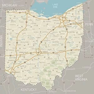
Plan of the Regents Park Estate, London 1820 Date: 1820
Mary Evans Picture Library makes available wonderful images created for people to enjoy over the centuries
Media ID 7402943
© Mary Evans Picture Library 2015 - https://copyrighthub.org/s0/hub1/creation/maryevans/MaryEvansPictureID/10474903
FEATURES IN THESE COLLECTIONS
> Europe
> United Kingdom
> England
> London
> Sights
> Regents Park
> Maps and Charts
> Related Images
> Mary Evans Prints Online
> National Archives
EDITORS COMMENTS
Regents Park Estate Map, London, 1820: A Visionary Urban Plan of the 19th Century This map print, titled "Plan of the Regents Park Estate, London," dates back to the year 1820, offering a fascinating glimpse into the urban planning and architectural development of one of London's most iconic and historic parks. Created during the 19th century, this map is an essential record of the Regent's Park Estate in its nascent stages. The Regent's Park, an expansive 395-acre royal park located in the heart of London, was the brainchild of the Prince Regent, later King George IV, and his architect, Decimus Burton. The park was designed to provide a tranquil retreat from the bustling city, offering a picturesque blend of natural beauty and architectural grandeur. This intricately detailed map reveals the meticulous planning that went into the development of the Regent's Park Estate. The map includes the layout of the park's gardens, roads, and buildings, as well as the planned locations for various institutions, such as the London Zoo, the Regent's Canal, and the Queen's Lodge. The map also highlights the park's grand entrance, designed by John Nash, which served as a symbol of the Prince Regent's vision for a regal and refined urban space. The map's intricate details offer a unique perspective on the history of Regent's Park and the broader context of urban planning during the 19th century. It serves as a testament to the visionary thinking of the Prince Regent and his team, who sought to create a space that would not only be a source of pride for the people of London but also a model for future urban development. This map print, with its rich historical significance and captivating design, is a must-have for anyone interested in the history of London, urban planning, or the evolution of public spaces. It provides a rare opportunity to explore the past and gain a deeper appreciation for the enduring legacy of Regent's Park.
MADE IN AUSTRALIA
Safe Shipping with 30 Day Money Back Guarantee
FREE PERSONALISATION*
We are proud to offer a range of customisation features including Personalised Captions, Color Filters and Picture Zoom Tools
SECURE PAYMENTS
We happily accept a wide range of payment options so you can pay for the things you need in the way that is most convenient for you
* Options may vary by product and licensing agreement. Zoomed Pictures can be adjusted in the Cart.