Fraud Blocker Skip to main content

Home > Science Photo Library > Aerial and Satellite

Aerial and Satellite Collection (page 2)

210 items

We are proud to offer this selection in partnership with Science Photo Library

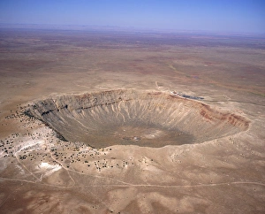
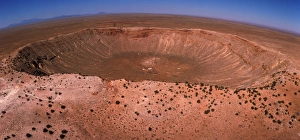
Background imageAerial and Satellite Collection: Aerial view of Meteor Crater, Arizona

Aerial view of Meteor Crater, Arizona
Meteor Crater. Fish-eye lens aerial view of Meteor Crater, near Winslow in northeast Arizona, USA. It is also called the Barringer Crater

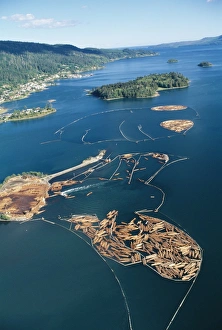
Background imageAerial and Satellite Collection: Aerial view of felled timber logs on water

Aerial view of felled timber logs on water
Timber industry. Aerial view of tree logs in floating storage areas. The logs have been corralled using floating booms. The logs have been floated from a timber felling area for use in a log mill

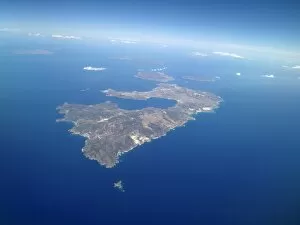
Background imageAerial and Satellite Collection: Greek islands

Greek islands. Aerial photograph of the Greek islands Milos (centre), Kimolos (upper centre, just above Milos) and Polyaigos (to the right of Kimolos)

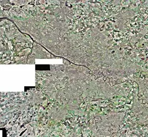
Background imageAerial and Satellite Collection: Glasgow, UK, aerial image

Glasgow, UK, aerial image
Glasgow, UK, aerial photograph. Glasgow is the largest city in Scotland, with a population of around 610, 000 (2003). It is in western Scotland on the banks of the river Clyde

Background imageAerial and Satellite Collection: Manhattan, New York City, aerial image

Manhattan, New York City, aerial image
Manhattan, New York City, aerial photograph. North is at top. This is one of the most densely populated urban areas in the world

Background imageAerial and Satellite Collection: Dry river beds, satellite image

Dry river beds, satellite image. North is at top. The bright blue areas are meandering wadis (dry river beds) that have formed in this desert area due to flooding

Background imageAerial and Satellite Collection: Aerial view of Meteor Crater, Arizona

Aerial view of Meteor Crater, Arizona
Meteor Crater. Aerial view of Meteor Crater, near Winslow in northeast Arizona, USA. It is also called the Barringer Crater

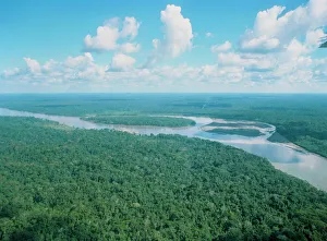
Background imageAerial and Satellite Collection: Aerial view of Rio Napo, eastern Equador

Aerial view of Rio Napo, eastern Equador

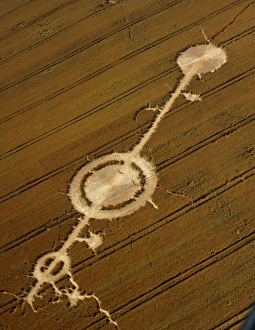
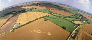
Background imageAerial and Satellite Collection: Crop formation, Alton Barnes, Wiltshire

Crop formation, Alton Barnes, Wiltshire
Aerial view of a crop formation near Alton Barnes, Wiltshire, England. Crop formations are patterns of flattened plants in crops such as wheat or barley

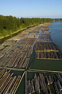
Background imageAerial and Satellite Collection: Log booms, Vancouver, Canada

Log booms, Vancouver, Canada
Log booms. Aerial photograph of log booms in Fraser River, Vancouver, Canada, where logs are stored on the water before use at a sawmill

Background imageAerial and Satellite Collection: Peloponnese, Greece

Peloponnese, Greece. Aerial photograph of the northwest region of Peloponnese (also known as Peloponnisos), a large peninsula in southern Greece

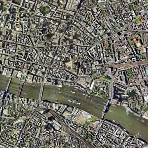
Background imageAerial and Satellite Collection: City of London, aerial image

City of London, aerial image
City of London, UK, aerial photograph. The River Thames runs through the City. The bridges crossing the river are, from left to right, Southwark Bridge, Cannon Street Railway Bridge

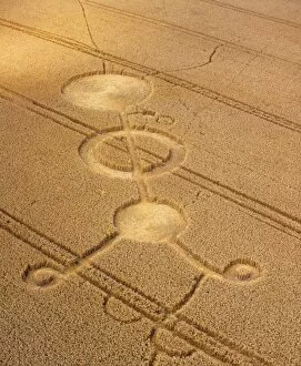
Background imageAerial and Satellite Collection: Crop formation, near East Kennett, Wiltshire

Crop formation, near East Kennett, Wiltshire
Aerial view of a crop formation near East Kennett, Wiltshire, England. Crop formations are patterns of flattened plants in crops such as wheat or barley

Background imageAerial and Satellite Collection: Crop formation, Cheesefoot, Hampshire

Crop formation, Cheesefoot, Hampshire
Aerial view of a crop formation at Cheesefoot, Hampshire, England. Crop formations are patterns of flattened plants in crops such as wheat or barley

Background imageAerial and Satellite Collection: Maiden Castle

Maiden Castle. Aerial photograph of Maiden Castle, the largest hill fort in Britain. The dimensions of the fort are truly impressive

Background imageAerial and Satellite Collection: Crop formation, Stanton St. Bernard, Wiltshire

Crop formation, Stanton St. Bernard, Wiltshire
Aerial view of a crop formation near Stanton St. Bernard, Wiltshire, England. Crop formations are patterns of flattened plants in crops such as wheat or barley

Background imageAerial and Satellite Collection: Sheffield, UK, aerial image

Sheffield, UK, aerial image
Sheffield, UK, aerial photograph. Sheffield is a city of some 510, 000 people (2003) in South Yorkshire. The M1 motorway (running down right) links Sheffield with London (to the south)

Background imageAerial and Satellite Collection: Peat extraction

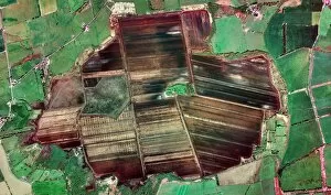
Peat extraction. Aerial photograph of excavated land in a peat mire at Bolton Fell. Bolton Fell is among the ten largest lowland raised peat bogs in the UK

Background imageAerial and Satellite Collection: Llyn Stwlan reservoir, UK, aerial image

Llyn Stwlan reservoir, UK, aerial image. This reservoir, near Ffestiniog in the Snowdonia region of North Wales, is used for hydroelectric power

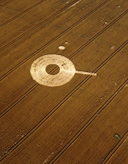
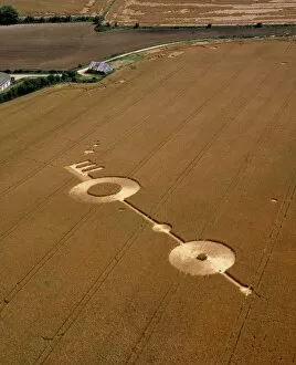
Background imageAerial and Satellite Collection: Hoax crop formation, Alton Priors, Wiltshire

Hoax crop formation, Alton Priors, Wiltshire
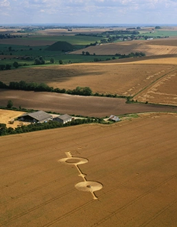
Aerial view of a hoax crop formation near Alton Priors, Wiltshire, England. Crop formations are patterns of flattened plants in crops such as wheat or barley

Background imageAerial and Satellite Collection: Leeds, UK, aerial image

Leeds, UK, aerial image
Leeds, UK, aerial photograph. Leeds is a city of around half a million people in West Yorkshire. It is linked to London to the south by the M1 motorway (running from bottom centre to far right)

Background imageAerial and Satellite Collection: Aerial view of a regenerating clear-cut forest

Aerial view of a regenerating clear-cut forest
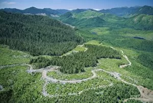
Regenerating forest. Aerial view of a forest in various stages of regrowth after being clear-cut at different times. Clear-cut forestry involves cutting down every tree in a certain area

Background imageAerial and Satellite Collection: Mangrove trees

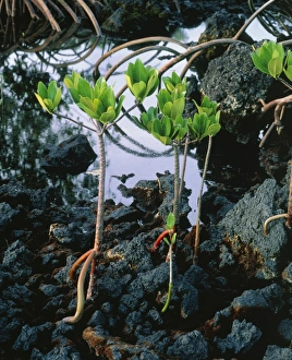
Mangrove trees. Young red mangrove trees (Rhizophora mangle) growing amongst volcanic rocks beside a swamp. The mangrove inhabits brackish water in tropical and sub-tropical areas

Background imageAerial and Satellite Collection: Crop formation, near East Kennett, Wiltshire

Crop formation, near East Kennett, Wiltshire
Aerial view of a crop formation near East Kennett, Wiltshire, England. Crop formations are patterns of flattened plants in crops such as wheat or barley

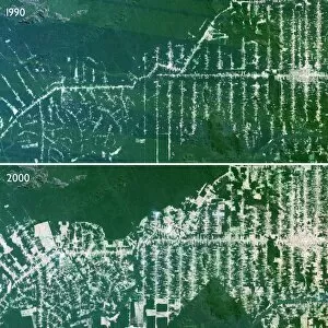
Background imageAerial and Satellite Collection: Deforestation in the Amazon

Deforestation in the Amazon rainforest, Brazil, comparing 1990 (top) and 2000 (bottom), satellite image. Roads take loggers into the centre of the rainforest

Background imageAerial and Satellite Collection: Birmingham, UK, aerial image

Birmingham, UK, aerial image
Birmingham, UK, aerial photograph. Birmingham is in the West Midlands, and is the second city of the UK. It has a population of nearly one million (2003)

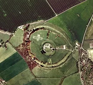
Background imageAerial and Satellite Collection: Old Sarum

Old Sarum, aerial photograph. Old Sarum is the site of the earliest settlement in Salisbury, England, with evidence of human habitation from 3000 BC

Background imageAerial and Satellite Collection: Meteor crater

Meteor crater
Aerial view of Meteor Crater, Arizona. Sometimes called the Barringer Crater, it was recognised as a meteor impact crater early in the 20th century and is thought to be about 25, 000 years old

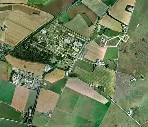
Background imageAerial and Satellite Collection: Porton Down, aerial photograph

Porton Down, aerial photograph. This site, in Wiltshire, UK, houses the headquarters of the Defence Science and Technology Laboratory, an executive Agency of the Ministry of Defence

Background imageAerial and Satellite Collection: Gloucester and Cheltenham, aerial view

Gloucester and Cheltenham, aerial view
Gloucester and Cheltenham. Aerial photograph mosaic of the area between the UK city of Gloucester (lower left) and town of Cheltenham (upper right), in the English county of Gloucestershire

Background imageAerial and Satellite Collection: Europe, satellite image

Europe, satellite image
Europe. Satellite image centred on Europe. North converges towards top. Water is blue, vegetation is green, arid areas are brown, and snow and ice are white

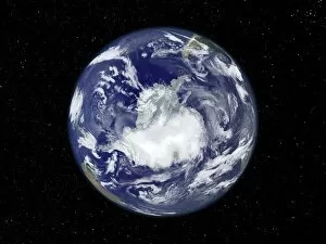
Background imageAerial and Satellite Collection: South America, satellite image

South America, satellite image
Antarctica. Satellite image of the Earth, set against a background of stars, centred on the Antarctic. The South Pole is at centre. Clouds (white) are seen in the atmosphere

Background imageAerial and Satellite Collection: Lands End, UK, aerial image

Lands End, UK, aerial image
Lands End, UK, aerial photograph. This headland is the westernmost point of mainland Great Britain. The site features several tourist attractions based around this feature

Background imageAerial and Satellite Collection: Middle East, satellite image

Middle East, satellite image
Middle East, satellite photograph. North is at top. The Middle East subcontinent is the cultural and geographical region of countries that occupy the divide between Eurasia and North Africa

Background imageAerial and Satellite Collection: Mount Ruapehu volcano, New Zealand

Mount Ruapehu volcano, New Zealand
Mount Ruapehu volcano. Aerial photograph of the crater lake and glaciers on the summit of Mount Ruapehu, a volcano on New Zealands North Island. There are several peaks on Mount Ruapehu

Background imageAerial and Satellite Collection: Lulworth Cove, UK, aerial image

Lulworth Cove, UK, aerial image
Lulworth Cove, UK, aerial photograph. This is a coastal erosion feature on the south coast of England. It was formed when the sea broke through the hard coastal limestone rock

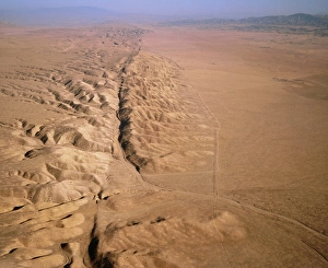
Background imageAerial and Satellite Collection: Aerial photo of San Andreas fault

Aerial photo of San Andreas fault
Aerial photograph of the San Andreas fault as it crosses the Carrizo Plain some 450km (300 miles) south of San Francisco & 160km (100 miles) north of Los Angeles

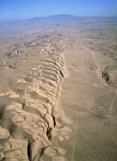
Background imageAerial and Satellite Collection: San Andreas fault, aerial view

San Andreas fault, aerial view
Aerial photograph of the San Andreas fault as it crosses the Carrizo Plain some 450km (300 miles) south of San Francisco & 160km (100 miles) north of Los Angeles

Background imageAerial and Satellite Collection: Aerial photo of San Andreas fault

Aerial photo of San Andreas fault
Aerial photograph of the San Andreas fault as it crosses the Carrizo Plain some 450km (300 miles) south of San Francisco & 160km (100 miles) north of Los Angeles

Background imageAerial and Satellite Collection: Aerial view of Pu u O o vent of Kilauea volcano

Aerial view of Pu u O o vent of Kilauea volcano
Pu u O o vent. Aerial view of the Pu u O o vent on the Kilauea volcano in Hawaii, USA. Kilauea is one of the worlds most active volcanoes

Background imageAerial and Satellite Collection: Aerial view of the SP volcanic crater

Aerial view of the SP volcanic crater
SP volcanic crater. Aerial view of the SP volcanic crater with its cinder cone. The crater was named " Shit Pot" by early explorers because of its shape

Background imageAerial and Satellite Collection: Aerial photo of the San Andreas fault

Aerial photo of the San Andreas fault
Aerial photograph of the San Andreas fault as it crosses the Carrizo Plain some 450km (300 miles) south of San Francisco & 160km (100 miles) north of Los Angeles

Background imageAerial and Satellite Collection: Geothermal research site, Kamchatka

Geothermal research site, Kamchatka
Geothermal research site. Aerial photograph of huts (centre) and geothermal wells (upper right) in the Mutnovsky geothermal field

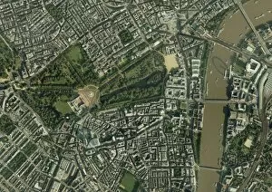
Background imageAerial and Satellite Collection: Central London, aerial view

Central London, aerial view. Buckingham Palace is at centre left. The river Thames is at right

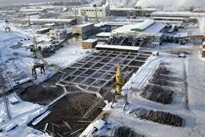
Background imageAerial and Satellite Collection: Aerial view of a Siberian sawmill

Aerial view of a Siberian sawmill
Sawmill. Aerial view of the Lesosibirski Sawmill No.1. In the foreground are pools used to defrost the logs when they arrive

Background imageAerial and Satellite Collection: Aerial view of a Siberian sawmill

Aerial view of a Siberian sawmill
Sawmill. Aerial view of part of the Lesosibirski Sawmill No.1. Here the logs arriving on trucks go through an initial sorting for size and shape

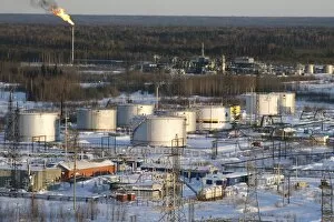
Background imageAerial and Satellite Collection: Oil field

Oil field. Aerial view across production facilities at an oil field. In the foreground are storage tanks, in the background is a chimney used to burn off natural gas associated with the oil

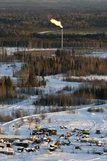
Background imageAerial and Satellite Collection: Oil field

Oil field. Aerial view across production facilities at an oil field. In the background is a chimney used to burn off natural gas associated with the oil


All Professionally Made to Order for Quick Shipping


-

Why Choose Us?

We are a leading provider of Art Prints and Photo Gifts since 2003, working in partnership with a range of Sporting Clubs, Charities, Museums and Picture Libraries. A large share of profits from any of their images will go directly towards supporting that charity or club. Our archive of images is carefully curated to bring you a wide range of subjects, including landscapes, wildlife, architecture, and more. We ship from our partner labs in the UK, USA, EU (Netherlands) and Australia.
+

How do I place an order?

Ordering is quick & easy - Just follow 5 Simple Steps:
  1. Find your image: Use our search box or browse our online photo Collections to find the image you want.

  2. Choose your print format: Select your desired product and add it to your cart.

  3. Enter your details: If you're a returning customer, simply enter your email address and password, and we'll fill in your billing and shipping address details. All personal details are held securely and are fully GDPR compliant. As standard, we remove all Personally Identifiable Information after 12 months.

  4. Pay for your purchase: We use state-of-the-art security for online shopping and do not have access to your card details.

  5. Sit back and relax: We'll email you confirmation of your order and when it's dispatched. Registered customers can also track orders in the 'My Account' area.

+

How do I pay for an order?

You can pay for your order with most of the major credit and debit cards, or PayPal. For added security, major financial institutions process payment details separately and securely on our behalf. We do not have access to your online payment card details. Online payments are preferred however we do take phone orders. For UK customers only we accept cheques issued against a UK bank.
+

Is my data safe?

We take data security very seriously. We do not have access to your full card details and all payments are requested over a fully secure connection. Additionally, we fully comply with current European and GDPR legislation, and automatically remove all personal data after at most 12 months (unless you have an account with us and have signed in recently). We also have a strict opt-in policy and would never sell your personal details. Your data is only used to fulfill your order promptly and efficiently.
+

Is wall art ready to hang?

For quick and easy installation all wall art, including framed prints, canvas prints and metal prints are supplied with a ready to hang solution on the back. Generally, saw tooth hangers are applied as they allow wall art to hang flush against the wall. The serrated edge of the hanger prevents the frame from shifting or tilting when hung.
+

Are the photo prints fade resistant?

Yes, we use archival quality photo paper photographic paper for vivid reproduction Prints are an accurate representations of the original artwork, which is preserved for artistic character and authenticity. We guarantee they match previews shown on our web site