Fraud Blocker Skip to main content

Plan of the Caledonian Canal between Loch Eil and Loch Lochie, Loch Lochie and Loch Oich, Loch Oich and Loch Ness, and Loch Ness and Loch Beauley

Plan of the Caledonian Canal between Loch Eil and Loch Lochie, Loch Lochie and Loch Oich, Loch Oich and Loch Ness, and Loch Ness and Loch Beauley
In Stock
We accept all major payment options so you can pay for the things you need in the way that is most convenient for you
Framed Photos
Buy from AU$119.99
Photo Prints
Buy from AU$12.99
Jigsaw Puzzles
Buy from AU$89.99
Poster Prints
Buy from AU$24.99
Canvas Prints
Buy from AU$124.99
Fine Art Prints
Buy from AU$92.53
Metal Prints
Buy from AU$43.99
Cards
Buy from AU$12.99
Home Decor
Buy from AU$24.99

Scottish Canals Photo Prints and Wall Art

Plan of the Caledonian Canal between Loch Eil and Loch Lochie, Loch Lochie and Loch Oich, Loch Oich and Loch Ness, and Loch Ness and Loch Beauley

Four plans showing the route of the Caledonian Canal between Loch Eil and Loch Beauley produced as part of the tenth report of the Commissioners for the Caledonian Canal in 1813. Scottish Canals are in charge of the five canals in Scotland. © Scottish Canals

Media ID 14786723

SECURE PAYMENTS
We accept all major payment options so you can pay for the things you need in the way that is most convenient for you

Made in Australia
Safe Shipping, Easy Returns

FREE PERSONALISATION
We are proud to offer a range of customisation including Cropping, Captions, and Filters. Zoom Cropping can be adjusted in the basket


EDITORS COMMENTS

This print showcases the intricate and strategic "Plan of the Caledonian Canal" between Loch Eil and Loch Beauley, offering a glimpse into Scotland's rich history. Produced as part of the tenth report by the Commissioners for the Caledonian Canal in 1813, this remarkable image unveils four detailed plans that depict different sections of this iconic waterway. The first plan highlights the stretch between Loch Eil and Loch Lochie, revealing a picturesque route adorned with lush greenery and tranquil waters. Moving forward, we are transported to the second plan which showcases an equally enchanting passage from Loch Lochie to Loch Oich. Here, one can almost feel the serenity emanating from these majestic lochs. Continuing our journey through time, we encounter the third plan illustrating an awe-inspiring path connecting Loch Oich to legendary Loch Ness. The mystique surrounding this fabled lake is palpable as its vastness unfolds before us. Finally, we reach our destination on this visual voyage - where breathtaking beauty meets historical significance - at last arriving at what lies between stunning Lock Ness and serene Lock Beauley. As we immerse ourselves in each intricately drawn detail within these plans, it becomes evident that they represent more than just geographical routes; they symbolize human ingenuity and determination to conquer nature's obstacles while preserving Scotland's natural wonders. This extraordinary print serves as a testament to Scottish Canals' commitment to conserving their heritage for generations to come – reminding.


Framed Prints of Plan of the Caledonian Canal between Loch Eil and Loch Lochie

Discover the rich history of Scotland's iconic waterway with our exquisite range of Framed Prints featuring the Plan of the Caledonian Canal. This set of four prints showcases the stunning route between Loch Eil and Loch Beauley, as originally depicted in the tenth report of the Commissioners for the Caledonian Canal in 1813. Each print is meticulously framed to preserve and enhance the intricate details of these historical plans. Transport yourself back in time and bring the beauty of the Caledonian Canal into your home or office.


Photo Prints of Plan of the Caledonian Canal between Loch Eil and Loch Lochie

Discover the rich history of Scotland's waterways with our exquisite Media Storehouse range of Photographic Prints. This stunning collection features a series of four plans depicting the Caledonian Canal route between Loch Eil and Loch Beauley. Dating back to 1813, these rare and authentic maps were produced as part of the tenth report of the Commissioners for the Caledonian Canal. Each print offers a captivating glimpse into Scotland's past, showcasing the intricate details of the canal system as it winds its way through breathtaking landscapes. Bring a piece of Scottish heritage into your home or office and transport yourself on a journey through time with our beautifully preserved, museum-quality prints.


Poster Prints of Plan of the Caledonian Canal between Loch Eil and Loch Lochie

Discover the rich history of Scotland's waterways with our stunning Media Storehouse Poster Prints. This set features four intricately detailed plans of the Caledonian Canal, tracing its route from Loch Eil to Loch Beauley. Originally produced as part of the tenth report of the Commissioners for the Caledonian Canal in 1813, these plans offer a unique glimpse into the engineering marvel that connects the Highlands and Islands to the sea. Add an air of history and sophistication to any room with these beautiful, museum-quality prints.


Jigsaw Puzzles of Plan of the Caledonian Canal between Loch Eil and Loch Lochie

Discover the beauty and engineering marvel of Scotland's Caledonian Canal with our exquisite jigsaw puzzles from Media Storehouse. This set features four captivating plans of the canal route, showcasing the breathtaking views between Loch Eil and Loch Beauley. Each puzzle piece fits seamlessly into the larger picture, revealing the intricate details of the canal's design as it winds through the stunning Scottish landscapes. Immerse yourself in history as you piece together these intriguing plans, originally produced for the tenth report of the Commissioners for the Caledonian Canal in 1813. Perfect for puzzle enthusiasts and armchair travelers alike, our Caledonian Canal jigsaw puzzles offer a fun and engaging way to explore Scotland's rich history and natural wonders.

diamond
Made With High Grade Materials
thumb_up
Professional Quality Finish
package_2
Carefully Packed To Aid Safe Arrival

You May Also Like


Map or Chart of the Caledonian Canal, or Inland Navigation from the Western to the Eastern Sea by Fort William and InvernessMap or Chart of the Caledonian Canal, or Inland Navigation from the Western to the Eastern Sea by Fort William and Inverness
Add to Basket
Bombed St Thomas HospitalBombed St Thomas Hospital
Add to Basket
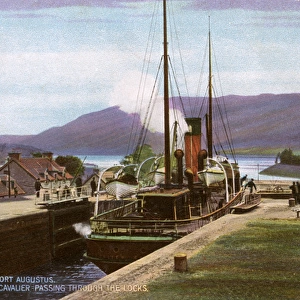
Passing through the locks at Fort Augustus, ScotlandPassing through the locks at Fort Augustus, Scotland
Add to Basket
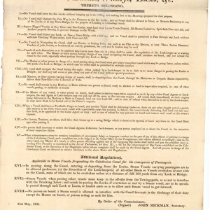
Rules & Regulations for the Conduct of Masters of Vessels and Other Persons Resorting to and Using the Caledonian Canal and the Harbours, Basins, Wharfs, Locks etc. Thereto BelongingRules & Regulations for the Conduct of Masters of Vessels and Other Persons Resorting to and Using the Caledonian Canal and the Harbours, Basins, Wharfs, Locks etc. Thereto Belonging
Add to Basket
Plan of the Caledonian Canal and lands belonging thereto Part IPlan of the Caledonian Canal and lands belonging thereto Part I
Add to Basket
Image of a kingfisher in flight above a frozen canal in winterImage of a kingfisher in flight above a frozen canal in winter
Add to Basket
Plan of the Forth and Clyde Canal through the lands of William Dunn EsquirePlan of the Forth and Clyde Canal through the lands of William Dunn Esquire
Add to Basket
SC0128reducedSC0128reduced
Add to Basket
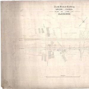
North British Railway, Union Canal, Plan of Land at SlatefordNorth British Railway, Union Canal, Plan of Land at Slateford
Add to Basket
Caledonian Railway Cart Canal, ClydebankCaledonian Railway Cart Canal, Clydebank
Add to Basket
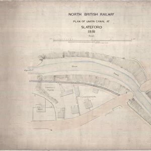
North British Railway Plan of Union Canal at SlatefordNorth British Railway Plan of Union Canal at Slateford
Add to Basket
Plan of the Crinan Canal between the Lochs of Crinan and Gilp in the County of ArgyllPlan of the Crinan Canal between the Lochs of Crinan and Gilp in the County of Argyll
Add to Basket

Gallery Wall Inspiration

The North British Rubber Company Ltd, Additions to Tyre Department
Image of ducks bathing in the canal at Linlithgow
Plan of the Crinan Canal between the Lochs of Crinan and Gilp in the County of Argyll
SC0362Breduced
Colinton Tramways, Bridge Over Union Canal
Lock Keepers Cottages at Kytra Lock on South East Side of Caledonian Canal
Plan of the Forth and Clyde Canal at Maryhill
SC0239areduced
North British Railway Plan at Kirkintilloch Basin
Plan of the ground belonging to James Haig Esquire lying contiguous to Lochrin Distillery shewing the ground occupied and intersected by The Union Canal August 1825
Plan of Ground at Viewforth, Edinburgh, Proposed to be Sold to Mr James McKelvie
SC0503reduced
Glasgow Corporation Tramways, Clydebank Bridges, Tramway Trolley Poles
North British Railway, Union Canal, Plan of Land at Slateford
Image of swans and cygnets getting showered by water in front of a lock gate
Survey of that part of the Estate of Glengarry which will be taken up by the Caledonian Canal between Lochs Lochy and Oich and as far west as the Estate of Glengarry extends
Canal Packet Vulcan
North British Railway, Union Canal, Plan of Ground at Polmont
Carronwater, Arrangement of Steam Steering Engine with Independent Hand Gear
Hillend Reservoir, Original Sluices, Cast Iron Facings on Original Timber Framing
Temple Opening Bridge, Detail Plan and Sections of North Abutment
Temple Opening Bridge, Elevations of Abutments
Temple Opening Bridge, General Details
The North British Rubber Company Ltd, Castle Mills, Edinburgh, Extension of Tyre Department Contract No. 6
St Cuthberts Co-operative Association Ltd. Canal Basin Site, Proposed Layout Scheme
Proposed Swing Bridge over Forth and Clyde Canal near Cadder
Trace of a Technical Docking Plan for the Dredger SS Carronwater


© Copyright Media Storehouse, All Rights Reserved 2003 - 2024
Facebook     Pinterest     100% Payment Secure     Reviews IO