
Maps Collection
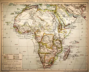
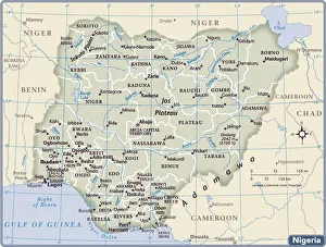
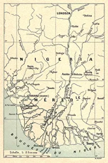
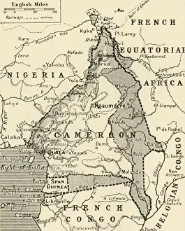
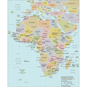
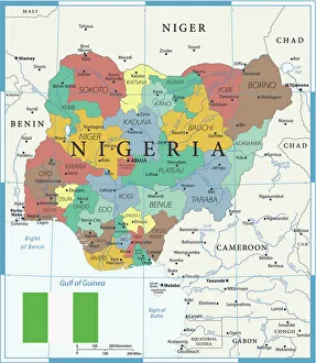
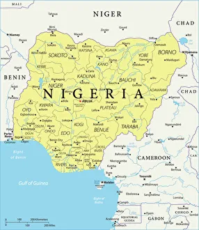
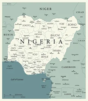
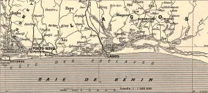
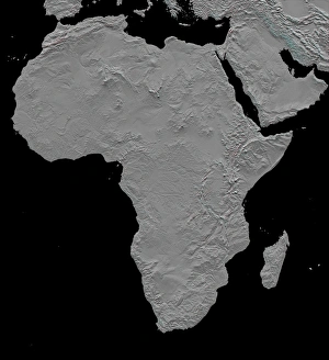
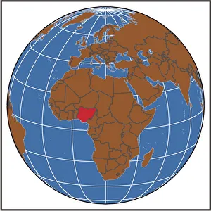
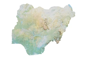
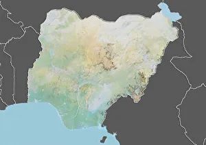
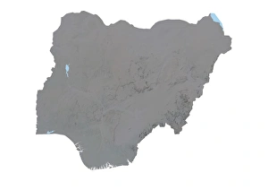
Nigeria is a country located in West Africa and is the most populous nation in Africa
Choose a picture from our Maps Collection for your Wall Art and Photo Gifts
24 items


All Professionally Made to Order for Quick Shipping
-
Maps Collection
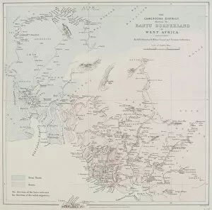
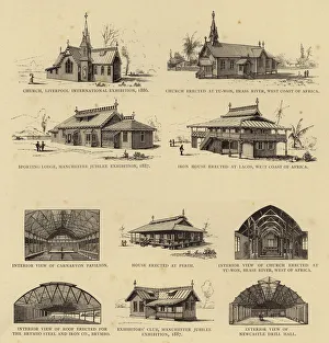
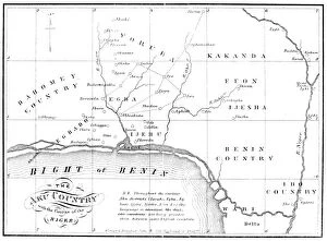
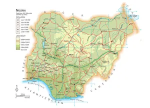
Nigeria is a country located in West Africa and is the most populous nation in Africa. Maps of Nigeria are important for understanding the geography of this large and diverse nation. The maps show the major cities, rivers, lakes, mountains, deserts, and other physical features. They also depict political boundaries such as states and provinces as well as international borders with neighboring countries like Benin, Cameroon, Chad, Niger and others. Additionally they provide information about the population density of each region which helps to understand how people are distributed across the country. Maps of Nigeria can be used to plan trips or study its history and culture, and are essential tools for anyone wanting to learn more about this fascinating African nation.
+
Our beautiful pictures are available as Framed Prints, Photos, Wall Art and Photo Gifts
The Maps of Nigeria Africa collection from Media Storehouse is a stunning compilation of vintage and contemporary maps that showcase the diverse geography, history, and culture of Nigeria. Our collection features a wide range of maps spanning different eras, including antique maps dating back to the 16th century as well as modern satellite imagery. Each map in our collection offers unique insights into Nigeria's rich cultural heritage, highlighting its natural resources, landmarks, cities, and regions. From detailed topographical maps to colorful political maps outlining administrative boundaries and ethnic groups across the country, our collection provides an unparalleled visual representation of Nigeria's complex identity. Whether you're looking for a striking piece of wall art or an educational resource for your classroom or office space, the Maps of Nigeria Africa collection has something for everyone. With high-quality prints available in various sizes and framing options to suit any decor style or budget preference, our collection is sure to impress anyone with an interest in Nigerian history or geography.
+
What are Maps of Nigeria Africa art prints?
Maps of Nigeria Africa art prints are beautiful and detailed representations of the geography, topography, and landmarks of Nigeria. These prints showcase the diverse landscapes that make up this West African country, including its mountains, rivers, forests, and savannas. They also highlight important cities and towns such as Lagos, Abuja, Kano, Ibadan and Port Harcourt. These maps can be used for decorative purposes in homes or offices to add a touch of elegance while showcasing an appreciation for Nigerian culture. They are perfect gifts for people who have a love for travel or those with roots in Nigeria. Maps of Nigeria Africa art prints come in different sizes to suit various preferences and spaces. They can be framed or hung without frames depending on personal preference. The quality is exceptional as they are printed using high-quality materials that ensure longevity. Overall these maps provide an excellent way to appreciate the beauty of Nigeria's landscape while adding sophistication to any space they adorn.
+
What Maps of Nigeria Africa art prints can I buy from Media Storehouse?
We offer a wide range of Maps of Nigeria Africa art prints that are perfect for those who want to add some African flair to their home or office. These maps come in various styles and sizes, including vintage, antique, and modern designs. You can choose from different types of maps such as political maps, topographical maps, roadmaps, and more. Media Storehouse has an extensive collection of Maps of Nigeria Africa art prints that showcase the beauty and diversity of this country. Some popular options include detailed city street maps like Lagos or Abuja, colorful regional maps highlighting the different states within Nigeria or even satellite imagery showcasing the natural landscapes. Whether you're looking for a unique piece to decorate your living room or a thoughtful gift for someone special with an interest in geography or travel - our selection is sure to impress.
+
How do I buy Maps of Nigeria Africa art prints?
To buy Maps of Nigeria Africa art prints from Media Storehouse, you can browse our collection online and select the print that catches your eye. Once you have found the perfect piece, simply add it to your cart and proceed to checkout. You will be prompted to enter your shipping information and payment details before submitting your order. We offer a variety of sizes for their art prints, so make sure to choose one that fits the space where you plan on displaying it. Their Maps of Nigeria Africa art prints are printed on high-quality paper using state-of-the-art printing technology, ensuring that each print is vibrant and long-lasting. Whether you're looking for a unique addition to your home decor or a thoughtful gift for someone special, our selection of Maps of Nigeria Africa art prints is sure to impress. So why wait? Start browsing today.
+
How much do Maps of Nigeria Africa art prints cost?
We offer a wide range of Maps of Nigeria Africa art prints that vary in price depending on the size and type of print. Our collection includes vintage maps, satellite images, and artistic interpretations of Nigeria's geography. We strive to provide affordable options for all customers while maintaining high-quality standards. Our Maps of Nigeria Africa art prints are available in various sizes ranging from small to large formats suitable for framing or hanging as wall decor. We use premium materials such as fine art paper and canvas to ensure durability and longevity. We take pride in our vast selection of artwork that showcases the beauty and diversity of Nigeria's landscapes. Whether you're looking for a unique gift or want to add some cultural flair to your home or office space, our Maps of Nigeria Africa art prints are an excellent choice at reasonable prices.
+
How will my Maps of Nigeria Africa art prints be delivered to me?
We take great care in ensuring that your Maps of Nigeria Africa art prints are delivered to you safely and securely. We use high-quality packaging materials to protect your print during transit, including sturdy cardboard tubes or flat packages depending on the size of the print. Once your order is processed and printed, it will be carefully packaged by our team before being dispatched for delivery. We work with trusted courier partners who offer reliable delivery services both domestically and internationally. You can expect your Maps of Nigeria Africa art prints to arrive at your doorstep in excellent condition within a reasonable timeframe. If you have any concerns about the delivery process or need assistance tracking your order, our customer service team will be happy to help. We hope that you enjoy displaying your new artwork and appreciate the effort we put into delivering it to you.