
Maps Collection
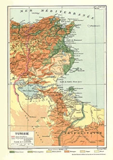
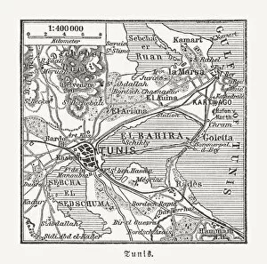
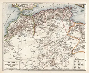
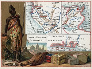
Tunisia is a country located in North Africa, bordered by Algeria
Choose a picture from our Maps Collection for your Wall Art and Photo Gifts
117 items


All Professionally Made to Order for Quick Shipping
-
Maps Collection
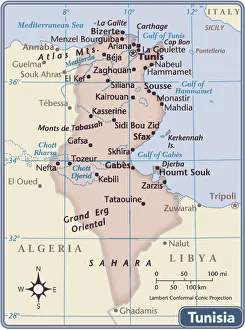
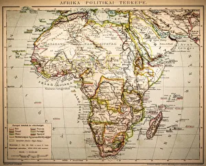
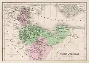
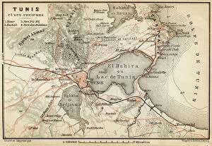
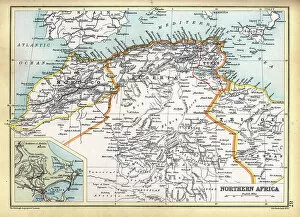
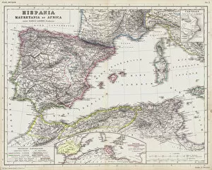
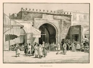
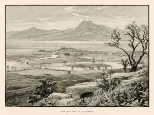
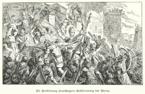
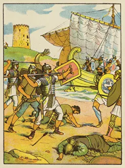
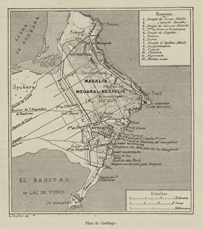
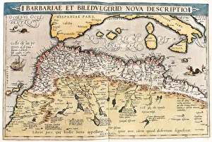
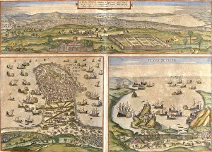
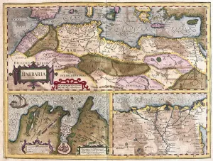
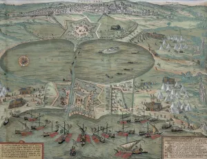
Tunisia is a country located in North Africa, bordered by Algeria, Libya and the Mediterranean Sea and has a population of over 11 million people and its capital city is Tunis. Tunisia has a rich history and culture that dates back to ancient times. Its landscape includes mountains, deserts, forests and beaches. The country is home to many archaeological sites from the Roman Empire as well as some of the oldest cities in Africa. Maps of Tunisia are essential for anyone travelling or exploring this fascinating country. They provide an overview of its geography, including major cities, roads, rivers and lakes as well as national parks and other points of interest. They also show political boundaries such as provinces or regions which can be useful when planning trips or researching local customs or cultures.
+
Our beautiful pictures are available as Framed Prints, Photos, Wall Art and Photo Gifts
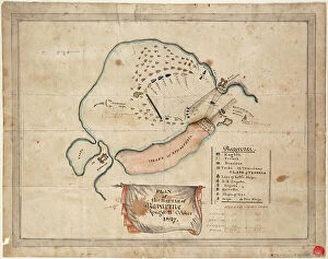
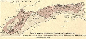
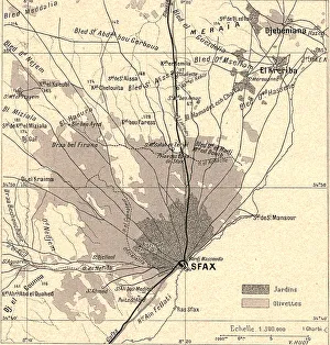
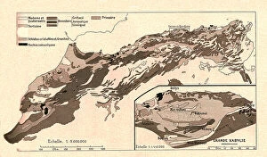
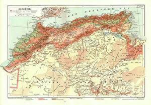
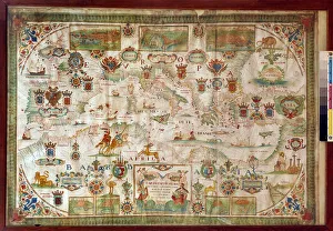
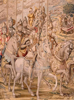
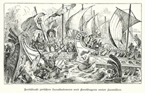
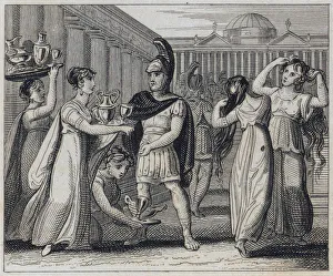
The Maps of Tunisia Africa collection from Media Storehouse is a fascinating and unique assortment of wall art and framed prints that depict the geography, history, and culture of Tunisia. Our collection features a range of maps dating back to the 16th century, including antique maps that showcase the country's cities, regions, and landmarks. These maps provide insight into Tunisia's rich history as well as its current political landscape. They also offer an opportunity for viewers to explore the diverse landscapes of this North African nation, from its sandy beaches to its rugged mountains. In addition to traditional cartographic depictions, the Maps of Tunisia Africa collection includes artistic renderings that highlight different aspects of Tunisian life such as agriculture or religion. These prints are perfect for anyone interested in exploring this beautiful country or adding some cultural flair to their home decor.
+
What are Maps of Tunisia Africa art prints?
Maps of Tunisia Africa art prints are high-quality reproductions of maps that depict the geography and topography of Tunisia, a country located in North Africa. These prints showcase the intricate details and features of the region, including its cities, towns, rivers, mountains, deserts and other landmarks. They are created using advanced printing techniques that ensure accurate reproduction of colors and fine details. Maps of Tunisia Africa art prints can be used for various purposes such as home decor or educational resources. They are perfect for those who love to travel or have an interest in geography or history. These prints also make great gifts for friends and family members who share similar interests. We offer a wide range of Maps of Tunisia Africa art prints to choose from. Our collection includes vintage maps as well as modern designs that cater to different tastes and preferences. All our products come with a quality guarantee so you can be assured that you're getting nothing but the best when you shop with us.
+
What Maps of Tunisia Africa art prints can I buy from Media Storehouse?
We offer a wide range of Maps of Tunisia Africa art prints that you can buy. These maps are available in various sizes and formats, including framed and unframed prints, canvas wraps, and photo gifts. You can choose from vintage or contemporary styles to suit your taste. Some popular options include the Tunis Map 1899 Vintage Style Print, which features intricate details of the city's streets and landmarks; the Tunisia Map Watercolor Art Print, which adds a splash of color to your walls with its vibrant hues; and the North Africa Political Map Poster, which provides an overview of the region's geography. Whether you're looking for a decorative piece for your home or office or a unique gift for someone who loves travel or history, we have plenty of Maps of Tunisia Africa art prints to choose from.
+
How do I buy Maps of Tunisia Africa art prints?
To buy Maps of Tunisia Africa art prints from Media Storehouse, you can browse our extensive collection of artwork online. Simply search for "Maps of Tunisia Africa" in the search bar on our website and select the print that catches your eye. Once you have found a print that you like, add it to your cart and proceed to checkout. During checkout, you will be prompted to enter your shipping information and payment details. After completing these steps, your order will be processed and shipped directly to your doorstep. We offer high-quality art prints that are perfect for adding a touch of culture and sophistication to any space. Whether you're looking for a unique piece of wall decor or a thoughtful gift for someone special, Maps of Tunisia Africa art prints are sure to impress. So why wait? Start browsing today.
+
How much do Maps of Tunisia Africa art prints cost?
We offer a wide range of Maps of Tunisia Africa art prints that are available at varying prices. The cost of each print depends on several factors such as the size, quality, and type of paper used to produce it. Our collection includes vintage maps, contemporary designs and artistic interpretations that cater to different tastes and preferences. We take pride in providing high-quality art prints that are affordable without compromising on their aesthetic value. Our Maps of Tunisia Africa art prints make great additions to any home or office space and can be purchased for personal use or as gifts for loved ones. Our website features an easy-to-use interface where you can browse through our extensive collection, select their preferred print(s), add them to cart and checkout securely. We also offer various payment options for convenience. The cost of our Maps of Tunisia Africa art prints is reasonable considering the quality they offer.
+
How will my Maps of Tunisia Africa art prints be delivered to me?
We take pride in delivering your Maps of Tunisia Africa art prints with utmost care and efficiency. Your order will be processed promptly upon receipt and dispatched to you via our trusted courier partners. We use only the best quality packaging materials to ensure that your artwork arrives at your doorstep in pristine condition. We offer a range of delivery options for you to choose from, depending on your location and urgency. Our standard delivery service is reliable and usually takes between 3-5 working days within the UK, while international deliveries may take slightly longer. Rest assured that we will keep you informed every step of the way through email notifications about the status of your order. You can also track its progress online using our tracking system. We are committed to providing a hassle-free experience when it comes to delivering your Maps of Tunisia Africa art prints right to your door.