
Maps Collection
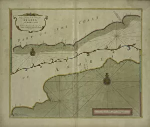
Maps of Yemen Asia are a type of map that show the physical features and political boundaries of the country
Choose a picture from our Maps Collection for your Wall Art and Photo Gifts
16 items


All Professionally Made to Order for Quick Shipping
-
Maps Collection
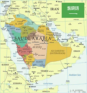
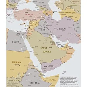
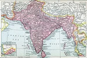
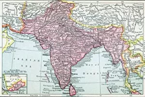
Maps of Yemen Asia are a type of map that show the physical features and political boundaries of the country. They include cities, towns, rivers, mountains, deserts and other geographical features. They also show major roads and highways as well as international borders. Maps of Yemen Asia can be used to plan trips or explore the country's geography in detail and are useful for locating places to visit or for finding out more about a particular region or city in Yemen. Maps of Yemen Asia provide an invaluable resource for travelers who want to explore this fascinating country with its rich history and culture.
+
Our beautiful pictures are available as Framed Prints, Photos, Wall Art and Photo Gifts
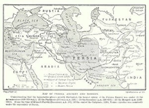
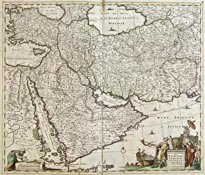
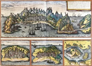
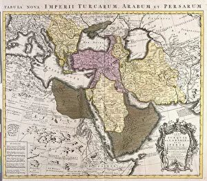
The Maps of Yemen Asia collection from Media Storehouse offers a unique and fascinating glimpse into the history and geography of Yemen. Our collection features a variety of maps, ranging from antique world maps to detailed regional maps of Yemen itself. The artwork is available as wall art or framed prints, making it easy to display in any home or office. These maps offer insight into the political boundaries, topography, and natural resources that have shaped Yemen over time. They also showcase the intricate details and artistic styles used by cartographers throughout history. Whether you are a collector of vintage maps or simply interested in learning more about this complex region, the Maps of Yemen Asia collection is sure to impress. With its high-quality printing and framing options, these pieces make for stunning additions to any decor while providing an educational experience for all who view them.
+
What are Maps of Yemen Asia art prints?
Maps of Yemen Asia art prints are beautiful and detailed representations of the geography, topography, and landmarks of Yemen. These maps are created by skilled cartographers who use advanced techniques to produce accurate depictions of the country's physical features such as mountains, rivers, deserts, and coastlines. They also include important cities, towns, villages, roads and other infrastructure. These art prints can be used for educational purposes in schools or universities to teach students about the geography and history of Yemen. They can also be used as decorative pieces in homes or offices to add a touch of elegance and sophistication to any space. Maps of Yemen Asia art prints come in various sizes with different framing options available depending on your preference. Whether you're looking for a small print to hang on your wall or a large canvas that will make an impressive statement piece in your living room or office lobby; there is something for everyone when it comes to Maps of Yemen Asia art prints.
+
What Maps of Yemen Asia art prints can I buy from Media Storehouse?
We offer a wide range of Maps of Yemen Asia art prints that are perfect for those who appreciate the beauty and history of this region. These maps showcase the intricate details and unique features of Yemen, including its cities, rivers, mountains, and deserts. You can choose from a variety of styles and sizes to suit your preferences, whether you're looking for a vintage-inspired map or a more modern design. Some popular options include antique maps that date back centuries, as well as contemporary designs that highlight the country's current political boundaries. Many prints also feature additional information about Yemen's culture and geography, making them both beautiful and educational. Whether you're decorating your home or office space or looking for a thoughtful gift for someone special, we have plenty of Maps of Yemen Asia art prints to choose from. With high-quality printing techniques and durable materials used in their production process, these prints are sure to last for years to come.
+
How do I buy Maps of Yemen Asia art prints?
To purchase Maps of Yemen Asia art prints from Media Storehouse, you can follow a few simple steps. Firstly, visit the Media Storehouse website and search for "Maps of Yemen Asia" in the search bar. This will bring up all available options for this particular print. Once you have found the desired print, select the size and format that suits your needs best. You can choose between canvas prints or framed prints depending on your preference. After selecting your preferred format, add the item to your cart and proceed to checkout. Here you will be prompted to enter your shipping details and payment information. Once you have completed these steps, simply confirm your order and wait for it to arrive at your doorstep. The process is quick and easy, allowing you to enjoy beautiful Maps of Yemen Asia art prints in no time at all.
+
How much do Maps of Yemen Asia art prints cost?
We offer a wide range of Maps of Yemen Asia art prints that are available for purchase. The cost of these prints varies depending on the size and type of print you choose. We have a variety of options to suit different budgets and preferences, including canvas prints, framed prints, and poster prints. Our Maps of Yemen Asia art prints are created using high-quality materials and printing techniques to ensure that they look stunning in any setting. Whether you're looking for a bold statement piece or something more subtle to complement your decor, we have something for everyone. We take pride in offering affordable prices without compromising on quality. Our goal is to make beautiful artwork accessible to everyone who appreciates it. So if you're looking for Maps of Yemen Asia art prints at reasonable prices, look no further than Media Storehouse.
+
How will my Maps of Yemen Asia art prints be delivered to me?
We take great care in ensuring that your Maps of Yemen Asia art prints are delivered to you safely and securely. We use high-quality packaging materials to protect your artwork during transit, so you can be confident that it will arrive in pristine condition. Your Maps of Yemen Asia art prints will be shipped directly to the address provided at checkout. We offer a range of delivery options to suit your needs, including standard shipping and express delivery for urgent orders. Once your order has been dispatched, we'll send you an email confirmation with tracking information so you can keep track of its progress. If there are any issues with delivery or if you have any questions about your order, our friendly customer service team is always on hand to help. We strive to make the process of ordering and receiving your Maps of Yemen Asia art prints as easy and hassle-free as possible.