
Maps Canvas Print Collection
Discover the enchanting beauty of Cape Verde, Africa with our Maps of Cape Verde Canvas Prints collection. These stunning, high-resolution maps showcase the unique islands and coastlines of this captivating region. Each print is meticulously crafted on premium canvas, bringing out the intricate details and vibrant colors of the maps. Hang one in your home or office to add a touch of exotic flair and inspire wanderlust. Explore the rich history and natural wonders of Cape Verde like never before with our Maps of Cape Verde Canvas Prints.
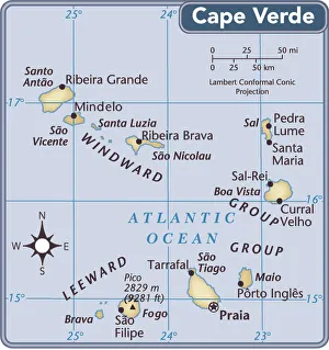
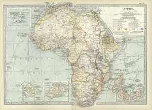
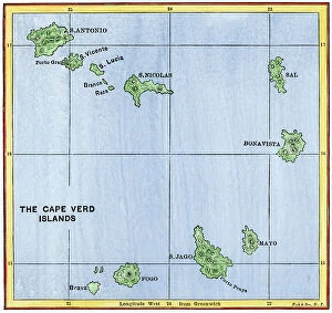
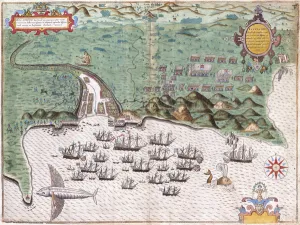
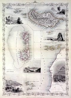
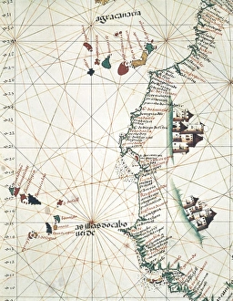
Maps of Cape Verde Africa are detailed representations of the island nation located off the coast of West Africa
Choose a picture from our Maps Canvas Print Collection for your Wall Art and Photo Gifts
26 Canvas Prints


All Professionally Made to Order for Quick Shipping
-
Maps Canvas Print Collection
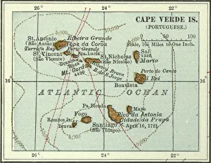
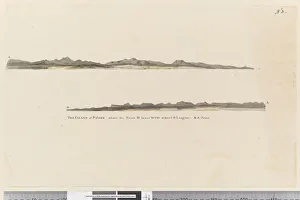
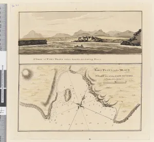
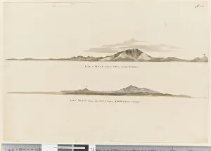
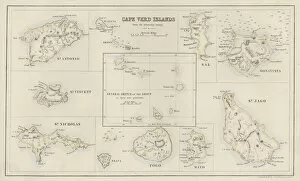
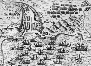
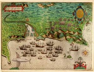
Maps of Cape Verde Africa are detailed representations of the island nation located off the coast of West Africa. The maps show the country’s nine inhabited islands, as well as its two uninhabited islands. They also depict its many mountain ranges, rivers, and other geographical features. Additionally, they show major cities and towns, airports, ports and harbors, roads and highways, national parks and reserves, lighthouses, beaches and other points of interest. Maps of Cape Verde Africa provide a comprehensive overview for travelers looking to explore this beautiful archipelago in the Atlantic Ocean and are useful for those interested in learning more about the country’s history or culture.
+
Our beautiful pictures are available as Framed Prints, Photos, Wall Art and Photo Gifts
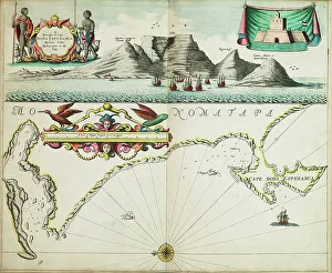
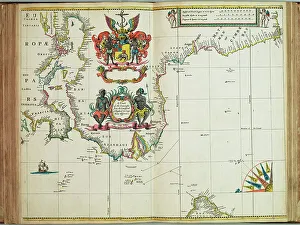
The Maps of Cape Verde Africa collection from Media Storehouse is a stunning compilation of vintage and contemporary maps that depict the archipelago nation off the coast of West Africa. Our collection features a range of maps, including topographical, political, and thematic maps that showcase the geography, history, and culture of Cape Verde. These high-quality prints are available in various sizes and formats such as canvas art prints or framed wall art. They make for an excellent addition to any home or office decor while also serving as educational resources for students and researchers interested in African geography. Whether you're looking to add some color to your living space or want to explore Cape Verde's rich heritage through its cartography, our collection has something for everyone. With its attention to detail and exceptional quality standards, it's no wonder why Media Storehouse is one of the leading providers of wall art prints online.
+
What are Maps of Cape Verde Africa art prints?
Maps of Cape Verde Africa art prints are high-quality reproductions of vintage and contemporary maps that depict the archipelago nation of Cape Verde, located off the west coast of Africa. These prints showcase the unique geography and topography of each island in stunning detail, including their coastlines, mountains, rivers, and cities. These art prints are perfect for anyone interested in history or geography, as we offer a fascinating glimpse into how Cape Verde has evolved over time. They also make great decorative pieces for homes or offices with an African theme or those looking to add a touch of sophistication to their decor. We offer a wide selection of Maps of Cape Verde Africa art prints in various sizes and formats to suit any taste or budget. Whether you're looking for a large canvas print to hang on your wall or a smaller framed print for your desk, we have something for everyone.
+
What Maps of Cape Verde Africa art prints can I buy from Media Storehouse?
We offer a wide range of Maps of Cape Verde Africa art prints that are perfect for anyone looking to add some African-inspired decor to their home or office. These maps feature detailed depictions of the islands and surrounding areas, highlighting key landmarks and geographical features. Some popular options include vintage-style maps that showcase the history and culture of Cape Verde, as well as more modern interpretations that incorporate bold colors and graphic design elements. Whether you're interested in exploring the geography of this beautiful region or simply want to add some visual interest to your space, we have a variety of Maps of Cape Verde Africa art prints to choose from. With high-quality printing techniques and durable materials, these prints are sure to make a lasting impression on any viewer. So why not browse our selection today and find the perfect map print for your needs?
+
How do I buy Maps of Cape Verde Africa art prints?
To buy Maps of Cape Verde Africa art prints from Media Storehouse, you can browse our extensive collection of artwork online. Once you have found the print that you like, simply add it to your cart and proceed to checkout. You will be prompted to enter your shipping and payment information before finalizing your purchase. We offer a wide range of sizes and framing options for their art prints, so you can customize your order to fit your specific needs. Whether you are looking for a small print to hang in your home or a large piece of artwork for an office space, they have something for everyone. Their high-quality printing process ensures that each print is vibrant and true-to-life, capturing all the beauty and detail of the original artwork. With fast shipping times and excellent customer service, buying Maps of Cape Verde Africa art prints from Media Storehouse is easy and hassle-free.
+
How much do Maps of Cape Verde Africa art prints cost?
We offer a wide range of Maps of Cape Verde Africa art prints that are available for purchase. The cost of these prints may vary depending on the size and type of print you choose. We have a variety of options to suit your preferences, including canvas prints, framed prints, and poster prints. Our Maps of Cape Verde Africa art prints are created using high-quality materials to ensure that they last for years to come. These maps showcase the stunning beauty and unique features of this beautiful African country in intricate detail. Whether you're looking for a piece to add some character to your home or office space or searching for a thoughtful gift for someone special, our Maps of Cape Verde Africa art prints are an excellent choice. With their vibrant colors and detailed designs, they're sure to make an impression wherever they're displayed.
+
How will my Maps of Cape Verde Africa art prints be delivered to me?
Your Maps of Cape Verde Africa art prints will be delivered to you in a safe and secure manner. We take great care in packaging your artwork to ensure it arrives at your doorstep in pristine condition. We use high-quality materials such as sturdy cardboard tubes or flat mailers with protective padding to prevent any damage during transit. Our delivery partners are reliable and efficient, ensuring that your order is delivered on time. You can track the progress of your shipment through our online tracking system, which provides real-time updates on the status of your delivery. We understand how important it is for you to receive your artwork promptly and without any issues. That's why we work hard to make sure that every aspect of the shipping process runs smoothly so that you can enjoy your new Maps of Cape Verde Africa art prints as soon as possible.